
Scan the QR code and open PeakVisor on your phone
Limpopo National Park, Parque Nacional do Limpopo, is situated in Mozambique and is an integral component of the Great Limpopo Transfrontier Park, a vast conservation area spanning approximately 3,500,000 ha (8,648,688 ac) across South Africa, Mozambique, and Zimbabwe. There are seven named peaks in Limpopo National Park. Ntabandlovu is the highest point, measuring 424 meters (1,391 ft), while the most prominent mountain is Gondesgonde.
Limpopo National Park, located in the southern part of Mozambique, shares borders with South Africa's Kruger National Park to the west and Zimbabwe's Gonarezhou National Park to the north. It is part of the Great Limpopo Transfrontier Park, a conservation area spanning South Africa, Mozambique, and Zimbabwe.
The South African section, situated in the Limpopo province, encompasses an area of 1,000,000 ha (2,471,053 ac) and features diverse landscapes, including 44% of classic sandveld terrain in the eastern portion towards the Limpopo River valley. Mixed bushveld areas and dense riverine woodlands along the Limpopo and Olifants Rivers contribute to its varied topography.
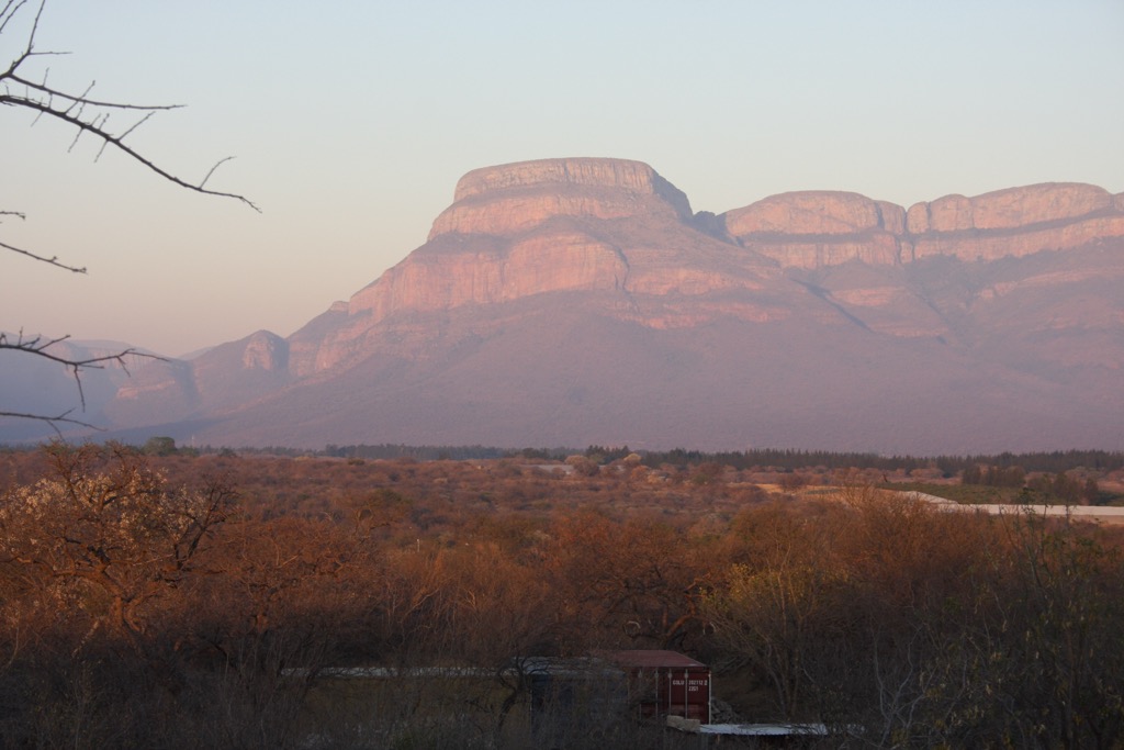
The Limpopo National Park’s elevation varies between 305 and 424 meters (1,000 and 1,391 ft), with the highest summits straddling the border between South Africa and Mozambique. The park's western boundary is marked by the rocky Lebombo Mountains, creating a natural demarcation with Kruger National Park. The Shingwedzi River flows through the park, supporting its rich biodiversity.
During the dry season from May to October, minimal rainfall and low humidity prevail, leading animals to gather around permanent water sources. The winter months of June to August feature cold mornings of 12°C (54°F) and pleasant afternoons of 26°C (79°F). September and October gradually rise to around 31°C (88°F) in the afternoon, with relief from dry conditions brought by the first rains.
Conversely, the wet season coincides with the summer months from November to April and is hot and humid, with peak temperatures exceeding 40°C (104°F). Afternoon storms, more frequent in November, constitute the primary rainfall. Morning temperatures rise to about 19°C (66°F).
The park is divided into three zones: the Tourist Zone, designed for visitors and offering recreational activities; the Wilderness Zone, a pristine area with minimal human impact; and the Resource Utilization Zone, allowing controlled hunting.
Ancient rocks and sedimentary formations characterize the geology of Limpopo National Park. The landscape is diverse, ranging from low-lying plains to rugged hills and plateaus. The park sits within the Mozambique Basin, a region with a complex geological history that includes tectonic activity and the deposition of various sedimentary layers over millions of years.
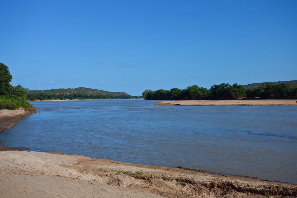
The Limpopo River, one of Africa's major river systems, flows through the park, defining much of its landscape. Erosion along riverbanks and the presence of floodplains contribute to the park’s dynamic geological processes.
The area encompasses a variety of rock formations, including granite outcrops and sedimentary rocks. Granite is often exposed in the higher elevations, contributing to the park's unique scenery. Sedimentary rocks, formed through the accumulation and cementation of sediments, are widespread and contribute to shaping the terrain.
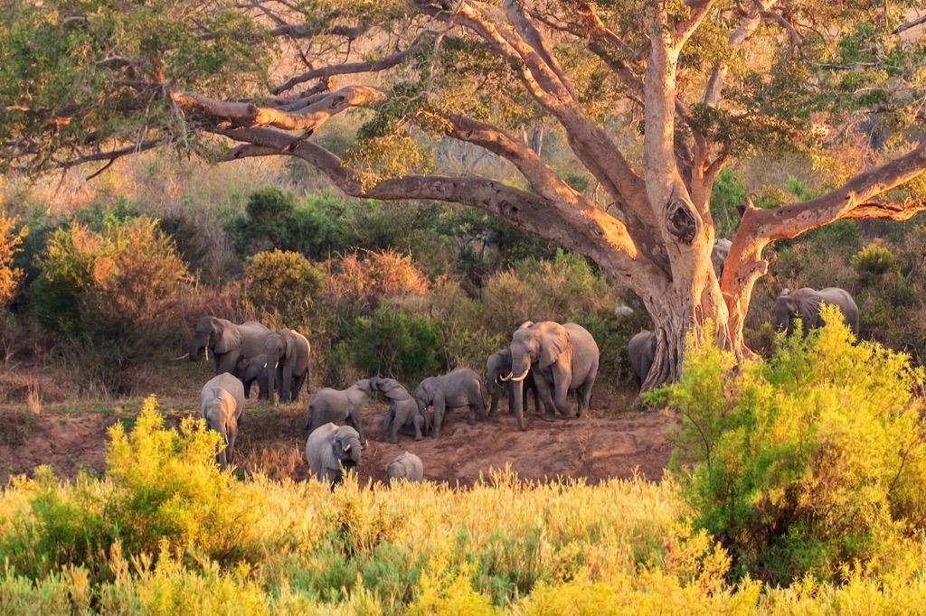
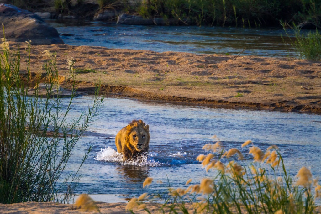
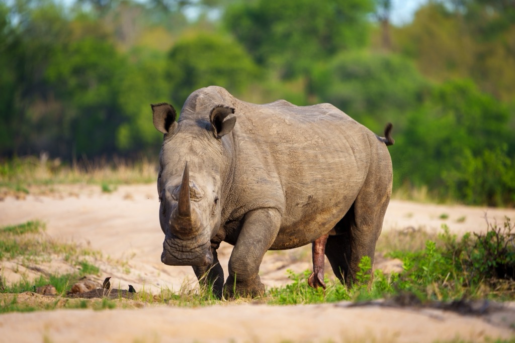
Limpopo National Park is renowned for its rich biodiversity, hosting a wide array of flora and fauna. Some iconic species in Limpopo National Park include the Big Five: African elephants, lions, leopards, buffalo, and rhinoceroses. These animals were dubbed the “Big Five” because they were traditionally the most dangerous to hunt. Additionally, the park is home to numerous other mammal species, reptiles, and birdlife.
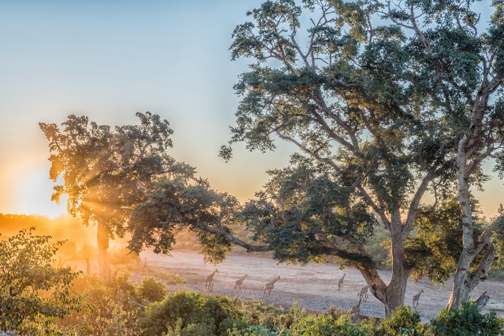
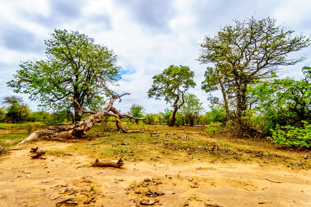
The park features diverse ecosystems ranging from riverine forests along the Limpopo River to mopane woodlands and open savannas. These varied habitats support many plant species adapted to different ecological niches. Mopane trees dominate extensive areas, providing sustenance for herbivores and shaping the landscape.
Limpopo National Park has a diverse human history. For tens of thousands of years, indigenous groups like the Shangaan and Tsonga lived in harmony with their environment. The region was subjected to European colonization in the late 19th century, leading to significant changes and a decline in traditional subsistence hunting and agriculture. The area has been dined by political upheaval in recent decades; Mozambique gained independence in 1975, followed by a civil war lasting until 1992.
In 2001, Limpopo National Park was established as part of the Great Limpopo Transfrontier Park, a transboundary conservation initiative involving Mozambique, South Africa, and Zimbabwe. The movement toward transfrontier parks aims to facilitate wildlife movement across borders for improved ecological sustainability.
Challenges such as poaching persist, but the park plays a vital role in biodiversity conservation. It has become a hub for eco-tourism, contributing to local economies and promoting sustainable development while balancing conservation and community needs. For the latest information, it's advisable to check recent sources or contact local authorities and conservation organizations.
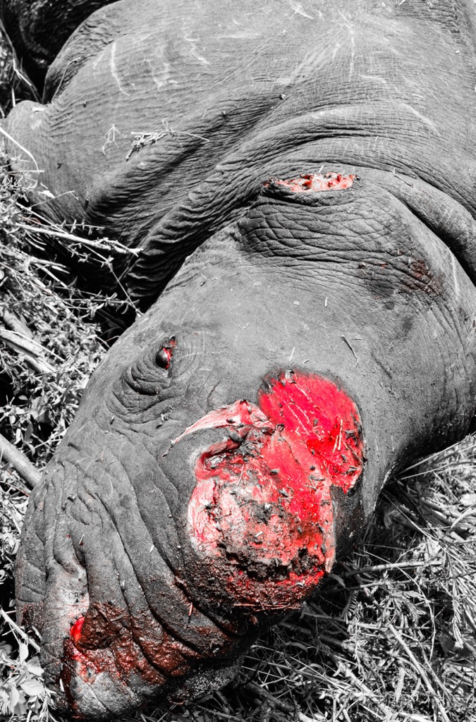
Hiking in Limpopo National Park is a strictly regulated endeavor due to the dangerous nature of the animals and the need to protect species from poachers. Indeed, poachers themselves are often killed by the animals they are attempting to hunt.
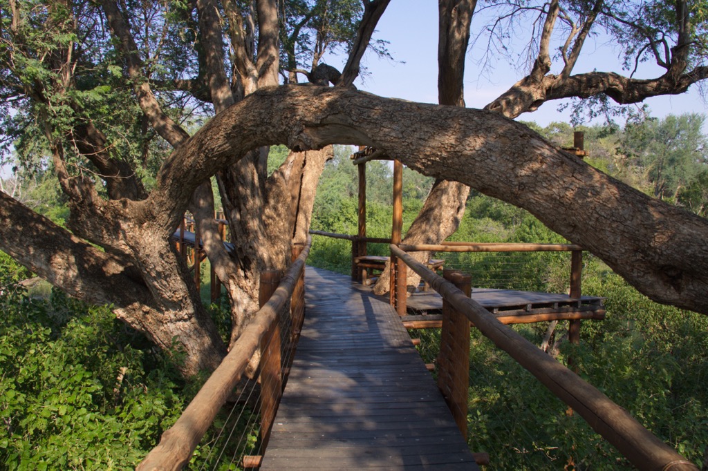
As a result, hiking is almost exclusively a guided experience emphasizing wildlife viewing, not distance. Still, hiking is the best way to connect with the park’s natural environment, and plenty of magnificent routes exist. Naturally, there is also an abundance of 4x4 routes, some of which can be self-guided.
The Elefantes Gorge Backpacking and Fishing Trail crosses into Mozambique from South Africa. Commencing from Olifants Camp, hikers cover approximately 42 km (26 mi) over four days. Hikers trek across the Olifants River towards the rugged Lebombos plateau of Kukumenzane and descend toward the shores of the Massingir Dam.
The region's expansive open plains offer excellent opportunities for observing wildlife. Abundant hippopotamuses and crocodiles can be easily sighted, accompanied by the continuous calls of fish eagles echoing along the rivers. The area is a haven for birdwatching enthusiasts, and its varied plant life featuring towering apple-leaf and sycamore-fig trees adds to the allure of this well-frequented wilderness trail.
The Lebombo Hiking Trail extends over four days, with an average distance of 12 to 15 km (9 to 12 mi) per day. Accompanied by a seasoned guide, hikers encounter the African bush and spot various wildlife species throughout the journey. The pristine terrain creates an ideal environment for observing wildlife and birdwatching.
The Palarangala Wilderness Trail offers a four-day, three-night experience with accommodation in a remote rustic camp. Guided game walks led by experienced guides showcase diverse landscapes, including the Lebombo plateau featuring Ntabadlovu. Participants encounter a wide variety of wildlife in the African bush.
The Shingwedzi 4x4 Eco-Trail presents an off-road experience spanning six days and covers 380 km (236 mi). The trail commences at the Pafuri Picnic Site in the northern part of the Kruger National Park, tracing the Luvuvhu River to its convergence with the Limpopo River at Crooks Corner. Upon crossing the Pafuri border post into Mozambique, participants traverse a remarkable Fever Tree forest and proceed along the Limpopo River, entering the Limpopo National Park.
Hoedspruit is located in the Limpopo Province in South Africa and is a popular destination for wildlife enthusiasts. Known as South Africa’s safari capital, Hoedspruit is a gateway to some of the country’s most renowned wildlife reserves.
Visitors can embark on game drives or guided bushwalks in nearby wildlife reserves such as Limpopo National Park, Kruger National Park, Timbavati Private Nature Reserve, and Balule Nature Reserve. Here, they can encounter Africa's Big Five (lion, elephant, buffalo, leopard, and rhinoceros) and other fascinating wildlife in their natural habitat.
Hoedspruit also offers adrenaline-pumping activities such as zip-lining, quad biking, and river rafting. Hiking expeditions lie along the Panoramic Route, encompassing scenic viewpoints like the Blyde River Canyon, Three Rondavels, Bourke's Luck Potholes, and God's Window.
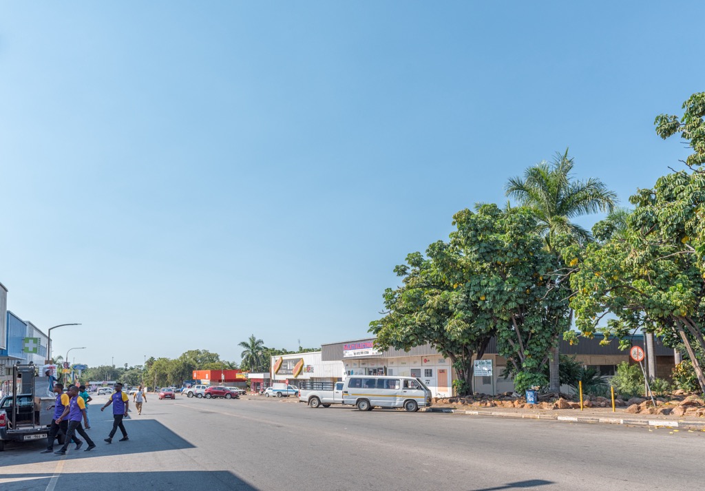
Phalaborwa is a town in the Limpopo Province's Mopani District in South Africa. Known for its proximity to the world-renowned Kruger National Park and the rich mineral deposits in the region, Phalaborwa offers visitors natural beauty, wildlife experiences, and cultural attractions.
Phalaborwa features an entrance to Kruger National Park. The gate is a starting point for various safari adventures and offers information centers, amenities, and accommodation options nearby.
Visitors can explore the Letaba Ranch Game Reserve for a more exclusive and intimate wildlife encounter. This reserve is home to a variety of species, and guided tours provide a more personalized experience. For a change of scenery, visitors can take a boat cruise on the Olifants River to spot wildlife along the riverbanks.


