Scan the QR code and open PeakVisor on your phone
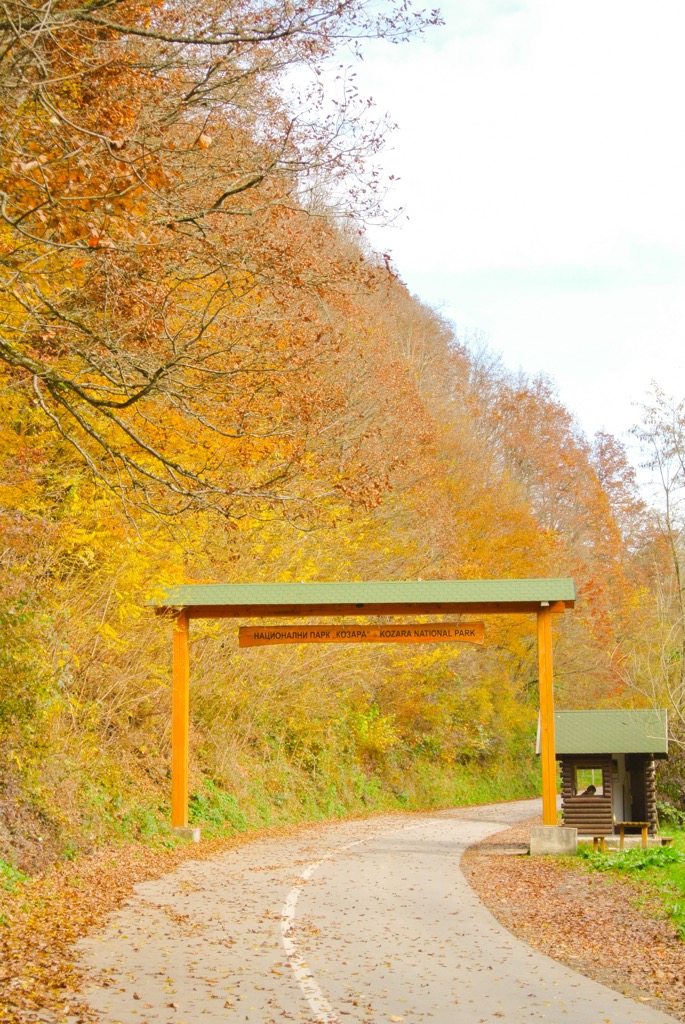
Lying near the border with Croatia, Kozara National Park is in the northwest of Bosnia and Herzegovina. This low-elevation national park isn’t protected only for its diverse and hilly forest landscape but due to its historical value and monuments. There are 21 named mountains in Kozara National Park. Gola Planina (868 m/ 2,847 ft) is the highest point. The most prominent mountain is Mrakovica (817 m/ 2,680 ft).

Kozara National Park is located in Bosnia and Herzegovina and was proclaimed a protected national park by Josip Broz Tito of Jugoslavia, in 1967. It is situated between the Sava, Una, Sana, and Vrbas Rivers and lies inside the Republic of Srpska territory of Bosnia and Herzegovina.
The national park's territory stretches from north-south and is 7 km (4 mi) long and from 3 to 6 km (2 to 3 mi) wide. This dense forest and verdant meadows make up 33.75 sq. km (20 sq. mi) of the region's total area. They are known as the green beauty of Krajina (Krajina is the name of the region inside Bosnia and Herzegovina).
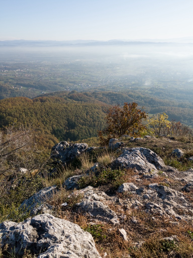
Kozara is a mountain with a variety of terrain. From peaks to plains, you can see Bosanska Gradiška, Prijedor, Banja Luka, and more. The moderate continental climate has mild winters and peaks that don't exceed 1,000 m (3,280 ft). The climate allows for many sunny days as well as some of the most peaceful viewpoints around.
This is a mountain that can be found between the Pannonian plain in the north and other Dinaric mountains in the south. Posavina also bounds it in the north, Pounje in the west, and Rivers Sana and Gomjenica in the east and south.
It is located in the territory of the municipalities: Bosanski Novi, Bosanska Kostajnica, Bosanska Dubica, Bosanska Gradiška, Laktaši, Banja Luka, and Prijedor. Also, it is part of the Republic of Srpska.
Also known as the "Krajiška Beauty," Kozara Mountain is bordered by the Vrbas, Sava, Sana, and Una Rivers. Its dense forests of conifers and deciduous trees have brought in visitors from all over Bosnia and Herzegovina and the region.
Kozara is a well-known hunting location. In recent years there have been many improvements to the Kozara Hunting Tourism development to maintain its reputation.
A smaller part of Kozara National Park is designated for nature lovers, with walking and biking being among the many activities. Everyone can enjoy winter here, from pro-sportists to amateur skiers and snowboarders. Numerous log churches that are wonderful places for a tourist trip are only a few kilometers away.
Kozara’s best-known aspect is the suffering of civilians in World War 2 when the forces of German Wehrmacht surrounded partisans on the Kozara mountain, intending to destroy them.
Formerly a battleground during WWII, Kozara remembers when parts of Bosnia became part of Nazi Germany. The Partisans' intimate knowledge of the rough terrain gave them an advantage over this new occupying army, thus eventually winning the Battle of Kozara.
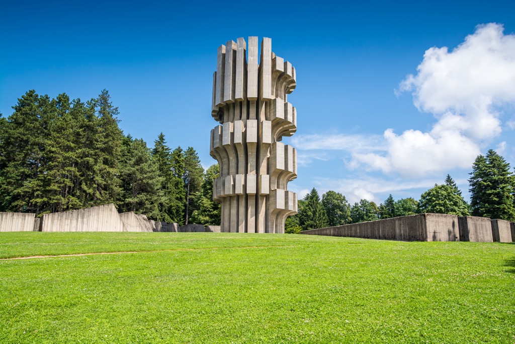
Mrakovica (817 m/ 2,680 ft) is the center of Kozara National Park and 24 km (15 mi) to Prijedor, or 56 km (34 mi) to Banja Luka. This is also where a memorial complex in memoriam of soldiers who died in the Second World War stands. The memorial complex consists of a monument, a memorial wall, and a museum that presents war artifacts.
The monument is towering 33 m (108 ft) tall and symbolizes the people's freedom and strength. The museum also commemorates the hardship that these people have been through and preserves evidence of their struggles.
Kozara mountain is an excellent place to visit if you're a nature lover. It also happens to be a form of natural air spa and offers facilities for many different sports. Kozara National Park, with its pristine natural landscape full of all kinds of wildlife, would enrich any visit. As a member of the IUCN II catgory and EUROPARC, it's one of the most beautiful and prized locations in the country.
From the Banja Luka - Prijedor road, take a turn for Kozarac village and follow the 12 km (7.4 mi) long winding paved road. You'll end up at the central parking space at Mrakovica (817 m/ 2,680 ft) plateau. The tourist offers of NP "Kozara" are extremely diverse. The range of accommodation includes hotels, motels and bungalows so everyone will find a suitable offer for themselves here. Kozara Mountain is an educational park and offers a stay in nature.
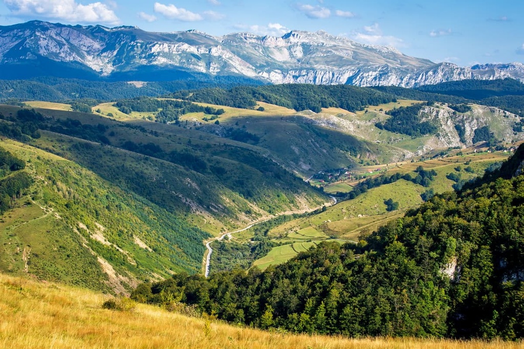
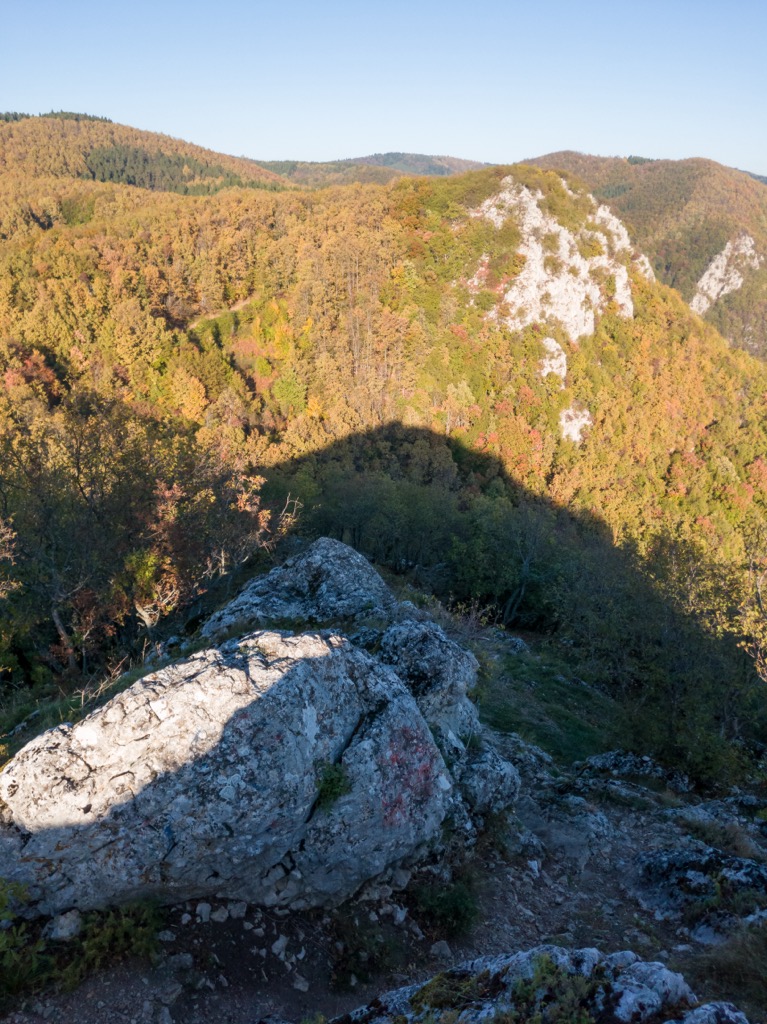
The relief of Kozara mountain is characterized by several interconnected ridges, mountain slopes, isolated peaks, and deeply incised stream valleys. The shape of the mountain range changes gradually due to forest coverage.
Kozara Mountain's highest points don't rise more than 1,000 m (3,280 ft) high, but a rich and expressive relief characterizes it. It stretches in the northwest to southeast direction and is 70 km (43 mi) long.
Rocks that are older than the Paleozoic show that Kozara is a result of volcanic eruptions. Up in the park, you'll find sediments that dominate both in form and distribution. There are primarily Eocene flysch and Mesozoic sediment rocks in this area, but there's also some lower-ocean limestone towards the south as well.
The relief of the Kozara area is the result of its morphogenesis, which took place due to endogenous and exogenous geomorphological processes. The Kozara region is a highland island with a tectonic relief created during the relatively long period of the younger Cenozoic. Due to the uplift of a part of the mainland under the influence of orogenic movements and the increase of the Pannonian Sea.
The most significant period of tectonic shaping of the Kozara massif occurred during the Alpine orogeny at the end of the Mesozoic and during the beginning of the Tertiary. The highest peaks rose from the Pannonian Sea in the middle part of the older Tertiary Era.
Kozara was a peninsula at first, but it became what we know as the entire mainland after being shaped by forces that were exogenous. It belongs to the Dinaric mountain system.
The reliefs of Kozara National Park are very expressive and they influence the climate and vegetation of this region. Different relief forms typical for the geological substratum of this area are present, with mountain peaks, rock faces, plateaus, and slopes.
The long, gradual slopes descending into the valley were formed in the Cretaceous-Eocene Flysch. Gabrodolerits and serpentine form short and steep slopes, resembling classic karst features such as ridges, valleys, and basins.
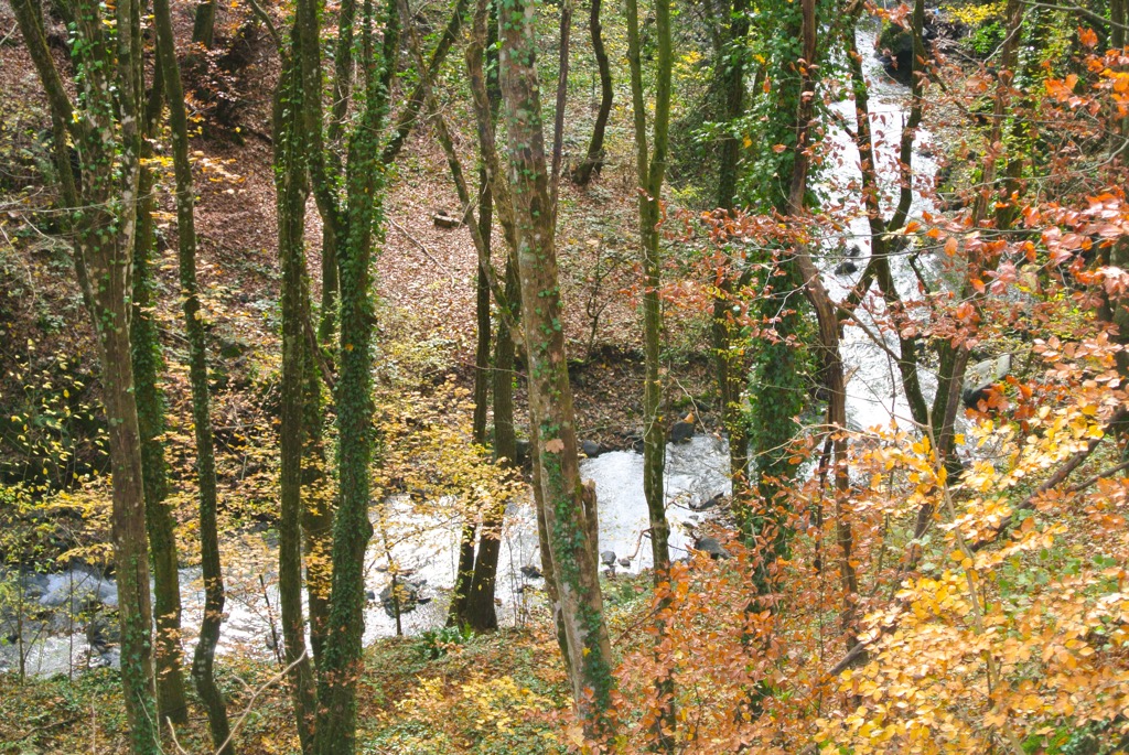
The rivers and streams that are found on Kozara include Mlječanica, Moštanica, Crna rijeka, Gračanica, Starenica, Vojskovačka rijeka, Bukovica. One of the natural boundaries of Kozara is the Sava, which runs along the Posavina area. From here, there are rivers that include: Una, Sana, Vrbas, and Gomjenica.
The highest peaks in the park include:
Kozara National Park is located in a moderate climate zone with clearly marked four seasons. The Continental climate is dominant here. Kozara National Park is one of the largest national parks in Bosnia and Herzegovina.
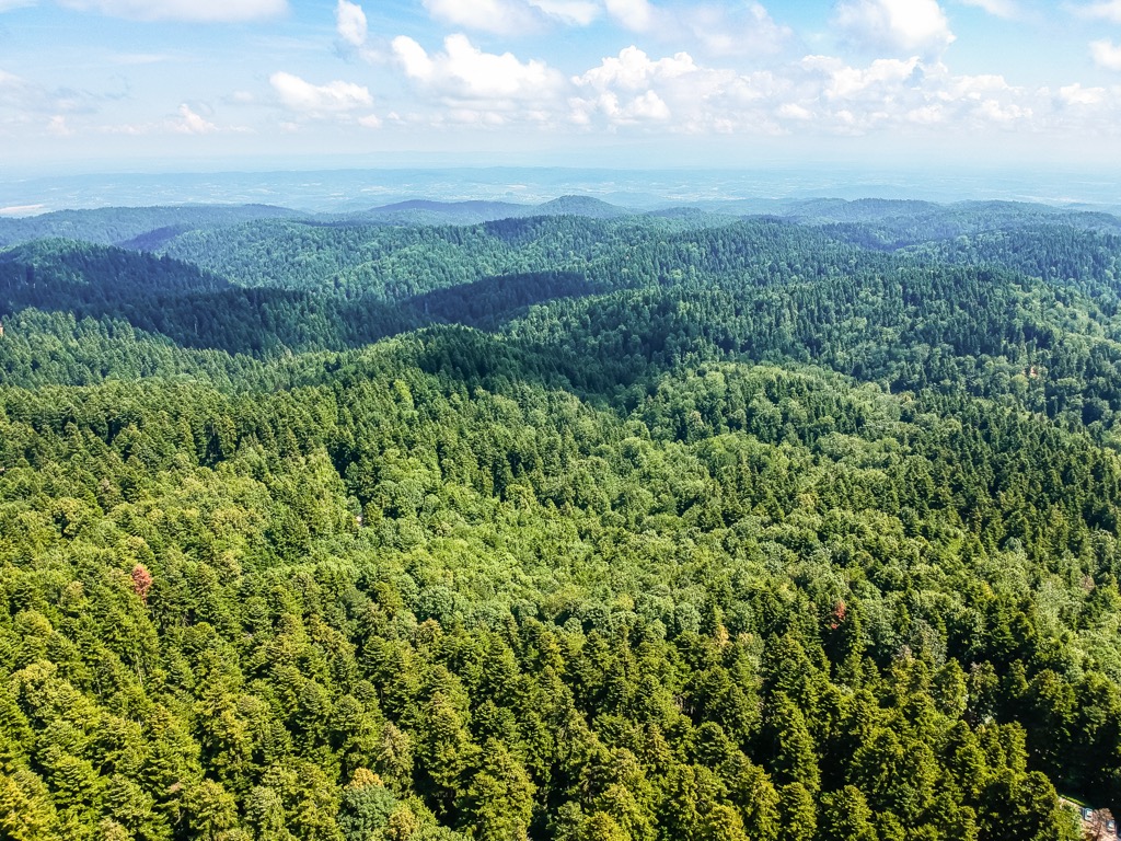
Forest landscapes comprise and cover about 90% of its territory. Forests in this area generally function as a protection and survival mechanism for plant communities, genetic resources, and species that haven't been altered by human intervention.
Kozara National Park's most prevalent forestry type is 'high beech and fir forests.’ The beautiful, rich shades of red, yellow, and brown seen in the fall, combined with the signature green, make these forests especially striking.
Kozara's vertical stratification of the plant system consists of pastures known as Potkozar, with a floor below of deciduous forests, mainly hornbeam, beech, and oak, and above are coniferous forests of spruce, fir, and others.
Differences in the distribution of trees between North and South are also seen. In the north, tall fir and beech forests predominate, while in the southern regions, low oak and coniferous cultures are widespread.
If we wanted to enter the Kozara forest near Laktaši and walk 70 km (43 mi) as far as the border with Croatia, all the areas we covered would be under forest. The forests also have a lot of noteworthy plants like mint, chamomile, thyme, and rosemary.
Kozara is a large hunting ground with many different species. There are roe deer, wild boar, wild cats, foxes, rabbits, pheasants, and partridges. The area is also a refuge for animals during the great Sava River floods. The entire forest on the mountain provides a lot of game for hunting.
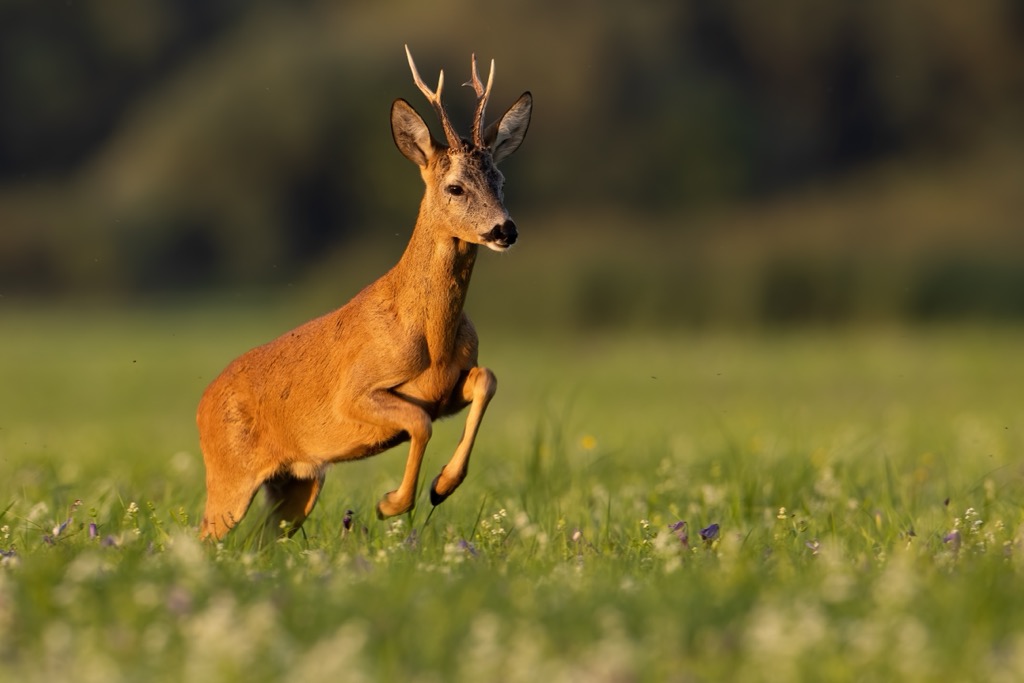
The park is home to many autochthonous animal species and also hosts various other animals that are just passing through. Examples of these species can include roe deer, wild boar, gray wolf, badger, squirrel, hedgehog, and others. There are many autochthonous bird species in the park as well, like partridge, wood pigeon, owl, magpie, and crested tit, to name just a few.
It's well documented that Kozara has a long, tumultuous history. From the prehistoric era until modern times, it's been subject to numerous uprisings and served as a refuge for locals during wartime.
The first cemetery in Mahovljani dates back from the tenth to the eleventh centuries. Bronze jewelry was found in 4 of the 8 graves, a typical Slavic cemetery. In the village of Kozarac, there is a tower that still dominates the area. The Kozarac tower was built in 1736 during the expansion of the former fortification.
In Pilanište, there's a chapel officially named after the Nativity of the Blessed Virgin. This chapel was built in 1903 on a hill overlooking an old mill. When the locals built this chapel, they named it Mehmed Church, and the name has stayed until this day.
A legend has it that this church was a witness to the love between Mary Šmucer, the daughter of Austrian entrepreneur Karl Šmucer, and Mehmed Kulasic from Kozarac. He worked for her father at the time, and their love was forbidden since they were not of the same religion.
Moštanica Monastery is located 14 km (8.6 mi) from Mrakovica (817 m/ 2,680 ft), and it first appeared in the records in 1579. The monastery church hosts the body of Petar Pecija Petrović. The leader of the famous uprising against the Ottomans was buried here.
The culture of the Kozara people includes their song "ojkača," folk customs, and cuisine. Luckily, it is kept alive in Potkozarje's villages. The uprising of Knešpolje from the sixth to the twelfth month of 1858, also known as The First Pecija Uprising, was a significant event in local historiography.
At its root, it was born as a response to the terrible crimes committed by the Ottoman army toward the Serbians living in Kozara. When it comes to local history, the most well-known event is the Kozara Battle. The Kozara Memorial Complex is situated on one of the highest points of the Kozara mountain, Mrakovica (817 m/ 2,680 ft), and pays tribute to those fallen in the Kozara Battel.
The monument at Kozara was created by Dušan Džamonja. On the memorial wall, there are 9,921 names of partisans and townspeople who sacrificed their lives for freedom.
The Battle of Kozara, officially Operation West Bosnia, is a battle from World War II that took place in June and July 1942 in the area of the Bosnia and Herzegovina mountain Kozara between partisans and Axis forces.
With the help of Ustaša and Chetnik units, the Germans launched an attack in the middle of April 1942. The goal was to destroy the Partisans on Mount Kozara. The German administration was troubled by the disturbance of communications to and from the rebel-controlled cities of Zagreb, Prijedor, and Banja Luka. But, in order to completely suppress the rebellion, they were also convinced that it was necessary to destroy any civilian population in those regions.
It was a tough fight, but in the end, 10,000 partisans broke through the enemy's ring and left with 80,000 civilians and only 500 wounded. Approximately 40,000 enemy soldiers attacked against only 4,000 partisans, who won in the end.
The partisans lost around 1,700 people during the offensive and around 50,000 civilians were sent to concentration camps, on both sides of the conflict. Despite this, many people still found Kozara a convenient focal point for the revolution.
Due to its position in relation to the Sava, Una, and Vrbas River communication lines and being surrounded by important mining operations, Kozara was an area of great importance for the occupation administration. Thus, many operations were undertaken against the partisans in Kozara.
Sculptor Dušan Džamonja received the commission for The Monument to Revolution on Kozara, which was built from 1971-1972. It is a modernist structure made out of 1,000 tons of cement.
It was built with the voluntary contributions of 400,000 citizens and 1,350 legal entities, and many people from the diaspora. The opening ceremony was on September 10, 1972 where a number of people, such as Josip Broz Tito, were also present.
The monument is made up of 2 parts, the access, and the central plateau. The access is 200 m from the central plateau, and you can get to it on foot. The shape of it is a cylinder with 20 vertical slabs on each side, giving a 33 m (108 ft) height.
Each segment is symbolized with deep cutouts representing death or bulges to show victory and life. The horizontally placed blocks around the monument signify any pressure from the enemy, and death, but life still prevails in the end.
This mountain became a famous site after heroic battles for freedom in World War II, and the idea of Kozara National Park was born in 1947 as a result. Forests of Kozara Mountain were declared to be forests of historical significance on June 6th, 1957, in order to protect the memory of the epic Kozara Battle, among other things.
The idea of declaring Kozara a National Park has existed since 1959. This was done in order to preserve and protect numerous monuments, natural beauties, and other landmarks which were created during the battles on Kozara. By establishing the park in 1967, it was ensured that the area would not be affected by rampant commercialization and create better conditions for visitors.
If you want to experience nature in Kozara National Park, these are the best hikes to try out:
Mrakovica (817 m/ 2,680 ft) to Gola Planina (868 m/ 2,847 ft) hike takes around two hours to complete. The trail starts at Mrakovica (817 m/ 2,680 ft) and leads to Gola Planina, the highest peak of Kozara National Park, where you'll enjoy an exceptional view of our surroundings. You can see Prijedorsko polje, the Saničane pond, Manjača, Grmeč, and even Croatia.
The trail passes by Gumlin, one of the most beautiful parts of Kozara National Park. This place offers a rock viewpoint, a cave, and a canyon all next to each other. It's about 50 m (164 ft) high and makes for an extraordinary view.
The Mrakovica (817 m/ 2,680 ft) hiking trail takes you to Kozarački Kamen in 2 hours. The views around here are stunning, especially from Beshicha Poljana (777 m/ 2,549 ft). This is a scenic spot for you to enjoy the surroundings and observe all the beauty surrounding you.
Going further, the route leads through the deciduous forest to Kozaracki Kamen, a lookout point high enough to offer an extraordinary view.
A 400 m (1,300 ft) long path from the main road to Mrakovica (817 m/ 2,680 ft) leads to Zečiji Kamen, one of the most beautiful locations in Kozara National Park. You can get your fill of spectacular views from its lookout rock.
There are many ways to get your adrenaline fixed here, with the 21 climbing routes of varying heights and lengths.
The nearest bigger cities to Kozara National Park include these:
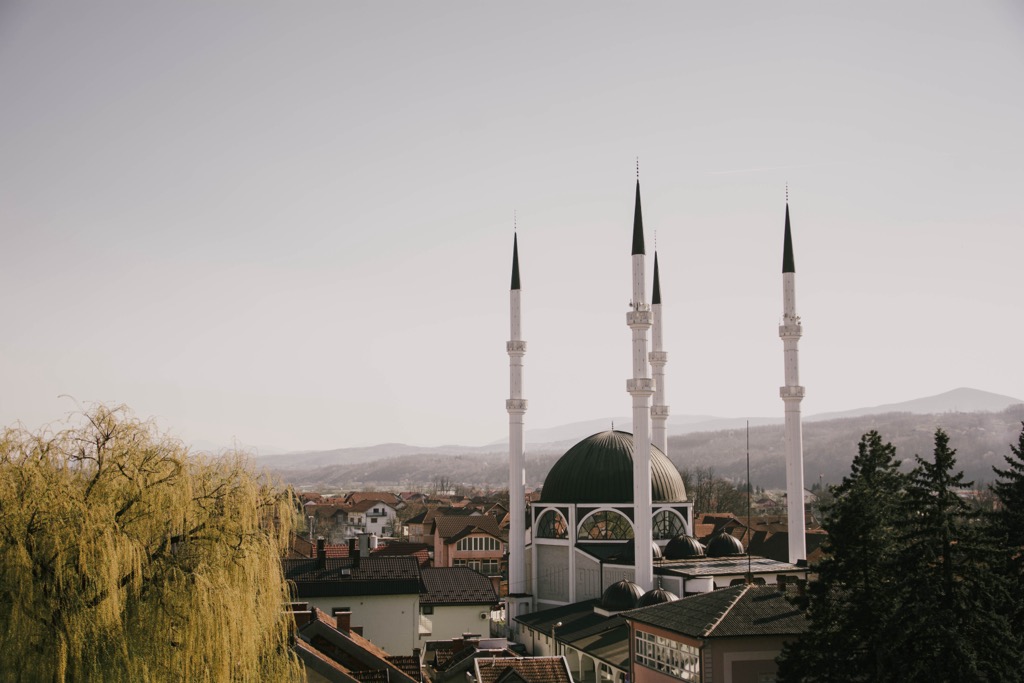
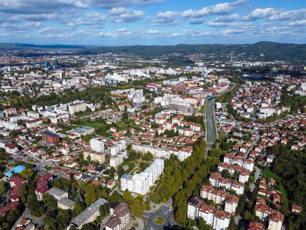
Banja Luka is the second-largest city in Bosnia and Herzegovina, and it is located in the northern part of Bosnia and Herzegovina, near the border with Croatia. The city has a population of around 200,000 people.
In 1991, it became part of independent Bosnia and Herzegovina. The war in Bosnia and Herzegovina caused great damage to Banja Luka’s economy, infrastructure, and culture.
Prijedor is a city and municipality in northwestern Bosnia and Herzegovina. It lies on the banks of the Sana River, some 45 km (28 mi) northwest of Banja Luka. The town center is located on the left bank of the river, while residential areas are on both banks.
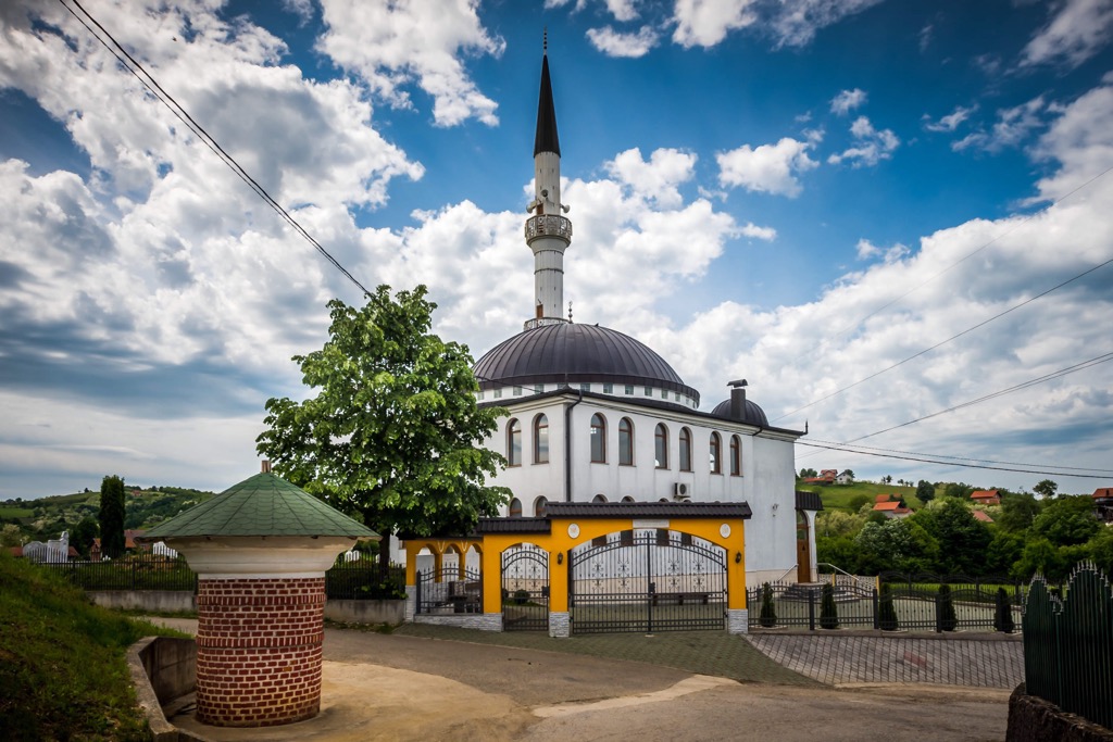
The municipality includes a number of small towns and villages, such as Kozarac, Omarska, Trnopolje, Blječevo, and others. It is the closest city to Kozara National Park.
Sanski Most is a small town in the northwest of Bosnia and Herzegovina. The town is located in the valley of the Sana River, on both banks of the river and near the border with Croatia. Its name means Bridge on Sana. Mountains surround it and the municipality has a population of about 50,000 people.