Scan the QR code and open PeakVisor on your phone
Kiu Tsui Country Park is a group of eight islands in the back garden of the Hong Kong Special Administrative Region of China. There are 2 named peaks in the park—Hóng Huā Lì Dǐng (136 m/ 446 ft) and Hak Shan Teng (97 m/ 318 ft).
With just 100 hectares (247 acres) in area, Kiu Tsui Country Park is the second smallest country park in Hong Kong. It is located in the district of Sai Kung in the eastern part of the city, 2 km (1.2 mi) off the waterfront of Sai Kung town center.
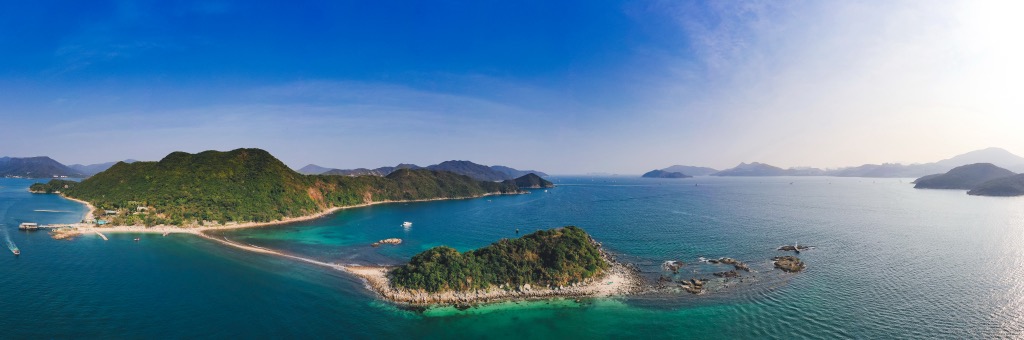
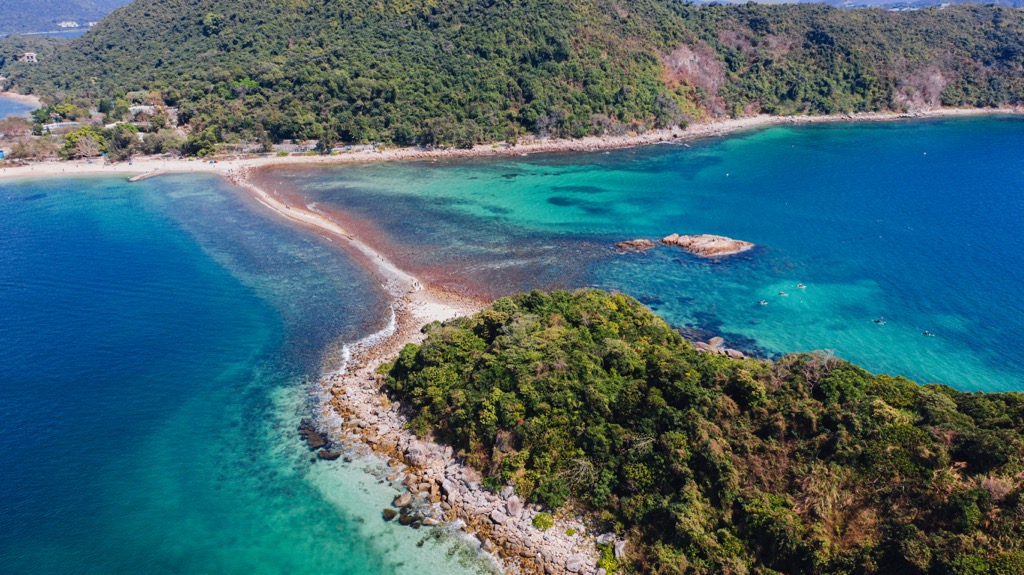
The park is made up of eight islands in Port Shelter, the biggest of which is Sharp Island. The others are Cham Tau Chau, Kiu Tau, Pak Sha Chau, Siu Tsan Chau, Tai Tsan Chau, Tuen Tau Chau and Yau Lung Kok.
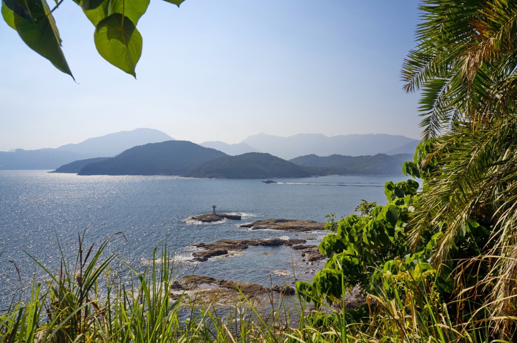
Despite being the biggest of the eight islands, Sharp Island is only 2,500 m (8,202 ft) long and 500 m (1,649 ft) wide. It is the only island reachable by shuttle boat service (locally known as kaito). During low tide, it is connected by a sand levee to Kiu Tau, a tiny islet to the west.
There are many other islands in the vicinity of the park. The closest of them are Yim Tin Tsai and Kau Sai Chau to the east.
The islands of Kiu Tsui Country Park are part of the ancient High Island Supervolcano, whose submerged remnants were discovered only in 2012. The islands are believed to have formed some 140 million years ago at the crater of the supervolcano.
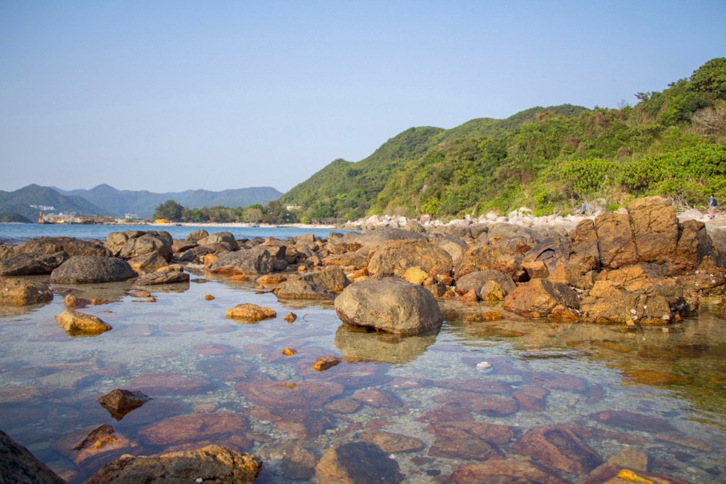
The park contains various types of igneous rocks such as tuff, volcanic breccia, rhyolite and quartz monzonite. Tuff is volcanic ash expelled from explosive eruptions that subsequently compacts and cements into relatively soft rock.
Volcanic breccia is a consolidated mixture of pyroclasts (rock or mineral fragments ejected from eruptions), lava and volcanic ash. Pyroclasts erupt lower and move shorter distances than volcanic ash because they are heavier. The further away from the crater, the smaller the breccia becomes.
Rhyolite typically develops from lava towards the end of the eruption stage when the force of eruption tapers off. The high viscosity of lava confines it to short distances from the crater. The distribution of rhyolite indicates the course of lava flow.
Rhyolite is similar to granite in terms of chemical composition but has finer grains and exhibits flow banding. It is developed through swift condensational consolidation of lava above ground while granite is a product of slow condensational crystallization of magma underground.
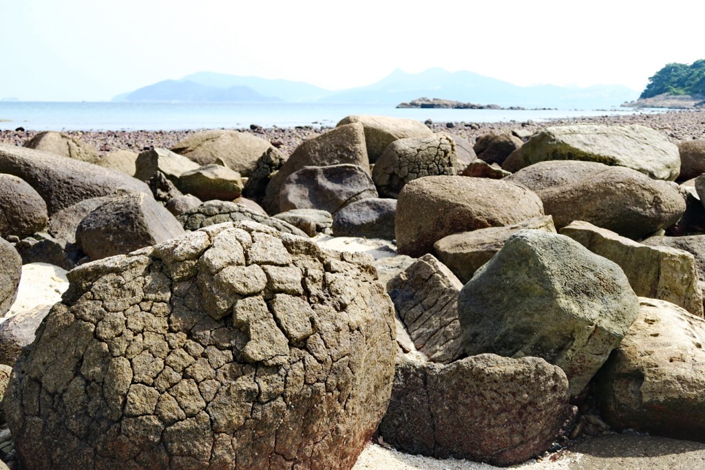
Quartz monzonite is sometimes categorized as a subclass of granite. In the intertidal zone, there are some heavily-weathered quartz monzonite boulders nicknamed “pineapple bun rocks”. Thermal expansion and contraction has produced reticulate cracks on the rock surface, resembling those found in a local delicacy, the pineapple bun.
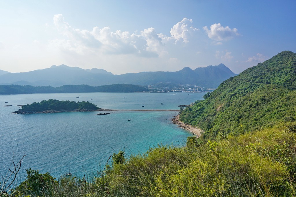
Sharp Island and Kiu Tau are linked by a 200-m (656-ft) tombolo, which is a natural levee containing sediments brought by waves and wind. It emerges above water at low tide and gets submerged during high tide.
Most of Sharp Island is covered with forests, while the other islands are thinly vegetated. The majority of trees on Sharp Island are native species such as ivy tree (Schefflera heptaphylla), camphor tree (Cinnamomum camphora), horsetail tree (Casuarina equisetifolia) and Chinese Banyan (Ficus microcarpa).
One of the trees that are well adapted to the conditions on the islands is the screw pine (Pandanus tectorius) which thrives in sandy and salty soil. It grows aerial roots for respiration to compensate for the lack of oxygen in the soil, and can be readily recognized by its pineapple-like fruits.
A few shrubs also grow on Sharp Island, including dwarf mountain pine (Baeckea frutescens) and rose myrtle (Rhodomyrtus tomentosa).
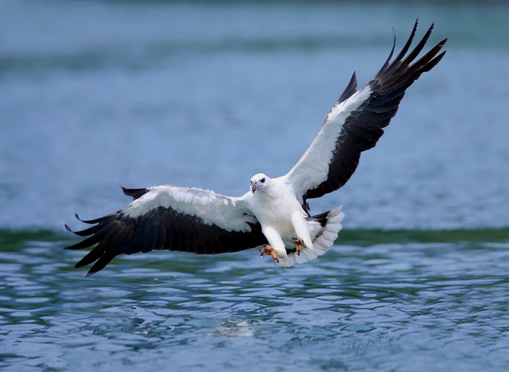
The most easily spotted type of wild animals on the islands are birds like the white-bellied sea eagle and striated heron. Species that mostly stay in the woods include the Asian koel, Indian cuckoo, sooty-headed bulbul and greater coucal.
The waters surrounding the islands harbor a rich diversity of marine life, with nearly 50 species of hard corals such as brain corals (Platygyra spp.) and lettuce corals (Pavona spp.). The northern shore of Sharp Island has a remarkable coral coverage of 74% (as of 2022), the highest among coral communities in Hong Kong.
The corals support about 170 species of fish like the spotted seahorse, threadfin porgy and sargassum fish. Unfortunately, the fragile environment is under stress from unregulated recreational diving, and record-breaking temperatures that have led to coral bleaching in the summer.
Designated in 1979 as a country park, the islands are uninhabited except for a handful of households on Sharp Island. Some of the land on Sharp Island is privately owned and excluded from the country park.
In the early 1980s, a businessman opened a seafood restaurant called the North Sea Fishing Village on Sharp Island and made a handsome profit. He doubled down on his investment and leased land from the government to create a resort that offered amusement rides, go-karts, barbeque areas and water sports facilities.
The resort became a popular getaway that many Hong Kong people still fondly remember, but it lasted just a few years before the owner ran into financial difficulty and sold the resort, which closed down in 1989.
It went into decay until the current owner, billionaire Francis Choi, started renovating and expanding it in 2009 for his own private residence. Some of the structures were found to be built on public land and Choi was ordered to tear them down.
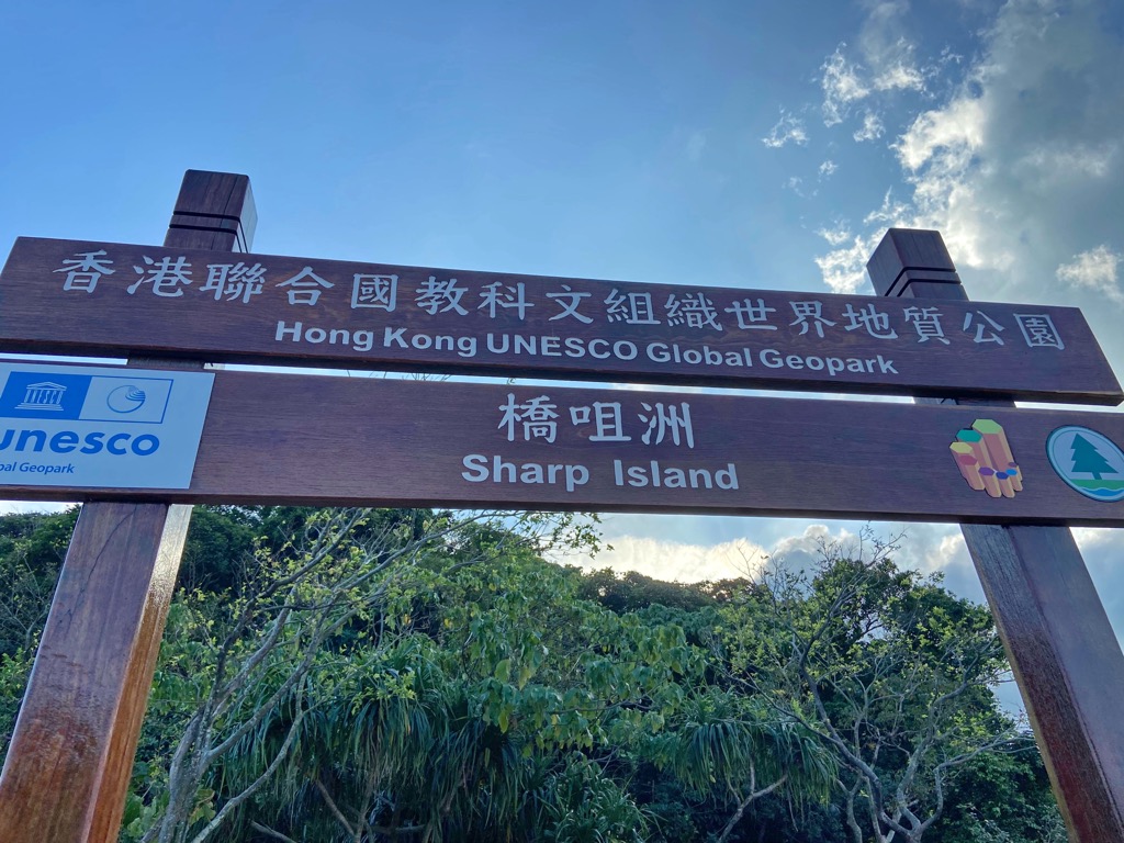
In 2009, Sharp Island became part of the Hong Kong National Geopark, which was upgraded to the Hong Kong UNESCO Global Geopark two years later. It is also the most accessible attraction in the Geopark.
In 2022, the Tourism Commission launched a three-year arts project, Sai Kung Hoi Arts Festival, which kicked off its first year on Sharp Island and nearby Yim Tin Tsai. Centering on the theme of “Joy Again, Isle”, the festival showcases the natural and cultural heritage of the isles through art.
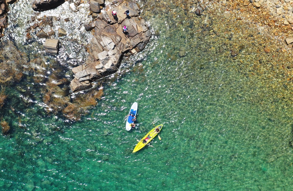
The festival features artwork installations by local artists at various locations and offers a range of free activities such as guided walks, kayaking trips, music/ dance performances, photography workshops and mindfulness practice.
The free activities for the first year took place from mid-November 2022 to mid-January 2023, though some of the artworks remain as regular exhibits. The second and third years will cover two more isles—Kau Sai Chau and High Island—with details to be announced at the event website.
Sharp Island is one of the nine “overlooked places” in Asia recommended by CNN. Apart from Kiu Tsui Pier in the northwestern corner, shuttle boats also serve Half Moon Bay in the south.
It is possible to walk over to the neighboring islet of Kiu Tau from Sharp Island, but to visit other islands, you will need to kayak or hire a boat.
Sharp Island and Kiu Tau are easy to get around, and here are the most popular sights to explore.
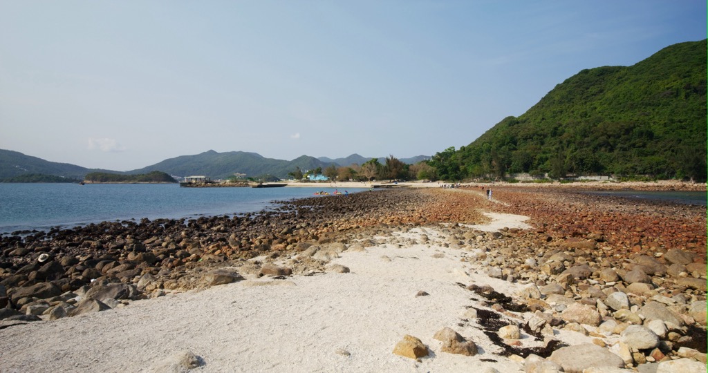
At just 1.6 km (1 mi), this short trail traverses Sharp Island from Kiu Tsui Pier, leading up to the peak of Hak Shan Teng (97 m/ 318 ft) before descending to the crescent-shaped Half Moon Bay (also known as Hap Mun Bay).
The trail is generally well maintained with a few rocky or overgrown bits. There are several vantage points along the way that afford spectacular views of the islands and Port Shelter.
Sharp Island boasts two beaches—Kiu Tsui Beach next to Kiu Tsui Pier and Half Moon Bay. Both have good facilities including changing/ shower rooms, barbeque pits and refreshment kiosks, and the latter also has a campsite.
From Kiu Tsiu Beach, the 500-m (1,640-ft) Sharp Island Geo Trail follows the tombolo that crosses over to Kiu Tau, passing by the “pineapple bun rocks”. The tombolo is walkable only when the tide level is below 1.4 m (4.6 ft).
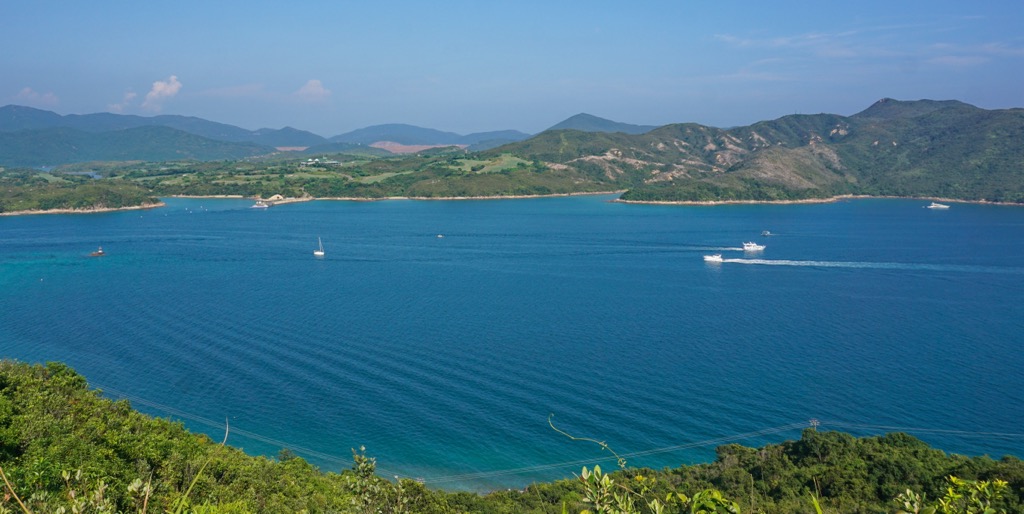
The water quality of Half Moon Bay is among the best in the city, but this means it gets crowded on the weekend. There is a secluded rock pool to the northwest of the bay, but it requires a bit of coasteering or kayaking to reach it.
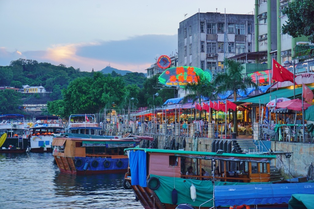
The gateway to the islands is Sai Kung Town, a neighborhood which has mostly escaped the large-scale developments in urban areas. With its waterfront promenade and age-old villages, the town has a laid-back vibe even when it gets packed with visitors on weekends and holidays.
The promenade teems with seafood restaurants, specialty eateries and weekend markets which make it a destination in itself. The public pier is lined with boat operators that offer rides to many offshore attractions, including Sharp Island which is just a 15-minute hop away.