Scan the QR code and open PeakVisor on your phone
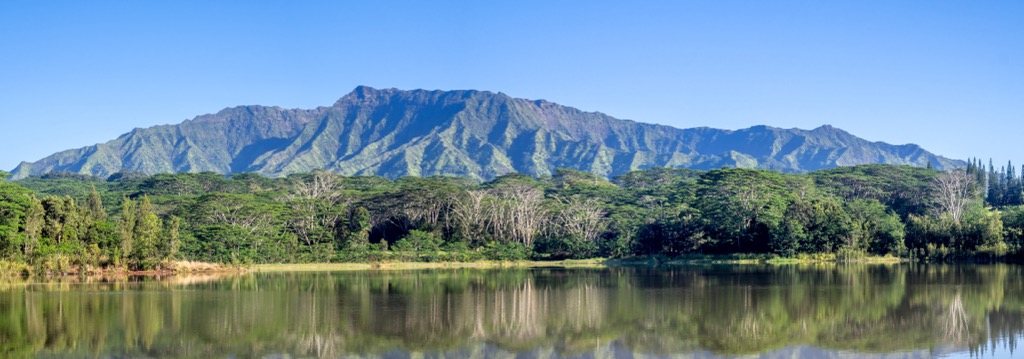
The Keālia Forest Reserve is situated in the northeastern portion of the island of Kaua’i in the US state of Hawai’i. The reserve helps protect land vital for native plants and animals on the island. There are 25 named peaks with Makaleha being the tallest at 3,215 feet (980 m) and the most prominent with 1,296 feet (395 m) of prominence.
The Keālia Forest Reserve is administratively combined with nearby Moloa’a Forest Reserve. Together the two reserves span 10,505 acres (4,251 ha) across northeastern Kaua’i. The Moloa’a Forest Reserve lies north of the two non-contiguous sections of the Keālia Forest Reserve.
This protected region is situated along the windward side of the island, including rugged ridge lines as well as rolling foothills. When the forest was created, it was made to not include any of the farmable terrain in the region, thus there are little to no flat sections of land within the reserve.
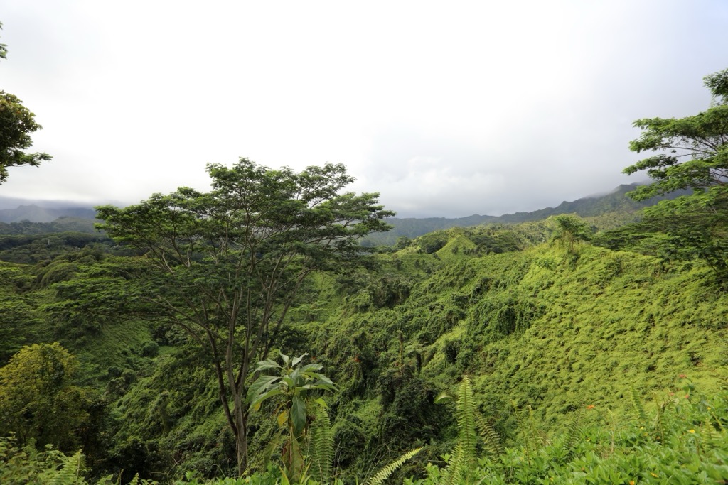
Similar to much of the eastern side of the island, Keālia Forest Reserve features steep mountains and ridgelines. The tropical terrain features dense vegetation throughout, with a high tree canopy at higher elevations.
The tropical forest is often wet, with inland sections of terrain receiving more rainfall. The entire reserve lies within Kaua’i county which encompasses the islands of Kaua’i, Ni’ihau, Lehua, and Ka’ula.
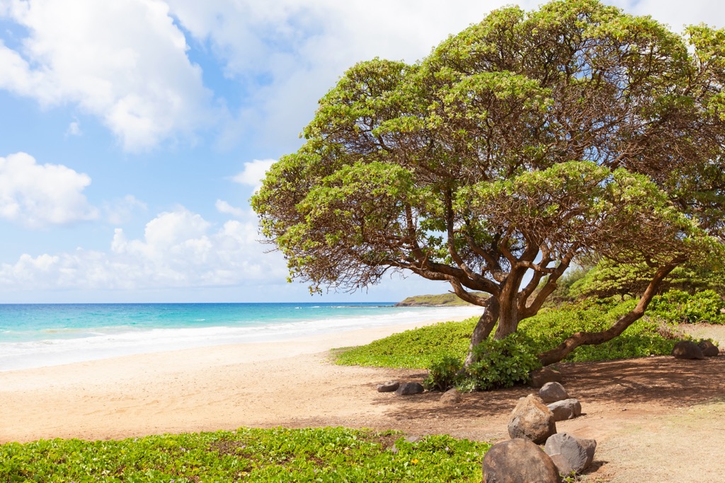
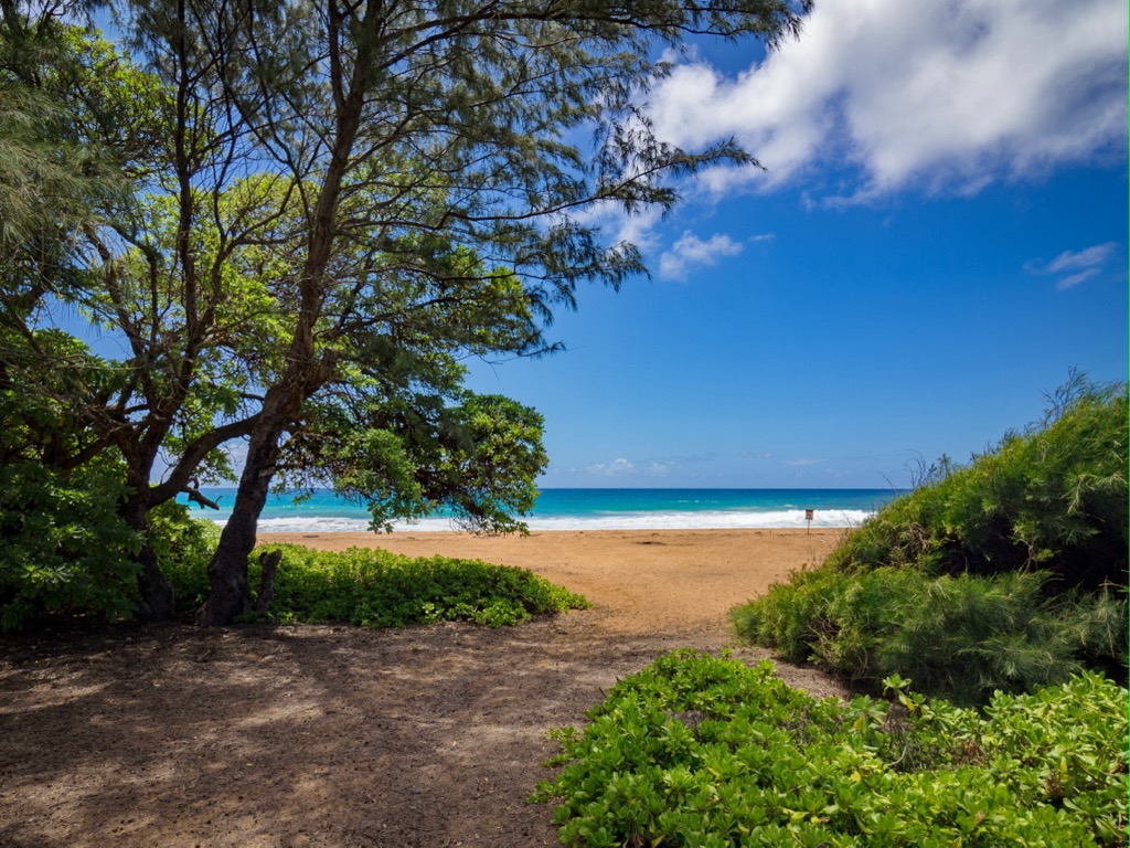
Land between the two non-contiguous sections is relatively flat and privately owned. The closest beaches lie directly east of the forest reserve with the Pacific Ocean surrounding the entire island.
The headwaters of the Kalihiwai River begins just west of the reserve. Throughout the Keālia Forest Reserve lie a multitude of small creeks and streams, fed by the rainfall throughout the region. The reserve helps protect the upper valleys of the watershed.
Additionally, the Keālia Forest Reserve is located near numerous other areas for outdoor recreation. Moloa’a Forest Reserve lies directly north while the Halelea Forest Reserve is located west and Lihue-Koloa Forest Reserve is to the southwest. The Nounou Forest Reserve and Kalepa Mountain Forest Reserve are situated to the south.
The island of Kaua’i, along with the other islands that make up the Hawaiian Islands, mark the tallest peaks of a massive mountain range spanning 3,500 miles (5,633 km) across the floor of the Pacific Ocean. Today these islands mark one of the most geographically isolated archipelagos in the world.
The island of Kaua’i, along with the rest of the islands in the chain, has volcanic origins. All of the islands were formed as the Pacific Plate moved over the Hawai’i hotspot. Kaua’i was formed roughly five million years ago, making it the oldest of the main Hawaiian Islands.
The Pacific Plate moved across the hotspot in a northwest direction at a rate of 32 miles (51 km) per million years. Volcanic activity has formed the entire chain of mountains, including those both above and below the water.
Active volcanism visible above the water is still present on the youngest and largest island, Hawai’i. Millions of years of erosion have slowly carved away at the island of Kaua’i. The older islands in the chain are much smaller in size and feature more dramatic cliffs due to the erosion they have sustained.
Kaua’i also features a massive caldera complex and a lack of rift zones, distinguishing its geological features from the other nearby islands.
Major peaks within the Keālia Forest Reserve include Makaleha, Pu’uehu, Namahana (Kekoiki), and Hokualele.
The warm temperatures coupled with an abundance of rain allow for a variety of both flora and fauna to thrive within the forest reserve. The forested landscape features both native and invasive plant species.
Some common species found in the region include albizia, java plum, and strawberry guava. Numerous species are listed as endangered including adenophorus periens, bonamia menziesii, cyanea asarifolia, exocarpus luteolus, and labordia lydgatei among others.
Numerous invasive plant species threaten the natural ecosystem in the region. Common invasive species include shoebutton ardisia, satin leaf, ironwood, juniper berry, white ginger, thimbleberry, African tulip, Java plum, albizia, and various others.
Native animals found in the region include koloa (Hawaiian duck), ‘opaekala‘ole ( freshwater shrimp), Awaous guamensis (goby), Amastrid land snail, Newcomb’s snail, ‘ōpe‘ape‘a (bat), and Hawaiian petrel.
Common invasive wildlife include various songbirds and mosquitoes as well as feral cats, goats, and pigs.
The Hawaiian Islands share a long and rich human history that dates back over a thousand years before the arrival of European colonizers.
The first people to settle on the Hawaiian Islands were Polynesians from the Marquesas Islands. These people arrived around 400 CE and were highly skilled farmers and fishermen, also bringing with them important foods and plants. A second wave of travelers, this time from Tahiti, also settled on the islands.
Many of the early communities were centered near the coasts of the islands. The forest reserve occupies the ahupua‘a of Ko‘olau, Kāhili, Waiakalua, Moloa‘a, Pāpa‘a, ‘Aliomanu, Anahola, Keālia, and Kapa‘a. Ahupua’a is a Hawaiian term for the subdivision of land that extends from the sea to the mountains, with each ahupua’a including vital resources such as watershed, farm land, forest, and ocean.
Each of the islands featured small communities that were ruled by different chieftains with communities that would battle one another in order to expand their territory. For over 500 years the people of Hawaii were isolated from the rest of the world.
The first European colonizer to arrive on the islands was Captain James Cook in 1778. When Cook returned to the islands in 1779 he was killed on the island of Hawai’i. Over the following 15 years, the warrior chief known as Kamehameha the Great, led a war to unite the islands. In 1795 the Kingdom of Hawai’i (Hawaiian: Ko Hawaiʻi Pae ʻĀina) was established.
Kaua’i did not join the kingdom until 1810 when the islands’ chief swore allegiance to Kamehameha. The kingdom was an independent constitutional monarchy with the two major dynastic families being the House of Kamehameha and the House of Kalākaua.
In 1820, the first Christian missionaries arrived on the islands, bringing with them infectious diseases that devastated the native population. During this time Lāhainā was the capital of the Kingdom of Hawai’i.
Following the death of Kamehameha I, Liholiho (Kamehameha II) ruled the Kingdom of Hawai’i. Both Kamehameha II and his wife died in 1824 on a state visit to England. The population of Native Hawaiians was estimated to around 300,000 when Cook arrived, dwindling to just 70,000 in 1853.
The Kingdom of Hawai’i developed trade deals with various nations and had a thriving agriculture based economy. In 1835 the first sugar extraction mill was built on the island of Kauai. The rise of plantation production led to workers being brought in from China, Japan, the Philippines, Korea, and Portugal.
In 1881, King Kalākaua became the first monarch in history to successfully circumnavigate the globe. In the following year, ‘Iolani Palace, the official residence of Hawaiian monarchs, was completed. The palace featured the first electric lights in the Kingdom of Hawai’i as well as amenities not yet in the White House.
The Bayonet Constitution was drafted by Lorrin A. Thurston in 1887. The constitution was brought to King Kalākaua by 3,000 residents including an armed militia, forcing the King to sign it. This new constitution created a constitutional monarchy, which stripped the King of most of his powers.
In 1893, non-native Hawaiian businessmen and politicians overthrew Queen Lili’uokalani, her cabinet, and the government of the Kingdom of Hawai’i. The coup was backed by the US Government, while the Queen was forced into house arrest at ‘Iolani Palace following the 1895 rebellion. The Queen was forced to sign a declaration known as “Liliuokalani Dominis'' which formally abdicated her throne.
In 1898, The Newlands Resolution was signed, ultimately leading to the annexation of the Kingdom, creating the Territory of Hawai’i. Shortly after, in 1901, the first hotel was constructed in Waikīkī.
The US government and missionaries drastically altered the Hawaiian Islands, stripping the people of their traditional homelands and native practices. Over the past 100 years, the islands have been transformed into a tourist destination, with rising housing prices forcing many Native Hawaiians to leave their home.
The Keālia Forest Reserve was originally established in 1906 followed by the Moloa’a Forest Reserve in 1909.
There are minimal amounts of established hiking trails in the Keālia Forest Reserve. Below are a few popular routes to check out on your next visit to the region:
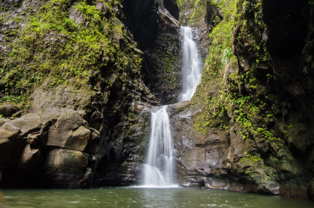
This out and back route is situated in the southern section of the forest reserve. The trail climbs steadily through the forested landscape, following along the Makaleha Stream. A final steep climb brings hikers to the back of Makaleha Falls. The falls cascade down through the narrow and lush valley. A small pool is situated at the base of the falls. This out and back route is 5.2 miles (8.4 km) in length and features 984 feet (300) of elevation gain.
This short hiking route lies along the southwestern edge of the forest reserve. The route is open to the public but passes through privately owned land. The trail descends down to the Kapa’a Stream where the falls cascade the rock face. This out and back route is 2.4 miles (3.9 km) in length and features 196 feet (60 m) of elevation gain.
The Moalepe Trail follows along the southern edge of the forest reserve. The path winds through the forested landscape, offering views of the surrounding mountains and ridgelines throughout. There are numerous creeks and streams along this route. Round trip the trail is 5 miles (8 km) and features 711 feet (217 m) of elevation gain.
Looking for a place to stay near the Keālia Forest Reserve? Here are some of the best cities and villages to check out in the region:
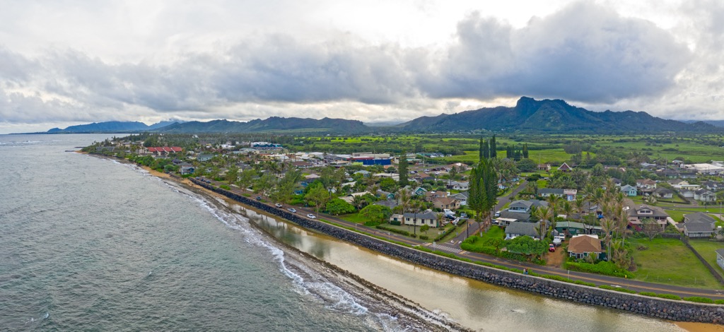
Situated just southeast of the Keālia Forest Reserve, Kapa’a is home to roughly 10,000 residents. Within the area lies Old Kapa’a Town which features local businesses, shops, and restaurants showcasing the history and culture of the region.
Visitors in the area can take in the beauty of the region by exploring the white sand beaches, or kayaking the Wailua River, the only navigable river in the state. Just a 20 minute drive from the Lihue airport, Kapa’a marks a historic town on the island.
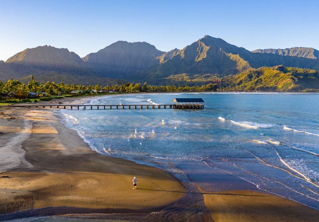
The town of Hanalei lies along the northern shores of Kaua’i, situated along the shores of Hanalei Bay. Hanalei has a rich human history, having been a well-populated region for hundreds of years by the Native Hawaiian people.
Local restaurants, shops, and art galleries line the streets of the town. Hanalei offers a great place for beginners to learn how to surf due to its consistent small waves. Visitors can also check out the historic Hanalei Pier built in 1892.