
Scan the QR code and open PeakVisor on your phone
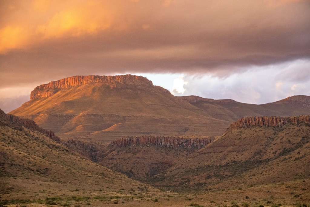
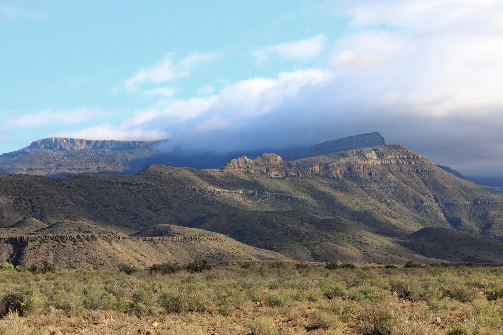
The Karoo National Park showcases the unique and rugged topography of the Karoo region in South Africa. There are 15 named mountains in Karoo National Park. Bilthouders Bank is the highest point, measuring 1,797 meters (5,896 ft). The most prominent mountain is Korannasfonteinberg, at 1,636 meters (5,367 ft) and 358 m (1,175 ft) of prominence.
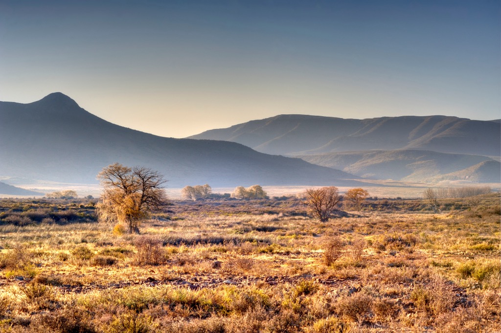
Karoo National Park is in the semi-desert Great Karoo area of the Western Cape, South Africa, near Beaufort West. The park encompasses an area of 76,800 ha (189,777 ac).
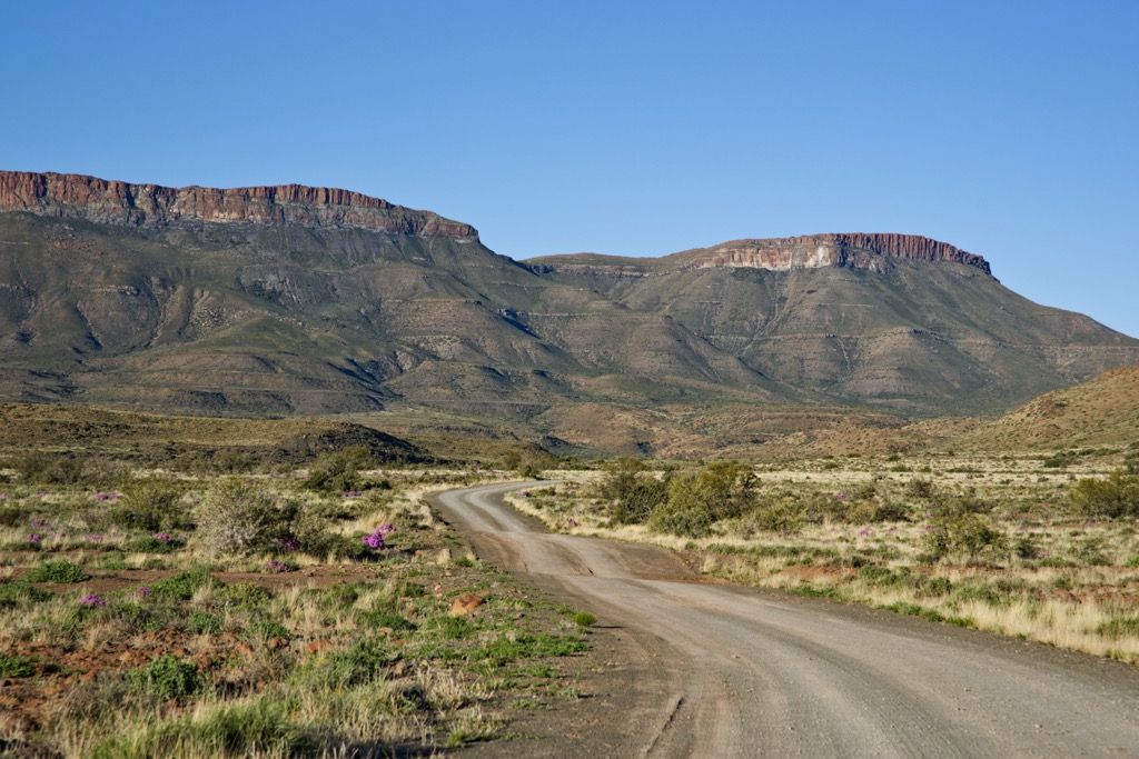
Open plains, rugged mountains, and deep valleys distinguish the park's topography. Elevations range from 500 to 1,797 meters (1,640 to 5,896 ft), with the highest point identified as Bilthouders Bank. The Nuweveld section of the Great Escarpment crosses the park, spanning both the Lower Karoo at approximately 850 meters (2,789 ft) and the Upper Karoo at elevations exceeding 1300 meters (4,265 ft).
Due to its semi-desert climate, the Karoo National Park is subject to wide variations in temperature and little-to-no rainfall. The annual average minimum temperature is 9°C (48°F), while the maximum is 9°C (48°F) and 24°C (75°F). The climate is characterized by extremes, ranging from -15 °C (−27°F) on the plateau during winter to temperatures exceeding 40°C (104°F) on the plains in summer. In addition, the park receives an average rainfall of 220 mm (78 in) per year and is subject to periods of drought.
Notably, the Karoo National Park is a repository of fossils dating back millions of years. The park's rich paleontological history is evidenced by the fossilized remains of therapsids, otherwise known as early mammal-like reptiles, and other prehistoric creatures.
The Karoo National Park is situated atop the geological formations of the Beaufort Group, part of the Karoo Supergroup dating back to the Permian age. The supergroup comprises the Dwyka Formation, Ecca Group, and Beaufort Group. The Beaufort Group, positioned above the Ecca Group, is characterized by alternating mudstone and sandstone. Dolerite rock, present in the form of sills and dykes, exhibits greater resistance to erosion compared to associated sedimentary rocks like mudstone, siltstone, and shale.
Furthermore, the park is located within the Karoo basin, housing a fossil record spanning a period of 240 to 190 million years. The area has yielded fossilized remains of approximately 26,000 therapsids.
The Karoo region is distinguished by its arid climate, marked by limited rainfall, clear skies, and notable temperature fluctuations. The indigenous flora and fauna have adapted to thrive in these challenging environmental conditions. These resilient plants endure extreme climatic variation, from winter snow to scorching summer heat.
Among the robust vegetation are hardy shrubs, succulents, and drought-resistant grasses. These plants have developed mechanisms to conserve water and endure intense sunlight. The region boasts a rich diversity of plant species, with an extensive photographic herbarium documenting over 100 varieties.
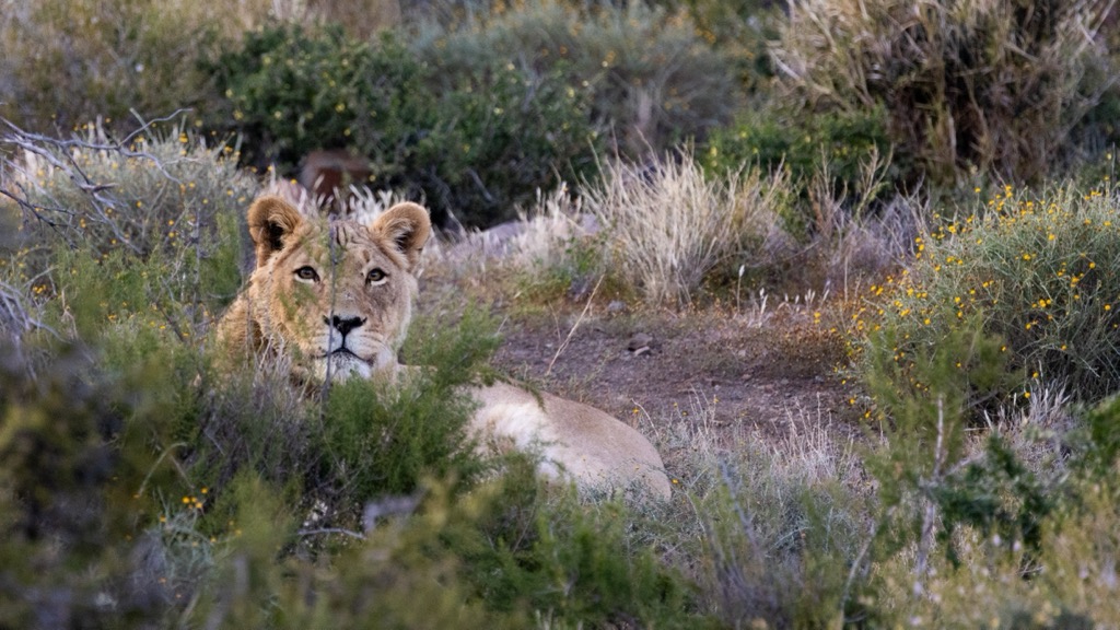
While the Karoo once hosted abundant herds of migratory game, this population has dwindled. Ongoing conservation initiatives aim to restore a thriving ecosystem. The park has reintroduced various game species, including nyala, sable, gemsbuck, springbok, and black wildebeest.
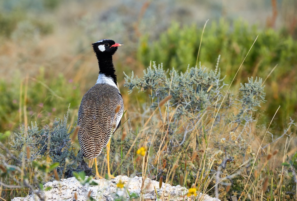
Similar to the plant life, the animal inhabitants of the Karoo have adapted to the harsh climatic conditions. Large mammals and smaller species, such as aardvark and steenbok, rely on efficient water usage and heat tolerance for survival. Moreover, the Karoo National Park boasts a diverse avian population, with over 120 documented bird species, including the northern black korhaan, yellow weaver, red bishop, and red-knobbed coot.
The Karoo National Park has a diverse history spanning millennia. Initially inhabited by indigenous groups like the San and Khoi people, who were adept at survival in semi-arid conditions, the region witnessed significant changes with the arrival of European settlers in the 17th century.
European farming practices, particularly sheep farming, transformed the landscape. Over time, the Karoo became an essential hub for agriculture and trade, marked by the growth of towns and transportation networks.
In recent times, efforts have been made to preserve the unique ecology of the Karoo. Karoo National Park was established in 1979 to protect the region's biodiversity, including its flora and fauna.
The Fossil Trail is a 400-meter (1,312 ft) walk that allows visitors to explore the fossil evidence of extinct Karoo wildlife. It showcases real fossils dating back a staggering 250 million years, long before climatic and geomorphological changes transformed the landscape.
Although the walk is short, the Fossil Trail showcases whole skeletons, skulls, and individual bones of ancient African wildlife amongst the endemic plant species such as Karoo bossie, spekboom, acacia, and aloes.
The Bossie Trail is a relatively short walking trail, spanning approximately 800 meters (2,625 ft). Along the way, an array of succulents and other plant species thrive in the unique Karoo environment.
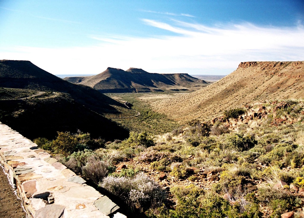
Hikers should take note of the intriguing rock formations. The mountains reveal layers of ridges known as turbidite fans, which result from sediment deposition by flowing water and subsequent compression. Panoramic views of the valley include the surrounding peaks of Die Skoen, Nuweveldberg, and Bakenskop.
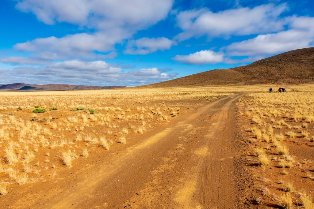
The Karoo Nuweveld 4x4 Trail is a self-driving course that spans approximately 90 km (56 mi), with an optional loop of 7 km (4 mi) known as Kookfontein. The circular trail includes a mix of terrain, such as management tracks, farm roads, sandy riverbeds, and rocky outcrops.
While en route, keep an eye out for antelope species like kudu, klipspringer, black wildebeest, springbok, and eland. There’s also a chance to spot zebra and enjoy birdwatching. The trail reaches a maximum elevation of 100 meters (328 ft), offering vistas of the Greater Karoo and the park’s highest peaks of Bilthouders Bank, Kleinplaat, and Korannasfonteinberg.
The Afsaal 4x4 Trail in the Karoo National Park offers an off-road adventure. This 13 km (6 mi) trail begins off the Potlekkertjie Loop, taking drivers south and then east before reconnecting with the loop. While not overly complicated, it provides a challenging drive, especially in wet conditions.
The route showcases the remoteness and rugged beauty of the park, showcasing the hills of Bosmanskop, Sandkop, and Rooikop. Along the way, visitors may encounter gemsbok, mountain zebra, kudu, and red hartebeest, as well as bird species like kori bustards, verreaux’s eagles, and karoo korhaans.
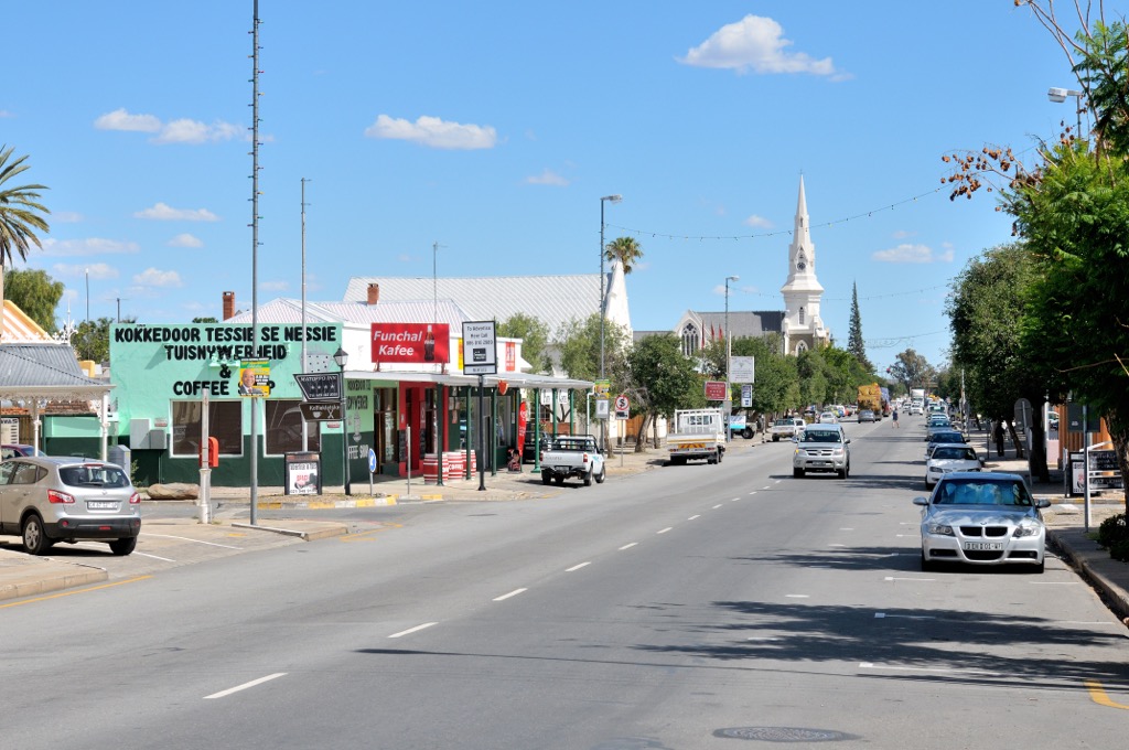
Beaufort West, situated in the Western Cape province of South Africa, is the largest town in the arid Great Karoo region and serves as a gateway to the rest of the interior. Steeped in history and surrounded by a semi-desert landscape, Beaufort West offers ample outdoor activities for visitors.
Beaufort West's clear, unpolluted skies make it an excellent location for stargazing. Visitors can enjoy the breathtaking celestial views and may even participate in organized astronomy tours or events.
Beaufort West boasts a well-preserved historical district with many restored Victorian and Cape Dutch-style buildings. A stroll through the old town provides a glimpse into the town's colonial past and architectural heritage.
While not directly in Beaufort West, the nearby Meiringspoort Pass is worth a visit. This mountain pass offers dramatic views and impressive rock formations.
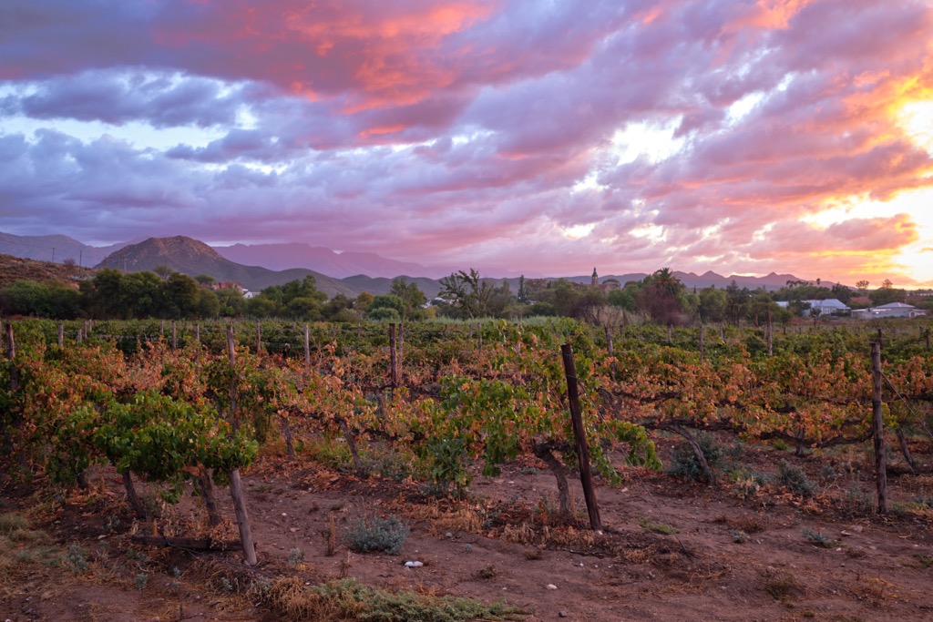
Calitzdorp is a town in the Small Karoo region in South Africa’s Western Cape province. It’s best known for producing world-class port wine and proximity to the country’s top outdoor attractions.
Calitzdorp is renowned for its port wine and is referred to as the Port Wine Capital of South Africa. Visitors can explore the various wine estates and cellars, sampling a diverse range of port-style wines. Some notable wine estates in the area include Boplaas, De Krans, and Calitzdorp Cellar.
Just outside Calitzdorp lies the Gamkaberg Nature Reserve. Visitors can explore hiking trails, enjoy views from the reserve's high points, and observe diverse flora and fauna.
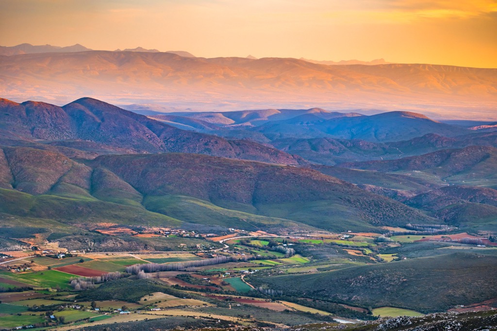
A short drive from Calitzdorp, the Swartberg Pass is a scenic mountain pass that offers 360-degree views of the surrounding landscapes. The pass is an engineering marvel with winding roads and is a gateway to the Swartberg Mountains, a UNESCO World Heritage site.


