Get PeakVisor App
Sign In
Search by GPS coordinates
- Latitude
- ° ' ''
- Longitude
- ° ' ''
- Units of Length

Yes
Cancel
❤ Wishlist ×
Choose
Delete
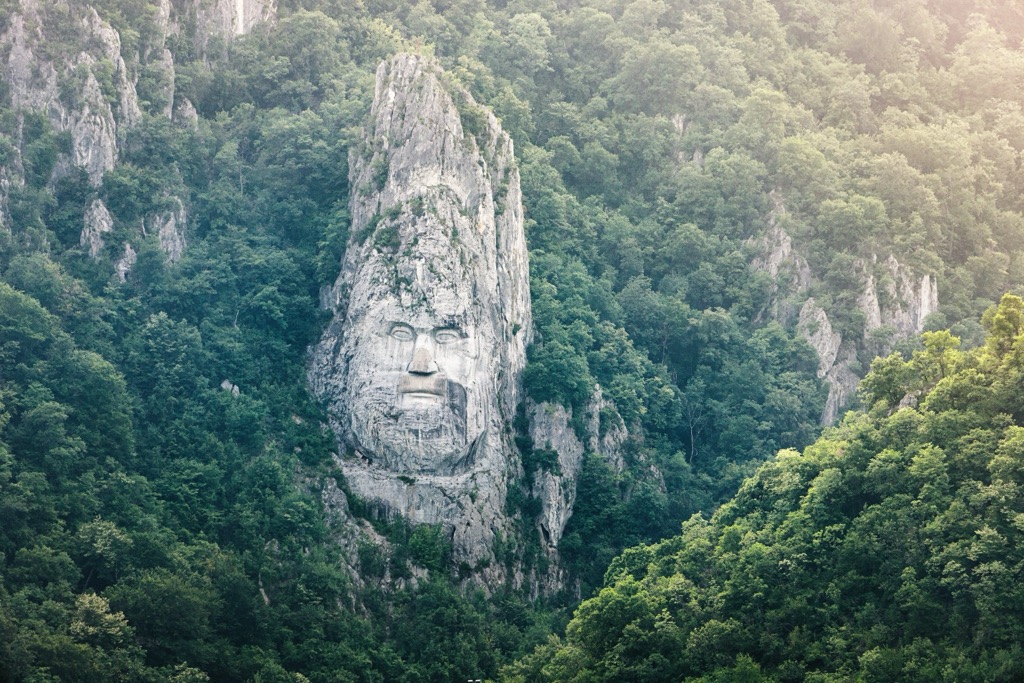
Iron Gates Natural Park, located along the Danube River in southwestern Romania, is one of the country's most striking natural reserves. The park is named after the Iron Gates Gorge, where the Danube cuts through the lower flanks of the Carpathian Mountains. The park features a mix of dense forests, cliffs, and unique geological formations. Especially along the Danube, the park is rich in history and culture, with ancient memorials, fortresses, archaeological sites, and traditional villages. These days, the Gorge’s most recent addition has become one of its most impressive attractions: a 55-meter rock sculpture of King Decebal, the ancient Dacian ruler who held out against Roman forces for decades until succumbing to the empire in AD 106.
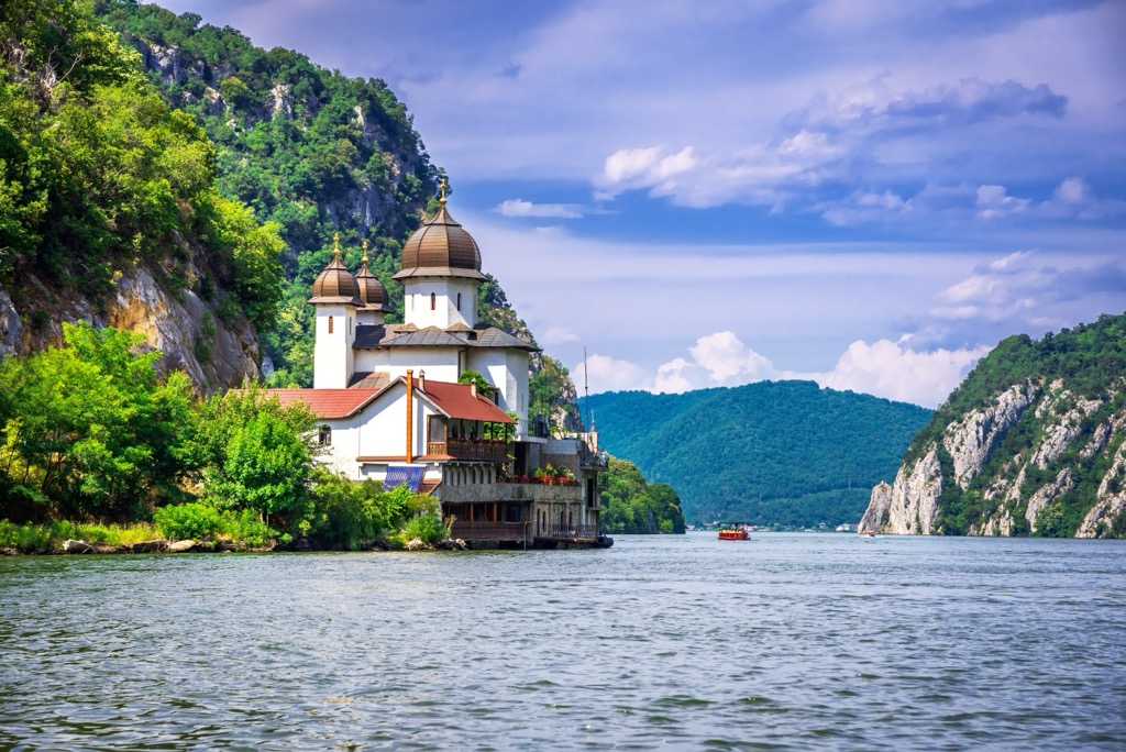
The Iron Gates, known as Porțile de Fier in Romanian, Ђердапска клисура or Гвоздена капија in Serbian, and Vaskapu-szoros in Hungarian, is a gorge on the Danube River. It is the national border between Serbia to the south and Romania to the north. The gorge is 134 km (83 mi) long and includes two hydroelectric power stations.
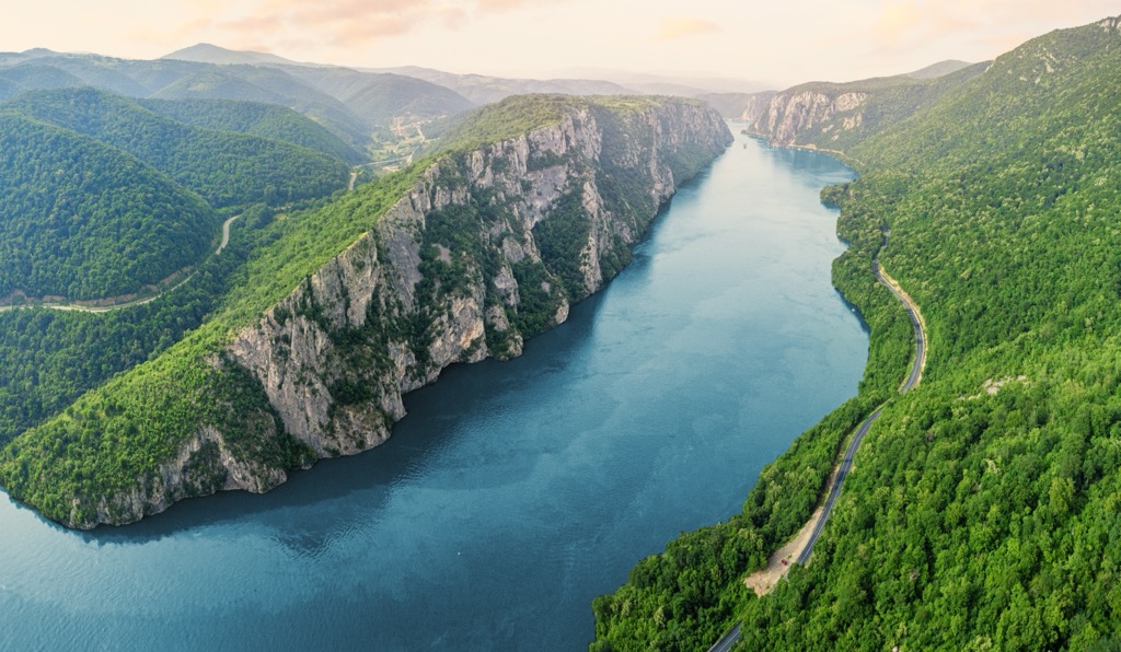
Iron Gates Natural Park covers 115,666 ha (285,820 ar). It encompasses the Romanian portion of the Danube River's Iron Gate and extends along the river's left bank in the counties of Caraș-Severin and Mehedinți. On the opposite side of the river is Serbia's Đerdap National Park. This section of the Danube separates the southern Carpathian Mountains and the northwestern foothills of the Balkan Mountains.
Established in 2000, the Iron Gates Natural Park aims to safeguard local wildlife and preserve the cultural and biological diversity of the region. As Romania's second largest natural park, it extends from Socol in the west to Drobeta-Turnu Severin in the east, with the Banat Mountains and Mehedinți Mountains to the north. The park encompasses 18 local protected areas, the largest being the Ostrov–Moldova Veche.
The park boasts diverse geological formations, from older Proterozoic rocks to younger Quaternary sediments. Over geologic time, the mighty Danube River has sculpted its way through the Banat Mountains, and the resulting gorge has become a geological centerpiece.
The gorge comprises four smaller gorges and three valleys. Deep whirlpools, some exceeding 80 m (262 ft) in depth, mean certain areas of the Danube's riverbed lie below sea level.
The first narrowing of the Danube, known as the Golubac Gorge, is beyond the Romanian isle of Moldova Veche. It stretches 14.5 km (9 mi) long and narrows to 230 m (755 ft) at its narrowest point, featuring the medieval Golubac fort on the Serbian bank.
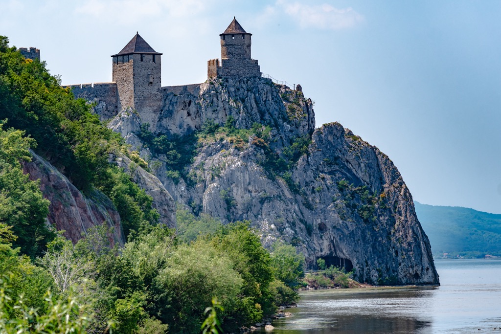
The second gorge, Gospodjin Vir, follows through the Ljupovska valley, spanning 15 km (9.32 mi) and narrowing to 220 m (722 ft), with cliffs reaching 500 m (1,640 ft) and being challenging to access from land.
The broader Donji Milanovac connects with the Great and Small Kazan Gorge, totaling 19 km (12 mi) in length. The Orșova Valley marks the last broad section before the river enters the Wallachia plains at the Sip Gorge.
The Great Kazan, meaning "cauldron" or "reservoir," is the narrowest and most famous of the three gorges. Here, the river narrows to 150 m (492 ft) and reaches a depth of up to 53 m (174 ft).
Before the construction of the Iron Gate I and II dams, much more of the cliffs showed above water. Suffice it to say, the dams and their power operation have transformed the gorge’s character, although they are now far more accessible to boats. The construction of Decebal’s Head would have been far more difficult if not for the dams.
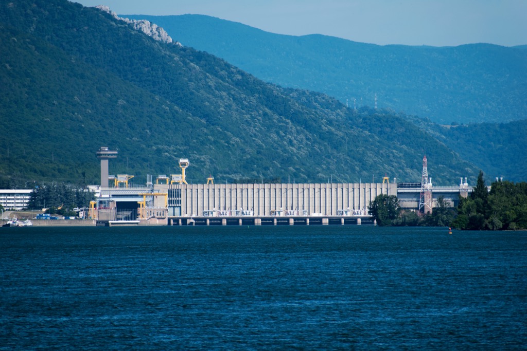
The park has been recognized as a biodiversity hotspot in Romania, attributed to its distinctive local climate, the product of the combination of humid continental and Mediterranean climates. A wide range of landforms and geological structures further enhances the area's biodiversity. The park boasts a remarkable variety of animal life, with many birds, fish, and amphibians, as well as endemic species.
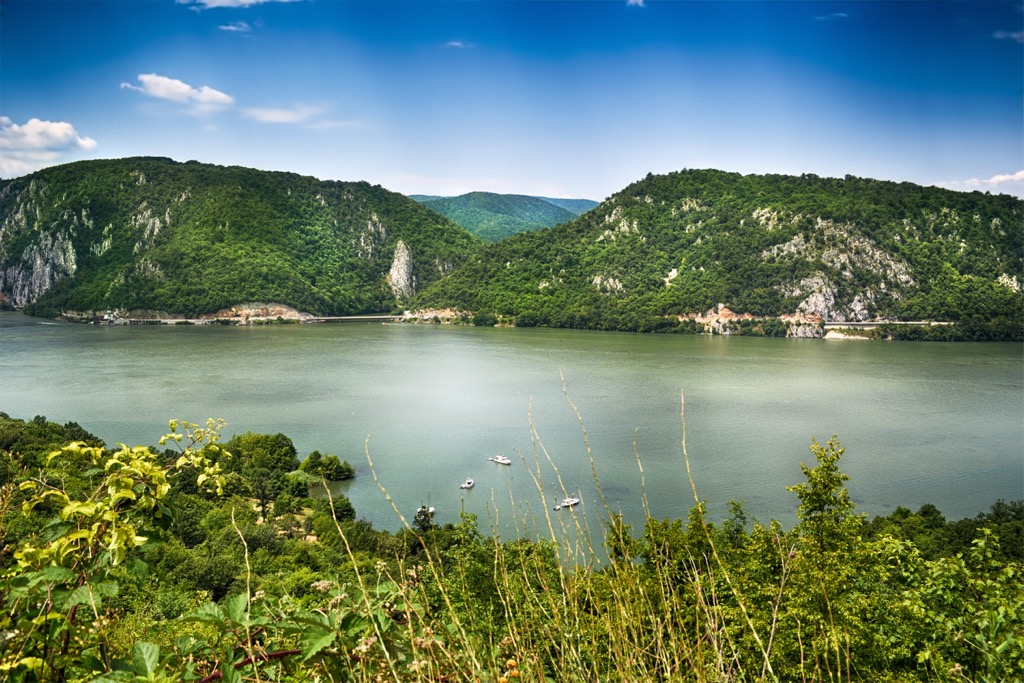
The biodiversity of the Danube valley between Baziaș and Drobeta-Turnu Severin has been extensively studied, especially before the construction of the Iron Gates I hydroelectric power system in 1960. Many consider the Iron Gates Natural Park as synonymous with Iron Gates Gorges. In reality, the park mainly comprises beech and oak forests along with fields, ecosystems that were studied less than those near the Danube River.
The park is home to thirty-four mammal species, ranging from large carnivores like the brown bear and lynx to wild cats and red deer. Iron Gates Nature Park is a sanctuary for two rare reptile species, Hermann’s Tortoise and the Long-Nosed Viper, both protected and endangered.

The area’s most well-known archaeology sites are the Iron Gates Mesolithic sites. The Gospodjin Vir gorge features the notable Lepenski Vir, considered the most important Mesolithic site in southeastern Europe, dating from approximately 5,000-13,000 years before present.
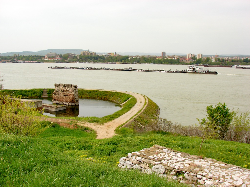
Roman Emperor Trajan commissioned the bridge built by Apollodorus of Damascus, constructed from 103 to 105, preceding Trajan's final conquest of Dacia.
Europe's largest rock sculpture depicts the ancient Dacian king, Decebal, standing almost 55 meters (180 ft) tall. Decebal proudly resisted the Romans for decades before finally succumbing to their power in AD 106.
Although the sculpture looks like something from Game of Thrones, it’s actually a modern creation by Romanian businessman Iosif Constantin Dragan. Accessible only by water, it required a decade of challenging work by a dozen artisans.
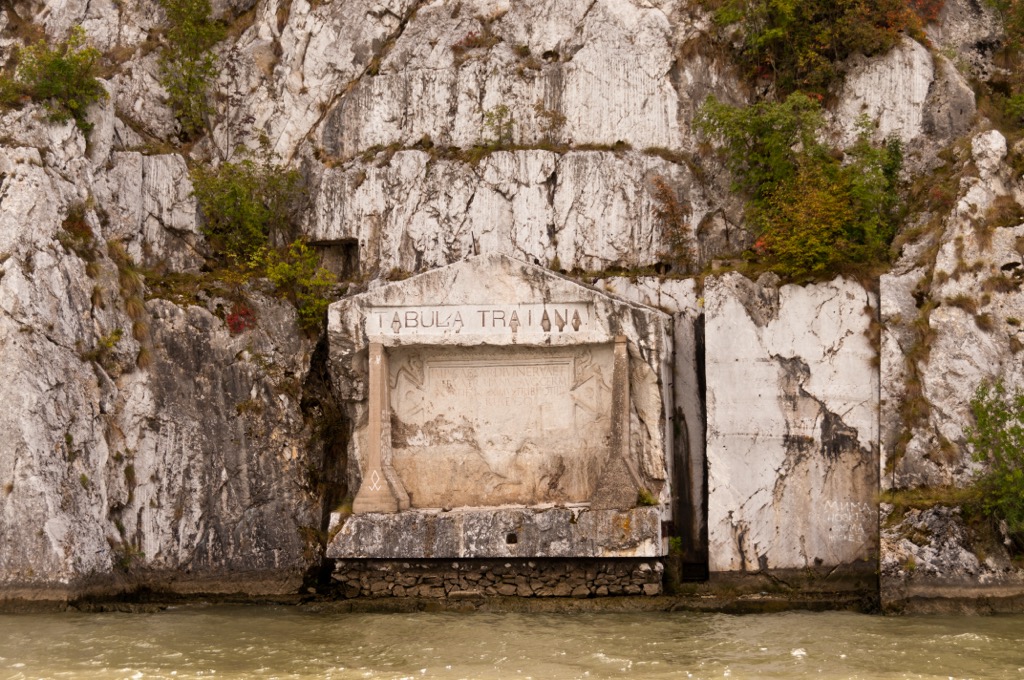
On the Serbian shore opposite lies the rock inscription Tabula Traiana, symbolizing the completion of the road that facilitated the Roman Empire's final attack on the Dacian Kingdom.
The challenging rocks and rapids in the gorge made it a notorious passage for shipping, navigated by local guides called Kalauz during Ottoman rule.
Under Prince Miloš Obrenović, local Serbs gradually took over this role. The dam's construction in the 1960s led to the flooding of Ada Kaleh, a former Turkish exclave known for its mosque, twisting alleys, and status as a free port and smuggler's nest.
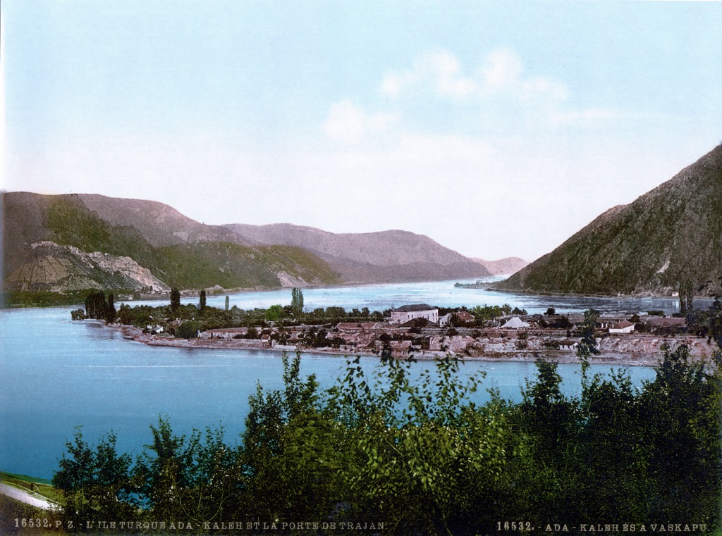
Today, this protected area boasts the highest ethnic diversity in Romania, with numerous Czech communities near the Danube Gorge and Serbian influences in the Locvei and Almajuli Mountains.
The trail to the Rudina Plateau is 12 km (7.5 mi) long and is moderately challenging. The route meanders along the scenic Liubotina Valley, marking one of the most picturesque tributaries of the Danube and full of waterfalls that enhance the area's allure.
The Rudina Plateau is the most impressive viewpoint, offering a panorama of the Danube and hills like Codicea Mică and Codicea Mare. Along the route, rustic mountain huts offer traditional local cuisine.
This hike follows the upstream course of the Racovaţ stream, spanning approximately 11 km (6.8 mi). It’s a loop, starting and ending near the Racovat fossil point and inside the Bahna Paleontological Reserve, recognized as Romania's first. The area has fossils dating back approximately 16 million years, including snails, shells, and corals.
The Cazanele Mic is a 9 km (5.6 mi) long mountain trail winding through oak forests, beech forests, and meadows. This path is known for the presence of ginseng (Genista tinctoria) and numerous viewpoints, which provide stunning vistas of the Big Cauldrons and Veliki Strbac on the Serbian side of the Danube.
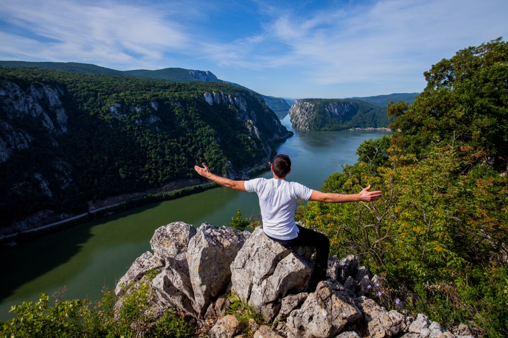
Drobeta-Turnu Severin, also called just Severin, is a city of around 100,000. Renowned for its historical landmarks, including the medieval fortress of Severin and the iconic Trajan's Bridge, visitors can enjoy the scenic riverfront along the Danube and the Iron Gorge.
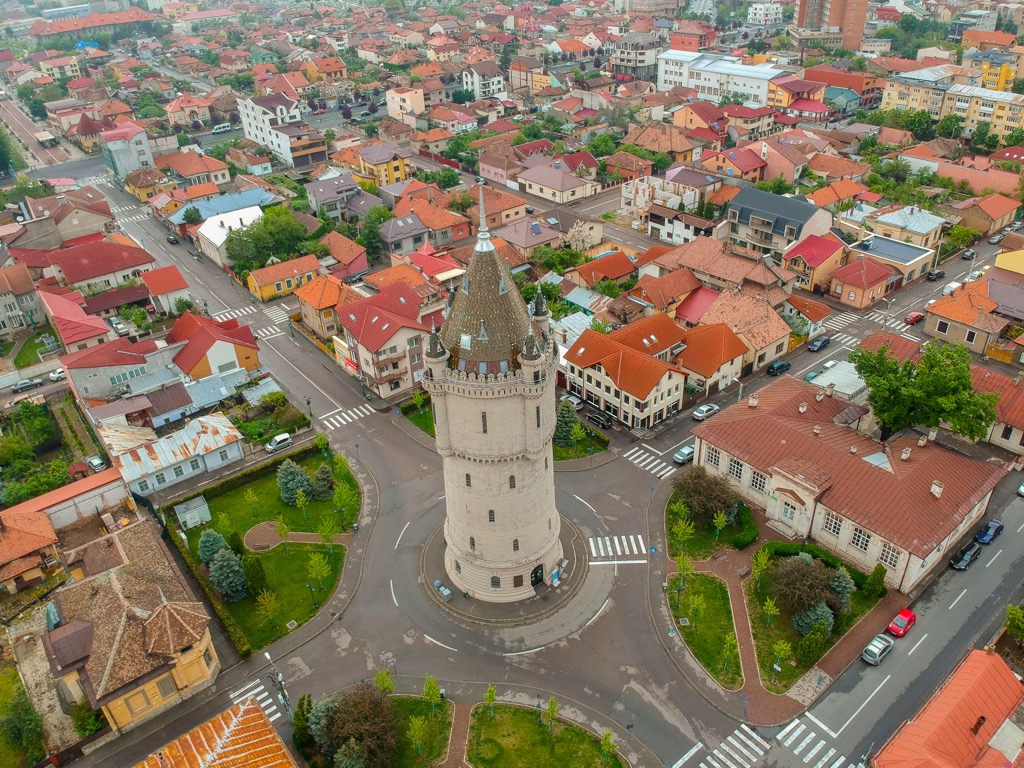
Perched amidst the scenic landscapes of western Romania, Reșița is a town of around 60,000. Notable landmarks include the Neo-Romanesque State Theatre and the historic Semenic-Caraș Gorge Railway. Visitors can enjoy the nearby Semenic Mountains.

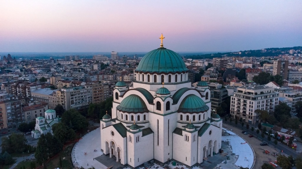
Nestled along the Danube and Sava Rivers with a population surpassing 1.5 million, Belgrade is a bustling metropolis with landmarks such as the Belgrade Fortress, Kalemegdan Park, and the St. Sava Temple.
Explore Iron Gates Natural Park with the PeakVisor 3D Map and identify its summits.


