
Scan the QR code and open PeakVisor on your phone
Burren National Park has 4 named peaks. The highest is Glasgeivnagh Hill at 208 m. Other notable peaks include Knockanes, Mullagh More and Slieve Roe.
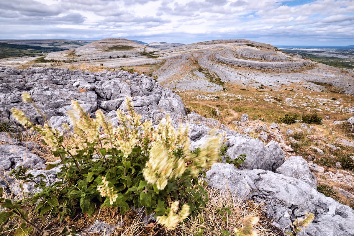
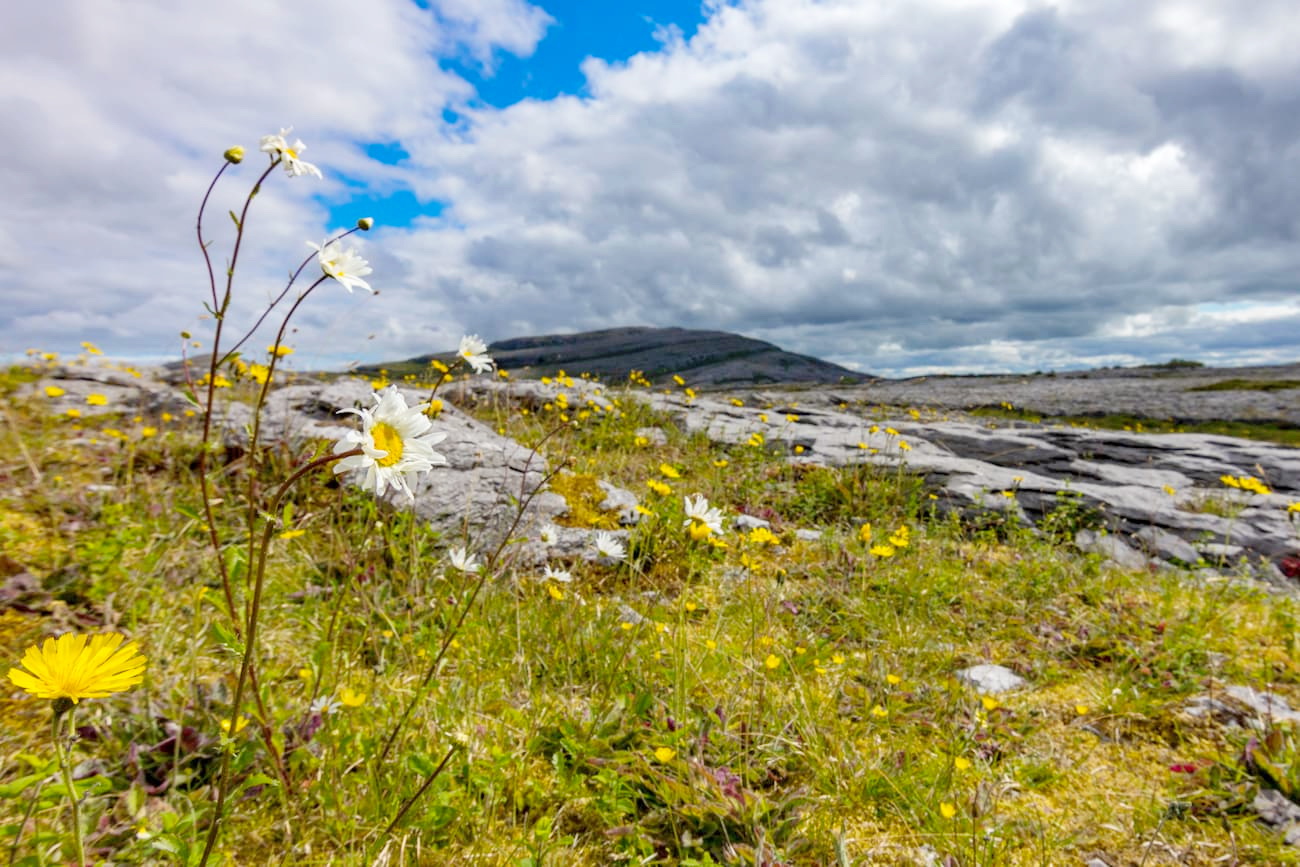
Burren National Park is home to one of the most unusual natural landscapes in Ireland. Limestone pavements and calcareous grasslands give the region a dramatic and barren appearance. Although the name "Burren" derives from boíreann, which means “a rocky place” in Irish, the Burren is highly fertile and home to an array of rare flora and fauna. At 3,700 acres, Burren National Park is the smallest of Ireland's 6 national parks.
The limestone that comprises the Burren dates back over 350 million years, to when a tropical sea covered Ireland. Sediment from the tropical ocean compressed onto the seafloor and created the Burren’s limestone rock formation.
The Burren as we know it today was formed during the last Ice Age. The ice eroded much of the landscape, which created the area's unique terrain. Burren National Park was the only part of the Burren subjected to earthquakes, creating the spiraled shapes along the park's hillsides. Many geologists consider the Burren to be one of the best examples of a Glacio-Karst landscape globally.
Situated in western County Clare, Burren National Park welcomes over 800,000 visitors each year, who come to hike through the stark landscape and watch for rare local wildlife. Amazingly, over 75% of all plant species in Ireland can be found within Burren National Park.
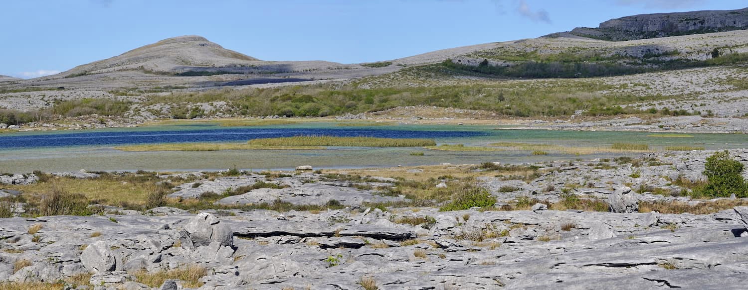
Burren National Park is also home to Lough Gealáin, a turlough fed by underground springs that run through the park's limestone. Lough Gealáin's water level differs drastically depending on the time of year, and during periods of low rainfall, the turlough has been known to disappear altogether.
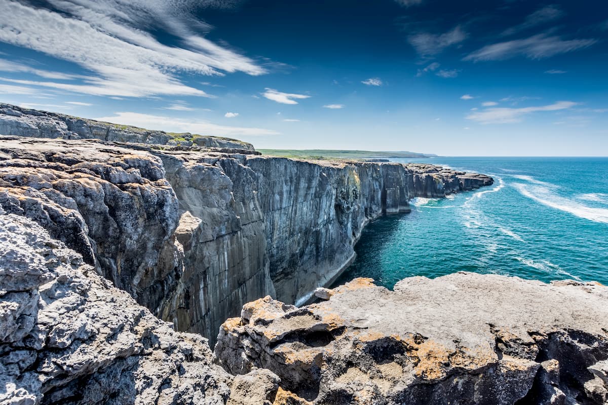
Burren National Park’s proximity to the Cliffs of Moher is another reason why it’s so popular. Located 30 km west, the Cliffs of Moher are among the most famous natural attractions in Ireland. The cliffs run for over 8 km along the coastline of County Clare, with visitors flocking from across the world to experience these sublime 200 m high sea cliffs firsthand. The Cliffs of Moher are also excellent for birdwatching, with over 60,000 birds inhabiting the cliffs, including protected species like razorbills, guillemots, and Peregrine falcons.
Hikers looking for an adventure will love trekking across the Burren and climbing its mountains. You'll find 7 marked trails in the Burren National Park, which range from 1 km to over 7 km in length. These paths will lead you up to peaks of some of the park's mountains, including Mullaghmore (183 m), the park's second most prominent point. You can also plan a hike off the beaten path to the pinnacle of Knockanes (210 m), the tallest mountain in the Burren National Park.
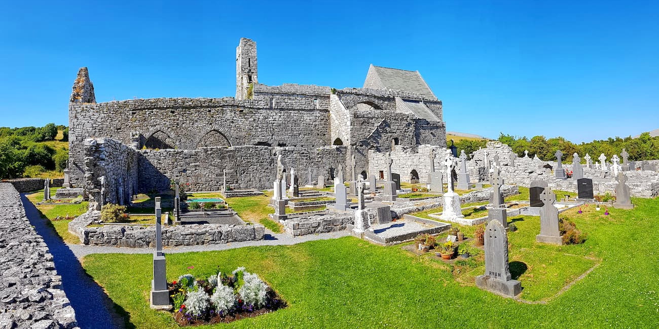
You can reach the trailhead at Burren National Park by heading along the L1112 from Kilnaboy village. After about 5 km, you'll turn right by a ruined church. Right again at the next crossroads, and find a suitable place to park. Follow the old Crag Road to the Burren National Park trailhead.
The Mullaghmore Loop is the most challenging marked trail in Burren National Park and should only be undertaken by experienced hikers. The loop is around 7.5 km in length, has an ascension of 140 m, and takes 3 hours to complete. To start this hike, head southwest from the trailhead, following the blue markers.
The primary terrain along the Mullaghmore Loop is limestone pavement; however, you'll also pass through woodlands and meadows. Along the trail, you'll be able to glimpse the beautiful Lough Gealáin, which is perfect for a break. From atop Mullaghmore, you'll have an excellent view of the Burren and the surrounding loughs.
This one-way trail runs across the heart of the Burren National Park. This route is ideal if you're planning to scale several of the highest points in the region. This trek is 6 km and should take 3 hours. Bear in mind this trail isn't a loop, so you may end up walking 12 km there and back.
Follow the marked red trail from the Burren trailhead. This route runs along the same path as the Mullaghmore Loop until you reach Mullaghmore's summit. From Mullaghmore, the trail will continue northwest across Slieve Roe, the fourth-highest point in Burren National Park at 160 m. The trail ends on the old famine road in Coolorta.
The three peaks trek is an arduous walk that leads up to the top of Mullaghmore, Slieve Roe, and the highest point in Burren National Park, Knockanes. This trek is about 13.5 km long and takes roughly 5 or 6 hours to complete. For the majority of the route, you can follow the red Mullaghmore Traverse trail past Slieve Roe.
Instead of heading northwest towards Coolorta, cut off the path down Slieve Roe towards Knockanes to the northwest. The best way to traverse this off-road area is by walking along the saddle between the two peaks. You'll be able to recognize the summit of Knockanes by a small cairn. Knockanes boasts stunning views, with Connemara and Galway Bay visible in the distance.

The Burren National Park Nature Trail is ideal for hikers of all abilities, with an ascension of only 20 m. The path is only 1.5 km in length and should take less than an hour to complete. From the trailhead, you'll follow the white markers through woodlands consisting of ash and hazel trees. The woodlands will come out by a doline and pass through grasslands and over limestone pavements.
Along the trail, you'll be treated to beautiful vistas of Mullaghmore's spiraling slopes and Lough Gealáin. While this trail is short and manageable for most hikers, the terrain is rugged and can be slippery after bad weather. As a result, ensure you bring along appropriate footwear for hiking.

One hike which is perfect for families is the Knockaunroe Turlough. The Knockaunroe Turlough is only 1.3 km in length and takes around 30 minutes. You can take this route by following the orange path markers. This trail is the best managed in the park, meaning you won't encounter any loose rocks or rough terrain. You'll pass by several environments along this short walk, including ash forests, meadows, and one of the Burren's turloughs.
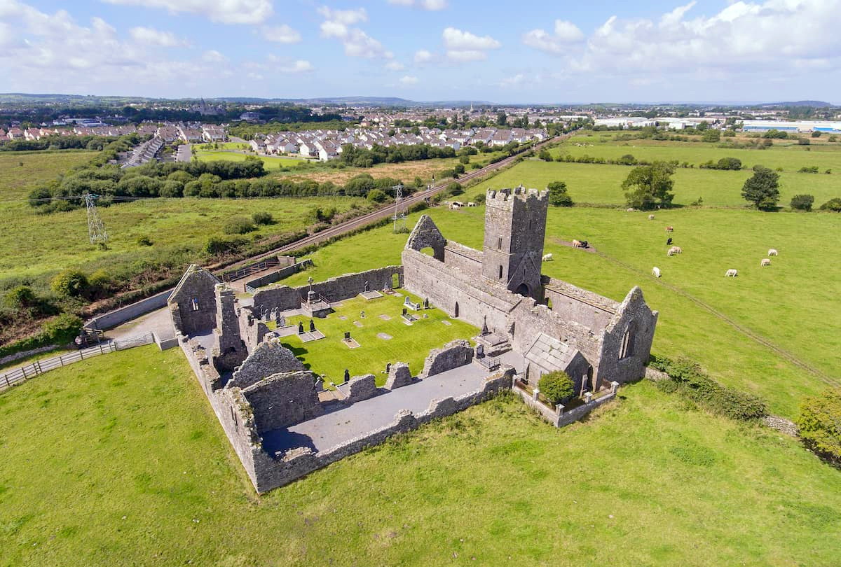
Ennis is one of the closest major settlements to Burren National Park. As Clare's county town, Ennis is home to many of the county's best historic and cultural sights. You can learn about local history at the Clare Museum, or take a tour of the 13th century Ennis Friary. There are also several quality hotels in Ennis, including Hotel Woodstock and Auburn Lodge Hotel, where you can get a good night's sleep after exploring Burren National Park.
To reach Burren National Park from Ennis, take the R476 northbound. The drive is 21 km and should take roughly 20 minutes. If you're traveling internationally to Ennis, you can fly into Shannon International Airport, which is 24 km south of the town. Shannon Airport is only the international airport in the region and is the best way to reach western Ireland from abroad.
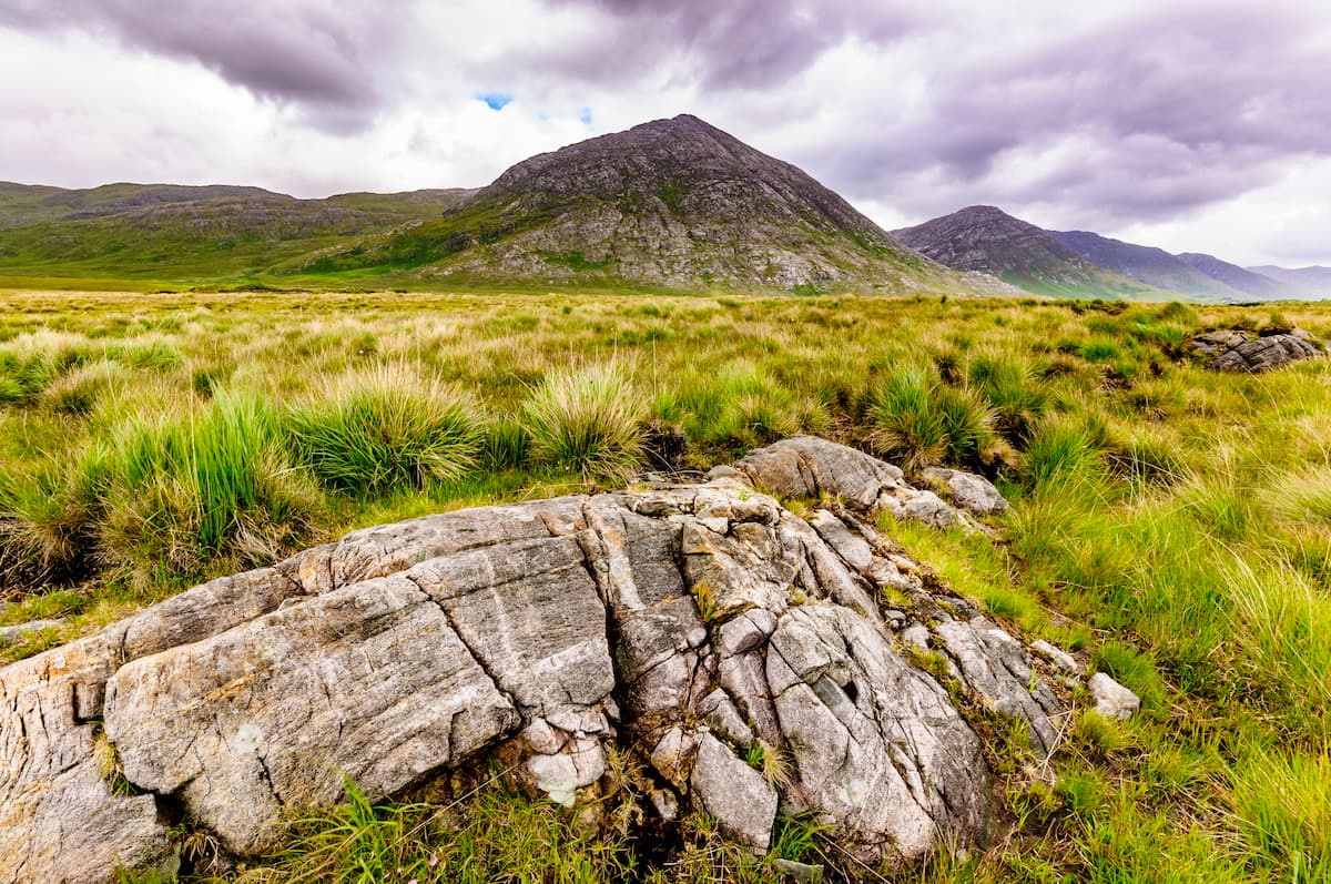
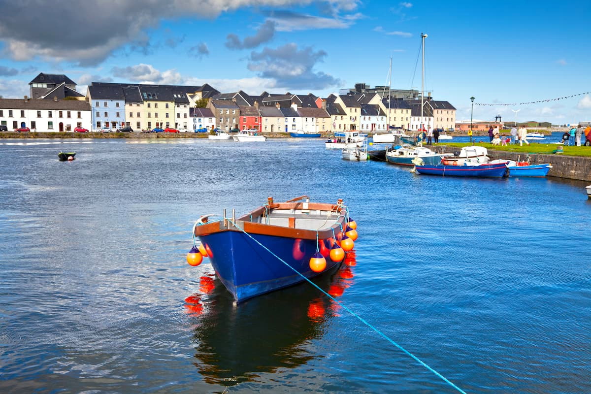
Adventurers looking to experience some of the best of Irish culture should plan a stay in Galway. Galway is the sixth biggest city in Ireland and is famed for its traditional Irish music, pubs, and festivals. As well as offering easy access to Burren National Park, Galway is also close to the stunning Connemara National Park, which is just 80 km west of the city.
You can drive to Burren National Park from Galway by traveling south along the M18. This drive is very scenic, with picture-perfect vistas of the Wild Atlantic Way. You'll find the journey is around 60 km and should take about an hour.
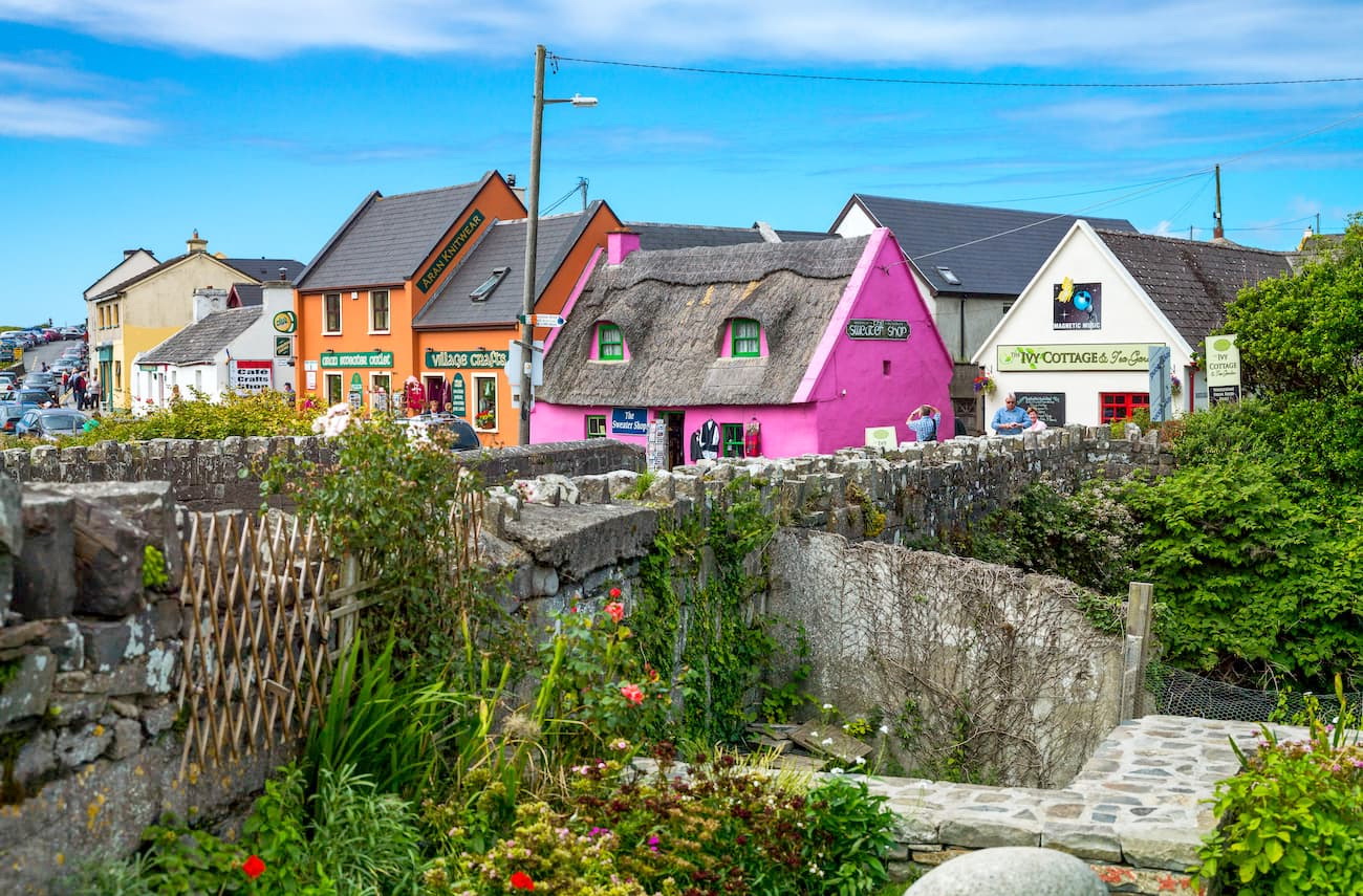
Despite its small size, Doolin is one of the most popular holiday destinations in Clare. This coastal village is perched on the Burren's western edge, with dozens of hotels offering views across the incredible landscape. Doolin is only a short drive from the Cliffs of Moher and acts as a gateway to the Aran Islands. Doolin is also said to be the home of traditional Irish folk music, so you won't be short of entertainment during your stay.
Travel to Burren National Park from Doolin by driving east along the R476 for 30 km. You'll find plenty of lovely scenery along this road as it weaves through the Burren and past picturesque villages, including Killinaboy and Kilfenora.
The spa town of Lisdoonvarna is ideal for exploring Burren National Park, thanks to its close vicinity to the park and the town's many hotels and restaurants. You'll find several popular resorts in Lisdoonvarna, including the Imperial Hotel and Rathbaun Hotel. After a long day hiking, ensure you swing by the Victorian Spa Resort to soak your aching limbs in the spa's mineral waters, which have been used therapeutically since the 18th century.
Lisdoonvarna is only 22 km from Burren National Park. Head eastbound along the R476. This drive should take around 25 minutes.


The highest peak in Burren National Park is Glasgeivnagh Hill, at 208 m.
Notable peaks in Burren National Park include Glasgeivnagh Hill, Knockanes, Mullagh More and Slieve Roe.


