
Scan the QR code and open PeakVisor on your phone
Belasitsa Natural Park has 11 named peaks. The highest is Radomir / Σιδηρόπετρα at 2,029 m. Other notable peaks include Punktova Skala, Kongur Ρουπέσκο and Debelo Brdo.
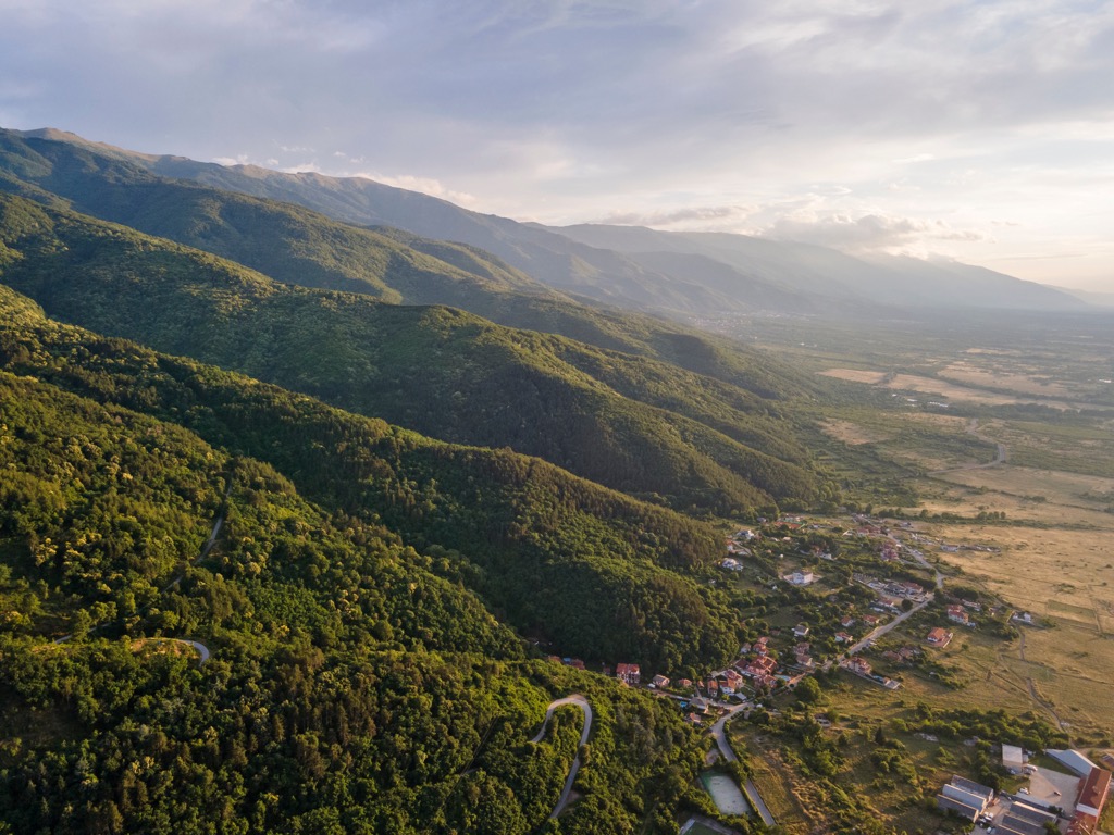
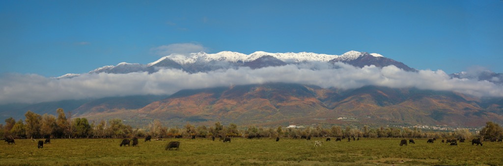
Belasitsa Natural Park is a protected area in southwestern Bulgaria, home to lush temperate chestnut forests, numerous waterfalls, and abundant wildlife. There are 11 named mountains in Belasitsa Natural Park; the highest and most prominent is Radomir / Σιδηρόπετρα (2,029 m / 6,656 ft).
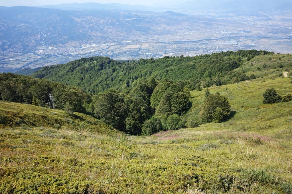
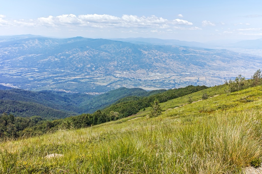
Belasitsa Park lies in the southwesternmost region of Bulgaria, sharing borders with North Macedonia to the west, Greece to the south, the Strumica and Sandan-Petrich fields to the north, and the Rupel Gorge to the east.
The Belasitsa massif itself is more extensive, divided between Greece (45%), Macedonia (35%), and Bulgaria (20%). The massif spans 63 km (39 mi) in length and has an average width of 7-9 km (4.35-5.59 mi). To its north, it borders Mount Ograzhden. To the east, the gorge of the Struma River acts as a natural boundary with Sengelska Mountain in Greece.
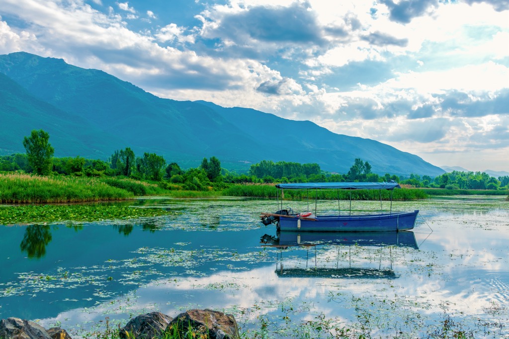
The Greek Kerkini Lake National Park protects the southern half of the Belasitsa massif. Kerkini Lake is an interesting example of human interference creating a new, productive habitat. The lake is an artificial reservoir created in 1932, but it has become a critical habitat for migratory birds and is one of the premier birdwatching destinations in Southern Europe.
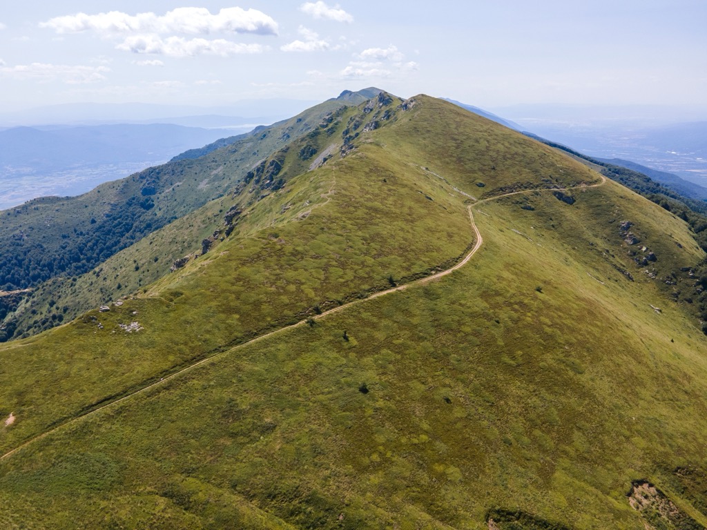
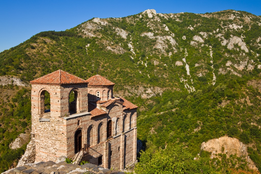
On its western side, the Kosturina Saddle (482 m/1,581 ft) and the Trkaina River separate the park from Macedonia's Smerdesh and Plavush mountains. Its southern slope descends steeply to the Sersko field in Greece. The highest point, Radomir (Kalabaka), is 2,029 m (6,656 ft).
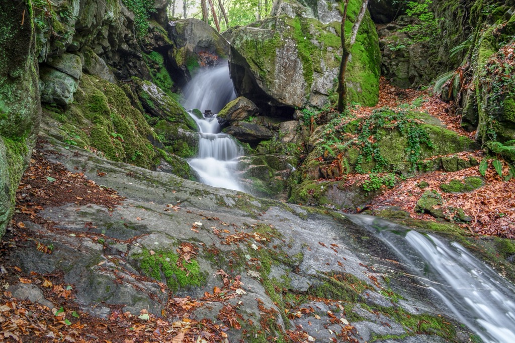
The park's total area is 117 sq. km (45 sq. miles). Elevations range from 300 to 2,000 m (984 to 6,562 ft). It was established on December 28, 2007, to protect ancient beech and chestnut forests. The park also conserves natural sycamore habitats, rare plant and animal species, and pristine rivers, streams, and waterfalls.
The park envelopes villages and towns, including Gabrene, Skrut, Kluch, Yavornitsa, Kamena, Samuilovo Kolarovo, and Petrich. Belasitsa is also part of the "Natura 2000" European ecological network to safeguard natural habitats and wildlife.
The park also encompasses two reserves for the protection of specific ecosystems. The Kongura Reserve protects chestnut and beech forests within the park, covering 1,312 ha. Near the Kolarovo village lies another reserve called "Topilishte," which safeguards the habitat of the royal fern.
Belasitsa is an ancient mountain formed during the Paleozoic period, 500 - 250 million years ago. Its current shape comes mainly from movements during the Tertiary and Quaternary periods.
When viewed from the north along the Strumeshnica River Valley or from the south across the Sersko field, Belasitsa looks like a wall. The ridge is narrow and sharp, covered in rocks and grass. The southern slopes are steep and rocky, with few trees, while the northern slopes are wooded and crisscrossed by deep valleys, rushing rivers, and waterfalls.
As the mountain rose, the nearby fields sank. Around a million years ago (between the Pliocene and Quaternary periods), movements along faults intensified and continue today, creating large alluvial cones on both sides of Belasitsa.
The oldest rocks in Belasitsa are gneisses, metamorphic rocks that date back hundreds of millions of years. Serpentines are also found in isolated spots. Additionally, the mountain holds deposits of sulfide ores like chalcopyrite and pyrite.
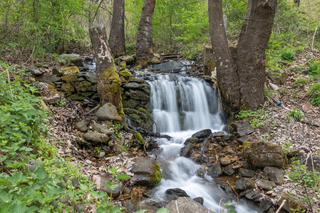
On the Bulgarian side of Belasitsa Mountain, the terrain includes around 15 significant streams and many smaller ones. These waterways flow into the Strumeshnitsa River as its right tributaries.
In the higher mountain areas, valleys cut deeply to create waterfalls and gorges. These rivers are generally relatively short, up to 10 km (6.2 mi). They often have low water levels or are ephemeral (existing only during certain seasons).
The biodiversity in the Bulgarian Belasitsa Natural Park is extensive, mainly due to the mountain's geographical location and its wide range of altitudes. This region houses approximately 1,500 invertebrate species. The diversity of diurnal butterflies in Belasitsa is particularly noteworthy, comprising over 140 species, more than 65% of the national total.
Regarding amphibians and reptiles, the Bulgarian side of Belasitsa hosts ten recorded amphibian species and 23 reptile species. Notable Balkan endemic species include the Greek long-legged frog, the Balkan gecko, and the striped lizard.
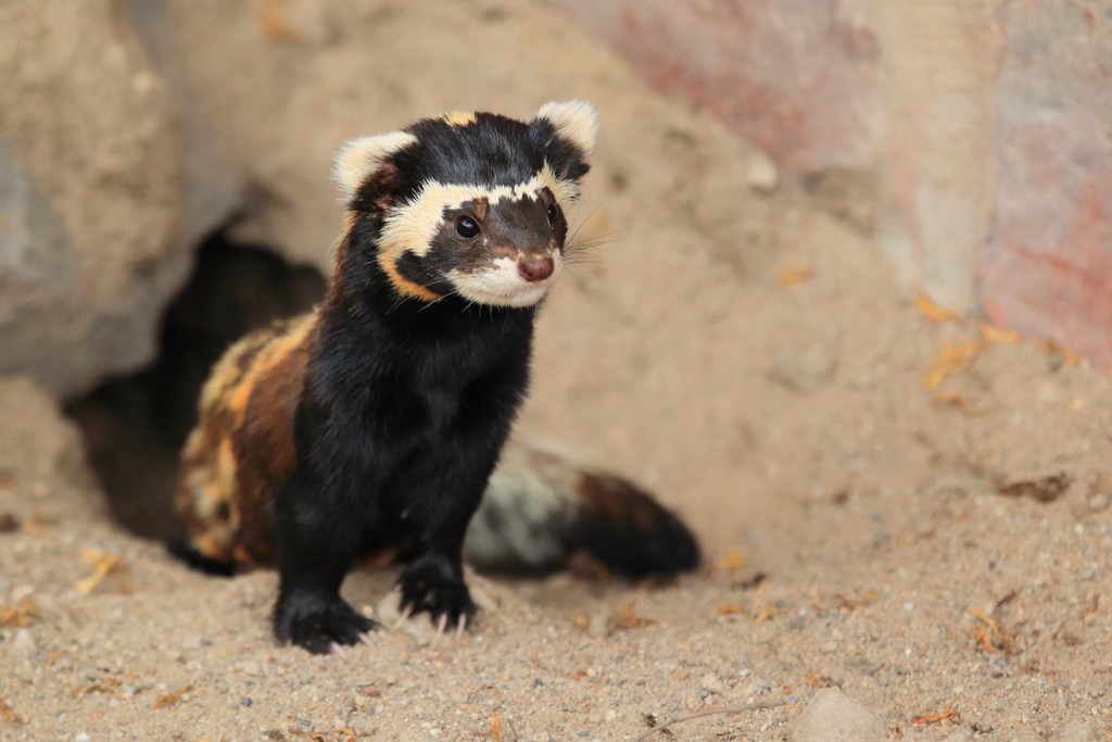
The park has over 150 bird species, accounting for over 35% of Bulgaria's avifauna diversity. The mountain accommodates 13 large and 38 small mammalian species, including the marbled polecat, golden marten, otter, wild cat, wolf, black ferret, and roe deer. The bat population in the area is relatively well-studied, with 21 species identified so far.
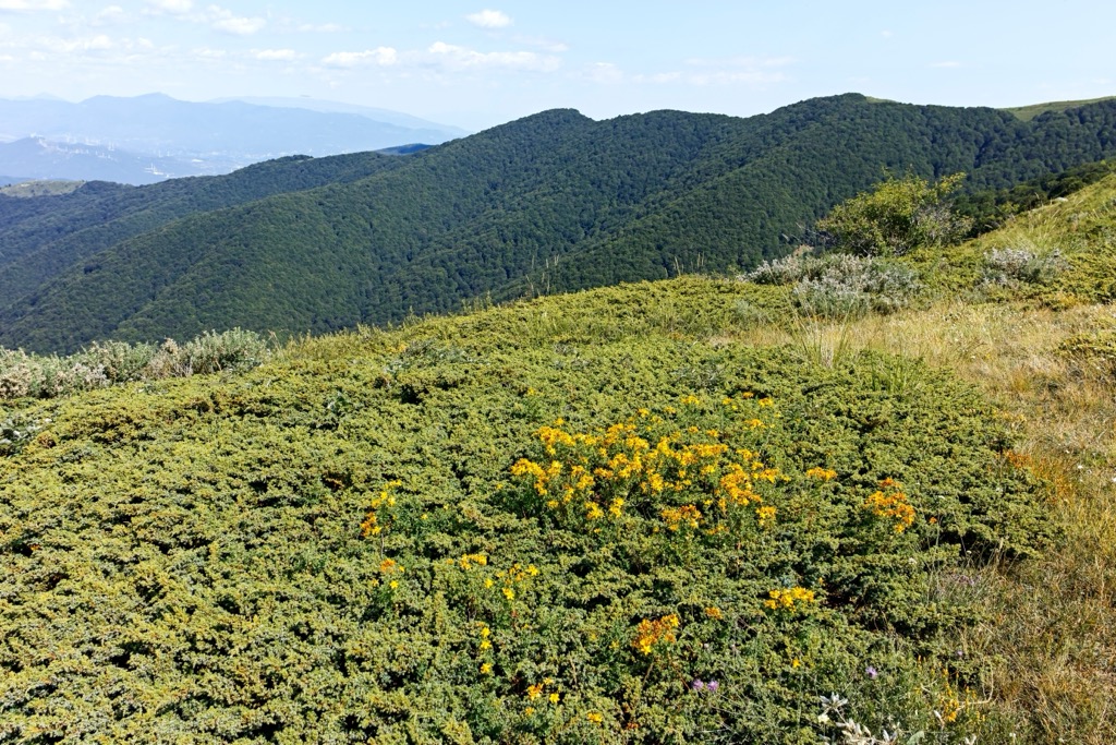
Thanks to its location and microclimate, the mountain's northern slopes have a unique variety of plants. The old chestnut forests are particularly exceptional for Bulgaria, classified as a priority habitat for conservation according to the European Union's Habitats Directive.
Over 1,591 plant species flourish in the Bulgarian section of Belasitsa, representing over a third of Bulgaria's flora. Of these, 104 species have conservation importance; the mountain holds 5 Bulgarian and 53 Balkan endemic species. Ecological habitats range from oak and chestnut to beech and conifers to a subalpine zone featuring grass communities.
Humans have inhabited the Belasitsa region for tens of thousands of years due to its ideal climate, landscape, and water resources. The earliest evidence of people living here is in Neolithic villages near Topolnitsa and Kolarovo. The archaeological site Topolnitsa is one of the oldest in this part of Bulgaria.
While Neanderthal and Homo Sapiens clans have passed through for possibly the last hundred thousand years, modern humans permanently settled the region about 10,000 years ago. The Struma River acted as a route between the Aegean Sea and Central Europe, and people began raising crops and livestock along it around 7000 BC.
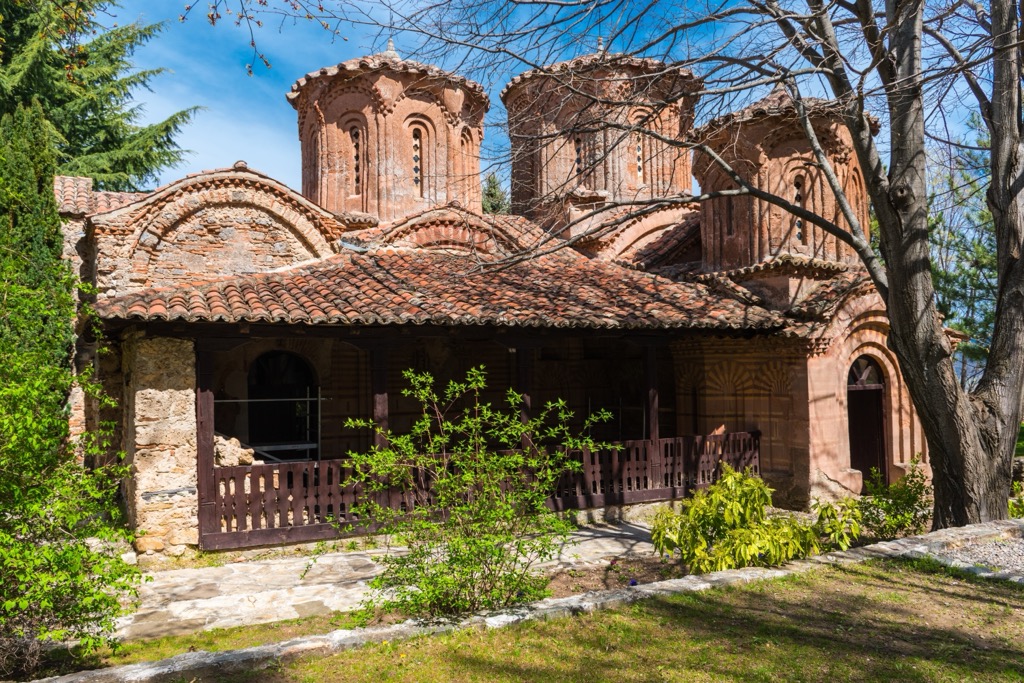
The region was home to a significant Roman city called Herculaneum Sintica, inhabited for almost nine centuries.
The Middle Ages here were known for the battle of Belasitsa in 1014, when the Byzantine Emperor defeated the army of Tsar Samuil and ordered the captured soldiers to be blinded.
Trade, farming, and crafts bloomed during the Bulgarian Revival period (seventeenth to nineteenth century). However, Bulgarians also waged many brutal battles during this time, with the goal of independence from the Ottoman Empire, which finally came to fruition in 1912.
Soviet socialism (1945 - 1989) also left a mark here. The area had borders with Greece and Yugoslavia (now North Macedonia, making the mountain a border area where visitors were not allowed. Having emerged from the Iron Curtain in 1991, it’s only in recent years that Belasitsa has begun to reveal its hidden treasures to nature lovers and mountain enthusiasts.
In 1988, the effort to protect nature in Belasitsa Mountain began with the Kongur Reserve. Belasitsa became official on December 27, 2007, making it the newest nature park in the country.
These are the hikes you need to check out in Belasitsa Nature Park:
The "Butterflies and Flowers of Belasitsa" is a delightful trail guiding you to the Yavornitsa waterfall. Your journey starts at the information board in the center of Yavornitsa village. The round trip takes about 1 hour and 20 minutes, and the path is clearly marked.
By opting for this route, you'll enter the enchanting world of colorful butterflies and blooming flowers during summer. Throughout your walk, you'll find four information boards providing additional insights.
To reach the Kongur hut from Petrich, follow the path with red markings (which passes Belasitsa hut) or take the shortcut with yellow markings to Gyulova Polyana.
The lodge serves as an excellent starting point for your ascent to the nearby Kongur Peak (1,953 m / 6,407 ft) (4 km / 2.5 mi) or the mountain's highest peak, Radomir (2,029 m / 6,656 ft), at 9.4 km or 5.8 mi.
Embark on the enchanting "Life of the Chestnut" trail, starting from the information board at the Kolarovo village center. Simply follow the blue markings, and you'll journey into the distinctive world of the chestnut forest. This loop trail (Kolarovo-Gjolchetto-Kolarovo) takes about 2 hours and 30 minutes without breaks.
The nearest cities to Belasitsa Natural Park are:
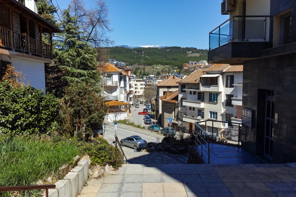
Petrich is a town in southwestern Bulgaria, near the border with Greece and North Macedonia, with a population of around 50,000. Known for its history and cultural heritage, Petrich offers a mix of ancient ruins and modern attractions. The area's thermal springs are also a draw for tourists seeking relaxation.
Sandanski is a Bulgarian town located in the southwest near the Pirin Mountains. With around 38,000 residents, it's famous for its mild climate and healing mineral springs. Tourists visit Sandanski for spa treatments, wellness resorts, and outdoor activities like hiking in Pirin National Park.
Strumica is a city in southeastern North Macedonia with approximately 35,000 people. The city is known for its vibrant cultural scene and hosts various festivals and events throughout the year. The nearby Smolare Waterfall and Bansko Lake are popular natural attractions for locals and visitors alike.


The highest peak in Belasitsa Natural Park is Radomir / Σιδηρόπετρα, at 2,029 m.
Notable peaks in Belasitsa Natural Park include Radomir / Σιδηρόπετρα, Punktova Skala, Kongur Ρουπέσκο, Debelo Brdo and Lozen.


