Scan the QR code and open PeakVisor on your phone
One of the most popular and beloved of US national parks, Acadia National Park sits on the rocky shore of the Maine coastline. It marks one of two places on the US east coast where the mountains meet the sea (the other being Camden, Maine).
With 62 named peaks—all nestled within the islands of Penobscot Bay—Acadia’s 49,075 acres contain a diversity of natural landscapes, including mountains, lakes, ponds, wetlands, forest, and unique glacial formations. The highest and most prominent mountain is Cadillac Mountain.
Acadia was the first national park to be established east of the Mississippi River, although the surrounding lands have been inhabited by the Algonquian peoples for over 12,000 years.
Most of Acadia exists on Mount Desert Island. Before being designated a national park, the island and its surrounding landscapes were a popular vacation destination for some of the most affluent families in the country, including the Rockefellers, Vanderbilts, Morgans, Fords, and Carnegies.
At the behest of noted landscape architect Charles Eliot, the park received status as a national monument in 1916. It became a national park in 1919, under the name Lafayette National Park. The park was renamed Acadia National Park in 1929, in honor of the old French colony that once included many parts of Maine.
Acadia features more than 150 miles of hiking trails of varying difficulty and terrain. Park visitors can find leisurely hikes along the rocky shore, as well as strenuous mountain summits through dense forest and glacial lakes. Hiking trails are not open to cycling, but around Eagle Lake, visitors will find crushed stone carriage roads. Financed by John D. Rockefeller Jr. from 1915 to 1940, these roads are open to cycling as well as horse traffic.
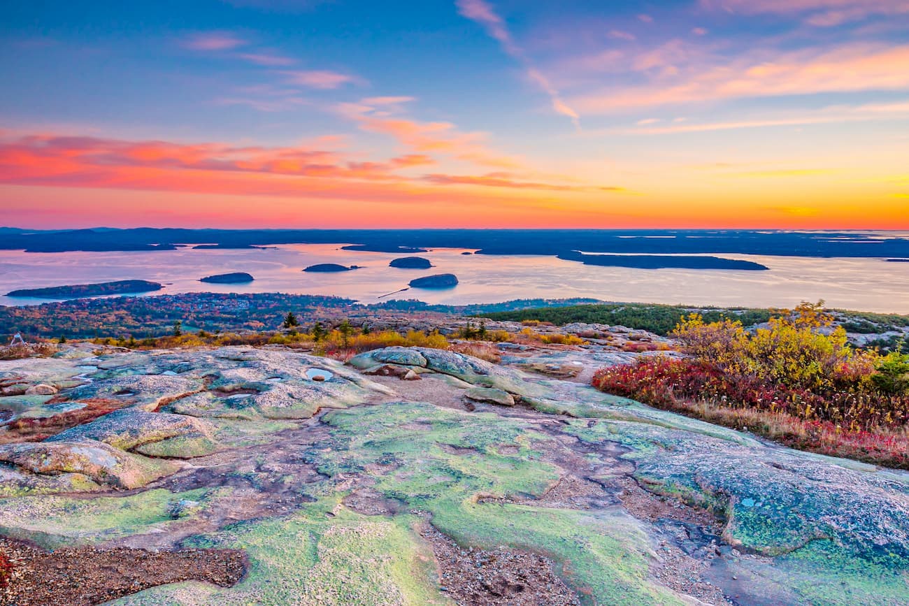
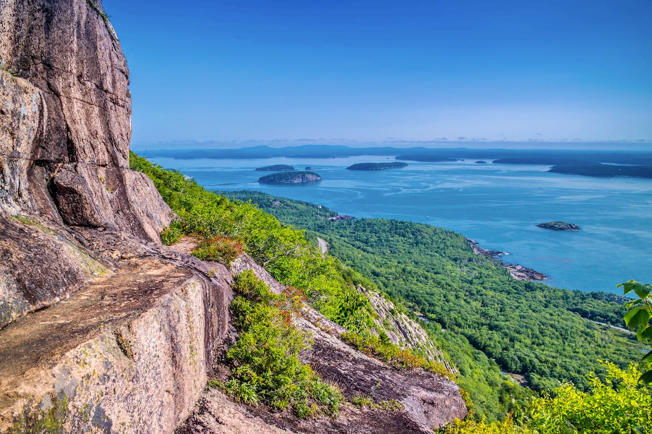
Among the most popular hikes is Cadillac Mountain, the highest peak in the park and the tallest on the eastern coastline. As such, it is one of the first places in the US where you can watch the sunrise, making it a popular destination on New Year’s Eve.
The Cadillac Mountain South Ridge Trail is one of the most popular and direct routes to the summit. You can access the trailhead at the parking lot by the Blackwoods Ranger Station on the southeast tip of Mount Desert Island. The 7-mile trail will elevate a total of 1,380 feet, meandering through cedar grove forests, rock scrambles, and tree clearings.
There’s a parking lot at the top, so if you’d prefer you can drive to the top to see the sites, but where’s the fun in that?
There are several other trails that will take you to the summit. From the park’s main parking lot off Park Loop Road, you can take the Emery Path all the way until it branches off into Schuff Path. That same trail will eventually skirt Dorr Mountain before reaching Gorge Path and a quick summit to the top.
For a casual hike with still plenty of sights, consider the Ship Harbor Trail. Off Seawall Road on the southernmost point of Mount Desert Island, this 1.8-mile loop passes through forests teeming with osprey, blue heron, and plovers, then skirts the narrow shore of Ship Harbor with its rocky tidal pools.

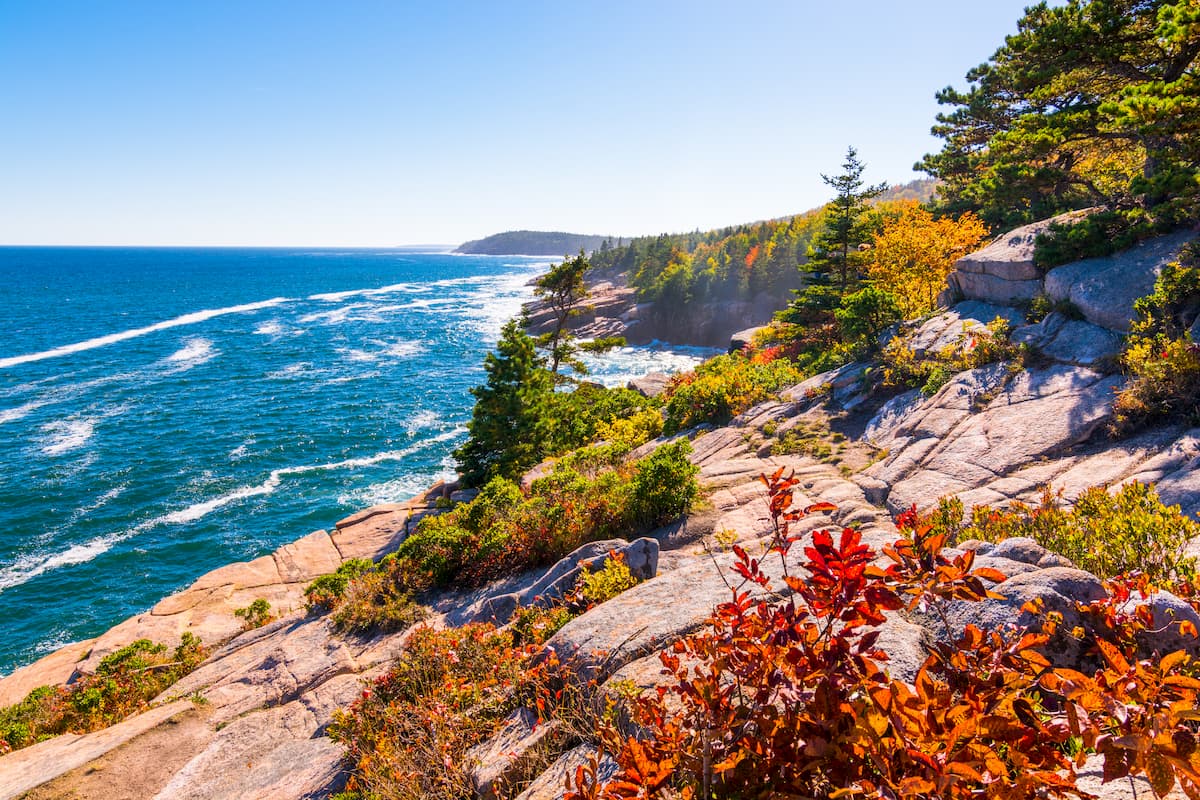
A slightly more strenuous coastal trail can be found on the Ocean Path, which is just off the Sand Beach parking lot on the eastern edge of Mount Desert Island. Acadia is, at its heart, a park that celebrates the converging beauty of sea and mountains. The Ocean Path, to that end, delivers the sea in spectacular bounty. A two-mile trail that terminates at the southern end of Otter Point, the Ocean Path reveals some of the iconic landscapes Acadia is most known for: rocky shorelines nudging up against broad rock faces and looming pine forest.
If you’re up for a serious challenge, the aptly named Precipice Trail is among the steepest and most difficult in all of Acadia. Be warned: While this hike offers some stunning views of Mount Desert Island, Frenchman's Bay, and the greater Atlantic Ocean, it involves scaling rock faces with embedded iron rungs. As such, the hike is in some ways more of a climb than a hike. But once you reach the summit of Champlain Mountain, you will not be able to regret the journey.
The Beech Cliff Trail provides a similar well-rounded but difficult excursion with slightly less traffic. On the western side of Mount Desert Island, sandwiched between Long Pond and Echo Lake, Beech Mountain is not very high, but it is extremely steep. Many sections require ascent by ladder, so if that’s not your kind of thing you might want to skip this trail.
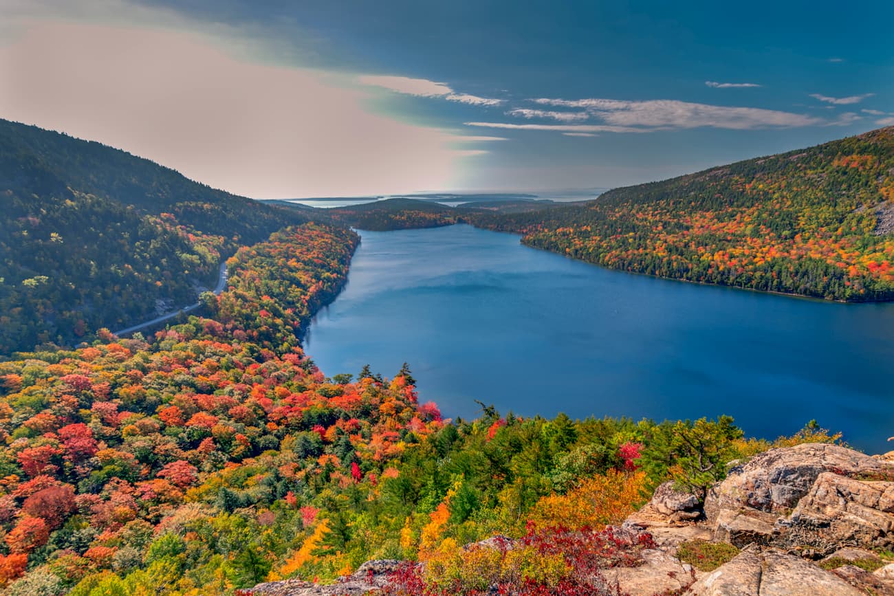
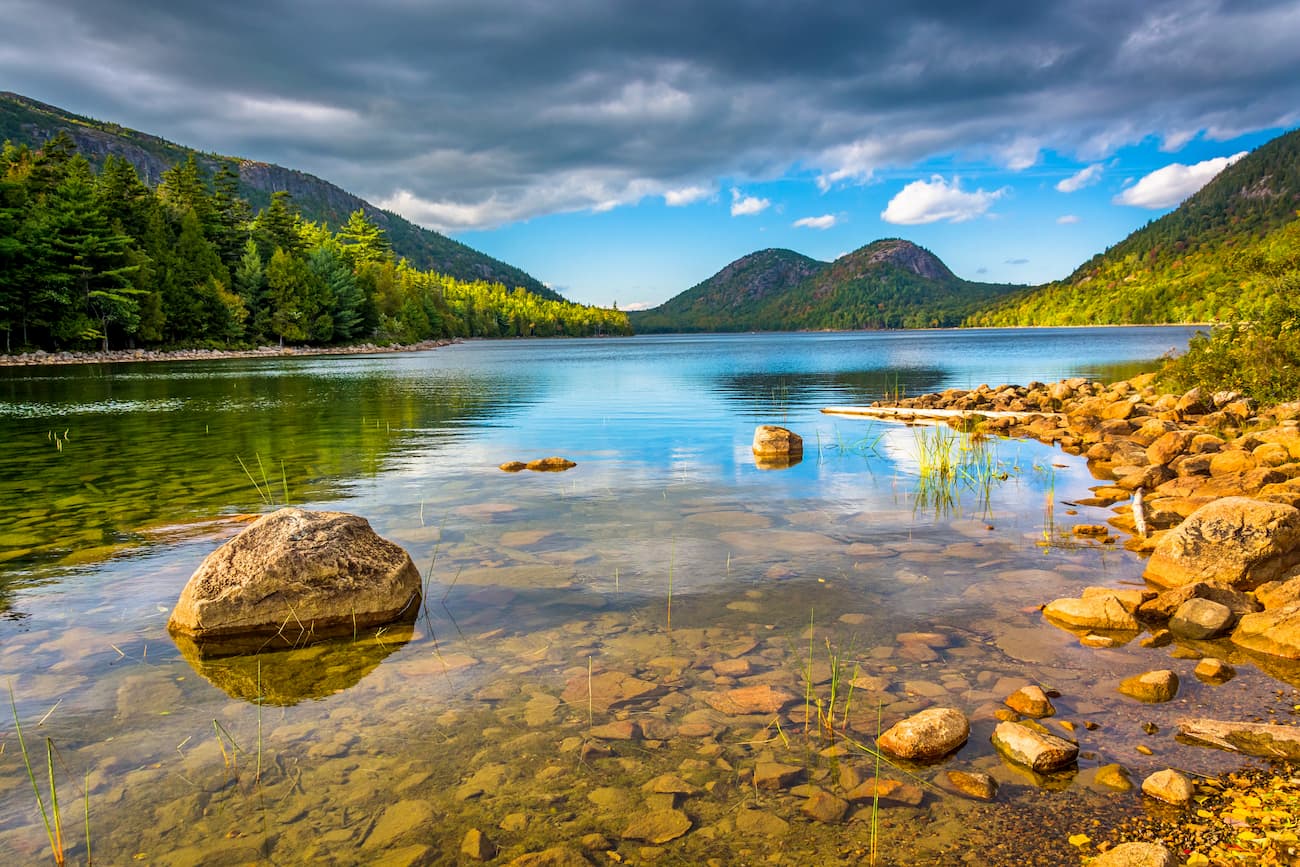
Right in the middle of Mount Desert Island, at the foot of Penobscot Mountain is Jordan Pond, a 187-acre glacially formed lake with glacial debris, extremely clear water, and shoreline hiking trails. Jordan Pond sits 274 feet above sea level but is incredibly deep, with a maximum depth of roughly 150 feet. Visitors can reach the lake via the Park Loop Road, which also connects the Jordan Pond House—a restaurant and shop overlooking the lake and its surrounding peaks.
On the western shore of Mount Desert Island you’ll find Thunder Hole, a rocky inlet where crashing waves create a thunderous roar, with water splashing up to 40 feet into the air. The sound is caused by a small cavern located just below the shoreline, where incoming air and water is rapidly forced out by the force of the wave. You’ll need to time your visit with the tide, though, as the inlet needs a big enough wave to produce the sound.
Gorham Mountain provides a slightly less trafficked alternative to Cadillac Mountain, with similarly impressive views of the entire park, including Cadillac itself. Accessible via the Park Loop Road just south of Thunder Hole, the Gorham Mountain Trail offers a 3.5-mile round trip, with spectacular views of the coastline and surrounding islands. Be warned: This trail also includes some rungs and ladders.
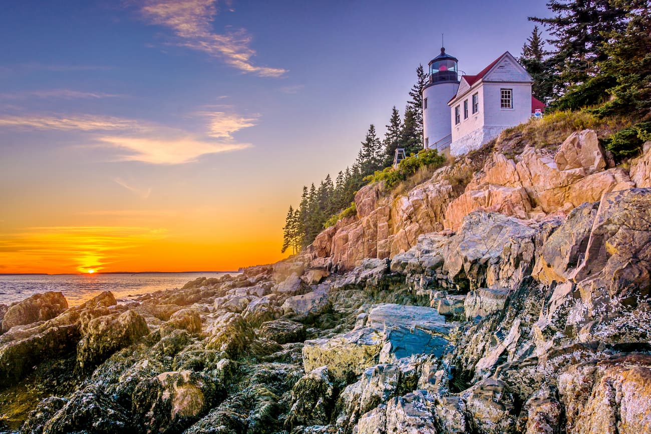
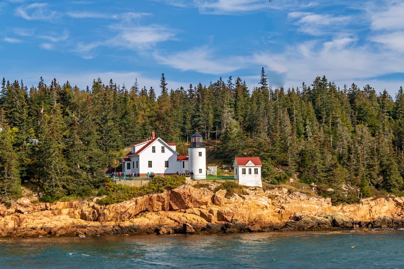
Maybe the most iconic image of Acadia National Park is the Bass Harbor Head Light perched atop a seacliff on the southernmost tip of Mount Desert Island. Built in the mid-19th century, the lighthouse sits on a rock foundation some 50 feet above tide. It’s a common attraction for photographers wishing to capture a rustic, seaside image of Acadia with both the ocean and rocky shoreline in view.
Most of Acadia’s jagged, rocky landscape is an artifact of glacial activity. The pinkish granite bedrock was carved up by receding glaciers at the end of the ice age, leaving behind Acadia’s distinct formations, including its many islands, U-shaped valleys, craggy striations, roche moutonnées, deep glacial lakes, and kettle ponds. The Somes Sound fjard, which carves its way up the heart of Mount Desert Island, is perhaps the most spectacular proof of ancient glaciers. It is the only such formation on the entire US east coast.