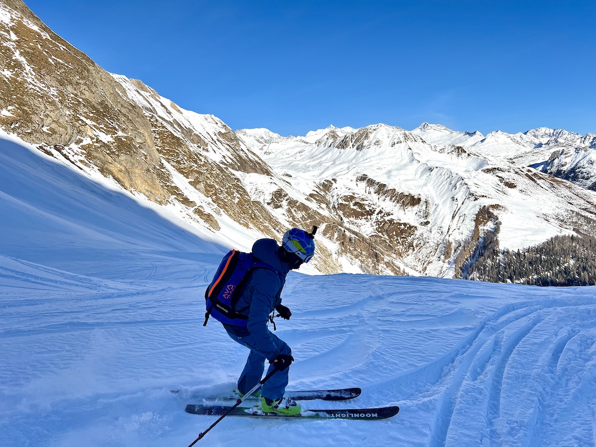
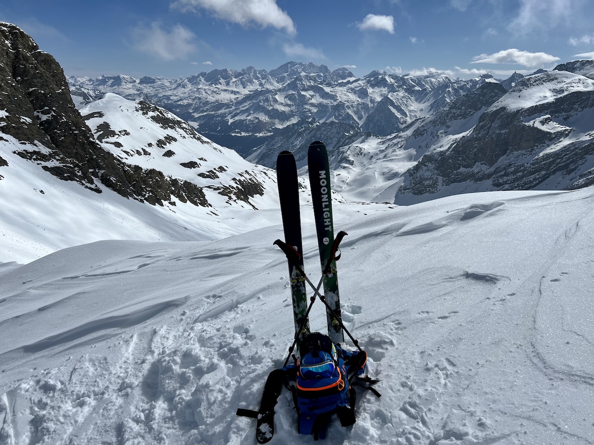
Ski touring is the oldest and one of the most beloved winter sports. To hunt and travel in deep snow, ancient peoples in Europe and Asia began attaching animal furs to the bottom of skis 10,000 years ago. In modern times, wandering through the enchanted winter landscape, climbing majestic summits with breathtaking panoramas, and skiing to the valley below are some of the most enriching experiences a person can have. What more could we dream about on a perfect winter day? (Well, more snow in the Alps would be great…)
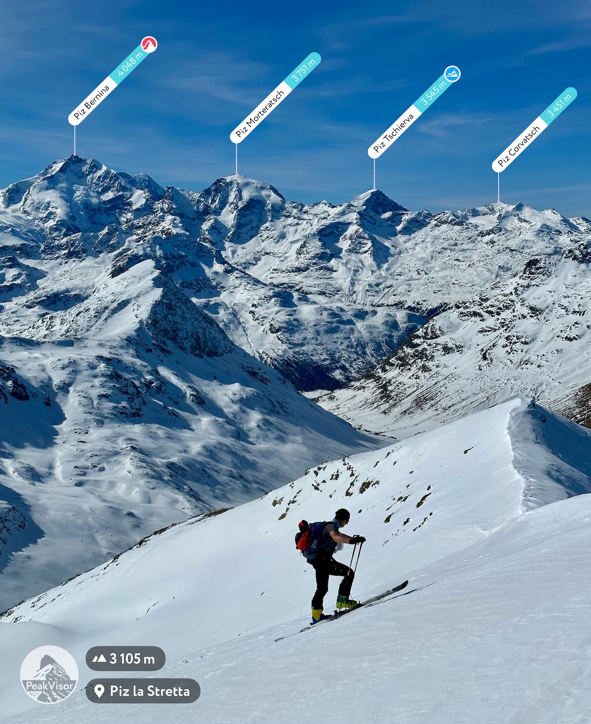
PeakVisor has been working on a ski touring feature for several years. Skiing hundreds of routes in the Alps was a large part of the project while developing the most convenient tool for planning, evaluating, and navigating a ski tour was our primary goal. This winter, PeakVisor is excited to present the Ski Navigator on the mobile app and our website.
The Ski Touring Map on the PeakVisor website allows backcountry enthusiasts to plan and evaluate the conditions with the convenience of modern computing. At the same time, the Winter Mode of the PeakVisor mobile app allows for the navigation of a ski tour and the planning of a new itinerary on the go should a need arise. It also helps track all your summits and mountain passes with check-ins.
Ski Touring Web Map
PeakVisor designed the newly released Ski Touring Map to plan and explore ski adventures. The platform is available on any modern web browser. Here are some suggestions to try when choosing the next adventure.
Search for Ski Tours
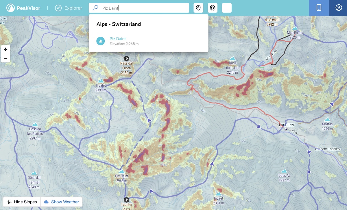
Use the search bar in the header to move the map to the area of your choice. This could be the name of a mountain, a ski resort, a mountain range, or almost anything else. It’s a great way to start exploring.
Highlight Dangerous Slopes
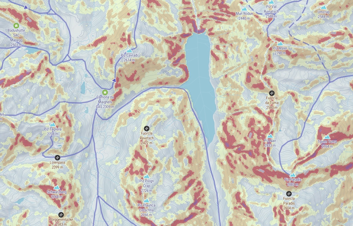
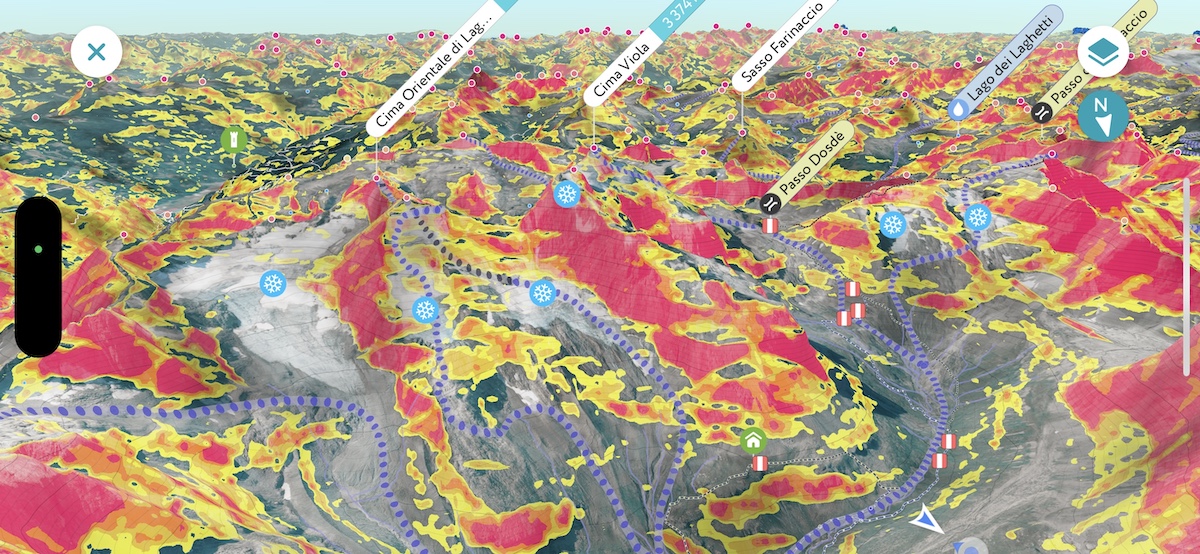
Depending on the avalanche risk level, it may be advisable to avoid steeper slopes while skiing in the backcountry. Avalanches almost always occur on slopes steeper than 30 degrees. Skier-triggered avalanches occur most frequently on slopes 30 to 45 degrees - this is the range in which a slope may not be steep enough to slide naturally but is steep enough to slide if aggravated by the weight of a skier. Our technology color codes the slopes steeper than 30 degrees. This feature is designed to help you acknowledge or avoid trail segments requiring greater attention.
Check the Weather
As with the local avalanche bulletin, it is essential to check the weather forecast before heading out into the backcountry. To avoid jumping across websites and mobile apps, PeakVisor has integrated weather data into the map. In addition to standard information on wind, temperature, and cloud cover, we also provide data on snowpack and snow forecasts.
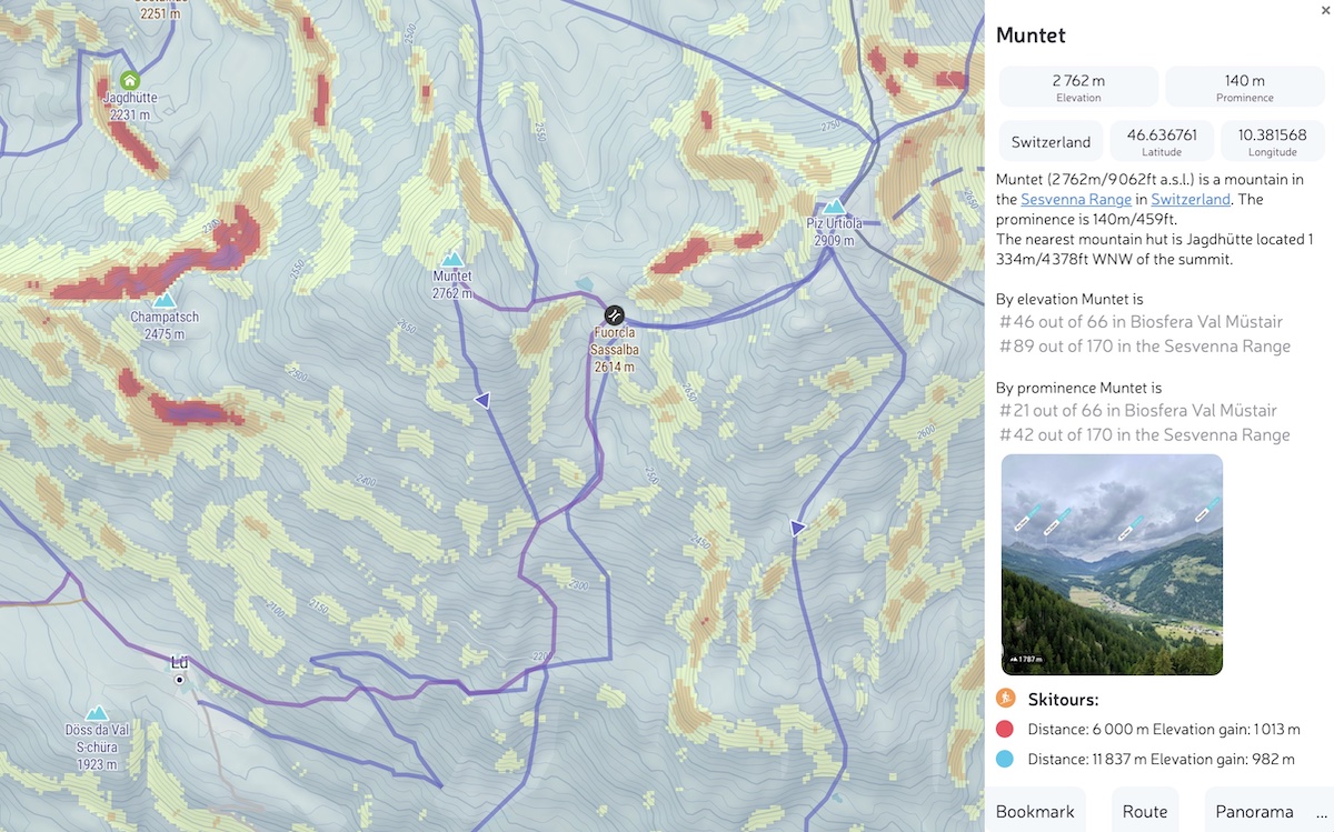
Choose a Ski Tour
There are thousands of ski tours across the globe presented on the map using purple lines. The map allows the user to evaluate numerous parameters, like distance and elevation gain. Also, for convenience, we prominently render parking lots and bus stations that serve as tools for many backcountry enthusiasts:
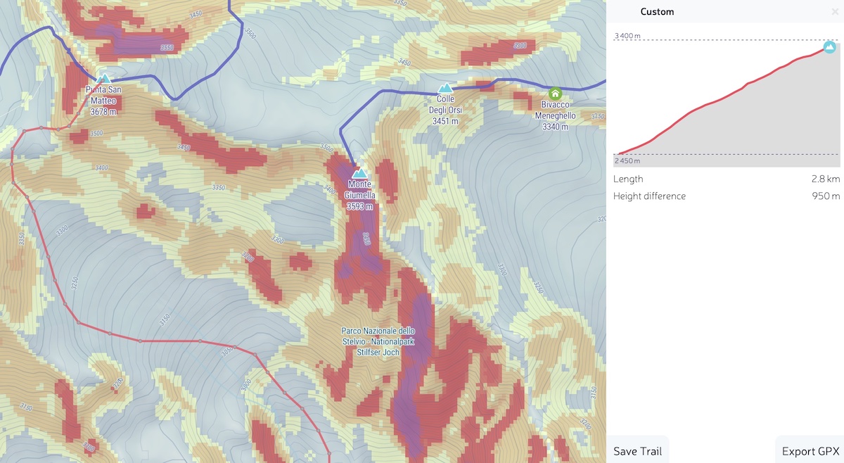
Import GPX Tracks
The mountains provide endless opportunities for ski touring. While it is impossible to have every route presented on a single map, we are steadily accumulating new routes and itineraries. Meanwhile, you can always drag’n’drop a GPX track from your adventures or any other web resource with GPX tracks. Drop it on a map and it will be added so you can see it in detail. If you need it later on a mobile phone, simply save it in your profile with the Save button. Just be sure to open PeakVisor on your mobile before going into the mountains (or losing service), so the app will have a chance to sync the route and render it available for offline use.
Plan Your Own Ski Line
Sometimes, our primitive spirit shines through and we revert to an exploratory mood. You may want to create your own ski tour and share it with others. It might be something away from the beaten path or an incredible feat to prove your skills. Either way, creating a new tour is easy; Simply right-click on the map (Control + Click on MacOS) to add the starting point and then add the following checkpoints. The resulting route can be saved and used later in the mobile app for navigation, or even exported as a GPX for use in your smartwatch or phone whenever you want. Of course, you can also create a new tour in the opposite order of operations (skiing then adding the route) by uploading the GPX of your route.
Share A Ski Map With Friends
If you’d like to share a map with your friends, simply click the share icon in the header (or just copy and paste the web page URL).
Our team sincerely hopes that PeakVisor will help you find the best ski tours in your area and enjoy them securely. Meanwhile, we’re headed back to the labs (and the mountains) to continue improving the app. Please continue to tell us about your skiing adventures and what you would like to see improved in the Ski Touring feature of PeakVisor.