Smartphones, especially the most recent models, land extreme computing powers into our hands (and pockets). Yet, if we want to exploit it to full capacity, we need to raise the standard for data precision significantly.
For a long time it has been ok just to have a mountain name label somewhere on the slopes, like in all old-time paper maps, but with the advancements of 3D modelling and Augmented Reality (AR) even a slightly biased measurement or an inaccurate placement become a serious flaw.
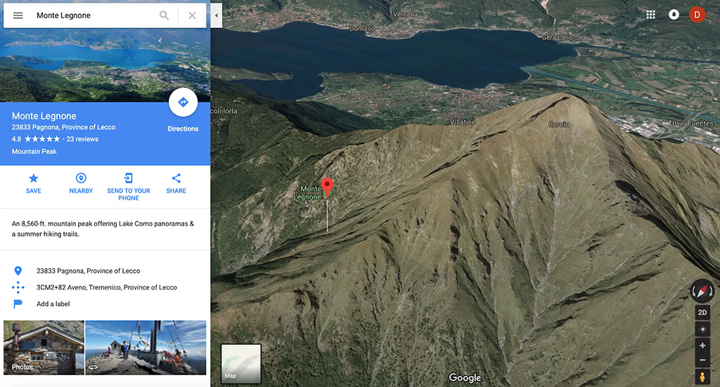
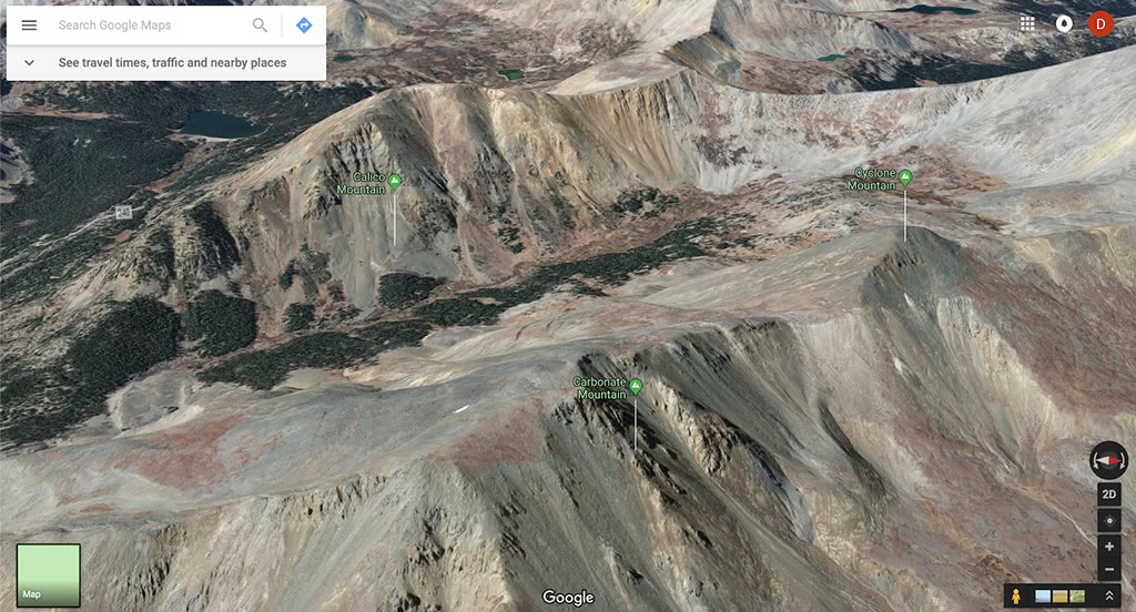
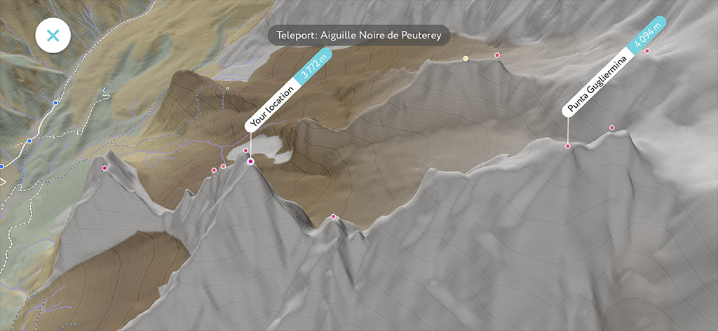
Here are just a couple of the places where we noticed major discrepancies (see the visual summit position and the map markers on the slopes):
Our data team combines multiple sources of raw geographical data into a high-precision 3D model of the world. The whole world model hefts over a TeraByte! In fact, we provide more data than most devices can chew, so we have to limit the amount and always optimize our tech to reduce battery drain.
The major components of PeakVisor 3D maps are:
- High-precision Digital Elevation Model - earth surface itself
- Terrain types - bare rock, glaciers, forests, grass, etc.
- Geographical names - mountain summit locations
- Water bodies, roads, walkways, cable cars, etc.
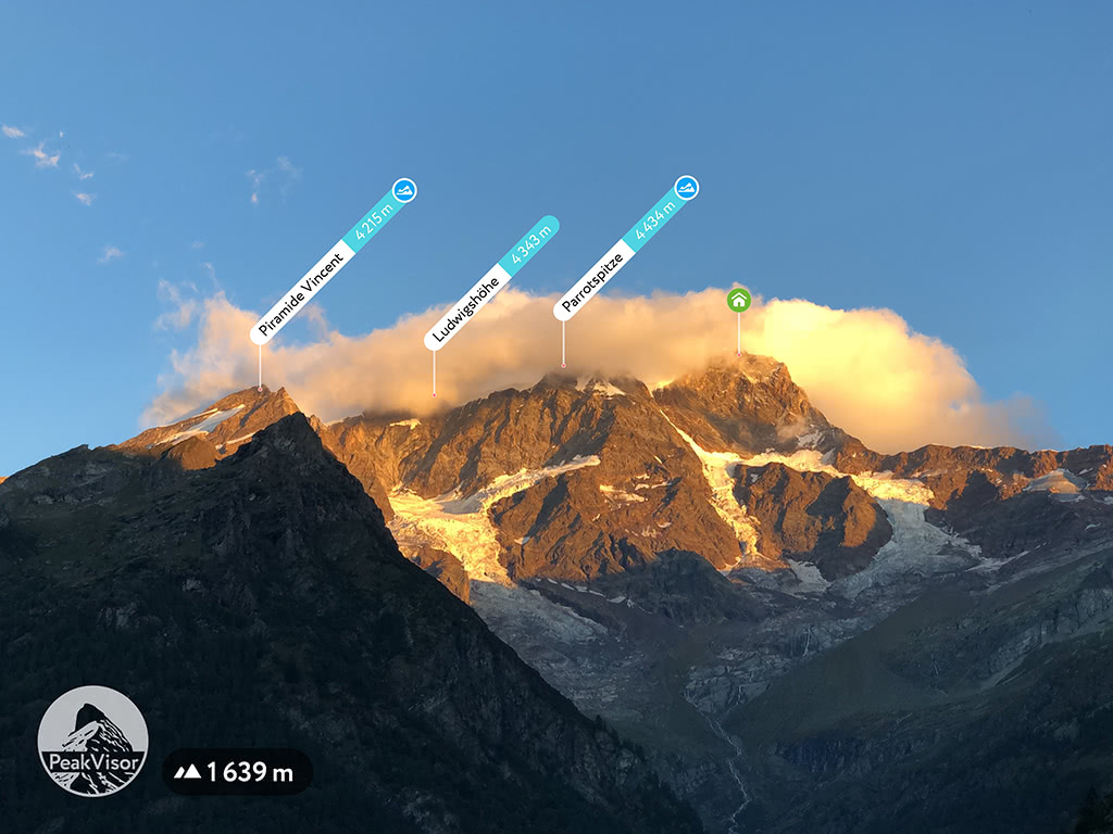
The best illustration of this is the screenshot straight from the app. Here we used the original data. Notice how slightly off are almost all the summits (red dots).
Recently, we came up with an idea to intellectually merge mountain summit locations with the high precision digital elevation model. By finding a nearest local extremum on the earth surface for more than a million mountains in the world we can now pin the peak names exactly on the peaks!
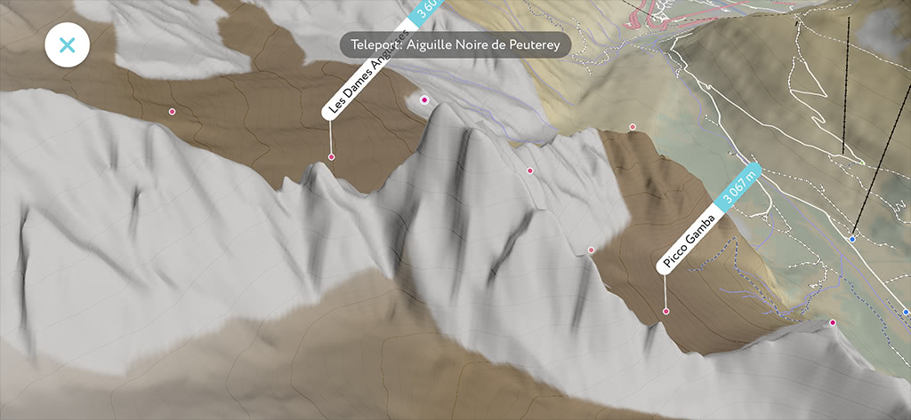
Having thus rectified the peaks locations, we’ve made 3D maps look much more precise with better calculated mountain prominences:
We hope that having the most precise mountain data in the PeakVisor app will let you enjoy outdoors even more!