
Scan the QR code and open PeakVisor on your phone
The Naxos Regional Unit is one of the 74 regional units in Greece. It is part of the Aegean Sea Administration, and it contains a collection of islands, including much of the Cyclades. The main feature of the region is its largest island, Naxos, which is home to the highest of the 20 named mountains in the unit, Zas/Zeys/Zeus (1,001 m / 3,284 ft).
The Naxos Regional Unit (Περιφερειακή Ενότητα Νάξου) gets its name from its largest island, Naxos (Νάξος).
The etymology of the name Naxos isn’t particularly interesting. However, the regional unit contains part of the Cyclades (Κυκλάδες), which is an archipelago located in the Aegean Sea.
The name of the Cyclades comes from the word κυκλάς, which can translate to ‘cycle’ or ‘cyclic.’ This is believed to be in reference to the fact that the archipelago is centered around (i.e., the rest of the archipelago encircles) the island of Delos (Δήλος).
Delos is one of the most important sites in Greece from a historic, mythological, and archeological perspective. It was considered sacred to the Ancient Greeks as it was the birthplace of both Artemis and Apollo. The island was subsequently inscribed as a UNESCO World Heritage Site in 1990.
The Naxos Regional Unit is one of 74 such regional units in Greece. It is located almost in the geographical center of the Aegean Sea. The regional unit has an area of around 622.1 sq. km (240.2 sq. mi), and it is home to more than 20,000 residents.
Administratively, the unit belongs to the South Aegean Administration, one of the two parts of the Aegean Sea Administration, which in turn is one of the seven official decentralized administrations in Greece that were created in 2011 as part of the Kallikratis Program (Πρόγραμμα Καλλικράτης).
Internally, the unit consists of two parts: Naxos and Lesser Cyclades (Νάξος και Μικρές Κυκλάδες) and Amorgos (Αμοργός).
The Lesser Cyclades, whose name highlights their smaller size when compared with Naxos and Amorgos, include the islands of Donousa (Δονούσα), Irakleia (Ηρακλειά), Schoinoussa (Σχοινούσσα), and Koufonisia (Κουφονήσια).
Meanwhile, Amorgos includes the main islands of Epano/Pano/Ano (Upper) Koufonisi (επάνω κουφονήσι), Kato (Lower) Koufonisi (Κάτω Κουφονήσι) and Keros/Karos (Κέρος), as well as several smaller ones like Glaronisi (Γλαρονήσι), Klidoura (Κλειδούρα), and others.
So, as a result, the unit consists of two large inhabited islands, five smaller ones, and many other rocky islets and other uninhabited islands.
From Naxos, you can travel to Crete in the south, Rhodes in the southeast, and the port of Piraeus (Πειραιάς) in Athens to the north. You can get to many of the region’s islands, including Naxos, from Piraeus.
Naxos, as well as the other Greek islands, can be reached by ferry from one of the many ports that are located across the Aegean Sea. There are many ferry companies in Greece, though the largest company that operates ferry services from the Greek mainland (primarily from Athens) to the Aegean Islands is Blue Star Ferries.
Blue Star Ferries offers regular trips to Naxos and it makes stops at all the major islands in the region. You can buy a ticket for a voyage on its official website, BlueStarFerries.com.
There are four general seating classes on Blue Star Ferries:
The normal-length voyage from Piraeus to Naxos is around 5 hours long. However, some voyages are 5.5 hours long and the faster (and more expensive) voyage is just under 4 hours long.
You can save money on your ferry ticket by booking an Economy seat, but sitting on deck for more than about 3 hours isn’t very comfortable, so it may be worth getting an Airplane-style seat instead. Do keep in mind, too, that these ferries travel long distances, so be cautious if you typically get seasick.
Note that the ferry to Naxos typically departs from Piraeus a few times during the day (normally twice in the morning and once at night). You can get to the ferry terminal from the center of Athens fairly easily by tram.
If you are taking the evening ferry out to the islands, keep in mind that you will arrive at your destination late at night. You may want to consider staying for a night near the ferry terminal at Naxos before heading on to your final destination, such as Amorgos.
Also, in Greece, be prepared for the unexpected. For example, the ferries do get canceled from time to time due to strikes, poor weather, or other issues. Be ready to be flexible in the event that things don’t go as planned. It can be helpful to have travel insurance just in case there are any unexpected delays during your journey.
Of all the Greek islands, the Cyclades are among the most interesting in terms of their human history. In fact, the Cyclades are known not only as a natural wonder but also as the home to some very important ancient civilizations during the Late Neolithic and Early Bronze ages.
This civilization is referred to as the Cycladic culture, and it is known for having its own distinct belief system and culture. Researchers have learned a lot about these civilizations from the many archaeological sites on the islands.
The Cycladic culture left behind some very interesting objects that have been the source of much intrigue among researchers over the years. This includes a collection of idols carved out of Parian marble that are up to 1.5 m (4.9 ft) tall. These idols were carved many centuries before the rise of the Minoan culture on Crete.
The uninhabited island of Keros, which is located in the archipelago but is now closed to visitors, is also a protected archaeological site from which a large number of ancient Cycladic art pieces were excavated during the twentieth century. Many of these objects are also found in the Goulandris Museum of Cycladic Art in Athens, which is named after the family who started the collection.
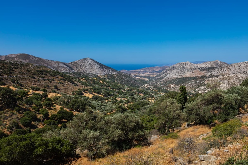
All the 20 named peaks in the Naxos Regional Unit are part of the Pindus Range (Πίνδος). The Pindus is one of the main ranges in Greece and it is also the largest part of the Greek Ranges, which cover the whole country.
The northern limits of the Pindus extend to Southern Albania, while the southern limits are considered to be the Tymphrestos Mountains that are located to the northeast of the town of Karpenísion on the Peloponnese Peninsula. The islands in the Aegean Sea Administration are considered to be an extension of these mountains.
Geologically, the Pindus Range is part of the larger Dinaric Alps, which cover almost the entire western part of the Balkan Peninsula. That being said, some people don’t consider the Pindus to be part of the Dinarides from a geopolitical perspective.
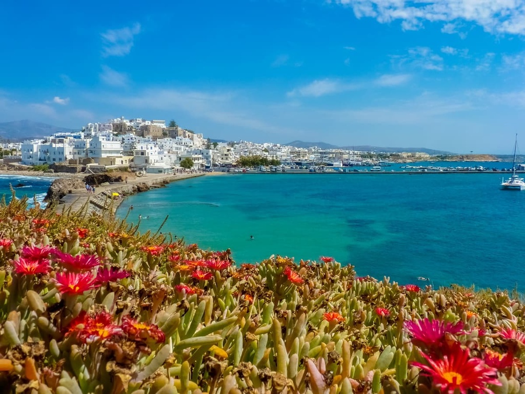
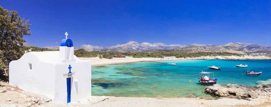
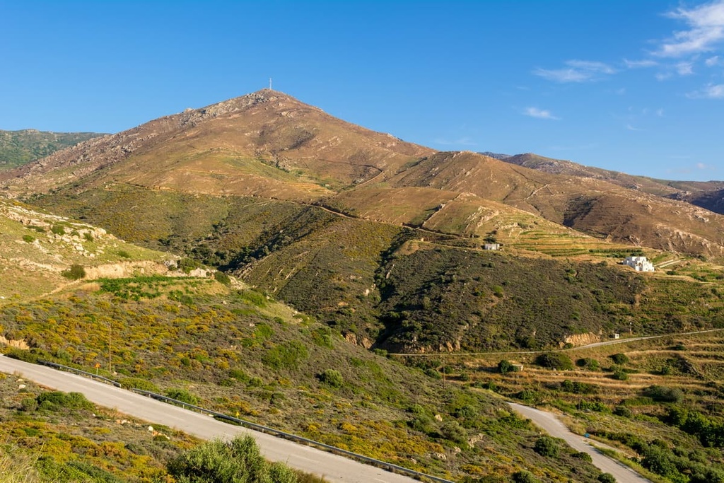
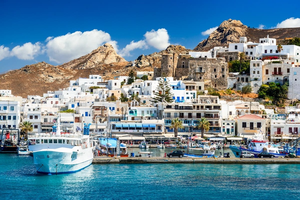
The highest and the most prominent peak of the Naxos Regional Unit is Mount Zas, which is also referred to as either Zeys or Zeus. It is the highest peak of all the Cyclades and the central part of the Aegean Sea. The peak is located in the small Tragea district in the center of the island of Naxos.
Zeys holds great historical significance for Greeks. It is believed that the cave on the northwest flanks of the mountain was the birthplace of the main god of Greek mythology, Zeus.
In total, Naxos is home to 15 of the 20 peaks of the regional unit, including:
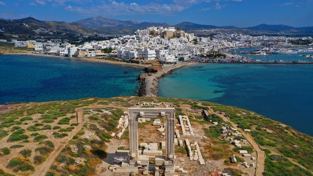
The closest high mountain to the main city of the island of Naxos is Stelidha (151 m / 495 ft), which is located just to the southwest of the Port. From its summit, you can see the city and the port, both of which are very beautiful.
Four more peaks of the Naxos Regional Unit are located on the island of Amorgos: Chorafakia, Vouno, Profitis Ilias, and Kórakas. The last peak in the regional unit is Papa, which is located on the island of Donousa.
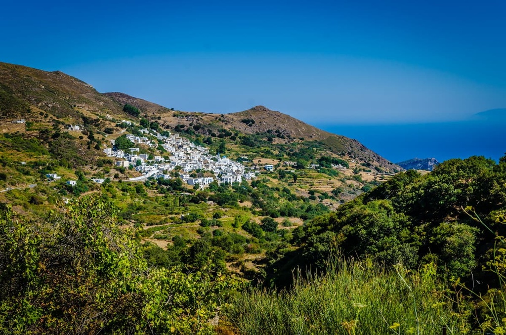
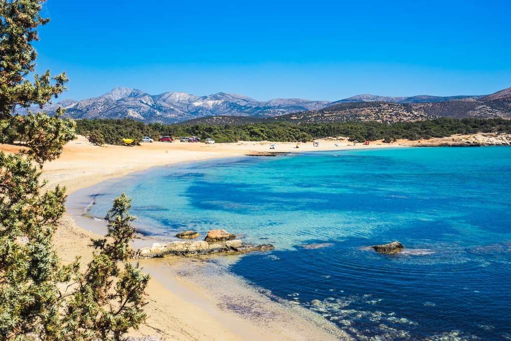
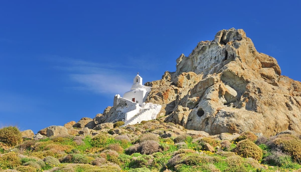
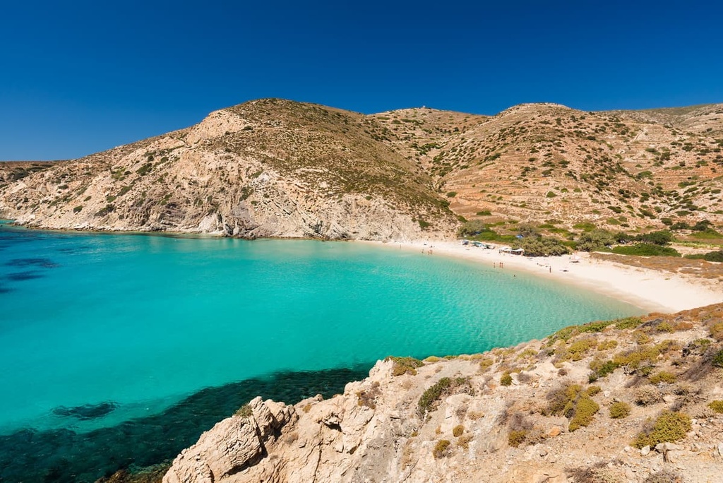
The most popular hiking areas in the Naxos Regional Unit are its three largest islands. Keep in mind that the marked trails on many of the Greek islands are actually ancient roads that were used to connect the main villages of an island and to offer easier travel to important places, such as churches, mills, springs, beaches, and more.
If you’re interested in hiking during your next trip to the Naxos Regional Unit, here’s a look at some of the most popular trails and routes in the area.
One of the best-known hikes on Naxos Island is easily the climb to the top of Mount Zas. There is a loop trail leading to the summit from the village of Filoti. The trail is around 10 km (6.2 mi) long and it has more than 500 m (1,640 ft) of elevation gain.
The island is also known for the Seven Villages Trail, which is 12 km (7.4 mi) long. It starts and ends in Kourounochori, and it passes through a number of villages, communities, and important sites, such as Mili, Potamia, Kalamitsia, and Melanes, among others.
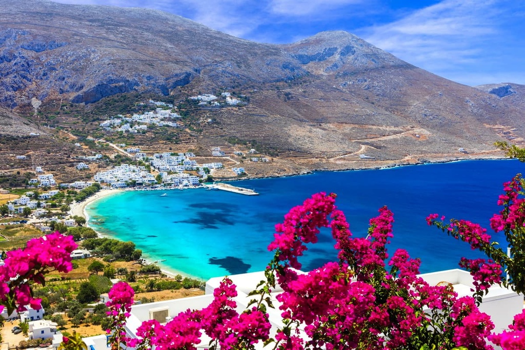
The highest mountain on the island of Amorgos, Krikelos, can be climbed on a magnificent loop trail that offers panoramic views of the sea along the entire northern part of the island. The trail begins in the largest village in the northern part of the island, Aegiali.
Be sure to take plenty of water and sun protection with you on this hike, as well as warm clothes. There are very strong winds on the tops of the mountains on the Greek islands that can make hiking a bit uncomfortable if you’re not prepared. Also keep in mind that these high winds can slow you down, so budget more time for your adventure than you think you need.
The longest route on Amorgos is called The Old Strata Route. It covers about half of the entire island and is around 20 km (12 mi) long.
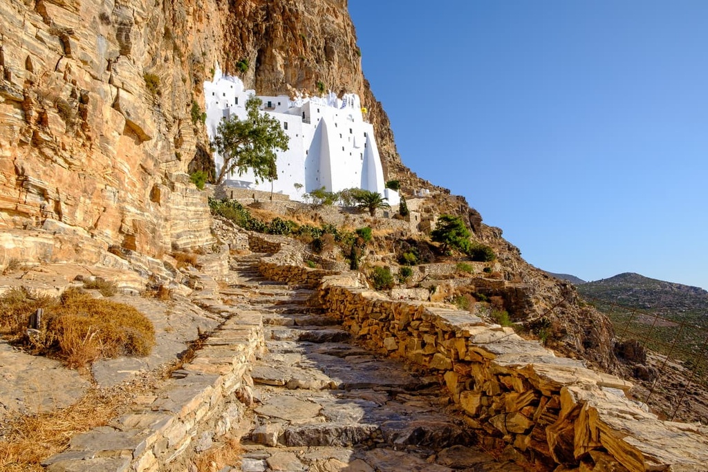
This trail connects its main village of Chora in the center of the island with the village of Aegiali in the northern part. It also passes by the extraordinary Hozoviotissa Monastery, which was built into the face of a cliff in 1017, making it the island’s most famous landmark. To this day, it is a functioning monastery where three monks live and conduct services, though it is also open to visitors.
In addition to the Old Strata Route, there are about 10 separate trails in all three parts of the island, including Fotodotis, Itonia, Melania, Pan, Valsamitis, and Evangelistria.
The smallest of the three largest islands of the Naxos Regional Unit is also a great place for hiking.
On Donoussa, you can walk between the island’s four main villages and a number of its important landmarks. Some of the many routes that you can hike on Donoussa include:
In total, there are more than 10 different trails on Donoussa for visitors to enjoy.
Before or during your trip to the region, you can get more information about the Naxos Regional Unit on the official Greek tourism website: VisitGreece.gr.
There are also some tourist offices in Athens where you can get more information during your travels. For example, the Athens Tourist Information Centre is located in the center of the city near the Acropolis.
The islands of the Naxos Regional Unit offer all kinds of accommodations for guests to enjoy, including hotels, rental apartments, 5-star villas, campsites, and hostels.
Note that accommodation costs tend to double or triple in price on the islands during the summer tourist season. But from about October through April and May, there are almost no tourists on the islands. Prices tend to be more affordable in the off-season and there also tend to be fewer crowds.
For example, I managed to spend all of November and December 2015 at the five-star Aegialis Hotel & Spa on Amorgos Island near Santorini. There were barely any other people there at the time and Amorgos itself is a great alternative to more touristy places like Santorini.
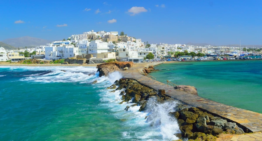
The main towns, resorts, and ports of the Naxos Regional Unit are Naxos and Chora on Naxos Island, Chora on Amorgos Island, and Agios Stavros on Donoussa Island. The word chora is often used by Greeks as the name of the main town on an island as it actually translates as ‘main town.’
The top sights and attractions of the Naxos islands are:
The islands' official tourist sites are: Naxos.gr, Amorgos.gr, Donoussa.gr.


