
Scan the QR code and open PeakVisor on your phone
Miami-Dade County is the county surrounding the U.S. city of Miami, Florida. With a population of over 2.7 million, it is the most populous county in Florida and one of the most heavily populated in the United States. Miami-Dade County, and Florida as a whole, is incredibly flat, and the highest point in the county is Miami Rock Ridge, which sits just 23-28 feet (7-8.6 m) above sea level. Unfortunately, nobody knows quite where the actual high point is along the ridge; even the most diehard county summiteers have been able to track it down, partly due to the amount of development (everything has been altered by humans at some point or another).
Miami-Dade County sits on the southeastern tip of the Florida peninsula, forming part of the Atlantic Coastal Plain and covering 2,431 square miles (6,297 sq. km) of land and sea. To the north, Miami-Dade County is bordered by Broward County, and to the south is Monroe County and the Florida Keys.
The region’s topography is characterized by exceptionally low relief. In other words, the dominant geographical feature here is flatness. There are no hills in Miami-Dade County, much less any mountains. The highest point is Miami Rock Ridge, only 23-28 feet (7-8.6m) above sea level. Low elevation is characteristic of Florida as a whole. The highest point in the state, Britton Hill (345 ft / 105 m), is actually the lowest “high point” in any of the 50 U.S. states.
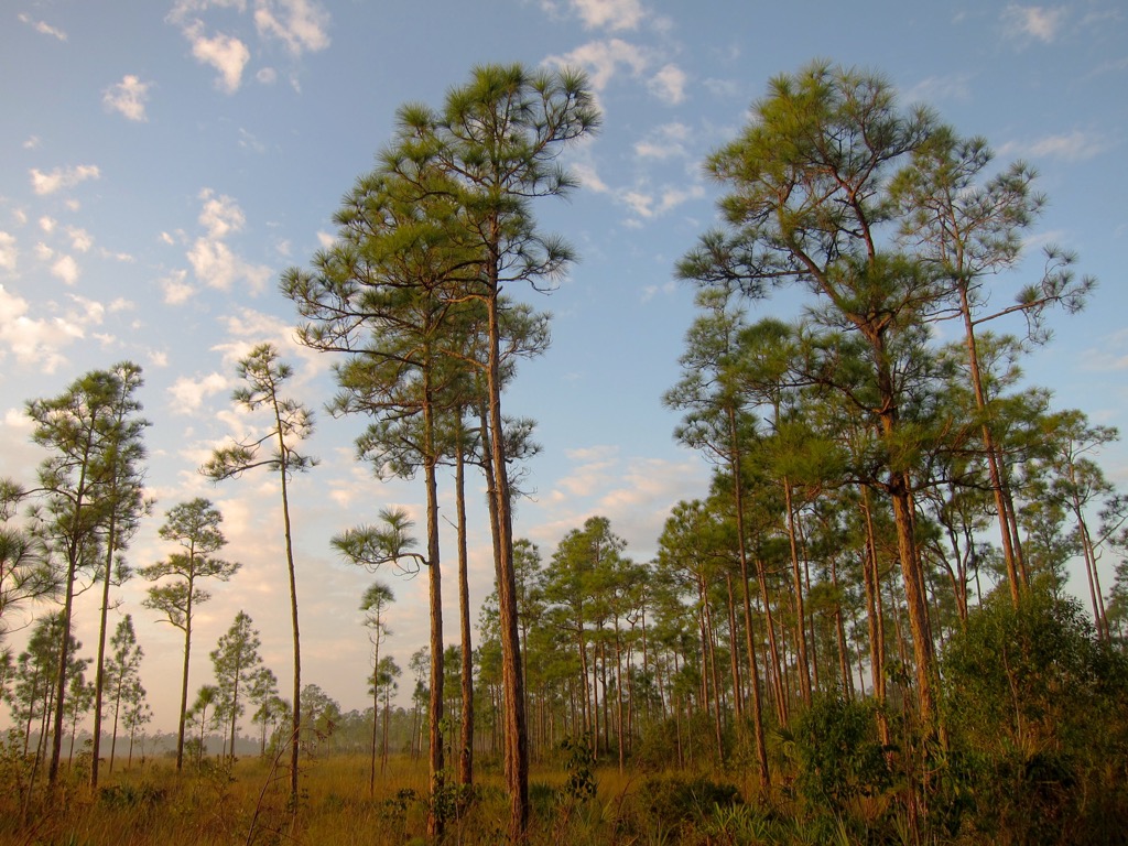
Despite this general uniformity, subtle variations do exist, like the Miami Rock Ridge, an elongated limestone formation running parallel to the coastline. This “ridgeline” runs from north of the Miami River south, towards the city of Homestead, then curves west into Everglades National Park. It represents the highest natural elevations in the county. In most cases, it does not exceed 10 to 15 feet (3 to 5 m), but there are points near 20 to 23 feet (6 to 7 m), particularly in the Coconut Grove neighborhood.
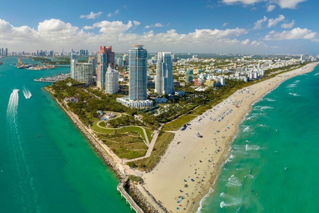
More than anything, Miami-Dade County is influenced by hydrological features. The county’s eastern boundary is the Atlantic Ocean and Biscayne Bay, a shallow subtropical lagoon home to the Port of Miami (the world's largest passenger port and one of the largest cargo ports in the United States). Barrier islands, including the municipality of Miami Beach, separate this bay from the Atlantic. Biscayne National Park, a marine protected area, encompasses much of the bay and its offshore waters.
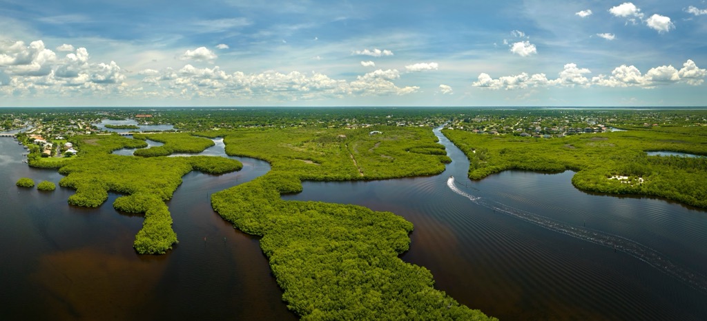
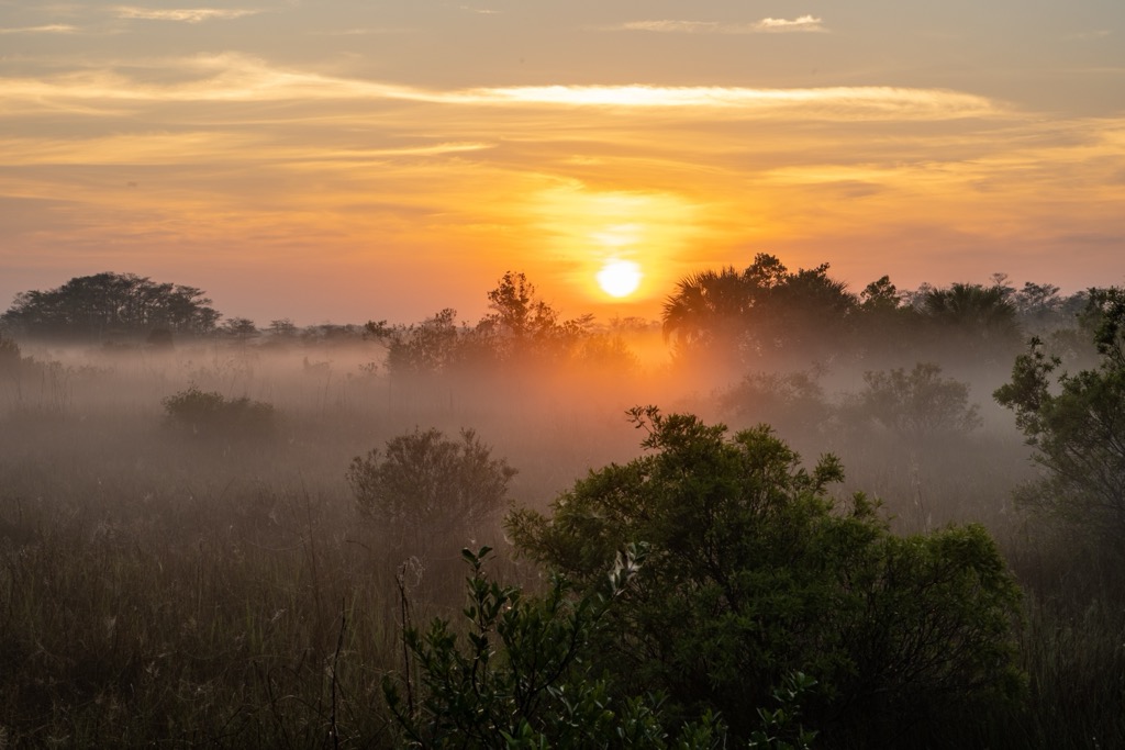
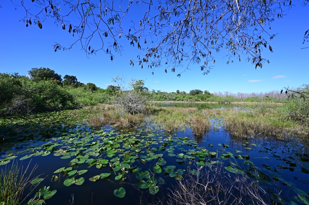
The western portion of Miami-Dade County contains a large area of the Everglades wetland ecosystem. Everglades National Park occupies approximately one-third of the county's total land area, extending westward from urban Miami.
The geology of Miami-Dade County is dominated by a formation called the “Miami Limestone” (also known as Miami Oolite), a marine limestone formation deposited during the Sangamonian interglacial stage of the Late Pleistocene epoch, which was approximately 130,000 years ago.
At that time, higher sea levels submerged southern Florida, creating a shallow marine environment conducive to carbonate deposits. The formation primarily consists of oolitic limestone, formed in high-energy shoals and bars, and bryozoan facies that were deposited in quieter, back-reef lagoons.
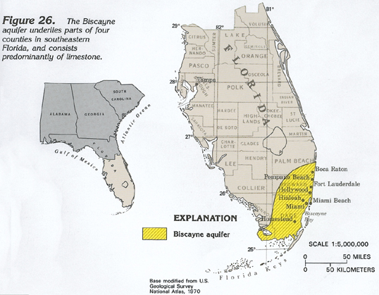
The Miami Limestone is highly porous and permeable, subject to dissolution by slightly acidic rainwater and groundwater, a process characteristic of karst terrains, and one that results in features such as solution holes and pinnacled bedrock surfaces. This porosity is fundamental to the formation and function of the Biscayne Aquifer, an aquifer system that sits within the Miami Limestone and underlying formations.
The Miami Limestone is the surface bedrock across the county's eastern portion, including the Atlantic Coastal Ridge area, and extends beneath the eastern Everglades and Florida Bay. It generally does not exceed 50 feet (15 m) in thickness. On top of this bedrock is a thin layer of soil, as well as peat (accumulated organic matter) in wetlands, like the Everglades.
It may not be mountainous, but Miami is full of fascinating wildlife. The subtropical climate and diverse habitats of Miami-Dade County include wetlands, pinelands, hardwood hammocks, and coastal zones. They support a rich array of flora and fauna with both temperate and tropical characteristics. The Everglades ecosystem features vast marshes dominated by sawgrass (Cladium jamaicense), interspersed with tree islands (hammocks), cypress domes featuring bald cypress (Taxodium distichum), and deeper water sloughs.
Unique to southeastern Florida are the pine rocklands, an ecosystem found atop the Miami Rock Ridge. This fire-dependent habitat features an open canopy of South Florida slash pine (Pinus elliottii) and an understory containing numerous endemic plant species, such as deltoid spurge (Chamaesyce deltoidea) and Small's milkpea (Galactia smallii).
Tropical hardwood hammocks occur on slightly elevated land and contain broadleaf evergreen and deciduous trees like gumbo-limbo (Bursera simaruba) and southern live oak (Quercus virginiana). Coastal areas feature mangrove forests, typically comprising red mangrove (Rhizophora mangle), black mangrove (Avicennia germinans), and white mangrove (Laguncularia racemosa), transitioning to seagrass beds in Biscayne Bay.
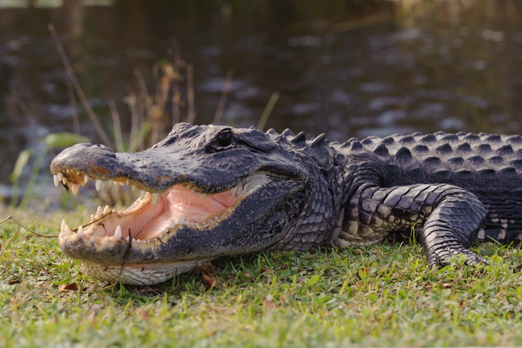
The most iconic fauna in Miami-Dade County is probably the American alligator (Alligator mississippiensis), a keystone species in the Everglades. Various wading birds, such as the great egret (Ardea alba) and white ibis (Eudocimus albus), are abundant.
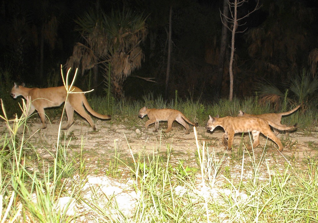
Endangered species utilize habitats within the county, including the Florida panther (Puma concolor coryi), the Florida bonneted bat (Eumops floridanus), and the specialized snail kite (Rostrhamus sociabilis). Pine rocklands also support endemic invertebrates like the Bartram's Scrub-Hairstreak butterfly (Strymon acis bartrami).
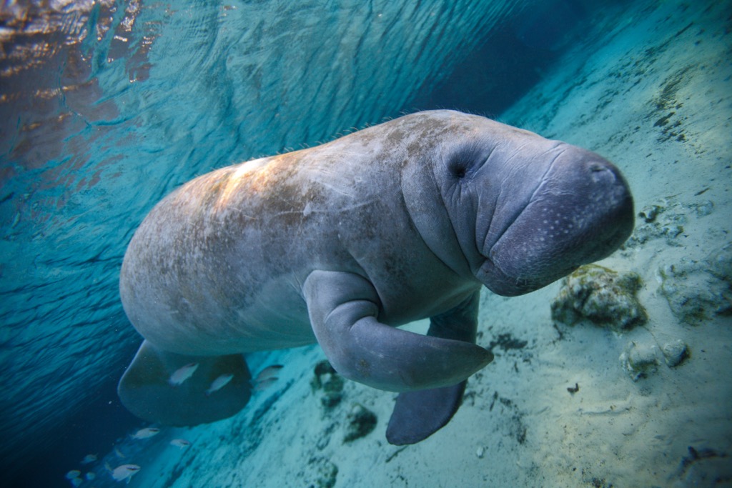
Marine fauna in Biscayne Bay and adjacent Atlantic waters includes the West Indian manatee (Trichechus manatus) and bottlenose dolphin (Tursiops truncatus). Both on land and in the sea, the biodiversity in Miami-Dade County faces significant pressure from urbanization, human overpopulation, and habitat fragmentation.
The history of human life in the Miami-Dade region extends back at least 10,000 years, but the Tequesta people were the predominant indigenous group at the time of European contact. The Tequesta established settlements primarily along the coast and near the mouth of the Miami River.
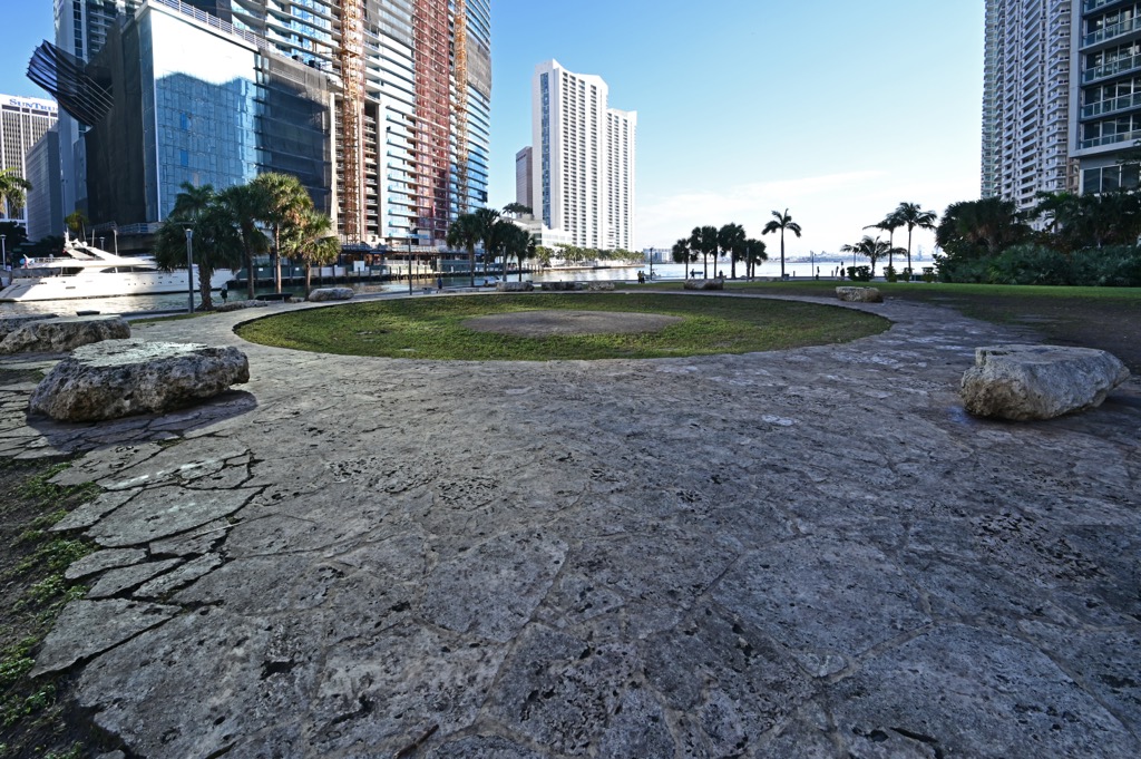
The Tequesta were hunter-gatherers, subsisting primarily from fishing and hunting, as well as gathering roots and fruits. They did not practice any form of agriculture. It is believed that the Tequesta were responsible for the Miami Circle, a perfect circle measuring 38 feet (11.5m), consisting of 24 holes or basins cut deep into the limestone bedrock. Archaeologists believe this circle (today a National Historic Landmark) was the site of a major Tequesta structure, perhaps 2,000 years old.
Spanish explorers were the first Europeans to arrive in the region, beginning with Juan Ponce de León in 1513. They claimed the territory for Spain, establishing brief missions but achieving little permanent settlement. However, Tequesta populations drastically declined due to introduced diseases and conflict, and they largely disappeared by the mid-18th century.
Florida was transferred from Spain to the United States in 1821, as part of the Adams-Onís Treaty (also known as the Transcontinental Treaty). The region remained sparsely populated for many years, serving primarily as a military outpost (Fort Dallas) during the Seminole Wars in the mid-19th century.

Significant development commenced in the late 19th century, driven by pioneers such as Julia Tuttle and the Brickell family. A pivotal moment occurred in 1896, when Henry Flagler extended his Florida East Coast Railway southward (prompted by Tuttle and the favorable weather conditions compared to northern Florida). This directly led to the incorporation of the City of Miami that same year.
The early 20th century saw cycles of rapid growth, notably the 1920s land boom, followed by economic downturns. Agriculture and tourism were early economic drivers. Post-World War II expansion was significant, but the region underwent a profound demographic and cultural transformation into a Latino hub beginning in 1959, with the mass arrival of exiles from Cuba, following the Cuban Revolution. This influx reshaped Miami into a bilingual, bicultural metropolis.
The late 20th and early 21st centuries saw continued growth, establishing the region as a major international center for finance, trade, culture, and tourism. Today, most Miamians speak Spanish as a first language. Over 70% of the city’s inhabitants are ethnically Latino, making it one of the largest Latino communities in the United States.
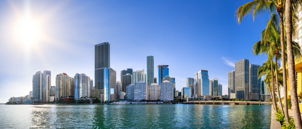
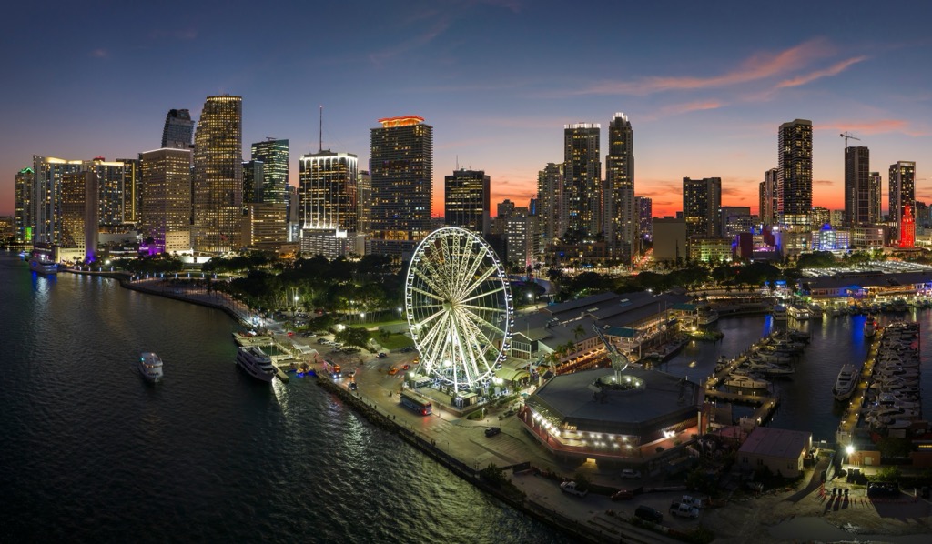
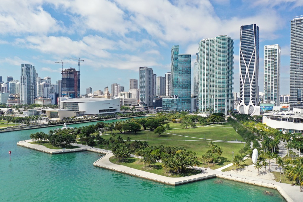
Though it lacks mountains, Miami is one of the tallest cities in the U.S. from a building perspective. As of 2025, the pinnacle of the city’s impressive skyline is the Panorama Tower, at 869 feet (265 meters).
Miami-Dade County is one of the most densely populated counties in the United States and is heavily urbanized. However, its area also contains nearly a dozen state parks and three nationally protected areas; two national parks—the Everglades and Biscayne—and a preserve, Big Cypress National Preserve.
Established in 1947, Everglades National Park encompasses over 2,357 square miles (6,105 sq km) at the southern tip of Florida, including western Miami-Dade County. Recognized globally as a World Heritage Site, International Biosphere Reserve, and Wetland of International Importance, it contains the largest subtropical wilderness in the United States. It is also the third-largest national park in the contiguous United States (after Death Valley and Yellowstone).
The Everglades are defined by a shallow, slow-moving sheet of freshwater, historically flowing south from Lake Okeechobee across vast sawgrass prairies (Cladium jamaicense), earning it the name “River of Grass.”
This dominant ecosystem is interspersed with freshwater sloughs like the Shark River Slough, tropical hardwood hammocks on slightly elevated land, cypress domes (Taxodium distichum), pine rocklands, and extensive mangrove forests that line the transition to the marine environment of Florida Bay.
The park provides critical habitat for numerous threatened and endangered species, including the American crocodile (Crocodylus acutus), West Indian manatee (Trichechus manatus, also known simply as the “Florida manatee”), the elusive Florida panther (Puma concolor coryi), and a diverse array of wading birds, and hundreds of species of fresh and saltwater fish. Its preservation is considered vital not only for biodiversity, but also for regional water quality and supply.
Located immediately south and east of the Miami metropolitan area, Biscayne National Park protects approximately 435 square miles (700 sq km), of which 95% are marine waters. Established as a national monument in 1968 and expanded to a national park in 1980, it preserves a unique confluence of four distinct ecosystems.
These include a narrow strip of shoreline mangrove forest, the shallow, productive waters of southern Biscayne Bay (characterized by extensive seagrass beds), the northernmost islands of the Florida Keys archipelago (formed from ancient coral reefs), and the offshore Florida Reef Tract, the only living coral barrier reef system in the continental United States.
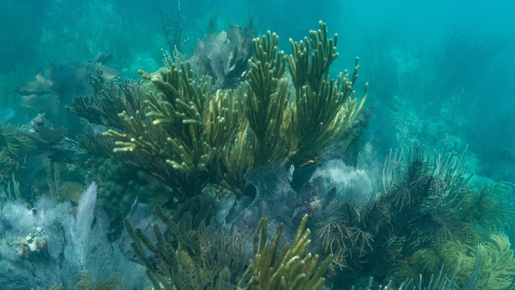
This combination of ecosystems supports considerable biodiversity, including over 500 species of fish, threatened sea turtles, manatees (Trichechus manatus), dolphins (Tursiops truncatus), fragile coral communities, and numerous bird species that utilize the area for nesting and foraging.
NOTE: Access to most of Biscayne National Park requires a boat.
Established in 1974 as one of the first National Preserves in the United States, Big Cypress National Preserve covers over 1,126 square miles (2,916 sq km) of swamp land, south of Everglades National Park.
Unlike the Everglades' dominant sawgrass plains, Big Cypress is characterized by its namesake cypress strands, featuring towering bald cypress (Taxodium distichum) and pond cypress (Taxodium ascendens). These wet forests are interspersed with pine flatwoods, hardwood hammocks, wet prairies, and mangrove estuaries near the coast.
The preserve plays a key hydrological role, protecting the flow of significant volumes of freshwater that are essential for the health of the western Everglades, as well as the Ten Thousand Islands coastal region downstream, in Monroe County.
It also provides vital habitat for diverse wildlife, including the endangered Florida panther (Puma concolor coryi), for which the preserve is a core habitat, the Florida black bear (Ursus americanus floridanus), American alligator (Alligator mississippiensis), and a rich variety of birds and epiphytic plants, like orchids and bromeliads. Its designation as a “preserve” (as opposed to a national park) allows for conservation alongside specific recreational activities.
If the Everglades aren’t your thing, the city of Miami (pop. 455,000) offers a mix of sun-soaked beaches, diverse culture, and energetic nightlife. It is one of the most ethnically diverse cities in the United States, and one of the largest cities with a majority Spanish-speaking population.
For those craving the rush and excitement of a big summit, you won’t find it. But what you will discover is the Skyviews Miami Observation Wheel, the best place to make all sorts of summit-esque observations of the surrounding cityscape and Biscayne Bay.
Then there’s iconic South Beach, famous for its pastel Art Deco architecture, bustling Ocean Drive, and broad sandy shores. You can take a boat tour around Biscayne Bay to see the exquisite shoreline real estate, or experience the city's famous nightlife in South Beach or Wynwood.
To get a bit of the city’s Latinx flair, check out the Wynwood Walls, an outdoor museum showcasing large-scale murals by global street artists. Head to “Little Havana” to experience the heart of Cuban culture along Calle Ocho, enjoying authentic Cuban food, strong cafecito, and lively music.
Lastly, Downtown's Museum Park features a cluster of world-class museums, like the Pérez Art Museum Miami and the Phillip and Patricia Frost Museum of Science. Furthermore, don't miss the Vizcaya Museum & Gardens, a historic Italianate villa on Biscayne Bay.


.jpg)