
Scan the QR code and open PeakVisor on your phone
The eThekwini Metropolitan Municipality is located in the province of KwaZulu-Natal in South Africa and encompasses the city of Durban and its surrounding areas. There are 32 named mountains in eThekwini Metropolitan Municipality. Cameni is the highest point, measuring 907 meters (2,976 ft). The most prominent mountain is Qhodela, at 775 meters (2,477 ft).
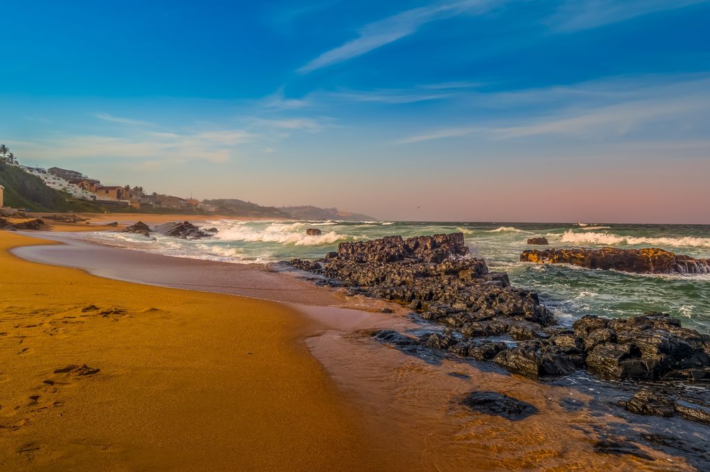
eThekwini Metropolitan Municipality covers approximately 255,600 ha (631,601 ac) along the eastern coastline of South Africa. It is bordered by the Indian Ocean, the uMngeni River to the north, the uMkhomazi River to the south, and hilly inland regions to the west.
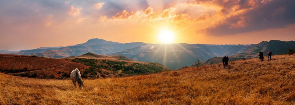
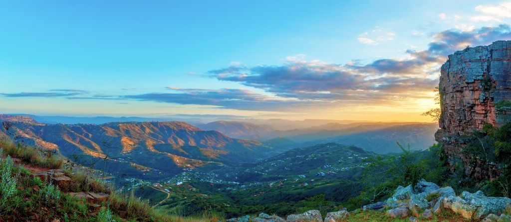
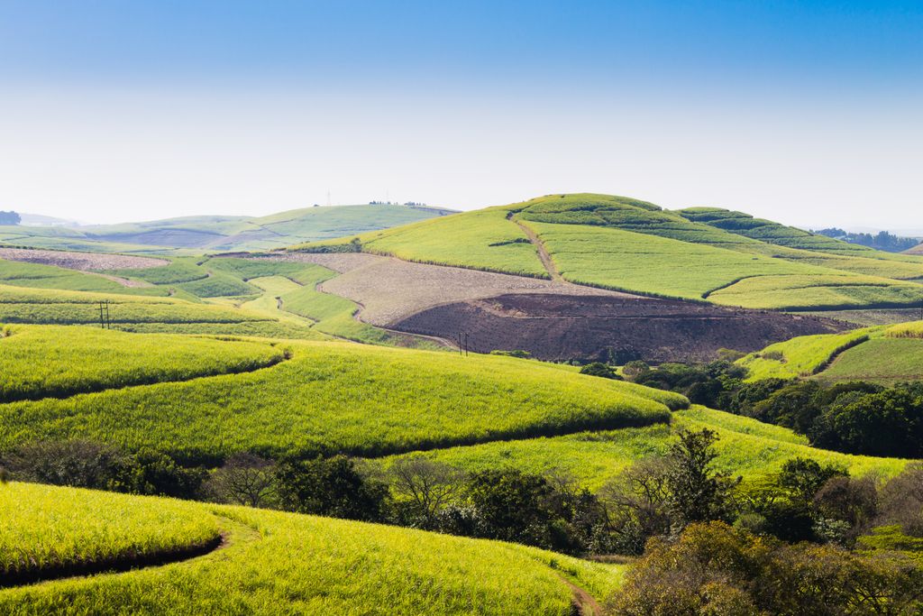
The topography of eThekwini is varied. The coastal zone, including Durban, features sandy beaches, estuaries, and wetlands. Moving inland, the terrain becomes hilly and is covered with grasslands and valleys. In the far western areas, the land rises into the foothills of the Drakensberg Mountains.
eThekwini has a subtropical climate with hot, humid summers and mild winters. Summer temperatures range between 24°C and 32°C (75°F to 90°F) and are accompanied by significant rainfall. Winter temperatures range from 10°C to 22°C (50°F to 72°F).
Several rivers flow through the municipality, the largest being the uMngeni River, which provides water for Durban and surrounding areas. Other significant rivers include the uMlazi, uMbilo, and uMkhomazi.
eThekwini integrates urban and rural elements. Durban is the urban center, with a bustling port, commercial districts, and residential neighborhoods. The western areas are more rural, with agricultural land and traditional homesteads. Industrial zones, especially near the port and in places like Pinetown, contribute to the region’s economy. The Port of Durban is one of Africa’s busiest.
The eThekwini Metropolitan Municipality features a diverse geological landscape shaped by ancient and recent formations. The oldest rocks are part of the Basement Complex, consisting of granitoids and gneisses over 2.5 billion years old. These are overlain by the Natal Group Sandstones, which date back 450 to 360 million years and form prominent ridges in the inland areas.
The region also includes the Karoo Supergroup, composed of sedimentary rocks and dolerite intrusions from around 300 to 180 million years ago. In more recent times, the Pleistocene-aged Berea Red Sands and Quaternary marine deposits have shaped the coastal plains and beaches.
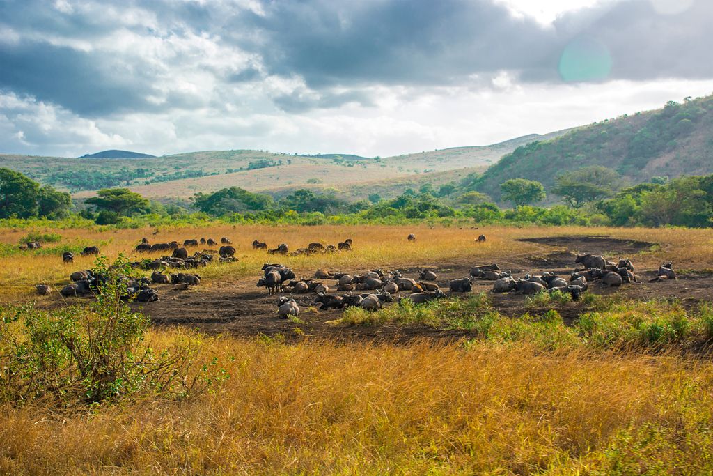
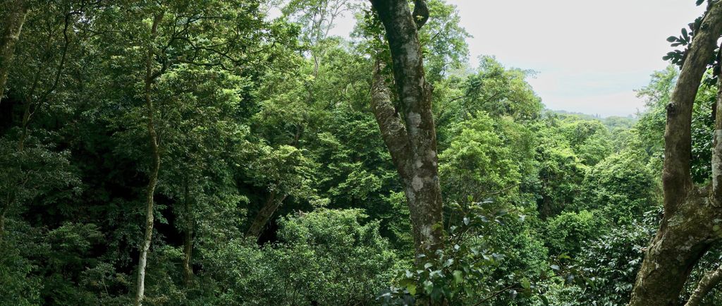
eThekwini Metropolitan Municipality features diverse ecosystems, including coastal environments, grasslands, wetlands, and forests, shaped by its climate and proximity to the Indian Ocean.
The municipality's vegetation includes coastal forests, savannas, wetlands, and thickets. Coastal forests protect the shoreline, while grasslands and savannas support grazing animals. Wetlands, like the Umgeni River estuary, provide critical habitats for aquatic species and birds. Thickets and forests host rare and endemic plants.
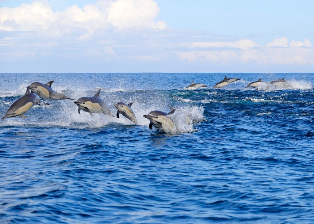
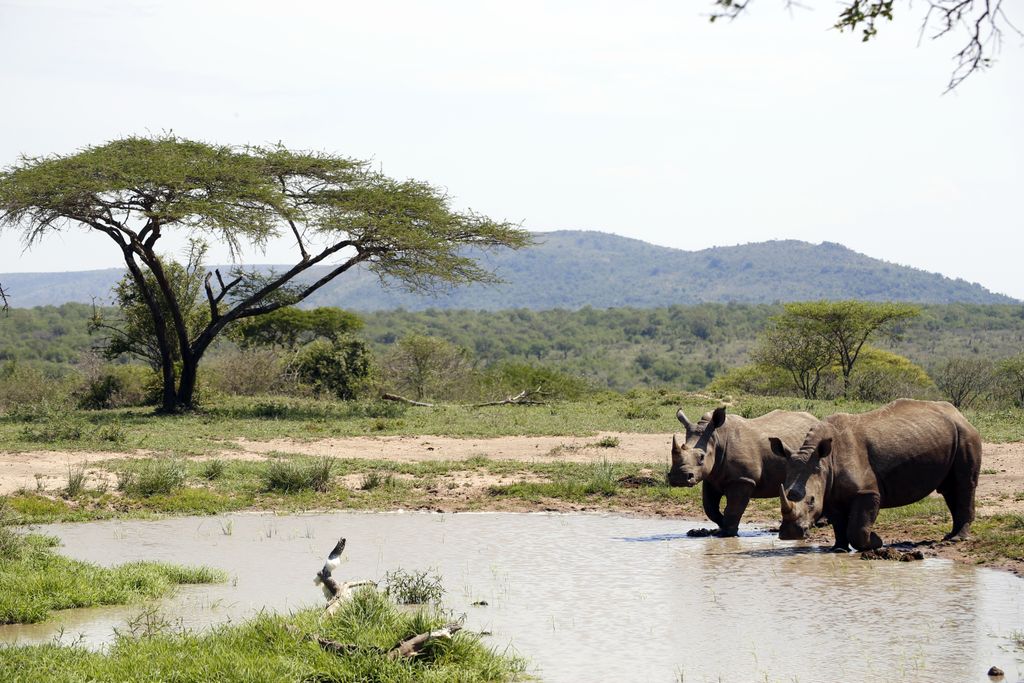
eThekwini’s fauna includes mammals like kudu and impala, as well as predators such as leopards. Coastal estuaries are important for migratory birds, and marine ecosystems support turtles, fish, and coral reefs.
Protected areas, including Hluhluwe-Imfolozi Park and the Dlinza Forest, conserve biodiversity.
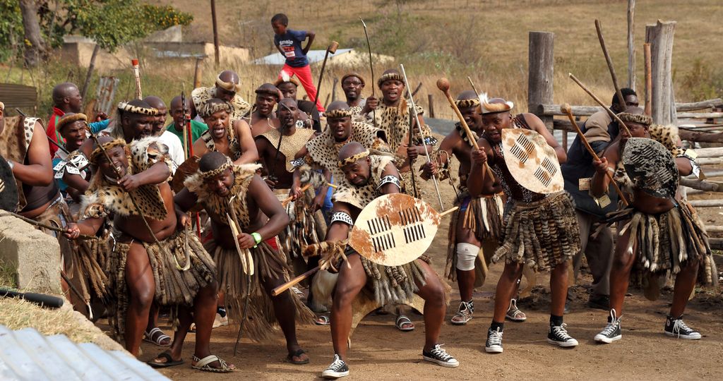
Before European colonization, the Zulu people inhabited the eThekwini Metropolitan Municipality. The Zulu Kingdom, especially under King Shaka in the 19th century, played a key role in the region’s history.
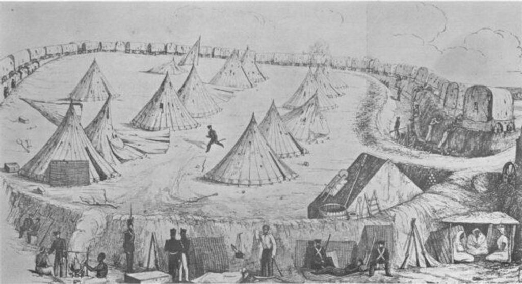
In 1824, the British established a trading post at Port Natal, which is present-day Durban. In 1843, they formally annexed the area, making it part of British-controlled Natal. The British settlement led to the displacement of many Indigenous people and the introduction of indentured laborers from India to work on sugar plantations.
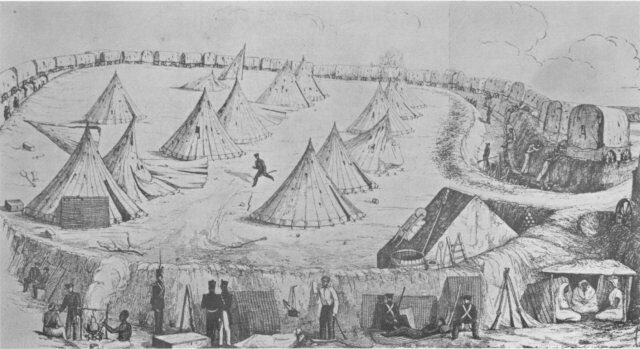
The Zulu Kingdom, under King Cetshwayo, resisted British control, resulting in the Anglo-Zulu War of 1879. Despite their defeat, the Zulu people retained cultural significance in the region.
Under apartheid, Durban was heavily affected by segregation policies, with black, Indian, and Coloured communities forcibly relocated to separate townships. The city became a center for resistance movements, including strikes and protests against apartheid.
After apartheid ended in 1994, eThekwini Municipality was formed, with the African National Congress (ANC) taking control. Durban’s port remained a key economic hub, and the city has grown as a tourism and cultural center.
Hluhluwe-Imfolozi Park offers diverse hiking trails for an immersive African wilderness experience. The Imfolozi Big 5 Wilderness Walking Trails are a highlight, featuring options like the Primitive Trail, which offers backpacking and endless stargazing opportunities. Meanwhile, the Base Camp Trail is equipped with accommodations at Mdindini Trails Camp. Shorter catered trails and extended hikes are also available. Nearby, the Zulu Rangers Tracks and Trails offer guided hikes through varied landscapes.
The iSithumba Hiking Trails are located in the Valley of 1000 Hills in the rural Zulu village of iSithumba. They offer views of the Mamba Gorge, Assegaai, and Gelengele. The trails vary in difficulty, and guided hikes provide insights into local flora and fauna. Village tours often include meeting the local healer and cultural leader.
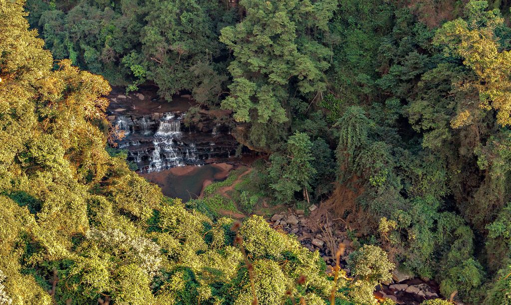
Dlinza Forest in Eshowe offers hiking trails showcasing its biodiversity and scenic beauty. The iMpunzi Trail is an easy 1.3 km (0.8 mi) walk through the forest, featuring Fluted Milkwoods and Giant Ironwoods. The 1.8 km (1.1 mi) Unkonka Trail provides a deeper experience of the lush vegetation and wildlife. The Bishop’s Seat trail leads to a forest clearing. The Aerial Boardwalk, 127 meters (417 ft) long and 10 meters (33 ft) high, ends at a 20-meter (66 ft) observation tower with panoramic views of the forest canopy and countryside.
Kloof Gorge is located within the Krantzkloof Nature Reserve in KwaZulu-Natal and includes the hills of The Boneyard, Maliphonjwana, and Rumdoodle. Popular trails include the Kloof Falls via Molweni Trail, which provides views of the Kloof Falls and the surrounding gorge, and the Long Shadow - Molweni Falls Trail, known for its Molweni Falls and stream crossings. The Mpithi Falls Trail starts and ends at the Kloof Falls Picnic Site and features the Mpithi Falls, while the Beacon Trail offers challenging terrain and rewarding views at the top, with a chance to spot the Crowned Eagle.
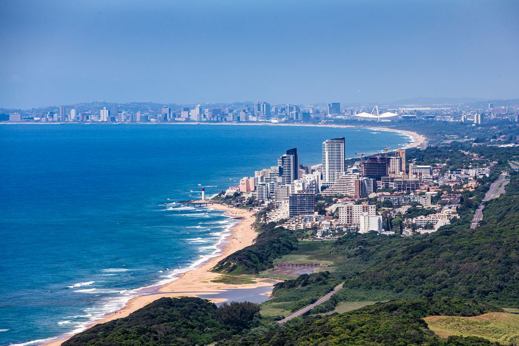
Durban is the third-largest city in South Africa, located on the country's eastern coast. It is a major hub for tourism and shipping. The city has a significant Zulu heritage and a large Indian community, which influence its cuisine and festivals.
Outdoor activities are abundant in Durban, particularly along its famous beaches. The Golden Mile is ideal for swimming and surfing, with a promenade stretching the expanse of the beach. Umhlanga Rocks offers upscale beaches and water sports, while uShaka Marine World Beach is perfect for families.
The Durban Botanic Gardens and Kenneth Stainbank Nature Reserve offer hiking and wildlife viewing. Phezulu Safari Park provides cultural experiences and game drives.
The Drakensberg Mountains are about a three-hour drive from the city. This mountain range is ideal for hiking, rock climbing, and scenic walks, offering mountain views, waterfalls, and diverse wildlife.
Pietermaritzburg is the capital and second-largest city of KwaZulu-Natal. It is situated in the Msunduzi River Valley and is steeped in history, dating back to its founding in 1838 by the Voortrekkers.
The KwaZulu-Natal National Botanical Garden features a variety of indigenous and exotic plants. The gardens also offer walking paths, birdwatching, and shaded picnic spots.
Tala Private Game Reserve offers game drives, during which visitors can spot rhinos, giraffes, zebras, antelopes, and more. These drives are an excellent opportunity to experience the region's rich biodiversity.
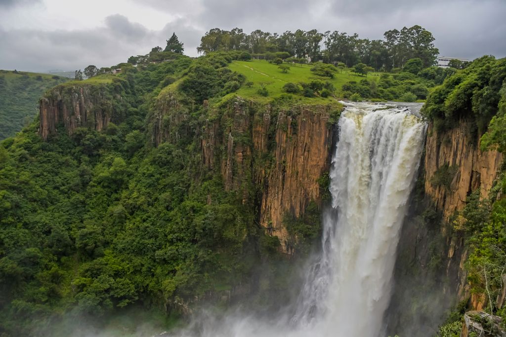
Just a short drive from Pietermaritzburg, Howick Falls is a 95-meter (312 ft) waterfall on the Umgeni River. Visitors can enjoy views from the observation deck or explore the surrounding trails.


.jpg)