Get PeakVisor App
Sign In
Search by GPS coordinates
- Latitude
- ° ' ''
- Longitude
- ° ' ''
- Units of Length

Yes
Cancel
❤ Wishlist ×
Choose
Delete
Christchurch is located on the east coast of New Zealand's South Island. With an estimated population of 398,520, this city is the largest in the South Island and the second largest city in the country.
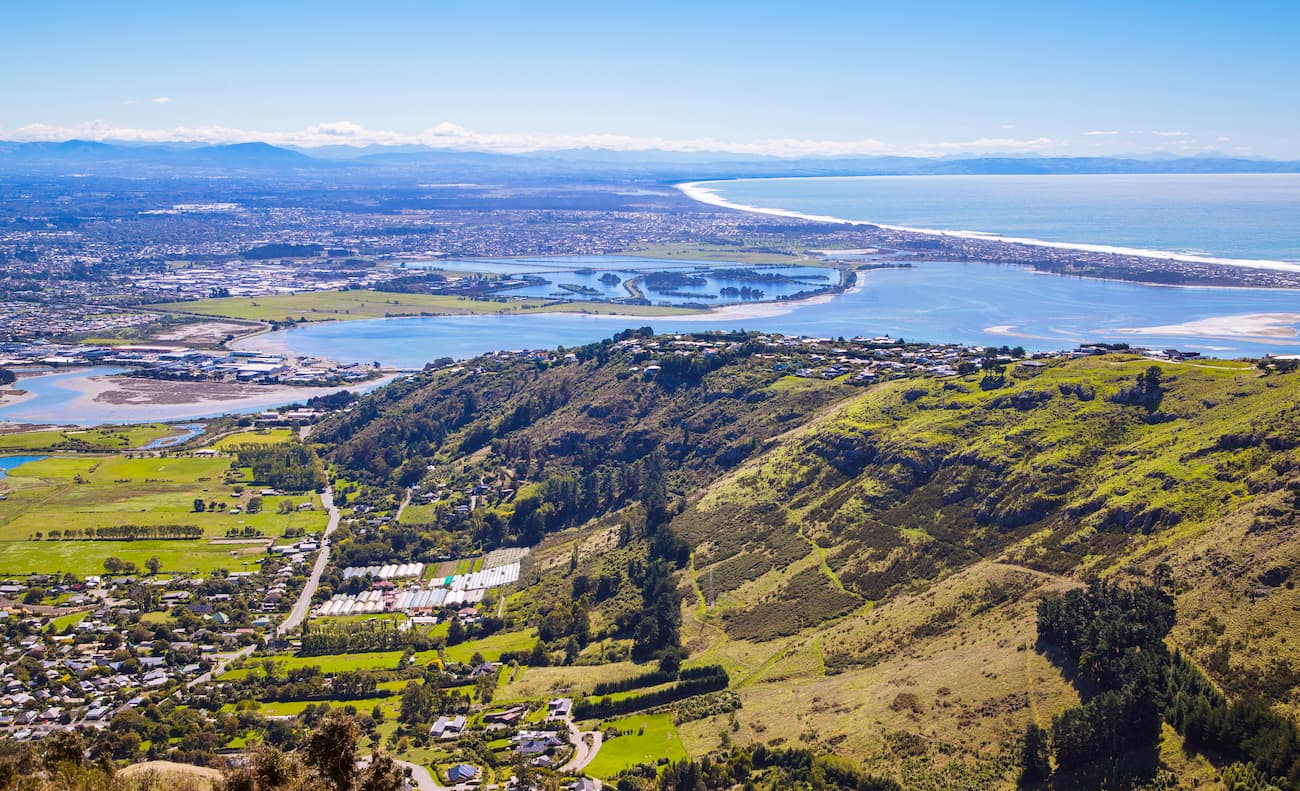
In 2010 - 2011, Christchurch suffered four major earthquakes bringing the city to an almost total destruction. However, such terrific devastation has allowed this beautiful city to modernise itself with a rejuvenated urban centre filled with boutiques, fresh hospitality, and plenty of hidden gems.
If city life has got its toll on you and you are trying to escape city life, Banks Peninsula is just a stone's throw away. The peninsula, located south of Christchurch, has two large harbours, many small bays with beautiful beaches, endless hills and hidden bushes. The peninsula is catering for every need, desire and want.
How about mixing city life with rural life? Keep on reading and you will learn much about walks you can do in both Christchurch and Banks Peninsula, as well as accommodation options for both areas and other activities you can do to keep your days full of adventure, your friends full of envy and your bucket list almost complete.
Christchurch lies in the east of the Canterbury plains, making this beautiful city the gateway to the Canterbury Region.
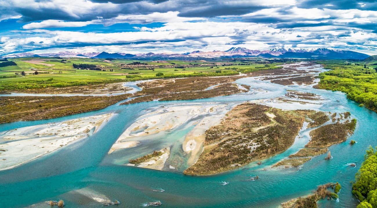
Christchurch is bounded to the east by the Pacific Ocean and the estuaries of the Avon and Heathcote Rivers, to the south and south-east by the volcanic slopes of the Port Hills separating Christchurch from Banks Peninsula, and to the north by one of the largest rivers in Canterbury - the Waimakariri river.
With a rejuvenated city centre, three major rivers, a big range of hills and many beautiful parks this city really offers everything for everyone.
Christchurch does not have impressive mountains to hike, but it does have hills which offer ample opportunities for families and those searching for a quiet and relaxed stroll.
This beautiful walk offers panoramic views of the city, the lyttelton harbour and the coastline.
The stroll is approximately 40 minutes to 1 hour one way and is suitable for most ages and fitness levels. Although the track is well equipped and has rather even surface, there are some steps along the way and thus it is not suitable for wheelchairs, buggies or strollers.

To start this track, you can park in the Mt Pleasant Bluff Track carpark. Once there, walk west via Summit road for a short period of time, approximately 5 to 10 minutes, before picking up the Mount Pleasant Bluff track on your left. Alternatively, hop on a city bus to Sumner to the end of the line. Walk for a few minutes via Evans Pass Road until you find the start of the track to your left.
Let the sheep that roam these hills be your companions, as the track takes you through adventures with tussocks and exotic grassess all the way to history where you will find Mt Pleasant gun emplacements. The five concrete structures are the remains of a heavy anti-aircraft artillery battery from WW2. The role of the artillery was to combat high flying enemy aircrafts.
When walking this magnificent track ensure you keep to the track. This area has rockfall hazards as a results of the 2010/2011 earthquake events. Also, watch out for Ongaonga, a native stinging nettle that may be growing around the gun emplacement.
Let this steep but moderately long track treat you to 360-degree scenic views of Christchurch and Lyttelton. Bring a pack lunch and enjoy it at the top on the picnic bench while enjoying the fantastic views.

This track can be accessed either from the Christchurch Gondola car park on Bridle Path Road or head through the tunnel to the Lyttelton side on Bridle Path. Please note that if you start from the Gondola car park, we recommend you arrive early as it can get quite busy and difficult to find a parking space especially at the weekend and public holidays.
If you are a family with young kids, or your fitness level is moderate, we recommend starting on the gondola side of the track as it is easier than the other side.
Please note this track has loose gravel and can be slippery, especially on the way down.
This popular open track located in the Port Hills is perfect for walkers of all fitness levels, runners, and mountain bikers. At the top, you will get fantastic views of the Lyttelton Harbour, the Pegasus Bay and the Canterbury Plains
The track starts at the junction between Rapaki road and Centaurus Road in Christchurch and takes approximately 45 minutes one way.

Please note, this track does not have much cover therefore it can get very hot in the summer and very windy in the winter. Ensure you add plenty of suncream in the summer or clear days in the winter. This is New Zealand and the sun radiation is strong no matter the season or the cloud cover. Also ensure you and your family have plenty of layers that can keep you warm or cool depending on the weather, as it can change rapidly.
This easy and gentle walk is just outside Christchurch, with only a 30-minute drive to the Gilbraltar Rock car park where you can start your 2 to 3 hour walk return.
Coopers Knob (573m) is the highest point on the Port Hills and offers stunning views of the Canterbury plains and the Lyttelton Harbour.
This walk can be done by a range of ages and fitness. However, you will not be able to take a pram as the track is rough and only partly paved for much of the way.
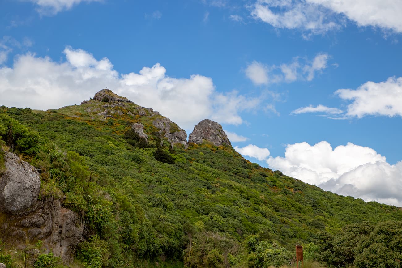
This is my favourite place, with so many different well maintained tracks there are walking paths and bike trails for every skill and fitness level.
At the top of the park, amazing views of Christchurch will take your breath away. It is truly a beautiful place to see the sunset or sunrise depending whether you are an early bird or a night predator.
With an incorporated dog park, a small playground for kids, and sheltered picnic tables scattered across the park, this place is truly a gem for families searching to relax and get back to nature.
To get to the park, either drive to the park’s main car park on Dyers Pass Road (past the Sign of the Takahe, or the Sign of the Kiwi, depending where you are coming form), or take the bus (the B blue line to Cashmere) which will take you to the Sign of the Takahe.

Please note this park can get very windy even in the summer. Make sure you have windproof clothes with you.
Christchurch was devastated by the 2010 and 2011 earthquakes that swept away much of the city. However, 9 years on and the city is almost completely rebuilt offering many types of modern accommodation.
The Grange Boutique B&B and Motel (56 Armagh Street, Central Christchurch) located in the CBD is only a stone's throw from the Botanical Gardens, the art gallery, riverside market, endless supply of restaurants and coffee shops, and more. This establishment offers rooms with free breakfast for those couples or single travelers seeking convenience and a clean and comfortable place to sleep in. It also offers self-contained units for those wanting to have somewhere to cook their meals and keep the cost down. The price ranges from $150NZD per night to $249NZD per night for a room with breakfast in the B&B, or from $150NZD per night to $175NZD per night for a self contained unit.
Christchurch TOP 10 Holiday Park although located outside the CBD (approximately a 12-minute drive or 30 minutes by bus), offers a great range of amenities for families. With a heated indoor swimming pool, bouncy castle, indoor playing area with soft furniture for the little ones to explore, a games room with table tennis, pool table and video games for the bigger kids and more, this holiday park really does cater for everyone. They also have a private spa to hire so you can relax after a day hiking, mountain biking or exploring the many things this city has to offer. The holiday park offers a range of accommodation from areas to pitch your tent or motorhome, to cabins and self-contained units for 1/2/3/4/5/6 and 8 people. The accommodation price ranges from $45NZD per night to put your tent up, to $160NZD per night for a self contained unit that accommodates 8 people.

Christchurch has so much to offer and as the rebuild of the city is wrapping up, more and more attractions are popping up.
For families with young kids, you can go for an easy but beautiful stroll in the Botanic Gardens, don’t forget to stop by the Canterbury Museum where you can explore a lot of New Zealand’s history.
Or perhaps, all you want is a quick stroll in the beautiful setting of the Hagley Park or the Sumner beach. Willowbank is a hit for the young ones as they can feed farm animals, eals, and the many species of ducks and even see the elusive kiwis. For the older kids the Orana park is perfect as you get to feed the giraffes, see gorillas, tigers and get very close to the lions as they feed.
The Christchurch adventure park is perfect for families, couples or individuals seeking some thrill. The 30 to 40-minute return walking tracks will show you beautiful forests, native birds and amazing views of Christchurch and the Southern Alps. The chairlift with stunning views of the city, the Pacific Ocean and the Southern Alps will take you for approximately 1.8 km (1 mi) ride to the top of the hill where you can start descending the 50 km (31mi) downhill mountain biking tracks of different levels of difficulty. The zip-line will allow you to combine enjoying the beautiful views with a real rush of adrenaline.

Being located approximately 1-hour drive south of Christchurch, Banks Peninsula Is one of New Zealand's most unique landforms with endless hills, bays, and bush lands.
With an area of approximately 1,150 sq.km. (440 sq. mi) this Nature’s playground offers great walks and things to do for families, individuals and couples seeking relaxation away from city life. Banks Peninsula is virtually a perfect retreat at Christchurch’s door step.
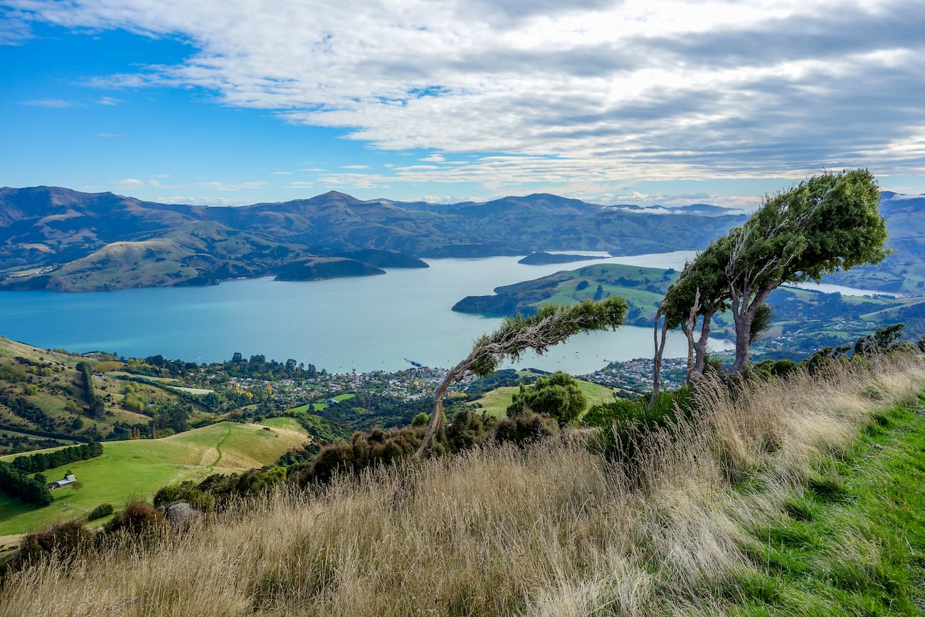
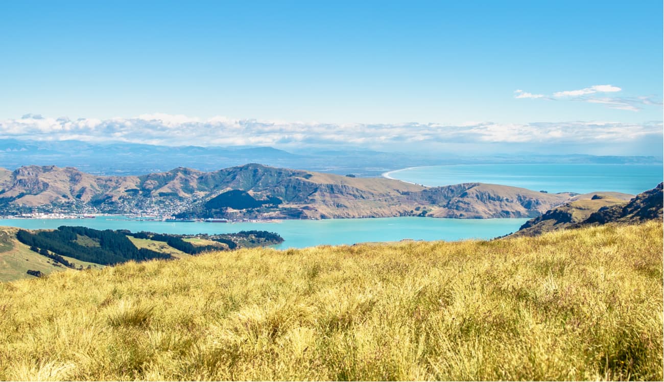
Located north of Diamond Harbour’s village, Mount Herbert stands tall at 920 m (3018 ft). The 6 to 8 hour return hike offers spectacular views of the Port Hills, Mount Thomas, Mount Grey and the open ocean.
Even though there will be almost 1000m of ascent required to reach the summit, none of it is particularly steep. Do take care though as the track crosses working farms, stay on the marked track and use the stiles to cross the fences.
The track is very exposed to the elements so ensure you have windproof clothing, sunscreen, and warm clothing. In general be prepared for cold, heat, fog, and wind. Take plenty of water as you will not have access to drinkable water on the track. Please do not use stock water supplies as these are not safe for humans to drink.
Please note that the track may be closed for the lambing season between August to October. Ensure you contact the Department of Conservation (+64 3 379 4082 or christchurchvc@doc.govt.nz ) if planning to do this great walk around the lambing season.
Once you get to the summit you can either return the way you came, continue left on to the Port Levy Saddle and stay at the Rod Donald Hut approximately 3 hr 20 min from the summit, or head towards the Orton Bradley Park, the Kaituna Valley or the Gebbies Pass, and stay at the Packhorse Hut.
Please note both huts will need to be booked before you arrive. Also ensure all water in the hut is treated before you drink it. For more information on the huts, go to the accommodation section below in this article.
Being right north of the Te Oka Bay, Saddle Hill is a modest 833 m high (2,733 ft). The 3 hour return family-friendly walk will exhibit beautiful views of the Akaroa Harbour, the Kaitorete Spit, the peaks of the Banks Peninsula and the Southern Alps.

Although the walk is gentle and kid-friendly, the terrain near the summit changes into quite very rocky and steep so it can get a little difficult for the younger ones.
The track is very exposed to the elements, so make sure you have windproof clothing, suncream, warm clothing. The recommendation is the same as before: be prepared for weather Armageddon coming at you any time. This track is best to do in summer and on a clear day.
It is a little difficult to find the track. If you are using GPS, the coordinates for the car park are -43.808462, 172.843901, if you do not have GPS drive along Reynolds Valley Road located in the Okuti Valley for approximately 6.8 km until you have a turning left onto Bossu Road. Continue on Bossu Road for approximately 400 m until you see the entrance to the track on your left. Please note the car park has space for only 5 cars.
Stoney Bay Peak (806m) is located in the Hinewai Reserve. On this 7.6 km moderate walking track you will see beautiful wild flowers, many species of birds, especially the famous fantail, and a magnificent view of the Akaroa Harbour. Be aware the track gets steep and narrow in some places, especially near the top.
Take plenty of water and snacks to see you through the hike. The track can be very exposed to the elements at times so ensure you have layers to keep you warm and sheltered from the wind.

Misty Peak track, rated as difficult, is approximately 3 to 4 hour return. The track offers wonderful views of the Akaroa Harbour and a beautiful mixture of flora including gorse, snow tussock and indigenous montane forest. This track is very exposed so dress accordingly.
There are two ways to start this track:

Side Note: For a child-friendly activity in the reserve, visit the waterfall. From the car park, follow the marked track to the waterfall (approximately a 10-minute walk). Please note this track is not suitable for prams.

Christchurch and Banks Peninsula have so much to offer for everyone that no traveller will leave this blessed place dissatisfied. Tell us about your adventures in New Zealand at [peakvisor@routes.tips], we are always uber happy to get your feedback and improve our work.
Explore Christchurch City with the PeakVisor 3D Map and identify its summits.


