
Scan the QR code and open PeakVisor on your phone
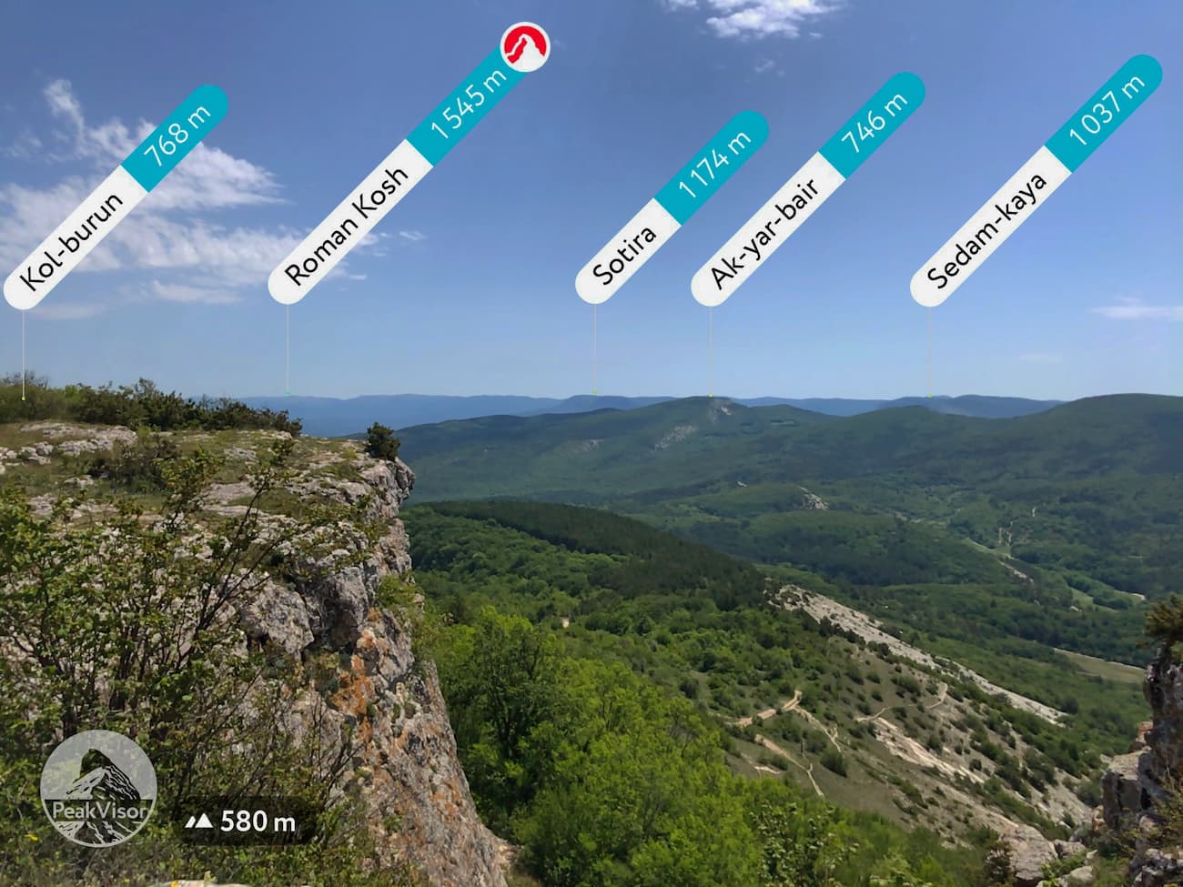
Republic of Crimea is home to 911 named mountains. The highest is Roman Kosh at 1,545 m.
The Mountainous Crimea is small and its peaks are low in comparison to the major mountains nearby – the Alps and the Caucuses. The highest mountain Roman-Kosh is just 1,545m. Actually, there are only 18 mountains over 1,500 m, and 2 of those don’t even have names. But Crimean nature is amazing and diverse. The geological structure has contributed to the formation of many caves e.g. the Red Cave has the largest length of caves in Europe, it is located in limestone rocks and stretches for about 27km. Since time immemorial the territory has lured different peoples that left their traces here.
The lucrative lavish lands of quite fertile soils and convenient travelling routes have historically been the bone of contention between the Scythians, the Cimmerians, the Roman Empire, the Goths, the Ottoman Empire, the Mongols, the Huns (aka the Vandals as known to most southern European countries), the Golden Horde, the Armenians, even the notorious Europeans checked in a number of times: the Genoese (the 13-15th centuries), the Greeks, the Brits (the Crimean war in 1853-56) to name a few. Even currently, it is a territory of dispute since Russia annexed it in 2014 from Ukraine.
The origins of the name are also quite vague. Some historians are attributing the name to Greek words Cimmerium (as the early tribes), or Cremnoi (meaning ‘cliff’) or Turkish term qirum (meaning ‘trench’ or ‘fortification’), or Mongolian word ‘wall’.
The Crimea
In written historical monuments, Crimea is first mentioned in the works of Homer and described in more detail in The History of Herodotus. Ancient cave towns started their history in the 1st millennium BC.
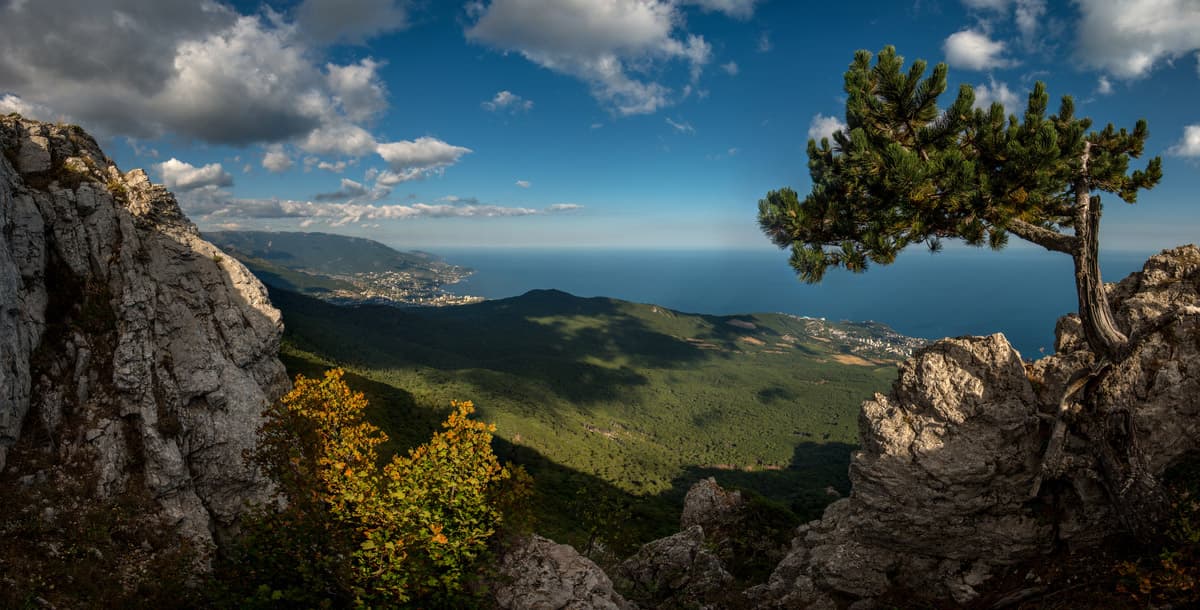
The mountain massif of the Crimea stretches along the coastline for about 180km, its width does not exceed 50km. The Crimean Mountains form three parallel ridges. The gentle northern slopes are covered with dense forests, the southern slopes abruptly break off into the sea, creating picturesque steep walls up to 500 meters high. The mountains of the main ridge are the highest. They have plateau-shaped peaks, which are called yaila (mountain pasture). Each yaila has its own name: Ai-Petrinskaya, Yalta, Dolgorukovskaya, Nikitskaya and others. The mountains of the inner ridge do not exceed 750 meters and the outer ridge peaks rise only 350 meters above sea level.
The highest point of the Crimean Mountains is located in the Babugan-Yaila massif. Its height is 1,545 m. Roman-Kosh is located on the territory of the Crimean Natural Reserve. Officially, entrance to the reserve is prohibited. In summer months, you are very likely to meet with representatives of the Reserve's protection on the Gurzuf Saddle Pass who in most cases prohibit you to pass on the plateau unless you have a permit.

From the top of Roman-Kosh
Route. You can climb to the top in one day. On average, the ascent takes about 6-7 hours, the descent is approx. 4-5 hours. Roman-Kosh is a protected area, to visit it you should get a permit in Alushta or Yalta. If you go hiking as a group, the permit is usually given to the guide. Most often you can get a permit from a gamekeeper or forester on site. Ascent is not difficult, the only problem being that you can easily get lost due to poorly marked trails, very dense vegetation, and no people for many kilometres around, which makes this place feel like a no-man’s land. There are several routes, the shortest from the village of Krasnokamenka, which is located between the villages of Partenit and Gurzuf on the South Bank highway. You can start from the Red Stone cliff. The beginning of the territory of the reserve can be identified by the boom barrier with the inscription "Attention! No trespassing, keep out!" After the barrier, the road goes up gentle slopes. The red markings on trees and rocks should be kept as a reference point. The red trail leads to the very top.
Eklizi-Burun Mt. (1.527m) is the highest point of the Chatyr-Dag plateau. The name of the mountain is Turkic-Greek and can be translated as "Cape Church". On the mountain, there are ruins of a Greek church, once a year the Greeks used to march up to this church for prayers.
At the foot of Eklizi-Burun , there are the remains of a medieval fortification built by the Byzantine Emperor Justinian in the 6th century BC to protect the southern coast. Not far from the top at an altitude of about 1,500m a.s.l, there is the highest cave of the Crimea, Eklizi-Koba.

Eklizi-Burun Peak
Route. You can get here from Alushta, Yalta or Simferopol by trolleybus №1 or by shuttle bus to the stop "Angarsky Pass". Then go to the recreation centre "Angarsky Pass". Navigate by the red circles and signs made by employees of the Crimean Nature Reserve and go up to the plateau and the top.
Ai-Petri (1,234m) is probably the most famous and best equipped for visitors. Ai-Petri has the biggest number of foggy days in the Crimea, it is the windiest point of the peninsula as well. The mountain is located above the town of Alupka and Koreiz village on the territory belonging to Yalta Mountain Forest Reserve.
Ai-Petri has a cable car — Miskhor — Pine Forest — Ai-Petri with one of the longest unsupported spans in Europe. From the mountain, there is a beautiful panorama of the Black Sea coast and Yalta. The length of the road operating all year round is 2,980m. It consists of three stations: "Miskhor" (lower, 86m a.s.l.), "Pine Forest" (middle one, 304m a.s.l.), and "Ai-Petri" (upper, 1,152m a.s.l.). The passenger cabin passes the way in 15 minutes and accommodates 40 people. The ride is 400 rubles one way (approx. 7 USD), opening hours are 11-15.30 ascent, 11-16.30 descent. Make sure you take some warmer attire since the temperature is usually 10 degrees lower on the top. Also, check the weather forecast as the cable car may be out of operation due to adverse weather conditions.

Ai-Petri landscape at night
Route. You can take a cable car, a bus will take you from Yalta to the first cable car station, or go on foot.
Should you opt for the latter, Berry Trail is the shortest and easiest Ai-Petri pedestrian path. Take a bus from Yalta to the sanatorium "Uzbekistan". This trail crosses the serpentine road to Ai-Petri - highway Yalta-Bakhchisaray several times.
The Taraktash Trail is quite complicated and starts slightly above Uchan-Su waterfall (the highest waterfall in the Crimea). You can reach the waterfall by a shuttle taxi from the bus station or by taking the Shtangeevskaya and Botkinskaya trails. This is the most interesting route for climbing Ai-Petri on foot.
The Demerdzhi massif offers amazing figured rocks, ruins of an ancient fortress, caves and fantastic views from the peaks. It is divided into northern and southern parts and each has its own high point. The southern part of Demerdzhi is lower, only 1,239m above sea level. Northern Demerdzhi rises to 1,359m and, unlike the southern relative is made of marbleized limestone.
The building matter of the Demerdzhi massif is limestone with numerous inclusions of pebbles and boulders made of hard rock, Limestone cements the structure which is constantly eroded by water and weathering, leaving the so-called sculptures of the hardest rocks. These are "fingers" - columns, "mushrooms" - columns with "lids" and many more. The largest of them is 5 meters wide and almost 25 meters tall.

Demerdzhi mountain
The most famous place of their gathering is the Valley of Ghosts. When clouds crawl along Demerdzhi, you can catch a glimpse of mysterious silhouettes which fade away in a matter of moments.
Route. Take a bus from Alushta or Simferopol to the village of Luchistoye located at the foot of the Demerdzhi massif. Luchistoye village has a camping house and some private hotels should you wish to stay overnight. From the village, walk along the Valley of Ghosts and go up to the Southern Demerdzhi farther to the north, the whole route is 5-6 km long.
The Crimea is not as active as Kamchatka with its lava-spitting volcanoes and devilish geysers, yet it has its own volcano. The Kara-Dag volcanic massif is not high, merely 577m a.s.l. at its highest (Mount Svyataya). The name Kara-Dag is translated as Black Mountain. Kara-Dag is the remnant of a volcano that was active about 173 million years ago. The Kara-Dag volcanic massif is a part of the Kara-Dag Natural Reserve of the Russian Academy of Science, there is a biological station on the territory, the station staff conducts excursions in the reserve. The individual passage is prohibited.
Kara-Dag Natural Reserve
Kara-Dag is popular for its minerals, there are different varieties of quartz-chalcedony, especially agate and carnelian of different shades, onyx, opal, amethyst, citrine, and multi-coloured jasper.
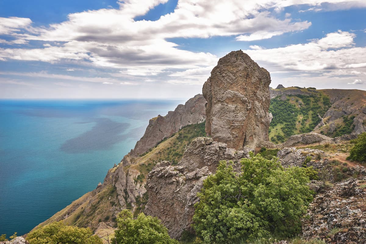
If you look at the coastline, you will find bizarre coastal rock formations, including the Golden Gate cliffs, Devil's Finger, Ivan-Razboinik (aka local Robin Hood), Lion, etc.

The Golden Gate cliffs at the foot of the Kara-Dag
Route. Karadag Nature Reserve RAS is located in Kurortnoe village, Nauka Street 24.
Most of these beauties are located in the Crimean Natural Reserve, so you can cover half of those on the list in a single day. Yet, the visits without official permission are prohibited, if you are caught trespassing, you’ll be fined. The permission can be obtained in Alushta (Partizanskaya Str. 42 zapovednik@tuvrk.ru ), the full list of camping sites over 1,000m a.s.l. can be found on the official website of the Ministry of Ecology of the Crimea (but it is in Russian and quite twisted). The two official camping sites on the Yalta Yaila are Kemal and Kosh.
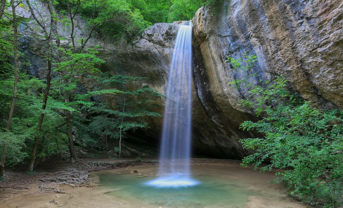
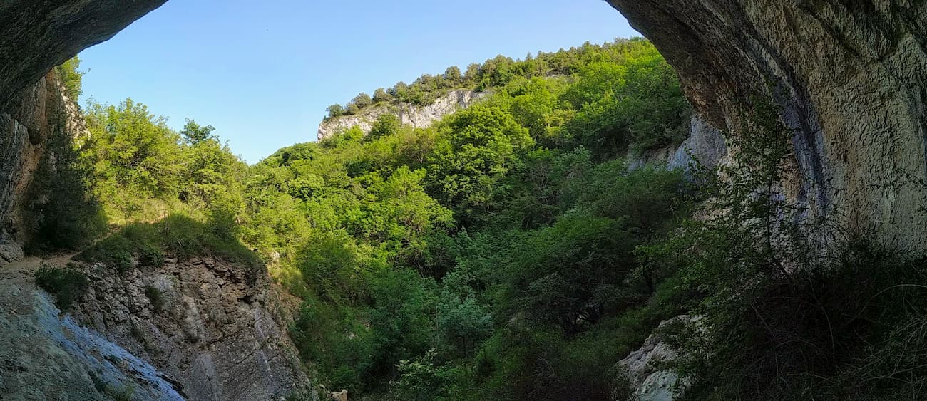
A large canyon that was formed by water erosion about 1.5-2 million years ago at the site of a tectonic crack. It is located 5km south-east of the village of Sokolinoe, Bakhchisaray district. The canyon is more than 320m deep, 3.5 km long and in some places less than 3m wide. On the border of the collision with the European plate, the base of the African plate slides under Europe thus raising the overlying layers of rocks. The Crimea rose quickly, and the water dissolved and pushed a narrow gap in the Crimean canyon, creating a giant rift in the Earth's crust.
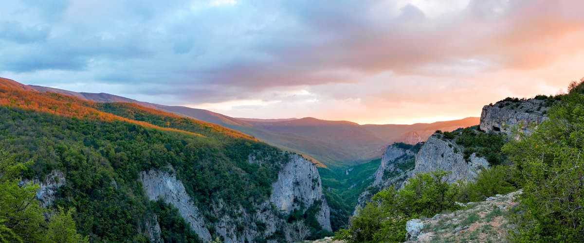
Crimea’s very own Grand Canyon
As a result of massive water erosion the canyon bed was formed, it is basically a trench with smooth walls, with heaps of boulders and rocks on the bottom, with rapids, waterfalls up to 3-4m high and erosion boilers (the so-called baths) up to 2.5m deep, as wide as the canyon itself in those places and up to 10m long. In total, there are over 150 such boilers in the canyon.
Blue Lake in the Grand Crimean Canyon
The canyon is fed by numerous mountain rivers, streams and springs (the largest of them is called Pania with an average annual water flow of 350 litres per second). At the end of the gorge, those waters flow into the Auzun-Uzen River. The water temperature in the river and its tributaries never exceeds +11ºC. Only during the second half of summer and autumn, when there is little rainfall does the canyon become almost dry and more accessible for exploration. It is dangerous to be in the canyon in rainy weather as the stone falls become more frequent and it is, therefore, unsafe to approach the walls of the canyon, which is not that safe even in dry weather. After many hours of rain, devastating water flows can sweep away everything on its way, even heavy boulders.
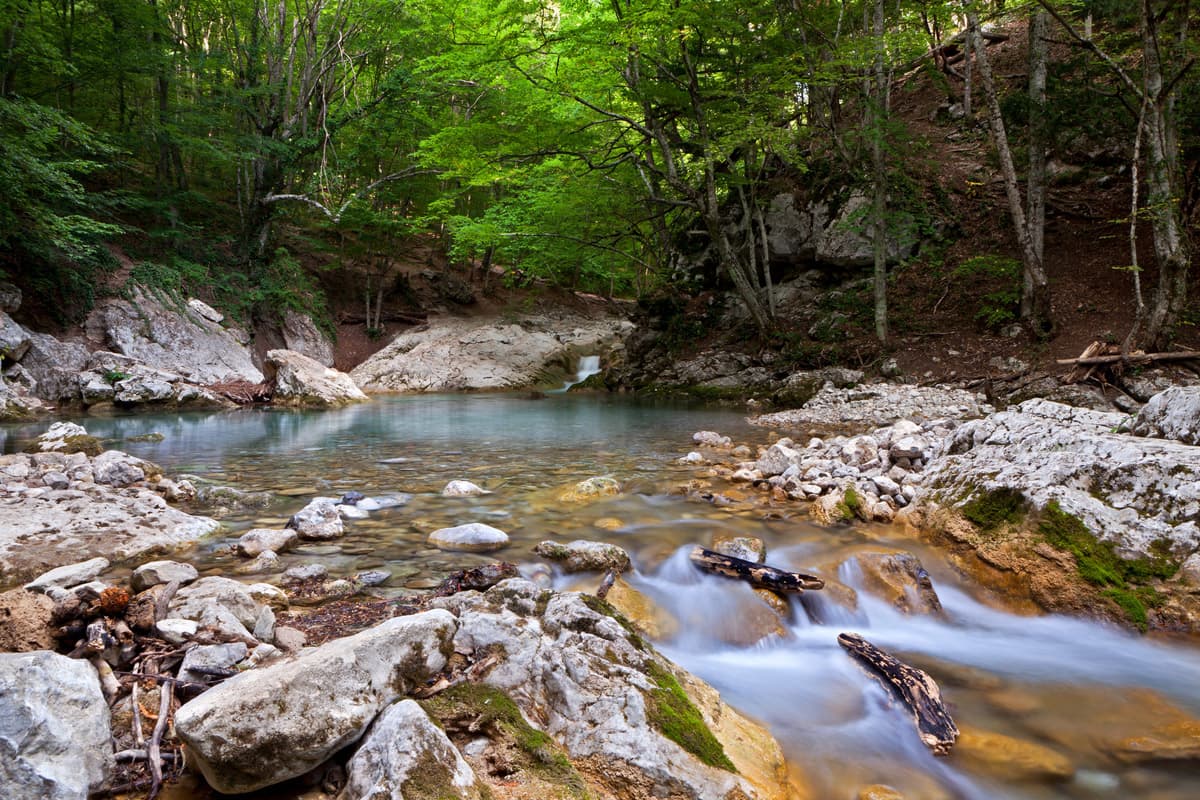
Blue Lake in the Grand Canyon
The most visited spots of the Crimean Canyon Blue Lake pond, the spring of Pania and the evorsion boiler filled with spring water, the so-called Bath of Youth. This name is known since the early 60s, the old name is Kara-Gol (Black Lake).
The Crimean Canyon has a special microclimate formed due to its geomorphological features and location. It differs from the surrounding area because of its high humidity and low temperatures.
Route. The easiest way is from the village of Sokolinoye, located a few kilometres from the beginning of the canyon. To get to Sokolinoe, take a bus from Sebastopol, Simferopol and Bakhchisaray. Then go on foot for about 5 km along the old trail called Yusupovskaya (it passes by the former hunting castle of the Yusupovs Counts). The route to the Canyon starts at the parking lot near the kilometre post labelled "30-42".
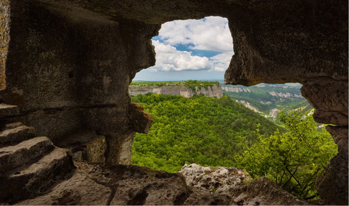
One of the biggest attractions of the Crimean Mountains is the cave towns or settlements that feature edifices of economic, religious and defensive purposes cut down in the rocks. There are also some land buildings including fortresses, monasteries, and residential towns. They are located in inaccessible mountainous areas with steep cliffs. The geological structure of sedimentary limestone rocks in the Crimea made it quite easy to carry out underground excavations using simple tools. The tradition went from the Cimmerians and Taurians 3000-2000 BC and was continued by other peoples who inhabited the Crimean Mountains until the 19th century. According to scientists, the tradition had never been interrupted, some caves had been reworked many times, expanded, and new underground towns emerged in place of old settlements.
The largest and most famous settlements are Mangup, Eski-Kermen, Chufut-Kale, Kyz-Kremen. The cave towns of Chufut-Kale, Mangup-Kale, and Eski-Kermen are federal cultural heritage sites and stop working in the autumn and spring periods in case of adverse weather conditions.
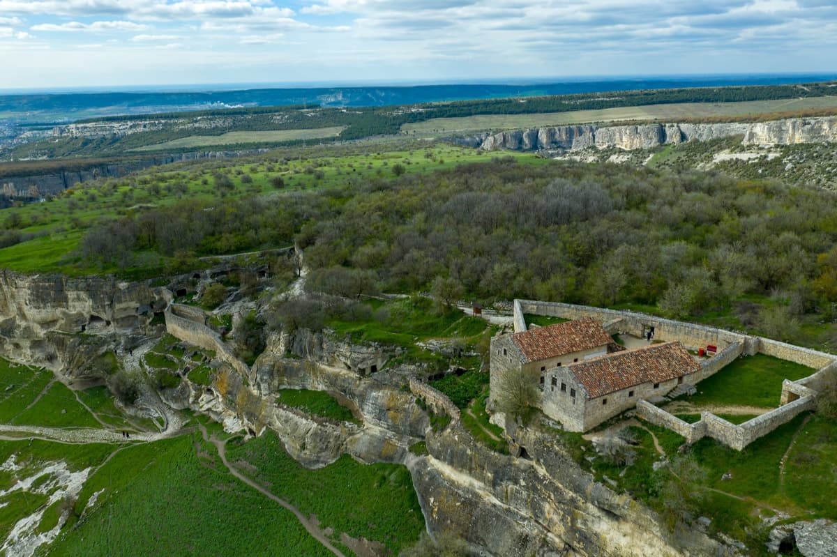
Chufut-Kale is a medieval town-fortress in the mountainous Crimea, near Bakhchisaray, at an altitude of 580m. It is located on a small plateau with rocky slopes, surrounded by deep gorges. Presumably, this medieval town appeared in the 5-6th centuries as a Byzantine fortification. In the era of the Golden Horde, it was the residence of the first khan of the independent Crimean Khanate after Khan moved to settle in Bakhchisaray, the fortress became a place of detention of high-ranking prisoners of war.
Chufut-Kale, a medieval town-fortress
The route to Chufut-Kale is quite simple, it is only 3km from Bakhchisaray Khan's Palace, so the fortress is one of the most visited places. The plateau offers a stunning view of the mountains.
You need to drive to Bakhchisaray, past the Khan's Palace (you can walk along the picturesque old streets of Bakhchisaray as well), reach the parking lot at the entrance to the territory of the Assumption Male Monastery. Follow the road to the monastery and then follow the signs or the navigator. Here is what signs to Chufut-Kake look like. The ascent to Chufut-Kale is not difficult, you can visit it with children.
The fortress and the cave town of Chufut-Kale are a federal cultural heritage site and stop working in the autumn and spring when difficult weather conditions arise.
Mangup is the fortress city located on the 90-hectares plateau of Baba Dag Mountain. The highest altitude is 583m. The plateau abruptly breaks off in the south and on the northern side has four long ledges which are called capes. The first discovered settlements date back to the 1st millennium BC. They belonged to the Taurians, presumably the remnants of the Indo-Aryan culture. Then in different periods, the Mangup plateau was inhabited by the Scythians / the Sarmatians, the Goths and the Tatars. In the 13th to the mid-15th century, the city of Doros (aka Mangup) was the capital of the late Byzantine Orthodox principality of Theodoro that controlled the south-western Crimea and was under the influence of Byzantium. It was from this era that numerous artificial caves, defensive walls, basilica foundations and the ruins of the citadel at Cape Teshkli-Burun were preserved. In later times, the city was captured by Ottoman troops and was dramatically rebuilt.
Mangup
Route. Mangup is located in Bakhchisaray region, 25km from Bakhchisaray itself. The closest village is Hodja-Sala. It is easier to get there by car as there is no direct bus service to Mangup. You can take a bus from Bakhchisaray to the village of Zalesnoye, stop by the lake and then walk to the Mangup tourist parking lot.
The Crimea is the ultimate classics of karst erosion which is extremely favourable for the formation of caves. At the moment, about 1000 caves have been found and documented in the mountainous Crimea. The majority are located in a small area. They are easy to reach on foot and by car, which makes caves in the mountainous Crimea very popular among tourists.
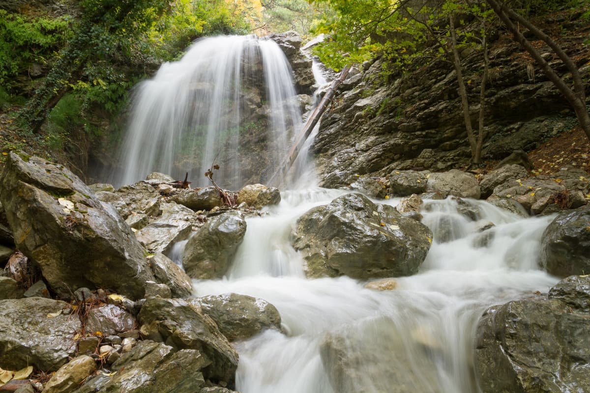
The Red Cave or Kyzyl-Koba, aka Krasnaya Cave, is the largest cave in Crimea. The cave is located on the western slope of the Dolgorukovsky massif, near the village of Perevalnoye. It got its name Red, or Krasnaya, due to the reddish colour of limestone which forms the basis of the cave.
The total length of its explored part is about 25km, the area 64000 sq.m., the height difference reaches 275m. The length of individual halls is about 70 - 80m, the height is up to 145m (The Hall of Blue Drop). The average air temperature in the lower floors is 8.1 - 9.0°C. There are several caves here, together they form a complex underground labyrinth of six floors, so a visit to the Red Cave is only allowed if accompanied by guides.
The Red Cave, largest cave in Crimea
The underground river Kyzylkobinka flows on the first floor. The cave has many lakes, waterfalls, siphons. It features one of the biggest stalactites in Europe. Its length is about 8m, and its age is about 8000 years.
The cave itself was formed by the Kyzylkobinka River, which flows out of the cave and forms the Su-Uchkan waterfall.
Route. The cave is located in the vicinity of the village Perevalnoye, Simferopol region. You can get to the village from Simferopol by a shuttle taxi Simferopol-Perevalnoye which departs approximately every 20 minutes from the railway station, or by trolleybuses № 21, № 51 (Simferopol-Alushta) or № 52 (Simferopol-Yalta). The stop is Perevalnoye -2 (Stadium). From Alushta, you can also take trolleybus No. 51 or 52. From the stop, there is an asphalted road to the parking which is located near the cinema and entertainment complex "VIKING".
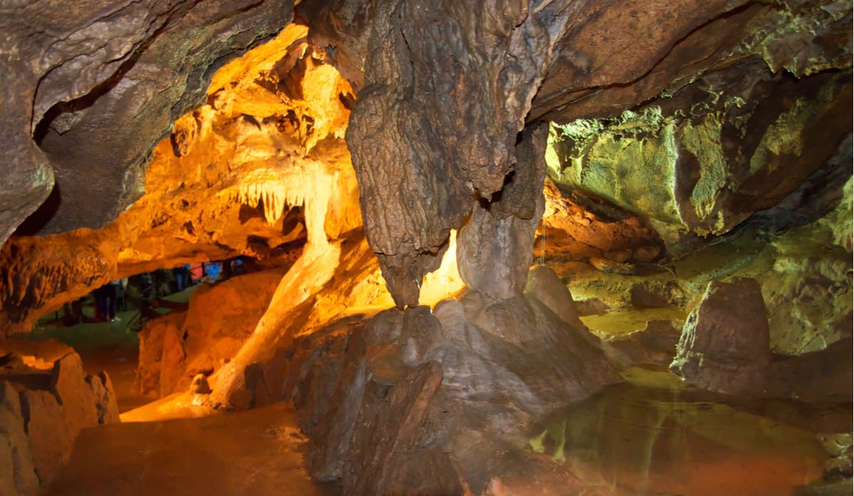
The Marble Cave is arguably the most beautiful cave of the Crimea. It is located on a plateau of the Chatyr-Dag mountain massif. Discovered in 1987, now the cave has more than 1 kilometre of equipped excursion routes. The total length of the Marble Cave is over 2km, and the depth is 60m. It has huge halls with fanciful formations, the rarest types of crystals, stalactites and stalagmites, kind of finely chiselled baths with water, stone waterfalls, and unique helictite flowers. The explorers found the remains of a large cave lion here.

The Marble Cave is arguably the most beautiful cave of the Crimea.
The landslide-style hall of the marble cave is one of the largest equipped halls in Europe and the largest hall in the Crimean caves, its length is more than 100m, the height is 28m. The grandiose walls are covered with corralite flowers, giant blocks are strewn on the bottom of the hall, elegant flow columns rise high, a variety of stalactites and stalagmites strike the imagination. The route ends at the crest of the calcite dam. Hundreds of fancy rimstone pools cover the whole dam. From above, you can see the Palace Hall with its unique flow columns called the King and the Queen.
The lower gallery of the cave is a natural mineralogical museum. The uniqueness of Marble Cave has brought it world fame. According to speleologists, it is one of the five most beautiful caves on the planet as well as one of the most visited caves in Europe, and in 1992 it was granted admission into the International Association of Equipped Caves.
Route. There is no public transport going directly to the caves. You can get here by car from Simferopol, take Simferopol-Alushta highway to the village of Zarechnoye, then turn towards the village of Mramornoe. Shortly before you reach Mramornoe, turn to the gardener’s partnership (referred to as ‘dachas’ in Russian) called Mramornoe, then take the dirt road to the cave, there will be signs on the way.
By public transport. Take shuttle taxi No. 142 from Simferopol to the gardener’s partnership called Mramornoe (start off Simferopol railway station, the route is called Railway station to ST Mramornoe). From there, if you walk along the dirt road, the distance is 8km, the altitude gain is 430m. Approximate travel time is 2.5 hours.
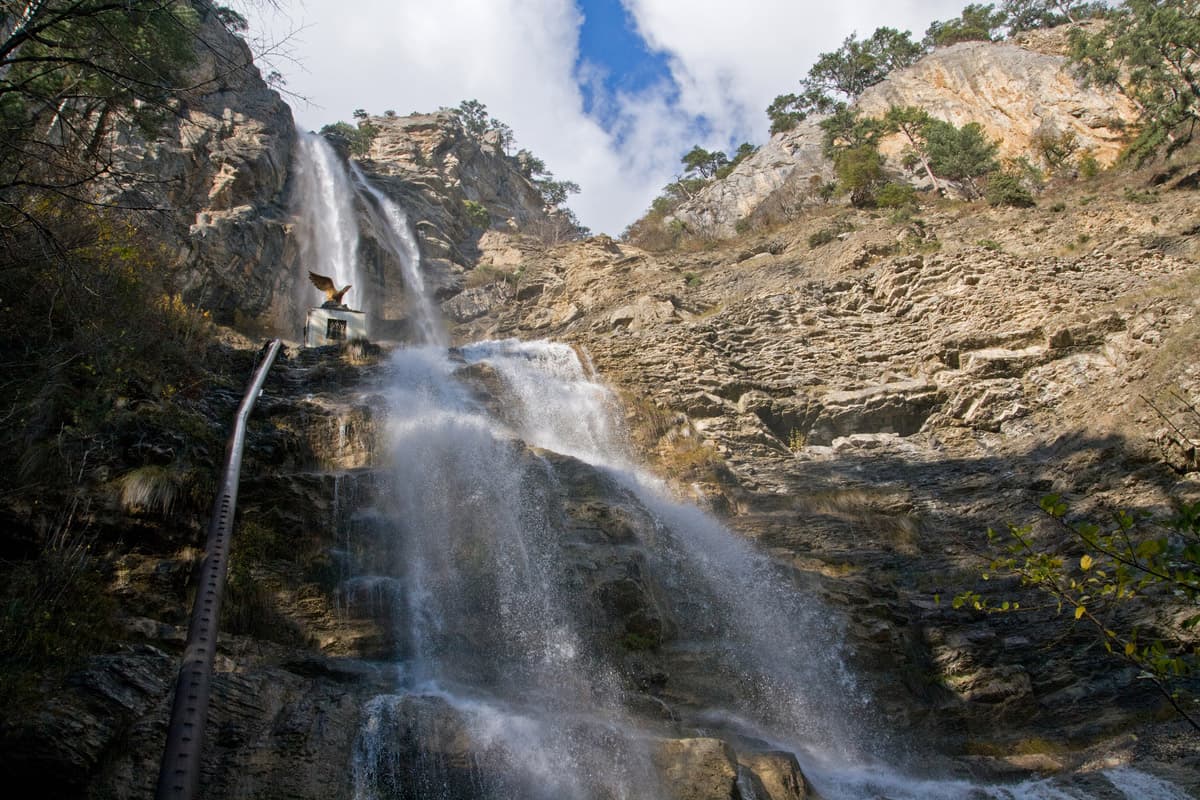
The Jour-Jour is the most powerful and abundant waterfall in the Crimea. The waters of the Ulu-Uzen River fall off a 15-meter ledge, and cascade five meters wide into a deep hollow beneath, thus it was called ‘the waterfall of hanging waters’ around 500 years back. Jour-Jour is formed by the waters of the East Ulu-Uzen River at an altitude of 468 m above sea level. If you are craving for some extreme swimming, give it a try here even though there are ‘no swimming’ signs. The water temperature hardly ever rises above 11°С and it is so heavy that you have a ‘burning’ sensation on your skin. No wonder, the average long-term water flow is 270 liters per second. The waterfall does not run out even in the driest season of the year. The waterfall is equipped with a bridge, wooden stairs with railings and an observation deck. Also noteworthy, there may be people asking you to pay 100 rubles for the view, their reasoning being it is Alushta Reserve and you have to pay the fee. They have some strange looking copies of documents. It is up to you to pay or not to pay for what feels like a scam scheme.
And finally, you can walk to the waterfall (it is merely 1km, but in the hot summer sun the trail turns into a furnace) or you can hire a local to drive you in a 4-wheeler (UAZ), the trip will cost around 30-40 USD, and it is not for the faint-hearted.
The Jour-Jour is the most powerful in the Crimea.
Route. The waterfall is located on the territory of Alushta Reserve, in the gorge Hapkhal, 2 km from the village of Generalskoye.
From Alushta take a shuttle bus to Generalskoye village, then follow the signs and go on foot to the reserve. Climbing to the waterfall is not difficult, there is a picturesque forest road so you will see plenty of hornbeams and beeches as well as oaks, hazel trees and cornels, there are areas of two-century-old forest with rock oak and rare species of Crimean pine. Some areas are equipped with wooden steps with railing.
The Uchan-Su is the highest waterfall in the Crimea. It is located at an altitude of 390 meters above sea level on the south-western slopes of Yalta mountain pasture (aka yaila), 6 km west of Yalta. The height of the waterfall is 98.5 meters. The Uchan-Su is formed by the river of the same name and has a two-stage structure. Surrounded by mountain ridges and lush greenery, it is especially beautiful during the period of downpours and when the snow is melting in the mountains. If the summer is hot, the waterfall almost completely dries up. In frosty winters you can catch an amazing sight - a frozen crystal waterfall.
The Uchan-Su the highest waterfall on the Crimea Peninsula
Route. The Uchan-Su is 6 km away from Yalta, on the southern slope of Ai-Petri Mt. It is part of the specially protected area of the mountain forest of Big Yalta. It is easy to get there on your own, you need to take the shuttle bus No.30 or No.8 at Yalta bus station and go to the final stop of the bus route. Or drive via highway "Yalta-Bakhchisaray" to the village of Vinogradnoye.
Baydasky Reserve is the largest reserve of the Crimea, it is located in the south-west of the mountainous Crimea and is sometimes called Crimean Switzerland for the mild climate, abundance of lakes and rivers. It includes the Baydarskaya Valley with adjacent mountain ranges and the Black River basin. The Baydarsky Reserve was created in order to preserve the unique natural landscapes of the Crimea and ensure the purity of water flowing into the Black River – the main source of water supply of Sebastopol.
The Baydarskaya Valley by Sebastopol, Crimea
The wildlife reserve includes:
The Baydarskaya Valley with the Chernorechenskoye water reservoir in its center. There is a dam on the Black River that ensures enough water supply for the reservoir.
The Chernorechensk Canyon (or the Black River Canyon if we translate the toponym) is basically a very deep gorge of the Black River. There are rapids, cascades, boulders, picturesque pebbles. The Black River is the main source of water supply for the city of Sebastopol, so the canyon of the river is protected from outsiders, entry is prohibited.
Murzak-Koba cave (closer to the middle of the Chernorechensky Canyon). There are traces of a primitive man: scrapers, chisels, knife plates, bone and ivory works, bones of modern species of animals, many shells of snails, as well as double burial of the Cro-Magnons.
The Skelskaya Cave, near Rodnikovski village. It is a beautiful cave of a considerable size in a relatively good condition. It consists of several halls. The biggest and the most beautiful is the second as you enter the cave. The length of this hall from north to south is 80 m, the average width is 10-18 m, the height of the Gothic-like vault reaches 25 m. The total length of all the galleries of the cave amounts to 570 meters. The cave is equipped by speleologists for visiting (there are special walkways and lighting).
Cave, grotto and waterfall at Fatma Koba. The cave features the Mesolithic man site. Archeological research has uncovered layers of Azil and Tardenoise cultures (the graves of Cro-Magnon men buried in crouching positions). The waterfall is about 15 meters high, but a large water flow is very rare.
Route. The Baydarskaya Valley is interesting to visit in the blooming period, the end of May and the beginning of June: the rivers and lakes are full of water, the forest foliage is bright green, flowers are blooming in the valley, it is the best time to see Fatma-Koba waterfall in all its beauty.
A visit to Fatma Koba (cave, grotto and waterfall): you can join the excursion or go on your own from Simferopol or other cities to the village of Podovoye. The trip will take about an hour one way, the starting point is a small waterfall called Kozyrek with a tourist camp Mulovskoye Lake nearby. This smaller waterfall is also beautiful as the water is falling from a kind of a canopy over an oval grotto.
Crimea is located on the 45th parallel, the same as the South of France, the North of Italy, Croatia, Serbia, Lakes Michigan and Huron, New York states of the USA. The climate of the mountains is moderately cold and humid. Winter precipitation most often prevails over summer rainfall, which is a sign of the Mediterranean climate. Winter in the mountains usually lasts from mid-October to late March. Snow cover is formed in the upper parts of the slopes and can be one or more meters thick. In winter, the slopes of several mountain ranges such as the Ai-Petri, the Babugan-Yaila, the Chatyr-Dag and the Demerdzhi can be avalanche-prone. Summers in the mountains are usually hot and dry. But even in summer, temperatures can drop to 0°C at night. During the year, fogs are very frequent. Each slope of the Crimean Mountains has its own climatic conditions, as it is influenced by different prevailing winds. The average monthly temperature in winter is 0-5°C in summer 20-25°C.
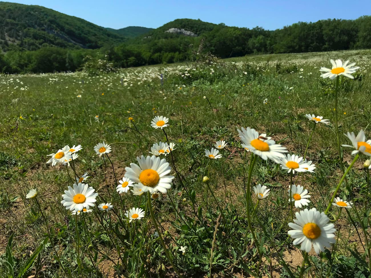
The ideal time to visit is May and June, as these months ensure very comfortable temperatures, there are still few tourists around, everything is in bloom, there is no parched land and the grass is still green, the rivers are full and waterfalls are powerful. September is also comfortable, the sun is not scorching and tourist crowds would have thinned away by the time school starts in Russia (which is September 01). In summer, there are often droughts which greatly increase the fire hazard. Therefore, summer hiking and excursions can only be conducted in an organized manner and accompanied by experienced instructors. Unorganized visits to the forest on the southern slope of the Main Mountain Ridge in summer are strictly prohibited.
In fact, a visit to the territory is possible only from Russia, the only airport in Simferopol services only Russian flights. Legally many countries recognize Crimea as part of Ukraine.
The most popular and affordable transport is buses. There is also a regular water connection between seaside settlements. It is possible to rent a car.
Routes. Use hiking route planning feature in PeakVisor 3D maps to get the most the Crimea can offer. Still, mind that some points on the map might be unreachable due to rules and regulations of the local authorities.
One-day trips are feasible from any Crimean city. See the options above.
The capital of Crimea, Simferopol is located in the center of the Crimean Peninsula, on the Salgir River. It is one of the two (along with Sebastopol) largest cities of the Crimea, the economic and cultural center of the peninsula. In ancient times, it was the capital of the Scythian kingdom, Scythian Naples.
Simferopol is the transport center of the Crimea; it unites the roads to all corners of the peninsula. It has an airport renovated in 2018. Since March 2014, the airport serves only Russian flights. There are no official international flights, which is due to sanctions imposed after the accession of the Crimea to Russia, and the disputed legal status of the peninsula. There are buses that can take you directly from the airport to Sebastopol. You can get to any city on the peninsula from Simferopol central bus station.
You can take a unique transport – an intercity trolley-bus connecting Simferopol with the resorts of the Southern coast of Crimea. The world's longest intercity trolley-bus route Simferopol-Yalta is 96 km long; a trip takes approx. 3 hours.
Bakhchisarai is located at the foothills, on the slopes of the Inner Ridge of the Crimean Mountains. On the territory of the present city, there have been several settlements since the times of the Golden Horde. It used to be the capital of the Crimean Khanate and later was the center of cultural and social life of the Crimean Tatars until their deportation in 1944 to the wild steppes and deserts of Central Asia by Stalin’s order.
Bakhchisarai is located on the highway Simferopol (25 km) - Sebastopol (about 30 km). A very picturesque road to the Southern coast of Crimea through Ai-Petri begins here.
Sebastopol, or Sevastopol as can be seen on some geographical maps, is the city in the southwest of the Crimean Peninsula, on the Black Sea coast. The waters of this commercial and fishing seaport never freeze. It is an industrial, scientific and technical, recreational and cultural-historical hub. Due to the heroic defense of the city during WW2, it now bears the title of the Hero City and many of its landmarks are connected with military actions. In Sebastopol now lies the main naval base of the Black Sea Fleet of the Russian Federation. The city is included in the list of historical settlements of federal significance of Russia.
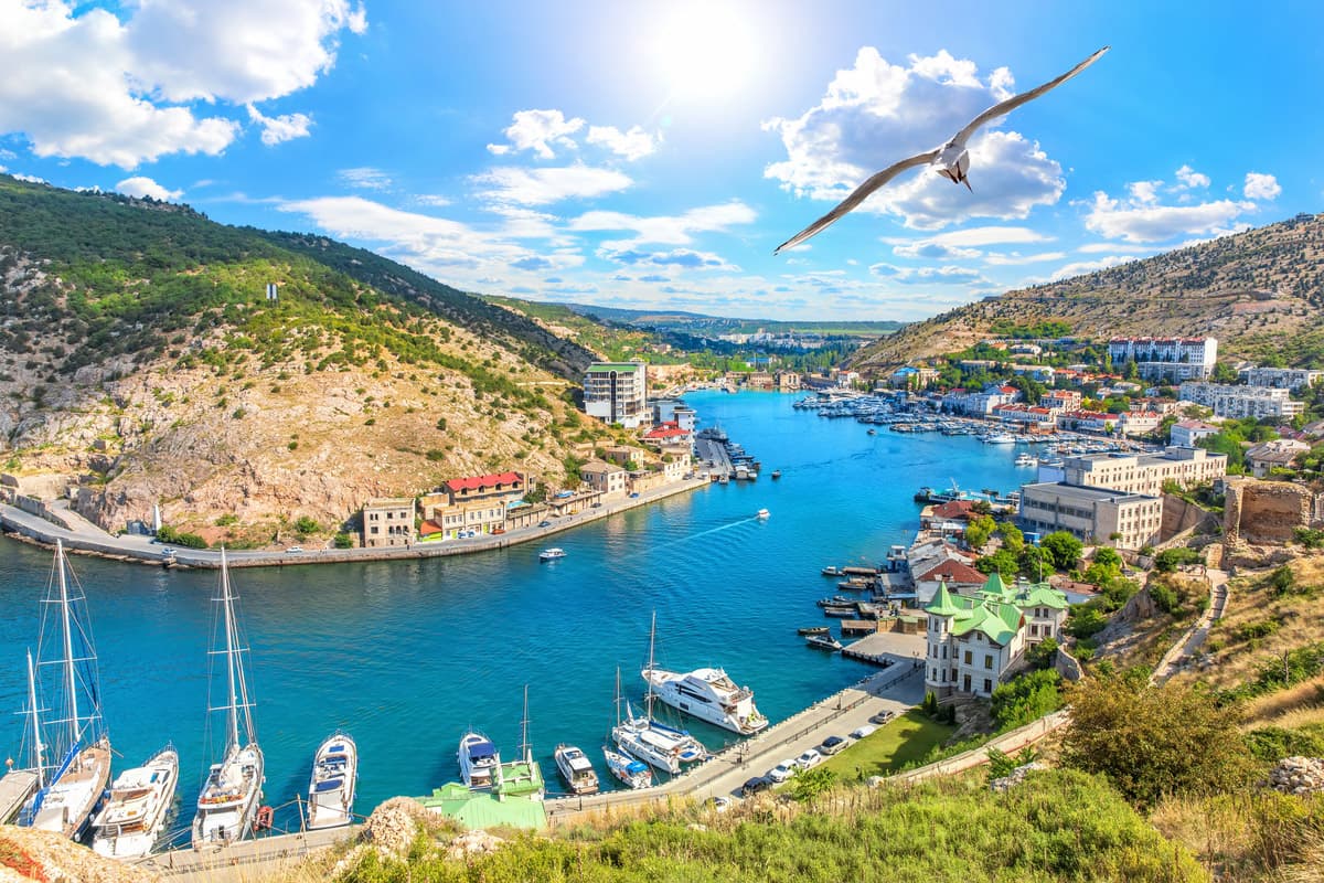
Balaklava Bay view in Sevastopol, Crimea.
There are few traces left of the ancient population and the first mentioned people living here - the Tauri. In the 5th century BC, the ancient Greeks, descendants of Heraclea of Pontus, founded Chersoneses Taurian. It used to be the only antique polis in the northern part of the Black Sea, an independent city state, a part of the Roman and later Byzantine Empires. Chersoneses was finally destroyed by the Golden Horde army. Now the ruins of Chersoneses are within the Sebastopol city limits. In the Medieval times, the territory of Sebastopol was controlled by the principality of Theodore, partly by the Republic of Genoa, and then by the Crimean Khanate, and partly directly by the Ottoman Empire. Immediately after the Russian-Turkish war (1768-1774), Crimea was annexed to Russia, which laid a strategically necessary military port. Thus, 1783 is considered to be the date of foundation of modern Sebastopol.
Things to see:
Yalta is an old-time favorite resort town and port on the South Coast of Crimea. There is a city itself and a territory called Big Yalta, spreading over 70 km deep in the peninsula, including Yalta, Alupka, and many villages. Big Yalta stretches from Foros in the west to Krasnokamenka in the east. The climate is mild Mediterranean, the sea never freezes and the mountain massif in the north wards off cold cyclones which ensures a mild sunny climate with short rainy winters, hot summers, and warm autumn.
There are many parks in Big Yalta, the most famous are Livadia and Vorontsovsky Parks. The former features the famous walking trail of the Tsars. Sun or Tsar trail is about 7 km long, it goes between the villages of Livadia and Gaspra and has no steep ascents and descents, which makes it very comfortable for walks. It passes within the reserve among rocks, juniper, pine and oak forests.
Also popular are the Botkin trail, which leads from Yalta to Stavri-Kaya rock, and Shtangeevskaya trail, winding up from the Uchan-Su waterfall on Ai-Petri Mountain. Other parks include Haraksky, Gurzuf, Cypress, Miskhor, Massandra, Foros, Lower Oreanda, Melas and Chair parks. These parks cleverly combine the endemic nature of the south-coast forest with extensive use of foreign imported ornamental plants. Big Yalta is also home to Yalta Mountain and Forest Nature Reserve established in 1974. Mount Rok (1,349m) is the highest point of the park.
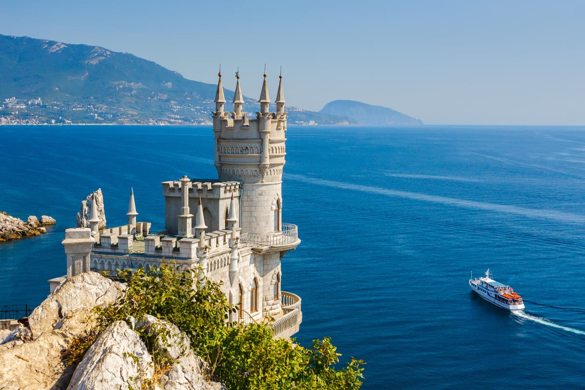
Another great landmark and film-making set is the Swallow's Nest, a gothic symbol of the Crimea. This quasi medieval castle built in 1912 is standing on the site of an ancient temple, clinging to a steep rock like a swallow's nest. The former owner of the estate called it "The Castle of Love". The size of the Swallow's Nest is actually tiny, you cannot swing a cat in an edifice 10 m wide, 20 m long, and 12 m high. During a major earthquake in 1927, part of the supporting rock collapsed into the sea. The castle was almost undamaged, except for the sharp spires and a piece of rock from under the lower balcony that fell into the sea. The place is well-worth a visit.
There is no railway or airport directly in Yalta, so you either have to drive a car or get a taxi or hop on a direct trolley-bus No.55 from Simferopol airport or bus No.52 from Simferopol railway station. The journey by public transport takes about 3 hours. Simferopol has the main airport of the peninsula that hosts flights from many cities in Russia and a railway station.


Yes. Republic of Crimea has 911 named mountains. The highest is Roman Kosh at 1,545 m.
The highest mountain in Republic of Crimea is Roman Kosh, at 1,545 m.
Republic of Crimea has 911 named mountains.


