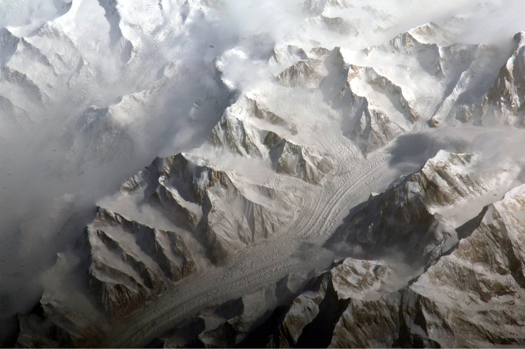
Xuelian Feng, Xuelian Peak or Snow Lotus Peak (Chinese: 雪莲峰), is one of the major mountains of the Tian Shan mountain range. It lies in Xinjiang province, China, about 50 kilometres (30 mi) east-northeast of Jengish Chokusu, the highest peak in the range. It is notable for its large, steep relief above the nearby valleys, and for its large topographic prominence. (It is ranked 84th in the world by this measure). The peak has two summits, with the main being the north summit at 6,627 m (21,742 ft); the south summit has an elevation of 6,527 m (21,414 ft).
The Tokai Section of the Japanese Alpine Club made four expeditions to Xuelian Feng, in 1986, 1988, 1989, and 1990, with the last being successful in ascending the main summit. (The 1989 expedition ascended the south summit and "Junction Peak", another subpeak to the south of the main summit, with elevation 6,450 m (21,161 ft), and came close to but did not reach the main summit.) In 1990, the expedition was led by Kazuo Tukushima, and ascended from the Karakume Glacier. The route ascended the southeast ridge of Junction Peak, then traversed a long (2 km/1.2 mi) corniced snow and rock ridge to reach the main summit tower. Other difficulties involved in the 2,500 m (8,200 ft) route included technical rock and ice walls, and snow gullies up to 70 degrees in steepness.
By elevation Xuelian Feng is
# 55 out of 419 in Xinjiang # 2 out of 8 in Baicheng County # 8 out of 2134 in the Tian Shan
By prominence Xuelian Feng is
# 18 out of 419 in Xinjiang # 51 out of 12241 in China # 2 out of 8 in Baicheng County # 13 out of 2134 in the Tian Shan
We use GPS information embedded into the photo when it is available.
3D mountains overlay
Adjust mountain panorama to perfectly match your photos because recorded by camera photo position might be imprecise.
Move tool
Rotate tool
Zoom
More customization
Choose which peak labels should make into the final photo and what photo title should be.
Next
Photo Location
Satellitte
Flat map
Relief map
Latitude
Longitude
Altitude
OR
Latitude
°'''
Longitude
°'''
Apply
Register Peak
Peak Name
Latitude
Longitude
Altitude
Register
Teleport
PeakVisor
This 3D model of Sagarmatha National Park in Nepal was made using the PeakVisor app topographic data. The mobile app features higher precision models worldwide, more topographic details, and works offline. Download PeakVisor maps today.
Download OBJ model
PeakVisor
The download should start shortly. If you find it useful please consider supporting the PeakVisor app.
PeakVisor for iOS and Android
Be a superhero of outdoor navigation with state-of-the-art 3D maps and mountain identification in the palm of your hand!