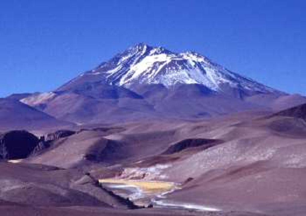
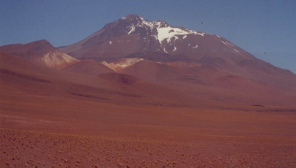
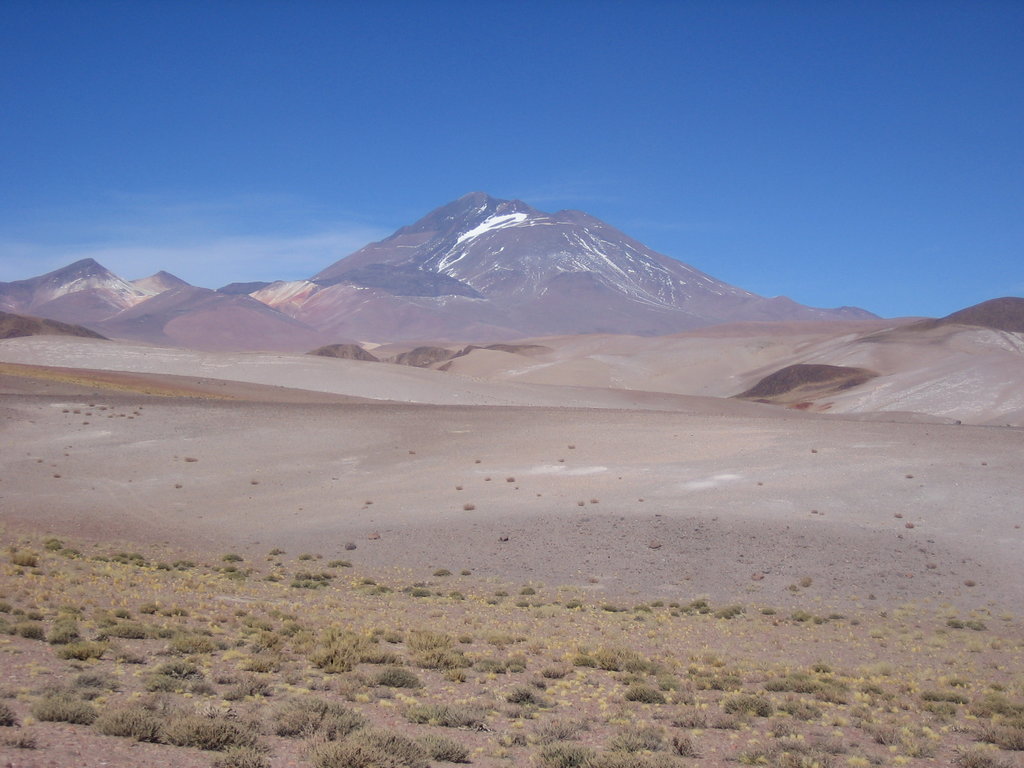
Llullaillaco (Spanish pronunciation: [ʝu.ʝai̯.ˈʝa.ko]) is a dormant stratovolcano at the border of Argentina (Salta Province) and Chile (Antofagasta Region). It lies in the Puna de Atacama, a region of very high volcanic peaks on a high plateau close to the Atacama Desert, one of the driest places in the world. It is the second highest active volcano in the world after Ojos del Salado.
Llullaillaco was constructed during two different phases in the Pleistocene-Holocene by dacitic lava flows. The oldest rocks are about 1.5 million years old. About 150,000 years ago, the volcano's southeastern flank collapsed and generated a debris avalanche that reached as far as 25 kilometres (16 mi) from the summit. The youngest dated rocks were erupted 5,600 ± 250 years ago in the summit region, but there are reports of activity from the 19th century.
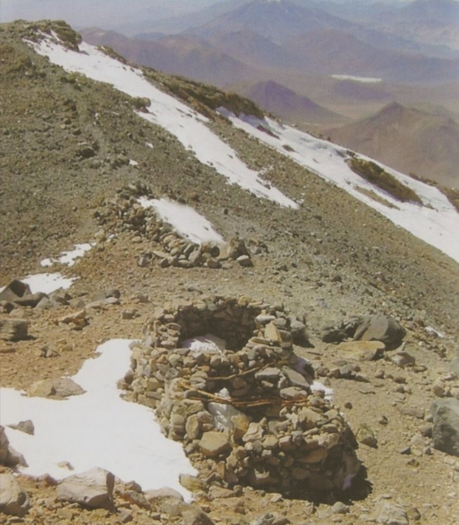
The mountain's first recorded climb was in 1950, but traces of earlier climbs, and a number of archeological sites, were found on the mountain and at its feet. With an archeological site at the summit region, Llullaillaco is the highest archeological site in the world. There, in 1999, the mummified remains of three children, known as the Children of Llullaillaco, were found. They are presumed to have been human sacrifices.
By elevation Volcán Llullaillaco is
# 1 out of 476 in Provincia de Antofagasta # 3 out of 10580 in Chile # 1 out of 761 in Salta # 1 out of 973 in Región de Antofagasta # 1 out of 89 in Reserva Provincial de Flora y Fauna Los Andes # 8 out of 8452 in Argentina # 1 out of 23 in Parque Nacional Llullaillaco # 8 out of 16361 in the Andes (Chile, Argentina)
By prominence Volcán Llullaillaco is
# 1 out of 476 in Provincia de Antofagasta # 10 out of 10580 in Chile # 1 out of 761 in Salta # 1 out of 973 in Región de Antofagasta # 1 out of 89 in Reserva Provincial de Flora y Fauna Los Andes # 13 out of 8452 in Argentina # 1 out of 23 in Parque Nacional Llullaillaco # 17 out of 16361 in the Andes (Chile, Argentina)
We use GPS information embedded into the photo when it is available.
3D mountains overlay
Adjust mountain panorama to perfectly match your photos because recorded by camera photo position might be imprecise.
Move tool
Rotate tool
Zoom
More customization
Choose which peak labels should make into the final photo and what photo title should be.
Next
Photo Location
Satellitte
Flat map
Relief map
Latitude
Longitude
Altitude
OR
Latitude
°'''
Longitude
°'''
Apply
Register Peak
Peak Name
Latitude
Longitude
Altitude
Register
Teleport
PeakVisor
This 3D model of Sagarmatha National Park in Nepal was made using the PeakVisor app topographic data. The mobile app features higher precision models worldwide, more topographic details, and works offline. Download PeakVisor maps today.
Download OBJ model
PeakVisor
The download should start shortly. If you find it useful please consider supporting the PeakVisor app.
PeakVisor for iOS and Android
Be a superhero of outdoor navigation with state-of-the-art 3D maps and mountain identification in the palm of your hand!


.jpg)