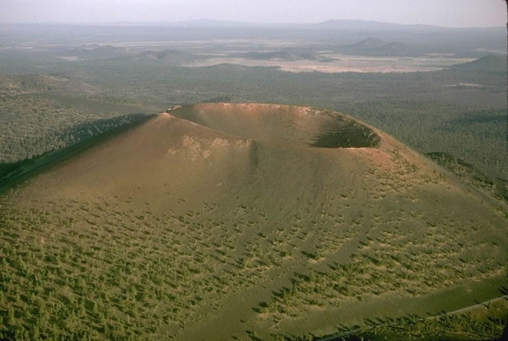
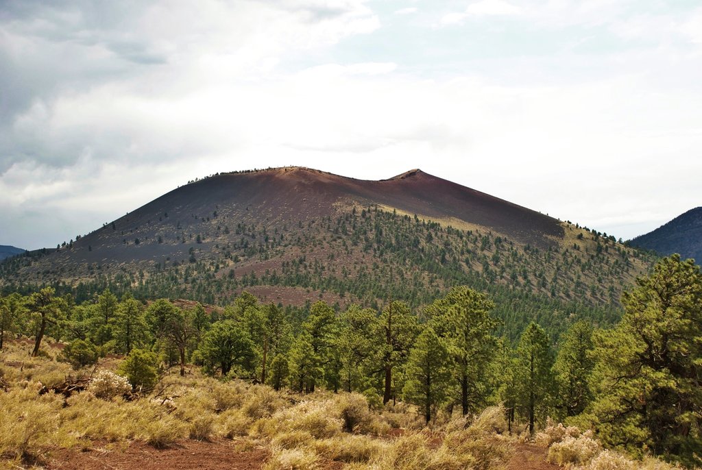
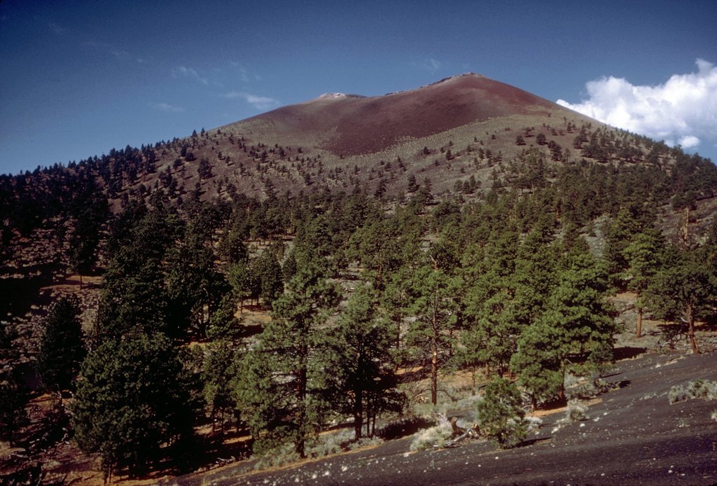
Sunset Crater is a cinder cone located north of Flagstaff in U.S. State of Arizona. The crater is within the Sunset Crater Volcano National Monument.
Sunset Crater is the youngest in a string of volcanoes (the San Francisco volcanic field) that is related to the nearby San Francisco Peaks.
The date of the eruptions that formed the 340-meter-high cone (1,120 ft) was initially derived from tree-ring dates, suggesting the eruption began between the growing seasons of A.D. 1064–1065. However, more recent geologic and archaeological evidence places the eruption around A.D. 1085. The largest vent of the eruption, Sunset Crater itself, was the source of the Bonito and Kana-a lava flows that extended about 2.5 kilometers (1.6 mi) NW and 9.6 kilometers (6 mi) NE, respectively. Additional vents along a 10-kilometer-long fissure (6.2 mi) extending SE produced small spatter ramparts and a 6.4-kilometer-long lava flow (4 mi) to the east. The Sunset Crater eruption produced a blanket of ash and lapilli covering an area of more than 2,100 square kilometers (810 sq mi) and forced the temporary abandonment of settlements of the local Sinagua people. The volcano has partially revegetated, with pines and wildflowers. The crater is the namesake for the Sunset Crater Beardtongue (Penstemon clutei). Since the last eruption of the volcano is a recent occurrence, it is considered dormant by volcanologists.
Damage from hikers forced the National Park Service to close a trail leading to the crater, but a short trail at the base remains.
The hiking trail below the summit skirts the substantial Bonito Lava Flow. This hardened lava is black and appears fresh as it has devastated the forest in its path. The lava flow also created an ice cave or tube that is now closed to the public after a partial collapse.
By elevation Sunset Crater is
# 78 out of 875 in Coconino County # 1 out of 2 in Sunset Crater Volcano National Monument # 25 out of 86 in the San Francisco Peaks
By prominence Sunset Crater is
# 43 out of 875 in Coconino County # 1 out of 2 in Sunset Crater Volcano National Monument # 7 out of 86 in the San Francisco Peaks
We use GPS information embedded into the photo when it is available.
3D mountains overlay
Adjust mountain panorama to perfectly match your photos because recorded by camera photo position might be imprecise.
Move tool
Rotate tool
Zoom
More customization
Choose which peak labels should make into the final photo and what photo title should be.
Next
Photo Location
Satellitte
Flat map
Relief map
Latitude
Longitude
Altitude
OR
Latitude
°'''
Longitude
°'''
Apply
Register Peak
Peak Name
Latitude
Longitude
Altitude
Register
Teleport
PeakVisor
This 3D model of Sagarmatha National Park in Nepal was made using the PeakVisor app topographic data. The mobile app features higher precision models worldwide, more topographic details, and works offline. Download PeakVisor maps today.
Download OBJ model
PeakVisor
The download should start shortly. If you find it useful please consider supporting the PeakVisor app.
PeakVisor for iOS and Android
Be a superhero of outdoor navigation with state-of-the-art 3D maps and mountain identification in the palm of your hand!