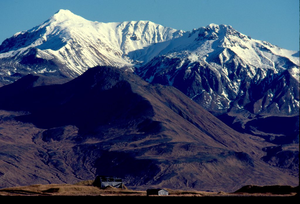
Mount Moffett is a mountainous stratovolcano that forms the summit of Adak Island of the Aleutian Islands in the U.S. state of Alaska. Its peak reaches 3,924 feet (1,196 m). It is heavily glaciated and is made primarily of high alumina basalt and andesite. It has never had an eruption in recorded history. The southern flank of the mountain is assumed to be its youngest side. In comparison to other Aleutian stratovolcanoes, Moffett is a small vent, characteristic of its mixed composition.
It was named by the U.S. Navy in 1936 for Rear Admiral William Adger Moffett.
It has occasionally been skied with there once being a ski-lift on the lower portion.
By elevation Mount Moffett is
# 62 out of 297 in the Aleutian Range
By prominence Mount Moffett is
# 51 out of 1793 in Unorganized Borough # 24 out of 297 in the Aleutian Range
We use GPS information embedded into the photo when it is available.
3D mountains overlay
Adjust mountain panorama to perfectly match your photos because recorded by camera photo position might be imprecise.
Move tool
Rotate tool
Zoom
More customization
Choose which peak labels should make into the final photo and what photo title should be.
Next
Photo Location
Satellitte
Flat map
Relief map
Latitude
Longitude
Altitude
OR
Latitude
°'''
Longitude
°'''
Apply
Register Peak
Peak Name
Latitude
Longitude
Altitude
Register
Teleport
PeakVisor
This 3D model of Sagarmatha National Park in Nepal was made using the PeakVisor app topographic data. The mobile app features higher precision models worldwide, more topographic details, and works offline. Download PeakVisor maps today.
Download OBJ model
PeakVisor
The download should start shortly. If you find it useful please consider supporting the PeakVisor app.
PeakVisor for iOS and Android
Be a superhero of outdoor navigation with state-of-the-art 3D maps and mountain identification in the palm of your hand!