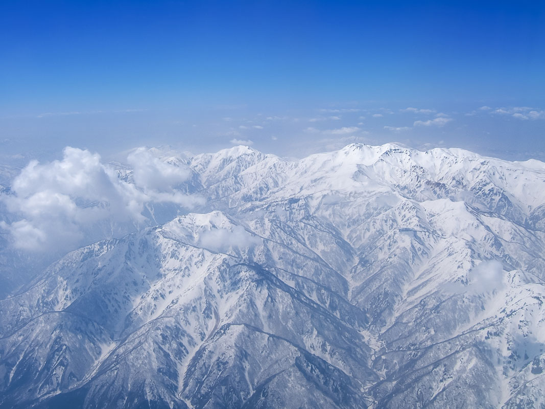
Mostly reverred is probably the territory of the Hakusan National Park, the Ryōhaku Mountains can be divided into two main sections: the Kaetsu Range and the Etsumi Range. Mt. Nōgōhaku (1,617m) is the main peak of the former, while Mt. Haku (2,702m) is the main peak of the latter.
Both major peaks contain the character ‘Haku’ (白white) in their name, which is why the entire range is called Ryōhaku (“two Haku”).
This range extends along 5 prefectures: Gifu, Toyama, Ishikawa, Fukui e Shiga. Being located beside the UNESCO World Heritage Site Shirakawago, the Ryōhaku Mountains offer visitors a huge selection of outdoor activities and places to visit, most of which have a deep connection with the history and the spirituality of the country.
Major Hiking Areas
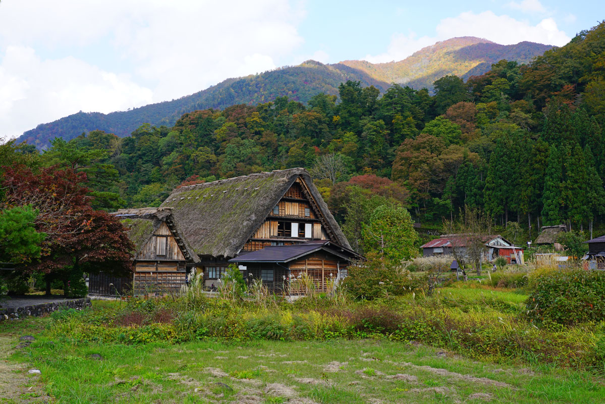
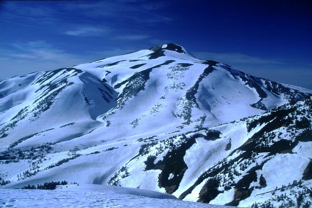
Mt. Haku (白山2,702m) has been climbed from 717AD when monks started to explore it for religious purposes. It is one of the most important mountains of Japan, mentioned in ancient poetry and known for the UNESCO World Heritage Site Shirakawago, famous for the 250 years old traditional gassho-zukuri farmhouses.
Mt. Haku is one of the three Holy Mountains (三霊山 Sanreizan), together with Mt. Fuji and Mt. Tateyama and one of the 100 Famous Japanese Mountains. It consists of three major peaks: Mt. Gozengamine (御前峰2,702m) on the left side, Mt. Kengamine (2,677m) and Mt. Onanjimine (大汝峰2,684m) on the right side and other minor peaks. On each of the major peak, there is a Shinto shrine. Being so important, it is accessible from the capital as well as from all the major cities. When it comes to choosing trekking trails, hikers have plenty of choices; in fact, there are 9 different long routes: Hakusan Zenjodo Route, Saboshindo Route, Kankoshindo Route, Nanryudo Route, Echo Line Route, Tonbiiwa Route, Tenbodo Observatory Promenade, Hirasedo Route, Pond Viewing Route, Chugudo Route. Facilities such as watering stations, toilets and shelters are scattered along the way. If you want to enjoy the historical beauty of Shirakawago, the White Road may be the right choice. This is a 33,3 km complex route connecting Hakusan City, Ishikawa Prefecture, Shirakawa Village and Gifu Prefecture. It is divided into driving routes, walking routes and trekking routes that connect all the most popular and beautiful places of the area, such as the Fukube falls, Shiritake Falls and the Hakusan Observatory. At the mountain feet, there is Hakusan Foothills Museum of History and Folklore, an outdoor museum devoted to the lifestyle of local people and Hakusan City Museum of Farming Culture.
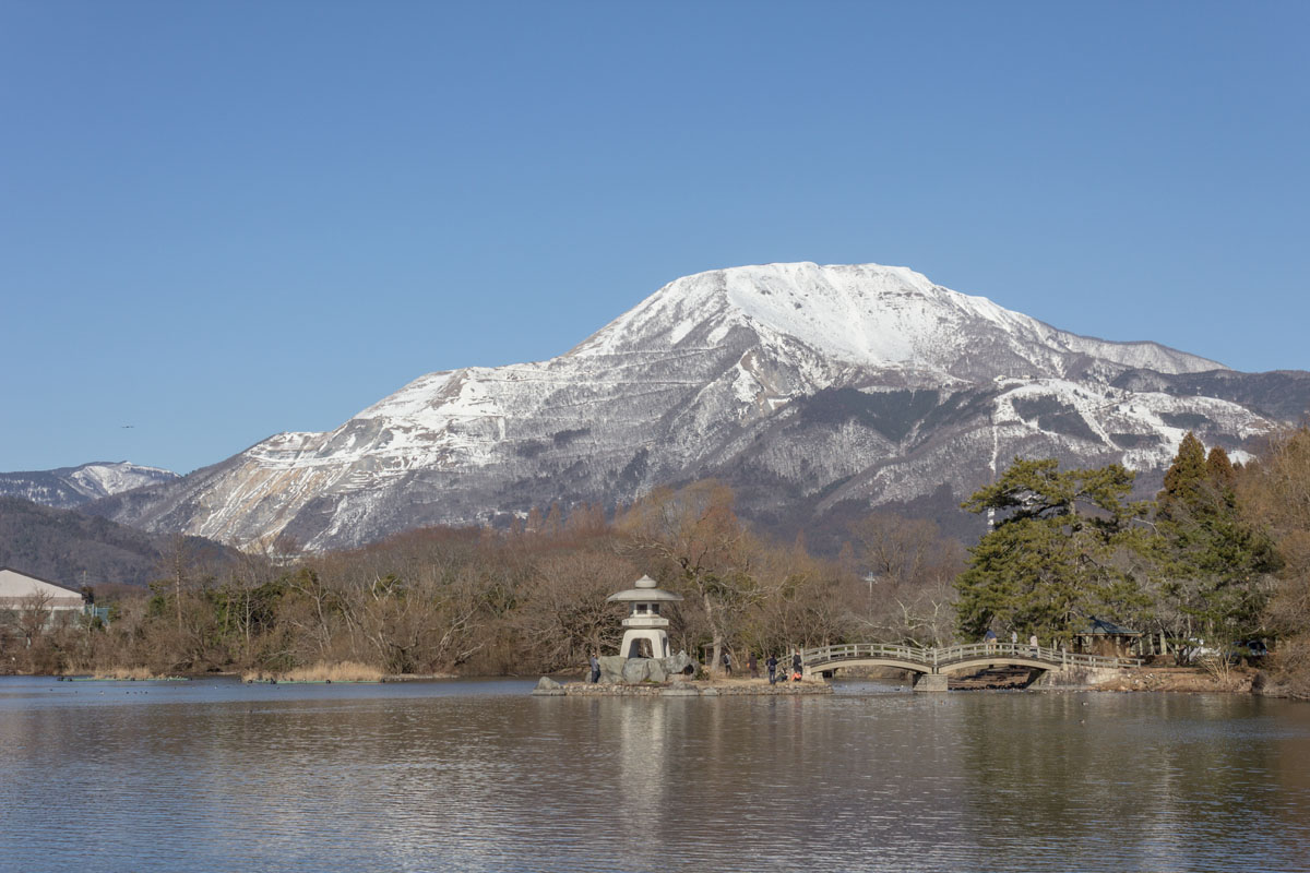
Mt. Nōgōhaku (能郷白山1,617m) is one of the 100 Famous, located between Gifu and Fukui. Its history dates at least 1300 years back when the first Buddhist temple was built on its top. The shortest route to climb the peak starts on the Fukui side from Nukumitoge Pass, while on the Gifu side there is a trail starting in Nogotani, recommended to good walkers with a strong will. From the latter, it takes about 4h30m to climb the mountain.
Mt. Bessan (別山2,399m) is a popular hiking route that runs from the Gifu Prefecture side of the range to Mt. Haku's peak traversing Mt. Bessan, which lays on the left side of the massif. Mt, Bessan, which name means "Separate Mountain," is slightly separated from the south side of Mt. Haku. This area is a part of the Hakusan National Park. In the southern part of Mt. Bessan, there is a small flat area called the Bessan Plain with a small lake called Lake Mitarashi. In the same area, there are ruins of an ancient rest house for those making the pilgrimage up the mountain. Bessan Shrine is located at a short distance from the peak.
Mt. Akausagi (赤兎山1,629m) is located inside the Hakusan National Park in front of Mt. Haku, this peak owes its name to the rounded shape of its slopes, which resembles the rabbit backbone (兎 Usagi means rabbit). Due to its soft shape, it is also considered a feminine mountain. Mt. Akausagi can be explored through 3 different trails: Kohara Trail, Hatogayu Trail, and Ridgeline Trail. Kohara Trail is a woodland path accessible from July to November for 3$, but it is not possible to leave a car on the available minibus parking lot. However, this is also the shortest way to reach the summit and to enjoy the view of the autumn red leaves. If you are moving by public transport, Hatogayu Trail is the most convenient route. The Tando Valley is the only dangerous point of the entire course because if the weather is rainy it becomes flooded. The Ridgeline Trail leads to the peak via Mt. Taisen and Mt. Kyōgatake (経ケ岳1,625m). The path is characterized by lots of ups and downs and, even if it cannot be considered a hard trail, it is recommended to people who know how to hike. If you do not use a GPS or if you do not consult a map you are highly likely to get lost. The main facilities in the area consist of two mountain huts and a hot spring.
Mt. Sannomine (三ノ峰2,122m) is quite difficult to reach without a car. Koike trail is suitable for day hikes and consists of a 4h30m walk (ascent only) on a steep path. There is a shelter for hikers who want to reach Mt. Haku via Mt. Bessan.
Mt. Sarugababa (猿ヶ馬場山1,876m) is located in the northern part of Hida city, but is not accessible from there, unlike Mt. Mominukayama (1,744m) nearby. Instead, two trailheads are starting in Shirakawago, beside the Myozenji Temple, and go via Mt. Kaerikumoyama (1,316m), behind the Kaerikumo Castle. Both trails take on average of 5h. Furthermore, due to heavy snow in winter and remaining snow in summer, it is necessary to bring mountain shoes with metal pins and pay attention not to get lost because the path is not well-tracked.
Mt. Arashima (荒島山1,523m) is another peak that is not easily accessible. In fact, there are only a few trains every day reaching Kadohara Station. The 13 km trail is feasible in 5-7h from Kadohara Ski Resort; there aren’t any facilities along the way and the trail is challenging; the first part consists of a steep concrete road that becomes steeper the farther you ascent. Also, a 10km trail starts in Nakande, leading to the summit in 6h. Compared to the other route, the Nakande trail runs over gentle slopes among the trees, and is quite pleasant despite the frequent ups and downs. After passing Mt. Koarashima, a minor peak of the same mountain, the route follows a large ridge, where fixed ropes and chains placed on the rocks help hikers to complete the route.
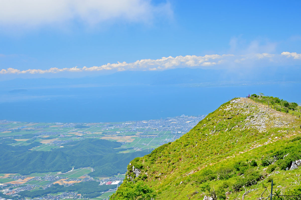
Mt. Ibuki (伊吹山 1,377m) – Despite the moderate height, the difference in altitude combined to the rocky terrain makes this peak quite arduous. The trail begins at Sannomiya Shrine and there is an opportunity to reach the 5th station of the route by a gondola lift located inside a ski resort. The mountain has been known for the presence of medical herbs and it is numbered among the 100 famous mountains.
One of the perks of choosing Mt. Ibuki is that the summit can be reached by car. Also, from the top hikers can see Lake Biwa, the biggest freshwater lake of Japan, which is a famous place featuring in Japanese literature and poetry, due to its proximity to Kyoto, the former capital of the country.
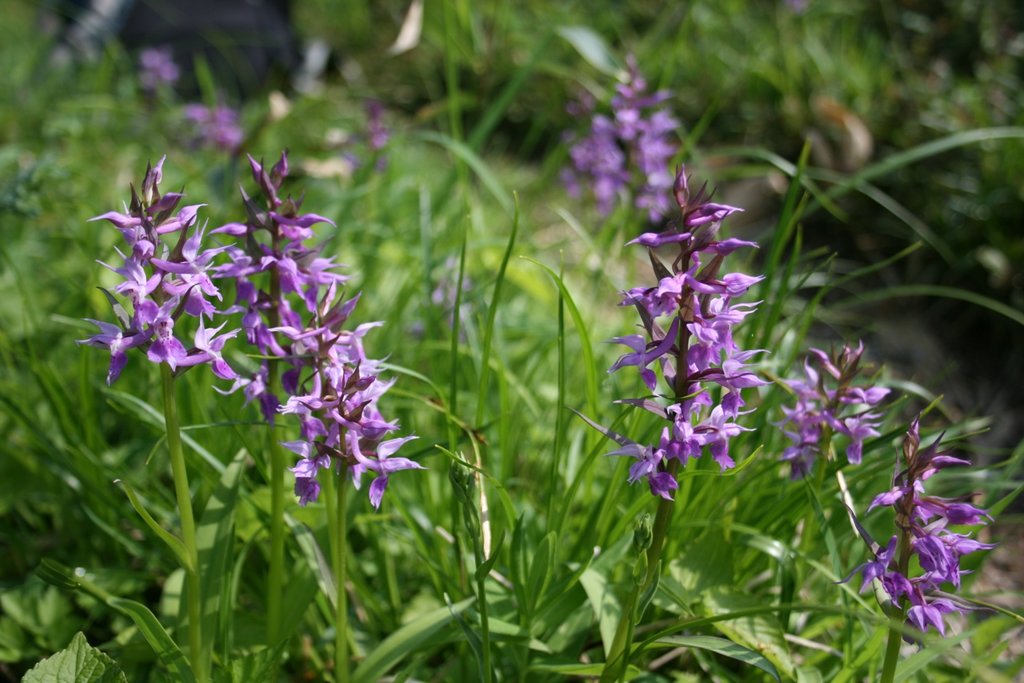
Mt. Oizurugadake (笈ヶ岳1,841m) is also called Hashigatake. This is a challenging peak where people sometimes get seriously injured. Since heavy snowfalls characterize the area, hikers are likely to find lingering snow even during the warm season. Also, Mt. Oizurugadake is one of the few Japanese peaks that cannot be climbed all year round and one of the only peaks in Japan without a single mountain hut or officially marked trail. Hence, despite the presence of ropes tied to the trees that will make your hike easier and the view of the beautiful dogtooth violets, this 8h walking is recommended only to expert hikers, especially due to the presence of dangerous passages, falling rocks, and other dangers.
Mt. Dainichigatake (大日ヶ岳1,709m) – There are three different hiking trails: the Dynaland Trail, which runs along steep slopes for 7km, it’s the shortest way to reach the summit. It takes only 3h30m to complete the hike. Hiruga no Kogen Trail takes 7h to be completed, but the hike is pleasant and runs in beech forests. Beginners can also take a breath while shortening the 6h round course using the gondola lift located on the Wing Hills Shirotori Resort Trail, which stops halfway at 1,350m.
These last two trails start inside Dynaland, a popular ski resort on the eastern side of the mountain that offers a wide range of ski runs and, together with the other ski runs of the area, creates a 32km network of ski runs.
Mt. Saihogadake (西方ヶ岳763m) If you are planning a family hike, this is the right place. However, it may become a long hike of 6h if you add a stop to Mt. Sazaegatake (687m). The trailhead is located near Jōgu Shrine, inside a tunnel of trees that suddenly pops out on a steep path. The terrain changes from rocky to muddy along the way. It takes about 3h to reach the summit of Mt. Saihogadake while reaching Mt. Sazaegatake from there takes 1h30m.
Major Cities and Facilities
Despite the Ryōhaku Mountains being a minor range, the fact that they are located right beside the Japanese Alps makes them easily accessible from all the major cities and prefectures nearby, such as Toyama, Niigata or Nagano, and also from cities like Tokyo, Nagoya, Gifu Fukui, Shiga or Osaka. However, access to each mountain may require the use of a car due to the lack of local transport. The nearest station is Shiramine.
This 3D model of Sagarmatha National Park in Nepal was made using the PeakVisor app topographic data. The mobile app features higher precision models worldwide, more topographic details, and works offline. Download PeakVisor maps today.
Download OBJ model
PeakVisor
The download should start shortly. If you find it useful please consider supporting the PeakVisor app.
PeakVisor for iOS and Android
Be a superhero of outdoor navigation with state-of-the-art 3D maps and mountain identification in the palm of your hand!