Get PeakVisor App

❤ Wishlist ×

Choose
Delete

Kitami Mountains

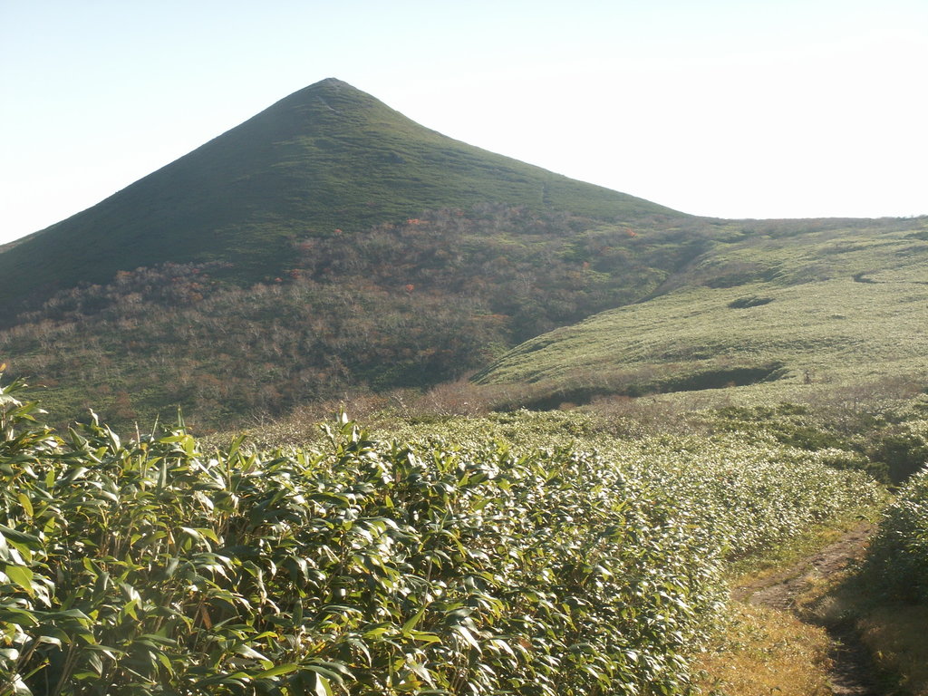
There are 94 named mountains in Kitami Mountains. Teshio Dake (1,557m) is the highest point. The most prominent mountain is Hako Dake (1,130m).

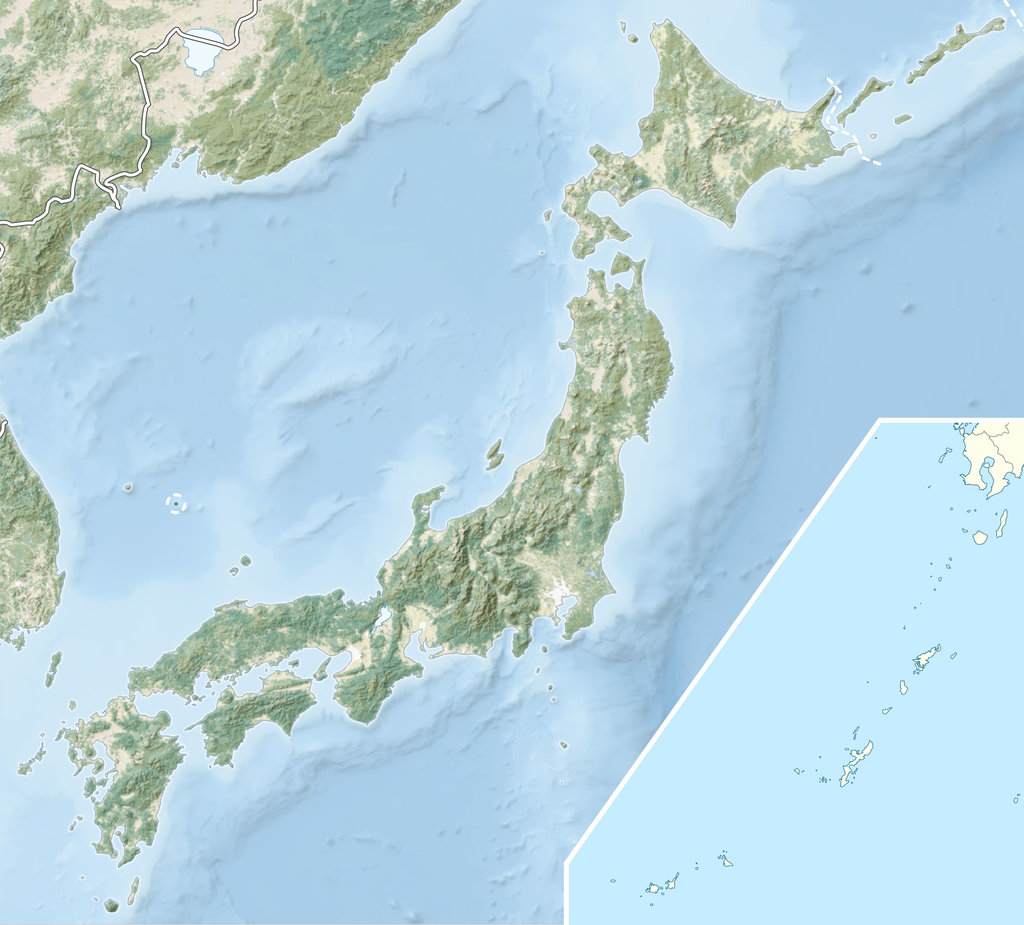
The word ‘kitami’ 北見 is composed by the characters of ‘north’ 北 and ‘to see’ 見, meaning these mountains can be seen if you look to the northern part of the region. In fact, they are located in the northern part of Hokkaido, near the Ishikari Mountain Range, in the Okhotsk subprefecture (オホーツク地方 Ohōtsuku-chihō), in front of the Kuril Islands, immediately next to Russia. Traces of Ainu culture and Russian culture coexist here with Japanese elements. The Kitami area is one of the coldest and wildest parts of Japan. The Kitami mountains are mainly outside the well-trodden path of the usual tourism destinations. Sadly, they are not as popular as other regions even though the Kitami area and municipalities neraby are a sightseeing base with immense potential due do the presence of the World Natural Heritage sites Shiretoko National Park and Abashiri Quasi-National Park, famous for the phenomenon of Drift Ice. In addition, the city is directly connected with the Daisetsuzan National Park and the Ishikari Mountains.

Shiretoko National Park

Major Hiking Areas

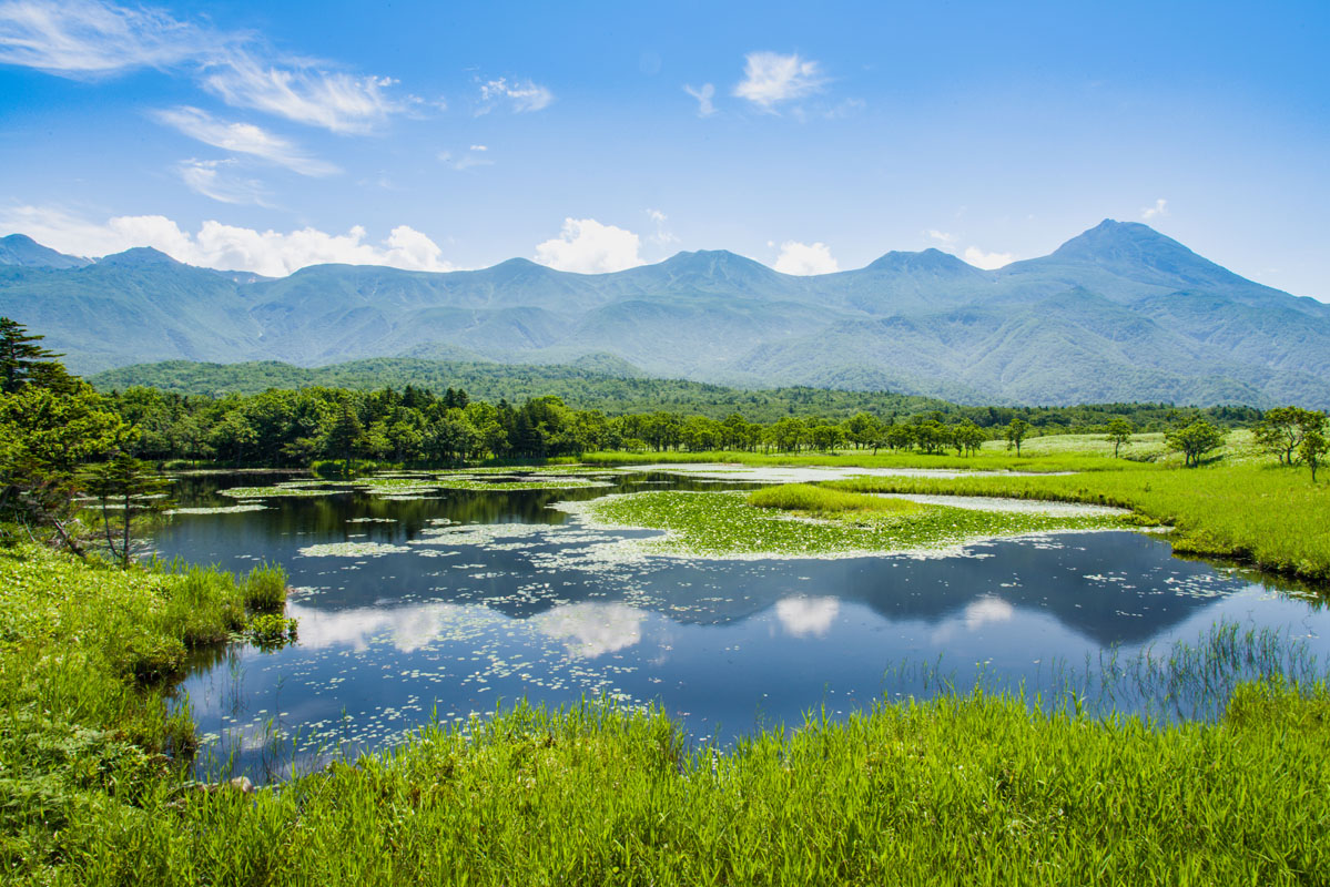
The Kitami Mountains share with the other Hokkaido ranges some common environmental features: the presence of lush flora, fauna endemic species such as bears that played a pivotal role in the Ainu traditions.

When hiking in Hokkaido, always remember to submit your itinerary to a local police station or directly to the Japan Police for your safety. You can file a form like this or use special service as shown here. In general, trails are not well-marked and most of these mountains are quite unexplored. Despite the moderate altitude, beginners should avoid these mountains. Instead, if they want to visit the region, they should choose any easy walk in one of the numerous Natural Parks and small green areas inside the major municipalities listed below.

  • Mt. Teshio (天塩岳1,557m) is located between the municipalities of Aibetsu and Kitami. This peak can be reached from Sapporo by train and bus with a change in Shibetsu. In any case, you will need a taxi to get to the trailhead.

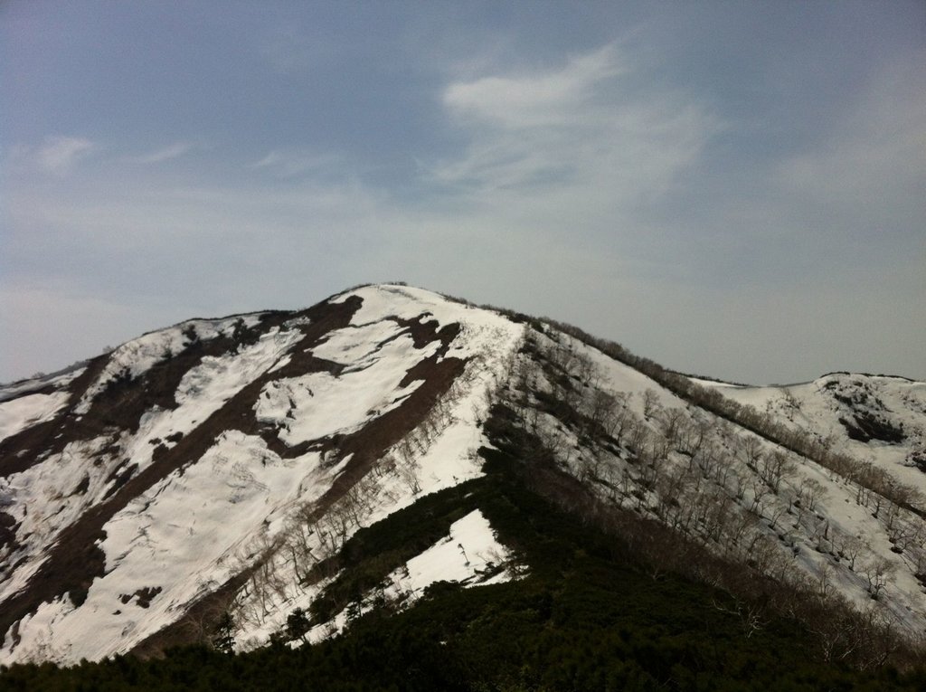
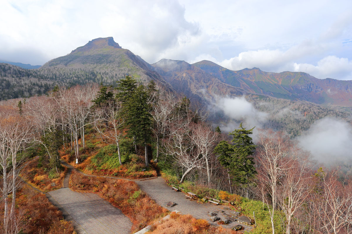
    Besides the main summit, the Teshio-dake massif features a number of minor summits like Mae-Teshio-dake (前天塩岳) and Nishi-Teshio-dake (西天塩岳).

    Four different trails reach the mountaintop. You can choose to use one to ascent the peak and a different one to descend to the starting point. The old trail (旧道コース) runs along the Teshio River from the Teshio hut. It is joined halfway to the New Trail (新道コース). If you follow the old trail you will reach Mae-Teshio-dake first. At this point, you can choose to take the New Trail to complete the descent. Mind that if you need to come back to the Teshio hut you must take the junction to the old trail because the two trailheads end in a different place. If you choose this trail you will find another hut along the way. You can also use the old trail until the junction with the Rakudagan, a parallel trail that skips the stop at Mae-Teshio-dake and goes directly to the main peak.

    On average, the route is 13km long, feasible in 6h. All the routes mentioned above do not include a stop at Nishi-Teshio-dake. In 1984, it was chosen by Kyūya Fukada to become one of the 100 Famous Japanese Mountains. It is also part of the Teshio-dake Prefectural Natural Park.

  • Mt. Hako (函岳 1,129m) is located on the border of the towns of Bifuka, Otoineppu and Esashi. The main characteristic of this peak is its flatness. It doesn’t present any particular feature or something beautiful that distinguishes it from other territories. It has been remaining almost unexplored until recent times. It was only used for mining. The best way to enjoy it is probably by skiing. It takes 4h to reach the mountaintop from the parking lot, passing through the old Mine Warehouse. There is also a route connecting this peak to Mt. Kumano via the Ofuntarumanai river which takes about 8h to be completed.
  • Mt. Wenshiri (ウエンシリ岳1,142m), in Ainu language this name means something like "a dangerous mountain" probably due to the presence of vertiginous cliffs. There are two main routes: one starting from the main camping site, the other from the central trailhead. The former is steeper but shorter than the latter. The rocky area starts from the so-called ice tunnel; here ropes are required for a safe climb. Trails are generally in good conditions. During the descent, you may want to extend your hike taking a side path that leads to Mt. Poronaipo (ポロナイポ岳1,093m). The junction starts in the northern side of the ridge and it is feasible in 1h30m. Instead of a traditional hike, you can try to enjoy this peak planning an MTB hike.
  • Mt. Kitamifuji (1,306m). From the parking lot next to the old trailhead to the summit it takes about 4h. The old route consists of a trail but not a really well-tracked one. It runs along a river that in part follows the ridgeline. There should be a sign indicating the Senman Waterfalls. From the peak, you can see all the key points of the area: Mombetsu, the Ohkotshk Peninsula, Shiretoko, Mt. Daisetsu on the north side, the spring of the Thirteen Waterfalls and Mt. Teshio.
  • Mt. Chitokaniushi (チトカニウシ山1,435m) is the second tallest mountain of the Kitami range. It is located on the border between the cities of Kamikawa and Engaru. Since the trails are not marked, it is better to be escorted by a local guide. The experience is definitely more exciting in winter when you can use skis or snowshoes. Starting from the Kamikawa side, it is also possible to plan an MTB/fat bike hike through Kitami Pass. Following the path that runs along the National Highway, you will encounter the Daisetsuzan Ski Resort. That ridge will connect to Mt. Tengu and Asahiyama.
  • Kamikawa

  • Mt. Poronupuri (ポロヌプリ岳804m) is accessible from the National Road 293. There is only one trail starting in the Ozawa parking lot. It is a 4h course, but the path is not well-marked. The trail itself is not difficult, but you must be well oriented and properly equipped to complete the hike.

Other activities

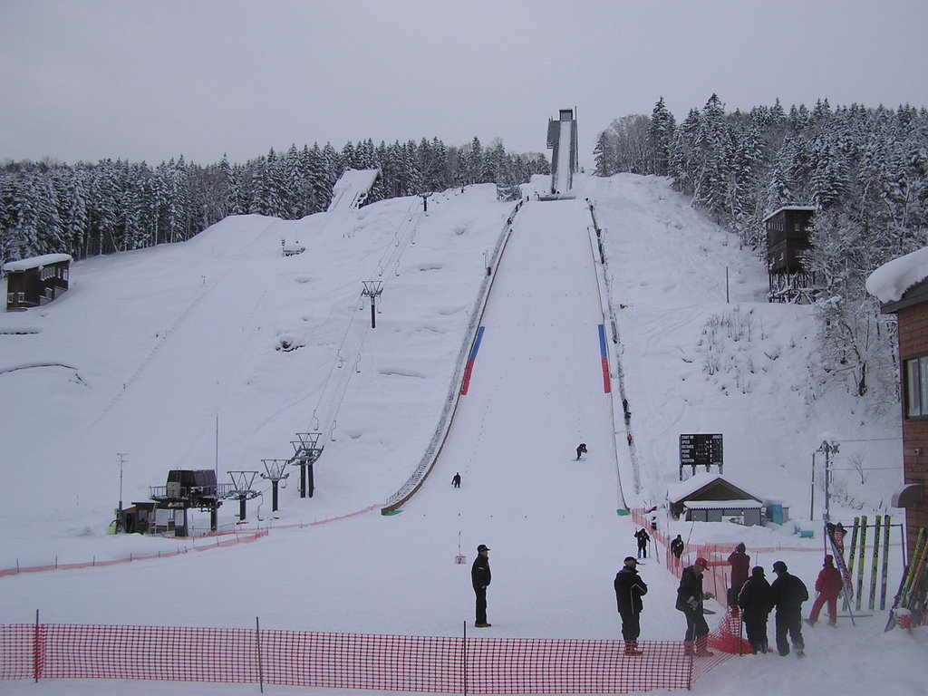
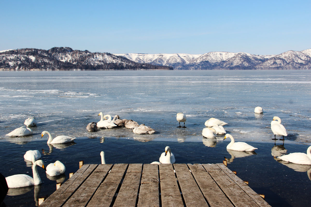
Hokkaido is a big peripheral area, wild and cold, a mixture of different traditions. You should chose Hokkaido as your destination because the it offers very unusual yet very worthy opportunities to explore Japan not from a very touristy side. For this reason, we suggest you should enjoy not only a standard hike but also a wide range of activities available in this area, such as horse trekking or fat bike experience. On Lake Abashiri (known for its prison as well) it is possible to try the smelt fishing on ice or practice bird watching, trying to spot the endemic Kingfishers. Lake Abashiri, together with Lake Notoro, Lake Saroma is a part of the famous Abashiri Quasi-National Park. If you are neither an adventurous nor an expert hiker, another option is to spend one day exploring the nature in Kitami city. A bike trail is laid out for 27km inside the city. It is feasible in about 2h starting from Kitami Station and stopping at some important places like the Kitami Memorial Museum, the Tenkei Temple, the Flower Paradise, a botanical garden. There are also several nice itineraries in the local parks in Kitami city and areas nearby. For example, there is a 5km trail inside the Okhotsk Forest extending between Kitami and Abashiri. Near the city, there is also the Kitami Wakamatsu Ski Resort equipped with 3 ski runs.

Lake Abashiri

Major cities and facilities

The Okhotsk area is well connected to Sapporo by buses and trains that reach all the major cities of the district. Visitors coming from the main island can book a flight from Haneda Airport to Memanbetsu Airport or Okhotsk Monbetsu Airport. Except for Sapporo, all the other municipalities, although fascinating, are far from being comparable to metropolitan areas like in Kanto and Kansai region. However, since reaching the Kitami range usually requires changing from a train to a bus and or a taxi, renting a car may be the most convenient option.

  • Kitami – Tokoro Ruins, Crane Farm & Fox Farm. At the north fox ranch Onneyu hot springs in Kitami, you can encounter lovely northern foxes anytime. The viewing style allows humans to come in to see in the north foxes which play around freely without being shut in cages.
  • Takinoue - shibazakura (pink moss phloxes) is glorified here by a yearly festival called Takinoue Shibazakura Matsuri, mint production
  • Kamikawa has Sounkyo Ropeway, which is 1,984 meters above sea level, it offers a view of Kurodake's treasure house of outstanding Japanese alpine plants. You can take the 101- passenger ropeway by Kurodake Ropeway from the Sounkyo hot-spring resort to the Kurodake fifth stage in seven minutes one way. In winter this area becomes a popular skiing spot. Kamikawa can boast of great hotsprings and Distinct Colummer Joints, Obako. Both rock faces of the large gorge extend for approximately 24km along the Ishikari River flowing from Daisetsuzan and have slim stick precipices with hexagons, and four cornered points. Obako is a place where you can see nature on a global scale, up close.
  • Monbetsu - Okhotsk sky tower, Sea Ice Museum
  • Abashiri – Cape Notoro, Drift Ice Sightseeing Icebreaker
  • Asahikawa – Kamui Ski Links
  • Aibetsu - mushrooms
  • Yubetsu - Kamiyubetsu Tulip Park, Akino Suzuran Hillside National Government Park
  • Engaru -Shibazakura, Yamabiko waterfalls
  • Shibetsu – Sheep of the World Museum
  • Tsubetsu – Tsubetsu Pass Observatory
  • Nishiokoppe – snowmobile, Kuroiwa waterfalls and Akaiwa waterfalls.

Explore Kitami Mountains with the PeakVisor 3D Map and identify its summits.

Register Peak
Peak Name
Latitude
Longitude
Altitude
Register
Teleport
PeakVisor
This 3D model of Sagarmatha National Park in Nepal was made using the PeakVisor app topographic data. The mobile app features higher precision models worldwide, more topographic details, and works offline. Download PeakVisor maps today.
 Download OBJ model
PeakVisor
The download should start shortly. If you find it useful please consider supporting the PeakVisor app.