There are 137 named mountains in Ishikari Mountains. The highest and the most prominent mountain is Asahi Dake.
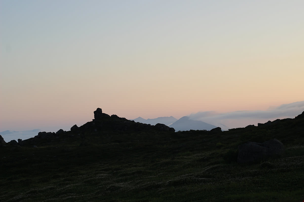
The Ishikari Mountain range is a mountainous region of volcanic origin located in the central part of Hokkaido, the northern island of the Japanese archipelago. It is divided into two sections: the Daisetsuzan volcanic group and the Tomuraushi volcanic group. It is also called “Hokkaido Roof” due to the altitude of its peaks, the majority of which reach stand above the 2000m; local people also call it Kamui Mintara which means “the playground of the gods” in Ainu language.
Hokkaido used to be the land of Ainu people, a native population of Japan that has almost entirely disappeared due to a forced process of inclusion that lasted for all the Meiji Period (1868-1912). The Ainu people were connected to their land and their mountains as well as to the local fauna, especially bears, both by a religious and an environmental bound.
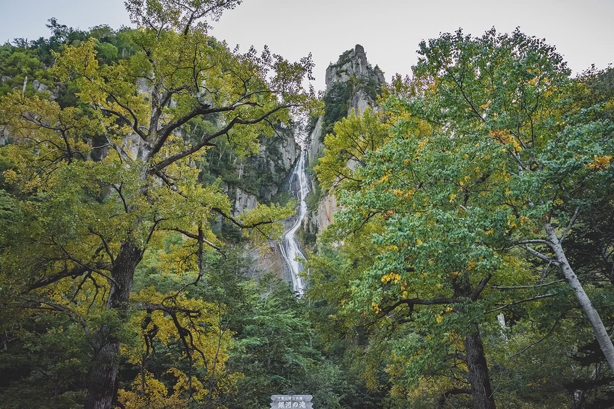
The most evident traces of Ainu civilizations still remain in most of Hokkaido topography, which is not immediately comprehensible to a Japanese native speaker as well due to the transliteration of names in Ainu language into the Japanese writing system, like Shikaribetsu or Niseikaushuppe-yama (1,879m). The Ishikari mountains host endemic species of flora and fauna, which are prolific despite the harsh climate conditions. Peculiar volcanic formations like Ohachidaira caldera or rock formations like the Columnar Joints in the Sounkyo and Tenninkyo gorges, inside the Daisetsuzan National Park represent another important feature of this range.

Major Hiking Areas
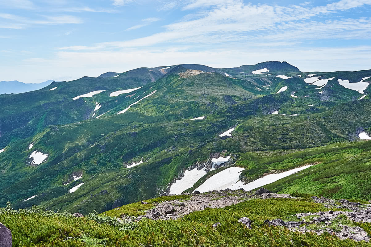
Most of the peaks of the Ishikari Mountains belong to the Eastern section of the Daisetsuzan National Park (also called Back Daisestu Area). The volcanic landscapes are characterized by gigantic boulders, lush green forests and breathtaking views, waters and hot springs near Shikaribetsu Lake. In general, this is a must-try range for serious hikers who have gained experience in this kind of adventure and love long hikes.
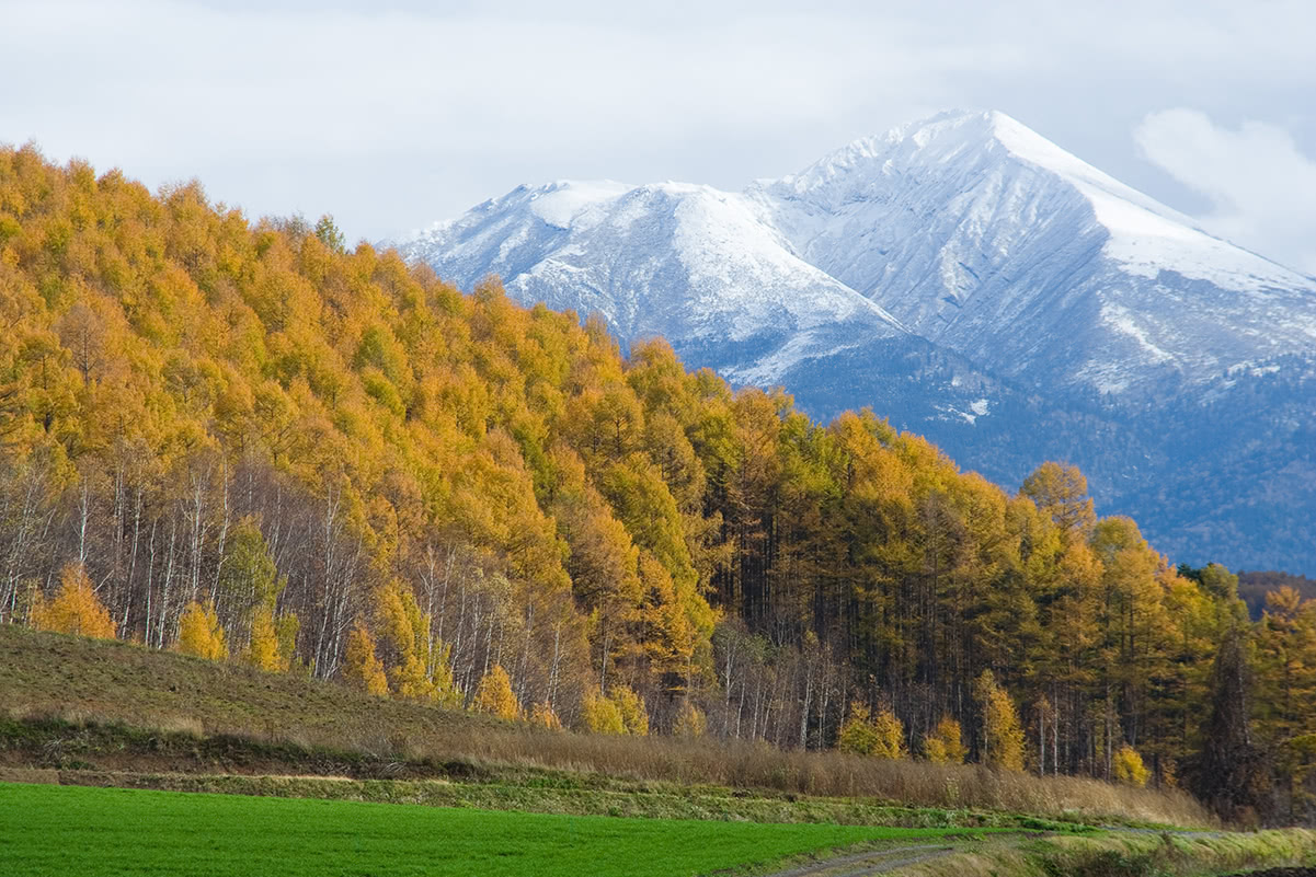
Hokkaido is one of the wildest parts of Japan. Nature literally explodes in summer, lavender fields and greeneries lure hords of tourists, especially outdoor lovers. But winter is fascinating as well and full of surprises. Hokkaido’s snow is usually heavy and starts falling around late August and early September. Being prepared to sudden weather changes and being properly equipped to deal with snow during spring and bears all over the year is something hikers approaching this area must always keep in mind.
The Central Ishikari Range does not seem to be a very popular destination, which is why it should be chosen by hikers who want to avoid the crowd and to experience a wilder part of Japan. This can also result in a lack of information about trails and facilities in the area. For this reason, it is better to plan your route before you start your journey and after you have consulted the local tourism office.
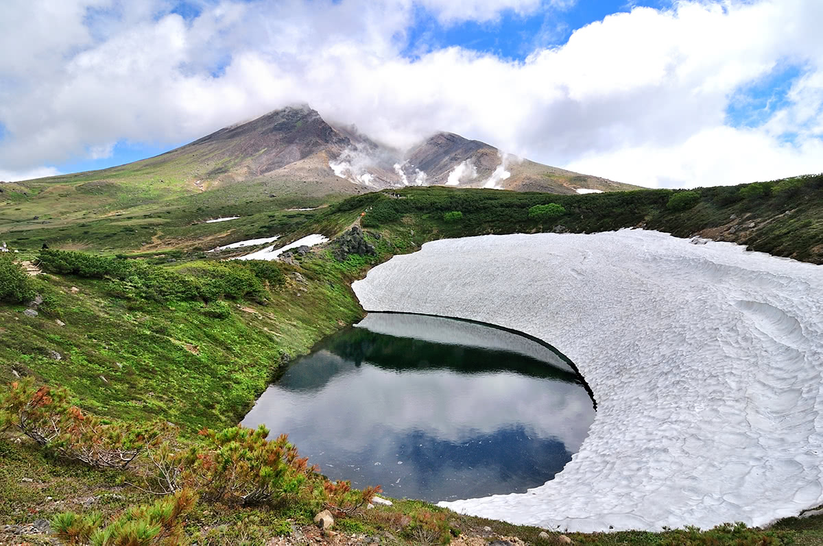
- Mt. Asahidake (旭岳2,291m) to Mt. Kurodake (黒岳1.984m) - Asahidake is the highest peak of the range, it is accessible using a ropeway. It is characterized by the presence of fumaroles, so it is the best place to enjoy the volcanic activity. There is a medium difficulty hike with a stop at a traditional hot spring. For hikers who want to fully enjoy this peak, the Asahidake to Kurodake traverse may be the best option. To enjoy not only the Kurodake area but also all the Daisetsuzan National Park, visitors usually use the Sounkyo Gorge as their key base. Mt. Kurodake is located right above it. There are seven stations leading to the mountaintop. You can take the gondola lift from Sounkyo station to the 5th station. After that, hikers can take a chairlift to the 7th station and reach the mountaintop in a 1.5h ascent.
The so-called Italian route is another option you may well want to try. In the eastern section of Asahidake lies Aka-dake (赤岳2,078m), at the edge of a stony plateau well known for alpine flowers. From there you can move to Hakuun-dake (白雲岳2,230m) on the southern slope of which there is the Hakuundake Refuge if you want to stay overnight. From here the last stop of the loop is Midoridake (緑岳2,020m). Asahidake is listed in the 100 Famous Japanese Mountains.
- Daisetsu Volcanic Group.There are two main trails: the Daisetsuzan Grand Traverse Trek which crosses the entire range from north to south, and the Southern Daisetsu Loop. Both of them are hard hikes requiring 8h walking per day. The former route takes 5 days, 1day camping outdoors and 4 days staying in mountain huts. The latter is a 3-day circuit requiring 2 overnight stays in mountain lodges; the stops include Mt. Biei -Mt. Tokachi - Mt. Furano -Tokachi Dake Onsen Resort.
- Mt. Tokachi ( 十勝岳2,077m) is the tallest volcano of the Tokachi Volcanic Group and also one of the 100 famous Japanese Mountains. Since it is still active, sometimes its volcanic activity may be spotted by hikers climbing its slopes. At its feet, there is a hut, a campground and a natural hot spring (onsen). There are four trails branching off from there and going to the peak, the most panoramic of which is a trail that reaches the summit via Mt. Furano (富良野岳1,911m) and Mt. Kamihorokamettoku (上ホロカメットク山 1,920m). The round trip takes about 7h to be completed. Once you have reached the top, you can also choose to add some variations to your itinerary. For example, you can stop at Bougakudai Observation Tower walking on a parallel trail for about 3h. Or you can walk along the trail that leads up to Mt. Biei (美瑛岳1,739m), it is connected to the main Asahidake route.
- Mt. Tomuraushi (トムラウシ山2,141m) in Ainu language probably means ‘a place with many flowers’ or ‘a place with many water stains’. There is a 15-km trail with the trailhead located at the Tomuraushi hot springs which can be reached by taxi or car from Shintoku station. The complex and snowy terrain hosts alpine plants of supreme beauty that deserve hardship of the long trail. On average, it requires 11h to be completed. It can be done in one day, but it is better to be prepared for an overnight stay.
- Mt. Ishikari (石狩岳1,967m) and Mt. Otofuke (音更岳1,932m) are two peaks which take their names from the namesake rivers. There are three main hiking trails on the Ishikari-Otofuke massif: two of them start at a trailhead at the end of the Otofuke-gawa River forest road, while one follows the gully of the Yuni-Ishikari River. All of them climb up to Jukkoku-toge Pass (十国峠). It takes 2 days to complete the route. The Schneider trail is easy in the first part of the ascent and a little bit arduous in the second part. Beginners may feel uncomfortable, but actually, there are no particular difficulties or dangerous spots over the 6h30m run. Climbing from Lake Daisetsu takes 2 hours from the trailhead to Jukkoku-toge Pass. You will find a campsite along the way.
- Mikuni Pass (三国峠1,139m) and Mt. Mikuni (三国山1,541m). Mikuni pass (1,139m) is the highest of all the Hokkaido mountains. Its name means ‘three countries’, which refers to its location on the border of three provinces: Tokachi, Kitami, and Ishikari. It is also loved by drivers due to the presence of a panoramic road accessible by car, but in winter it may be closed due to heavy snow. The hiking course traversing the pass is feasible in 3.5h. In the area of Mikuni Pass lies one of the magic hundred mountains in Japan: Mt. Daisetsu(大雪山2,291m) with Daisetsu Dam encircling Lake Daisetsu. Mt. Tomuraushi (2,141m), Mt. Tokachi-dake (2,077m) are located in the same area as well. Mt. Mikuni can be reached following different ways. One option is to proceed along the Mikuni Tunnel then going back to the parking lot located in the immediate vicinity. The trailhead is not well traced but if you go straight you will pass a small river and then reach the Hokkaido watershed, an intersection point of all the major rivers of the area. From there, the path to Mt. Mikuni is marked.
- Mt. Kogane (黄金山739m) is a small mountain with an original Ainu name meaning 'the mountain that rises in the middle of the growth'. In fact, despite the moderate altitude, its presence is outstanding if compared to the low terrain around. Also, even if it takes just 1h30 to climb to the top and 1h to come back to the foot, the path is quite steep and could be a little bit harsh for hikers without experience. The trailhead is located on the southern side of the mountain and, at a certain point, it has a bifurcation in the vicinity of a watering hole. From there you can choose either to take the ancient trail or go up the new trail. The latter is also more difficult to climb.
- Mt. Niseikaushuppe (ニセいカウシュッペ山1,879m) and Mt. Upepe (うペペ山系1,848m ). The only reason why these two peaks are treated together is their names, both derived from Ainu language. The first one means 'the thing that sits above the gorge', referring to the fact that it is located right above the Sounkyo Gorge, while the second means 'mountain abundant in melted snow'. Most of the trails are not well-marked or even abandoned, like the old route that used to start in a small district called Kiyokawa along the Ishikari river. The new access to the trailhead follows the Furukawa Forest Road which branches off National Route 273 in Nakakoshi district. NB The forest road to the trailhead has a gate with a lock, so it’s a good idea to call the forestry service to get the passcode. In the early season and late in fall, as well as after any heavy rains, the road may become impassable, so check before heading out. The first 10 km of the trail is almost flat, but suddenly it becomes steep. It takes 6h to reach the summit. It is not a popular destination, but a silent and peaceful mountain calling for deep meditaiton. Mt. Niseikaushuppe is also popular for river fans. As for Mt. Upepe, there are three trails: Nukabira trail, Kanno Onsen, West Kanno Onsen. Check before starting your journey. Sometimes some path may be closed due to the frequent landslides. From the trailhead to 1400m the path is well marked; from 1400m to 1600m you may encounter bushes on your way; From 1600m above the path is well-marked but quite narrow.
Major Cities and Facilities
Being a volcanic area, it goes without saying hot springs are quite popular here. Banya no yu in Ishikari city, Shisaino-yu in Furano, or Shikaribetsu Kohan Onsen are among the most popular thermal springs of the area. For a more authentic experience, hikers should ask locals if there are any small public baths, possibly not inside big resorts. The starting point for every Hokkaido trip is Sapporo, the landing point for travellers coming from any other place in Japan. Major tourist destinations are connected to Sapporo via public transport, like train and buses, but if you are planning to visit wilder areas renting a car, especially in winter, is probably the most convenient choice.
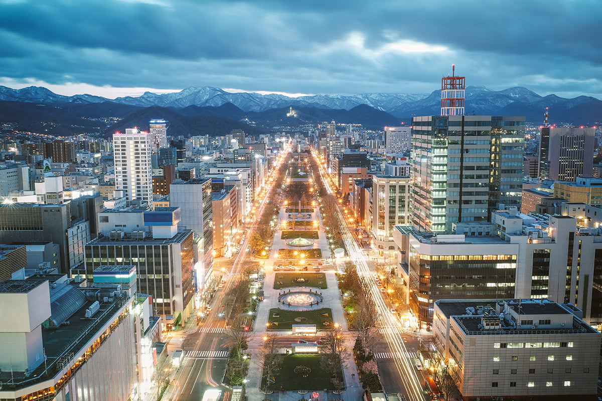
- Sapporo. Sapporo (札幌, "important river flowing through a plain" in Ainu language) is the capital of Hokkaido and Japan's fifth largest city. Sapporo is also one of the nation's youngest major cities. In 1857, the city's population stood at just seven people. Sapporo became world famous in 1972 when the Olympic Winter Games were held there. Today, the city is well known for its ramen, beer, and the annual snow festival held in February.
- Furano. Furano (富良野) and Biei (美瑛) are towns in the center of Hokkaido, known for their pleasant and picturesque rural landscapes. The best time to visit is July, when the lavender fields are in bloom. During winter, Furano turns into a popular downhill and cross countryskiing resort. Furano benefits from Siberian storm systems that pass over the Sea of Japan and then dump the lightest and driest snow in all of Hokkaido - and 9 meters of it each season. After a big snow fall there is often untracked powder for days.
- Ishikari
- Shinshinotsu is the smallest and the only village (circa 3000 people) in Ishikari Subprefecture, but it has Shinsinotsu Onsen - a very nice hot spring. The Ishikari River flows the east of the village.
- Ebetsu
- Tobetsu
- Eniwa
- Obihiro
- Kamishihoro
- Kamikawa