Scan the QR code and open PeakVisor on your phone
There are 214 named mountains in Kitakami Mountains. The highest and the most prominent mountain is Mt. Hayachine.
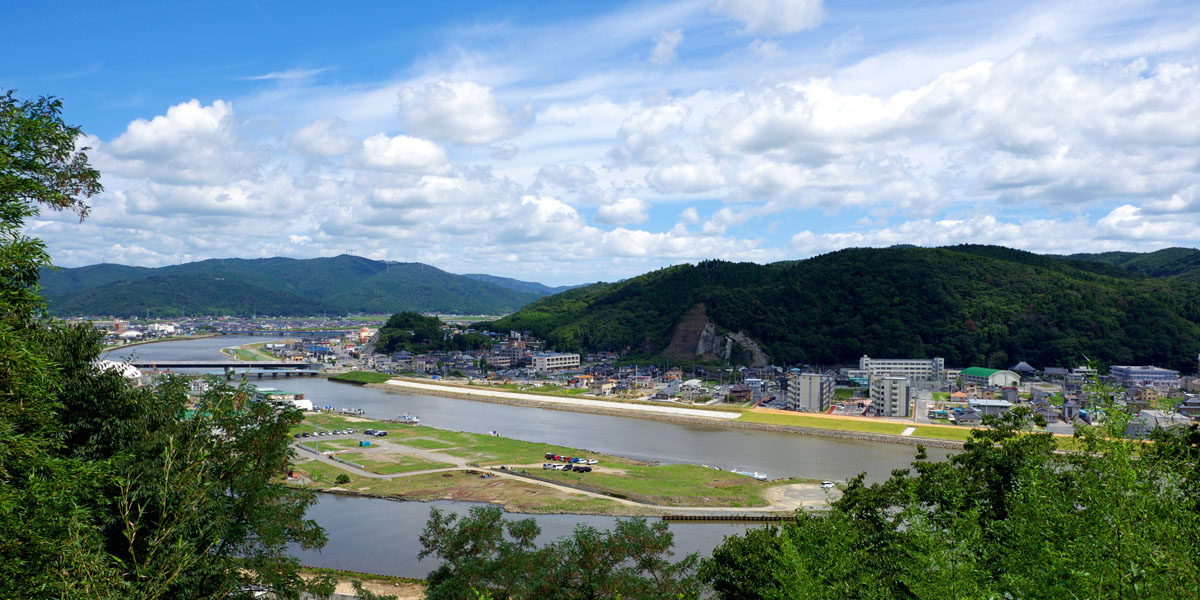
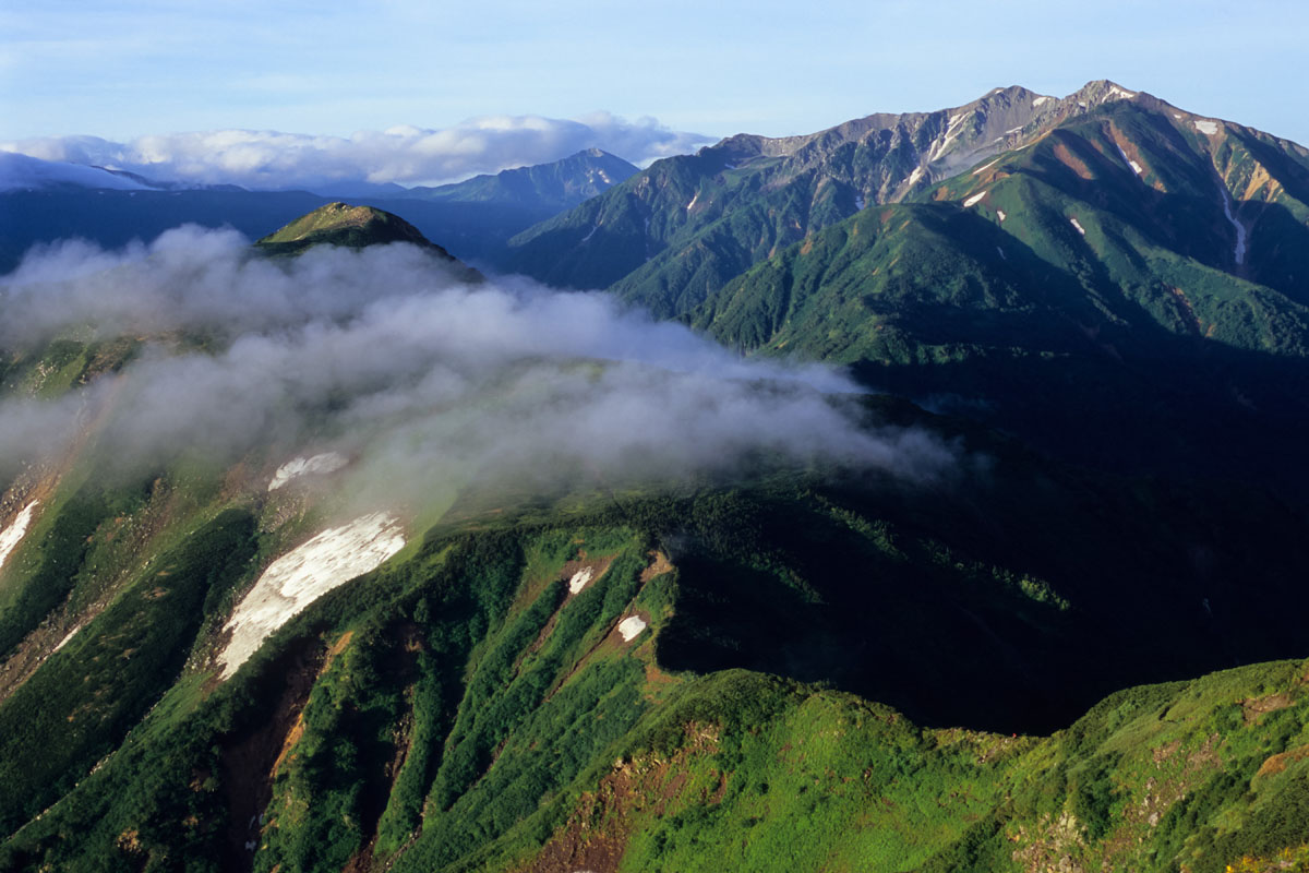
This range extends for 250km from south Aomori to Miyagi prefecture, it passes through Iwate prefecture where most of the peaks are located. It is the second major range of the Tohoku region, together with the Ōu range which lays on the western border of the Kitakami range and it is separated from it by the Kitakami River. On the west side, the Kitakami mountains rise from the east side of Morioka city, in an area known not only for its sansai (wild edible plants) and mushrooms but also for its livestock of Japanese Shorthorns, made famous throughout Japan by Akabeko - a toy of a red cow. On the east side, the Kitakami range faces the Pacific Ocean. The range ends in the Oshika Peninsula. It has a maximum breadth of about 80km and a maximum length of 250km. Alongside with quite smooth topography, which is a result of the last glacial period, there are some wedge-shaped peaks with dissected erosion surfaces. The east side presents a 300m high marine terrace and a greatly embayed coast. Due to the power produced by the Pacific Plate shrinking in the Japanese Trench, this is a highly seismic area. Varied climatic zones of the mountain range allow for ample alpine vegetation, and the valleys in between the rugged peaks are used for breeding dairy cattle.
Big Peaks
Mt. Hayachine (早池峰山1917m) consists of a major peak and several minor peaks, such as Mt. Kengamine (east), Mt. Nakadake and Mt. Keito (west). It extends for more than 10 km in the very centre of the Kitakami range dividing it into a northern section and a southern section (see the details below). It also appears in two Japanese classics: the Tono Monogatari by Yanagita Kunio and the poetry of Kenji Miyazawa. Also, the botanists Sugawa Chonosuke and Karl Maksimovič were particularly interested in studying this mountain’s vegetation and endemic alpine butterflies. Like many other Japanese mountains, women cannot climb it because it used to be worshipped as a holy mountain and was a ground for ascetic training. Mt. Hayachine is also believed to be a den of the Rain God, which makes the terrain particularly fertile. Thanks to all these peculiar features it earned a place in the 100 Famous Japanese Mountains.
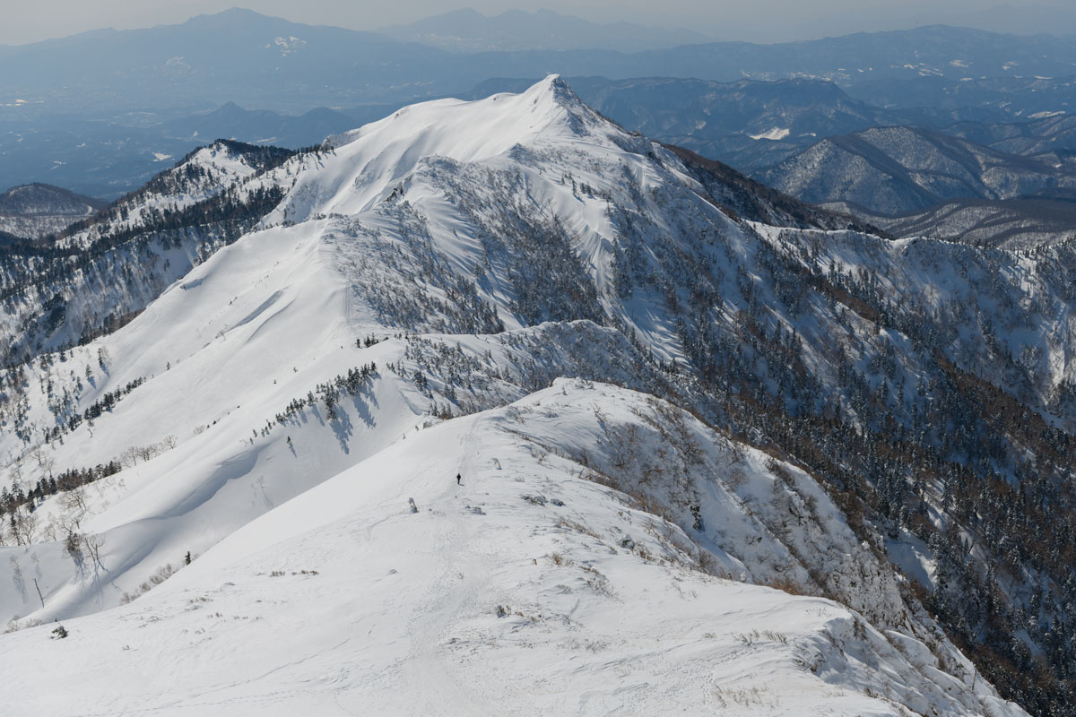
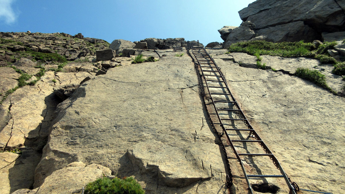
Hikers can approach the peak by six major trails: the Kawaranobo trail (a standard route) is a route for beginners that starts in Kawaranobo Camping Ground and takes 3h. Concerning the descent, hikers may take the Jengotare trail via Mt. Keito, which takes 5h and is a medium-level trail. Kadoma Trail is a well-marked medium-high level route where it is impossible to get lost; it is divided into 9 stages and is feasible in 5h. Yet, not all mountain trails in Japan are marked equally well, unprepared hikers may get lost on The Hiratsuto trail, a less known but very beautiful path feasible in 6h. Another option is the Odagoe trail, located on the same way to Mt. Yakushi (薬師岳1,645m), the second most important mountain of the range usually climbed together with Mt. Hayachine. The name refers to a Buddha who heals all diseases and prolongs people’s lives. The first part of the trail runs on a wooden road, but after 20min of walking, the path becomes rocky and narrow. Hikers who approach the mountain from the south should choose the Umadome Trail, feasible in 5h via the Mataichino Falls. From Odagoe it is also possible to do a 14km traverse via Mt. Keito and Mt. Nakadake which, despite the length, is a light walk.
The Northern section
Most of these peaks don’t reach 1000m, so it usually takes less than 3h to complete the longest of the trails.
For example, the summit of Mt. Nakui (名久井岳 615m) is easily reachable in 1h35m. It is called ‘Little Fuji’ due to its harmonious shape. Mt. Nakui has the most representative features of the northern section. Also, it is possible to find many kinds of fruit trees and temples at its feet, which proves its natural and historical value.
Mt. Oritsume (折爪岳 857m) is located in a strategic area, inside the Oritsume Basenkyo Prefectural Natural Park. The forest trail takes 2h35m to be completed and it is perfect for beginners due to the presence of an almost all-paved road. Along the way, hikers come across the mountain’s five waterfalls: the Odode-Sama Waterfall, the Esashika Waterfall, the Hime-machi Waterfall, the Orihime Waterfall, and the Isuzu Waterfall. Alternatively, hikers may choose to take a walk through the Koropokkur Land, an outdoor leisure facility on the east side of the mountain. Just beside this peak, the village of Kunohe offers a beautiful seasonal view of the areas nearby. This was the site of the battle between Hideyoshi Toyotomi and Masazane Kunohe and it is said that Masazane Kunohe’s head is buried inside the Kunohe Shrine. The site is also popular for the presence of a ski resort with 3 different courses: The Panorama Course recommended for exciting long-distance adventures, The Dynamic Course that can be also experienced at night, and The Karamatsu Course suitable for beginners. This area is also one of the largest in the Tohoku region where you can spot fireflies.
Among the highest peaks of the sections, there are Mt.Toshima (遠島山 1,262m) and Mt. Akkamori (安家森 1,166m). The former is particularly hard to climb due to the slippery terrain, it takes 4h to reach the top, whereas the latter is feasible in slightly over 1h.
From the standard trail on the south slope, it takes 2h45m to reach Mt. Anamegadake (穴目ヶ岳 917m) which is the perfect destination for snowshoe walking aficionados. Instead, Mt. Hashikami (階上岳 739m) is accessible from three different trails, the easiest of those is feasible in just 45m. The peak is characterized by clear trails and a stunning sunrise view.
The Southern section
Considering various features, such as the presence of easily accessible parking lots and other facilities along the way as well as the short distance from the trailhead to the summit, these peaks represent a perfect destination for family hikes and beginners who want to experience the beauty of a wild landscape without complications.
Mt. Murone (室根山 895m) overlooks the MILC candidate site and it is reachable in only 10min from the parking lot. Even though most visitors prefer to a good drive, a 2.5h steep climb from Orikabe Station is well worth a try.
With just 40min walking hikers can reach Mt. Nonodake (箟岳山 220m) which offers a nice view of the surrounding area as well as the opportunity to try exciting activities. On a Bird Watch, you will be able to spot pheasants, white wagtails, Japanese white-eyes and other interesting species. But you can also try paragliding, horse riding or experience the thrill of an astronomical observation at Muronesan Kirara Observatory. If you are planning a camping experience you might like to lodge at Boyotai Campsite (望洋平キャンプ場).
If you are travelling by plane, JAL flights to Iwate Hanamaki airport are available from Sapporo, Osaka, Nagoya, and Fukuoko. Travellers who have chosen train as their means of transport can reach the area leaving from Tokyo, getting on Tohoku Shinkansen to Shin Hanamaki station or Kitakami station. Tohoku Expressway or Tohoku Odan Akita Expressway may be used to move from other prefectures nearby. The southern part of the range is also crossed by two major railways running from the Pacific coast and connecting to the main railway lines in the Kitakami River valley.
Between the big cities and the isolated mountainous areas, there are many facilities offering outdoor experience. Just to give two examples, in Kuzumaki Town there is a ranch where visitors can take care of the animals, milk cows or make ice cream. For a more adventurous experience, the village of Ichinoseki hosts the 2km Geibikei Gorge, formed by the Satetsu River and surrounded by cliffs of over 50 meters. It is famous for its 90min round-trip boat ride, with a great view of waterfalls, impressive rocks and a limestone cave.