There are 70 named mountains in Hidaka Mountains. The highest and the most prominent mountain is Poroshiri Dake.
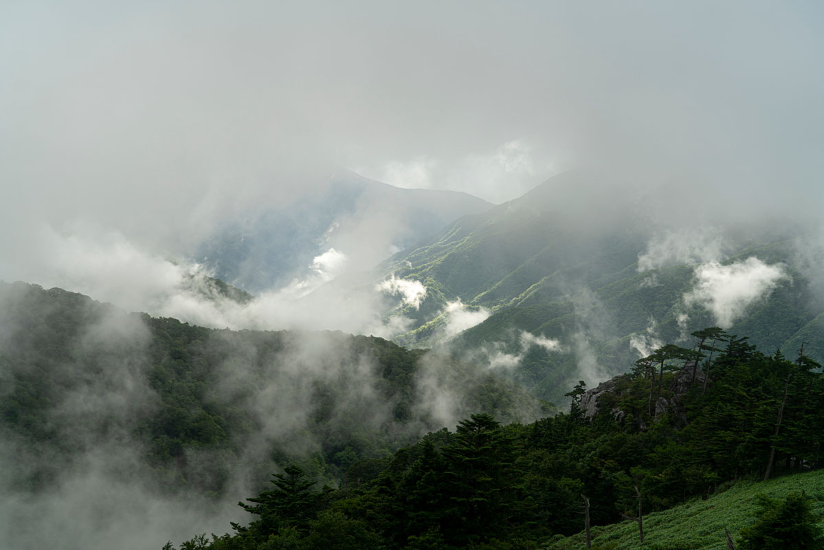
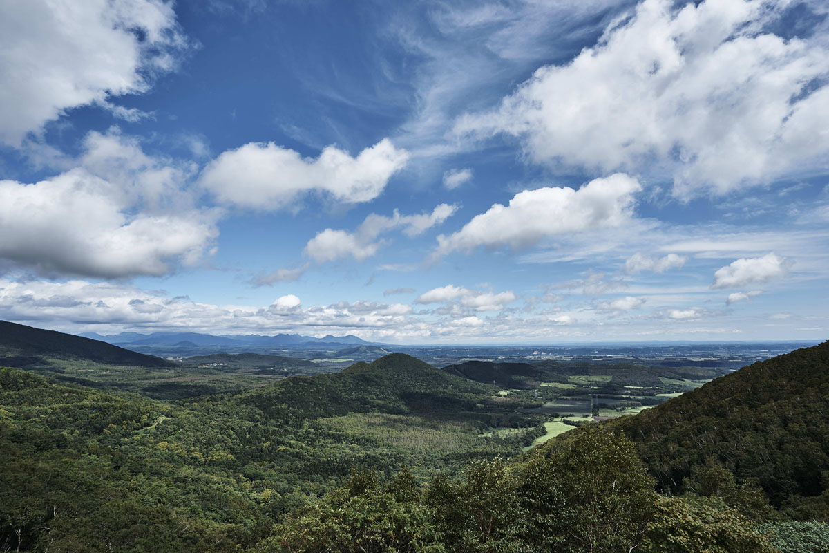
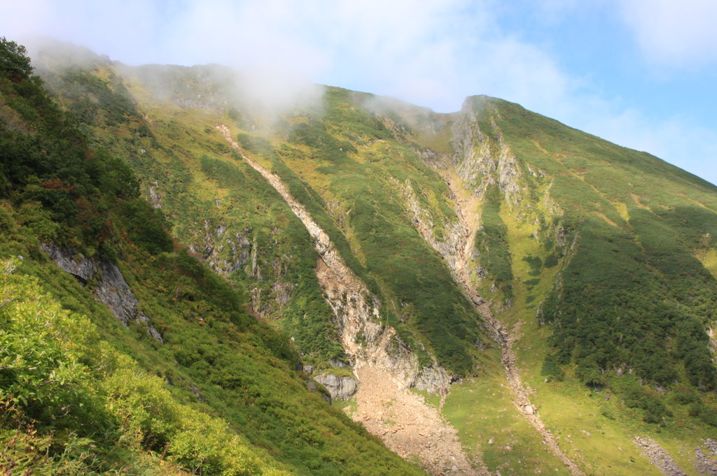
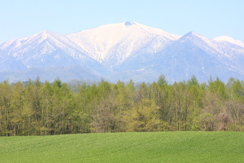
Located in the south-central part of Hokkaido, the Hidaka Mountains are one of the major ranges of the region, also called the “Hokkaido backbone”. They extend for 150km from Karikachi Pass to Cape Erimo and they are characterized by a considerable presence of knife-ridge slopes and precipitous cirques, valleys formed by glacial erosion. The entire range is divided into three sections: northern, central, and southern, all part of the Hidaka-sanmyaku Erimo Quasi-National Park, the largest Quasi-National Park of Japan (those are managed by the prefectures under the supervision of the Ministry of the Environment).
Considering the latitude, alpine plants grow at relatively low altitude, like on Mt. Apoi, famous for the presence of many rare and endemic species.
The geological value of the Hidaka Mountains is the clear distinction between different geological layers that had formed these mountains during the collision process that had brought them to life.
In general, the Hidaka Mountains belongs to the wilder Hokkaido, which is why they are quite isolated and sometimes trails are not even marked. Besides, the access to the trailheads is usually complicated, especially for hikers intending to reach their destination without a car. The overall difficulty level of each trail is rather challenging to such an extent that they are mostly not recommended to beginners.
Major Hiking Areas
According to many Japanese hiking lovers, the most popular peaks of the Hidaka Mountains are the following seven:
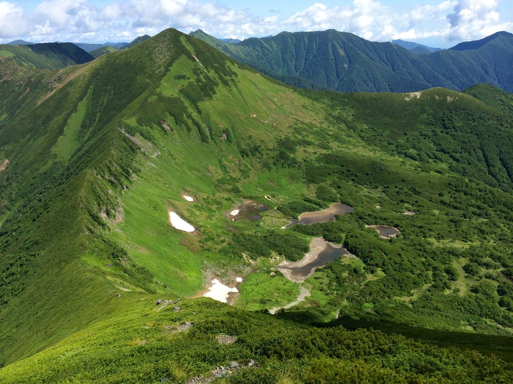
- Mt. Poroshiri (幌尻岳 2,052m) is the top-class of the 100 Famous Japanese Mountains. In the Ainu language, its name means “big mountain” and in ancient times it was respected and revered like a god. It is not only popular for the presence of lush nature and varied fauna, but also for the Nanatsunuma cirque (七つ沼カール): a wide rainwater basin formed after the erosion of a glacier, which is completely covered with flowers in summer. Due to the presence of numerous tricky passages, it is considered one of the most difficult hikes in the country, with the greatest number of obstacles along the way to the summit. The Nukapira river trail is recommended to expert hikers since it is required to wade a river 10 times and the entire trail, in general, is quite steep. Once you have reached the main ridge, you can proceed to Mt. Tottabetsu (1,959m). This trail is usually feasible in two days, spending the night at the Poroshiri hut. Another option is the Niikappu Trail, an 18-km trail running in the forest where it is easy to lose sight of the main path. This trail is feasible in 3 days.
- Mt. Tottabetsu (戸蔦別岳 1,959m) and Mt. Northern-Tottabetsu (北戸蔦別岳 1,912m) are located in the northern Hidaka and are both embracing the Nanatsunuma cirque and the Northern cirque. These peaks are suitable for medium-level hikers. There are two main trails: one traversing the western ridge via Mt. Poroshiri in 7h30m, stopping at Poroshiri hut and the other traversing Mt. Northern-Tottabetsu in 4h30m. It is suitable for expert hikers only.
- Mt. Apoi (アポイ岳809m). Despite its moderate elevation, the mountain is the habitat for over 80 different alpine plants, some of which are endemic species, like Callianthemum miyabeanum(ヒダカソウ), known as Hidaka-so, and the snail called Paraegista apoiensis (イマイマイ). For this reason, it has been designated a UNESCO site. Compared to the other peaks of the range, this one is not only easily accessible but is also a popular destination among beginner hikers. The trail branches off the visitor centre directly inside a forest and it is well-marked. Once you pass the hut, the trail becomes suddenly steep. The peculiar feature of this peak is the alpine vegetation that hikers can spot along the way, whereas the view from the summit is less rewarding if compared to other peaks of the range. Hikers who want to keep the journey longer may proceed to Mt. Yoshida. Remember to take a stroll around Lake Toyoni in Erimo known for its heart-shaped banks. A helicopter sightseeing tour is available for hikers who want to have some adventurous experience.
- Mt. Tsurugi (剣山1,204m) is located in the northern section of the range at the end of the Tokachi plain. It takes its name from the swords protruding from its summit. Also, the word 'Tsurugi' means 'sharp mountain' in the Ainu language. It is a symbol and a holy mountain, connected to different legends of the region. The route from Tokachi Shrine is feasible in a one-day hike and takes 2h30 to reach the top. The route also includes a passage into three different forests. Specifically, it takes 1h to reach the first forest, which is marked by signposts. From that point, the ascent becomes quite difficult for non-athletic people, because there are ladders, ropes, and steep paths to climb.

- Mt. Fushimi (伏見山 1,792m). Being located in the northern section of the range, this peak is particularly difficult to access. At least, thanks to the presence of signing posts along the way, it is easy to understand the route, especially if compared to similar trails on the other peaks of the range. However, hikers must pay attention to bears and to the vegetation that tends to grow thickly. The main feature of this peak is the sea of clouds visible from the summit, among which Mt. Poroshiri, Mt. Kamuiekuuchikaushi and all the major peaks of the range pop out. The Shelter Trail starts in Kamibisei district and proceeds along the Bisei river on a paved road that ends in a forest. The trail is divided into 9 stages and the average round trip takes about 5h30m to be completed.
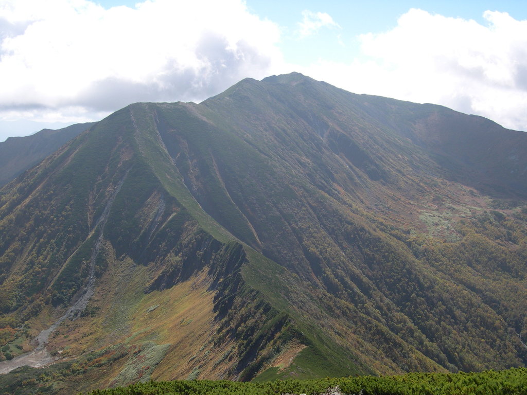
- Mt. Kamuiekuuchikaushi (カムイエクウチカウシ 1,979m) is located in the central Hidaka area. It belongs to the 100 Famous Japanese Mountains and it is the second-highest peak of the range. Its name means "a mountain so steep that even bears fall", which perfectly represents the challenging character of this mountain. Two accidents happened on this peak: an avalanche in 1965 that caused the death of 6 hikers and a deathly brown bear attack in 1970. Despite the danger, people who love geological formations and peculiar landscape may enjoy the view and the exploration of moraines as well as various accumulation zones, like the Hachinosawa cirque (ノ沢カール) in the Tokachi district or the Koiboku cirque (コイボクカール). In the Hidaka range, hikers are likely to find unmarked trails, alternative routes and detours, and boggy ground that make hikers wade through those morasses being knee-deep in bog. However, the view from the summit is stunning, characterized by the presence of vivid-coloured flowers like the Gentiana japonica (Miyamarindo) or the Pedicularis japonica (Yotsubashiogama). It is recommended to plan a 2-day trip here.
- Mt. Petegari (ペテガリ岳1,736m) is located in the central Hidaka, close to Shinhidaka city and Taiki city. It is one of the 100 Famous Japanese Mountains, whose name means “the mountain of the wandering river” in Ainu language due to the presence of the springs of the Petegari River. It is also called a “far away mountain” since a one-way route to reach its peak takes 12h and requires an overnight stay. There are also other trails on both sides of Tokachi district, but the main route follows the western ridge. Proceeding along a path inside the forest and passing by Petegari hut, hikers reach an observatory from where it is possible to enjoy the view of all the area around. It is better to plan 2 overnight stays but, if you want to keep it shorter, you can also plan a one-day trip stopping at Petegari hut(ペテカリ山荘)after 9km, or 4h walking. Also, the extremely difficult ascent and the presence of many perilous passages located inside the grove make this peak accessible only to expert hikers. When the river overflows, the path may become particularly slippery. In general, the natural world on this peak is quite wild, and hikers must be prepared to face bears and ticks (louse flies) as well as other obstacles.
But there are also other fascinating peaks in this range.
- Mt. Tomamu (トマム山1,239m) is popular for the presence of a ski resort extending over two different mountains where enthusiast skiers have a large selection of trails to choose from. Hikers may enjoy it as well, thanks to the presence of groomed trails and a well-maintained terrain. Due to the combination of high atmospheric pressure, wind conditions and temperature changes, Mt. Tomamu is a perfect place to see the Unkai (Sea of Clouds). There is a gondola lift stopping at the Unkai Terrace, a panoramic building that makes visitors enjoy the Unkai from different perspectives. Also, from the Gondola Peak Station, there is a hiking trail that goes straight to the summit in less than 50m, allowing families with children as well as beginner hikers to discover the beauty of the Hidaka Mountains without facing unsurmountable challenges.
- Mt. Sahoro (サホロ岳 1,059m) is located 4km south of Tokachi Pass and north of Karikachi Pass it hosts the Sahoro Ski Resort, which offers a gondola lift and 11 ski runs of different difficulty levels, as well as a cross-country track. Sahoro Hut is located at the summit of Mt. Sahoro and is a bunker-like shelter built to withstand the brutal winter conditions of the Hidaka range and to allow hikers to plan longer hikes on this peak. The route from Karikachi Pass follows the main ridge to the summit and takes about 3.5 hours. Since the ridge route is very exposed, hikers are likely to find prominent cornices and cracks in the snow. This trail is not recommended during strong winds onslaught. An alternative route approaches the summit from the 6th Station on Karikachi Pass.
Mt. Memuro (芽室岳1,753m). From Maruyama Farm on the east side of the Hidaka Mountains, hikers must follow a forest road along the Memuro River and they will find the trailhead. Since the climb is long, it is better to stay at the trailhead the night before the hike at the adjoining campsite or at a small wooden lodge here called Memuro-dake Lodge.
Without water supply along the way and not being the easiest of the hikes, Mt. Memuro still offers a gentle ascent if compared to the ridgeline in the Hidaka Mountains, considering that the Hidaka is usually known as unforgiving peaks. From here, it is also possible to climb up to the Mt. Pankenuushi using a junction located on the main ridgeline. It takes more than 4h to reach the summit.
- Mt. Petegari (ペテガリ岳1,736m) is called “the queen” of the Southern Hidaka. As seen from the east side, its shape is elegant, characterized by the presence of three cirques, whereas from the south side, its majestic shape is considered particularly masculine. One of the first trails dates back to the period before the war. Originally, it took 17h to complete it, but after the war, the trails on this mountain were re-shaped. The most used is a 2h route starting in Shizunai district, but there is also a 5h trail that follows the western ridge and an 11h trail on the eastern ridge via Mt. Ponyaorumappu, but this one is not well-marked.
Major Cities and facilities
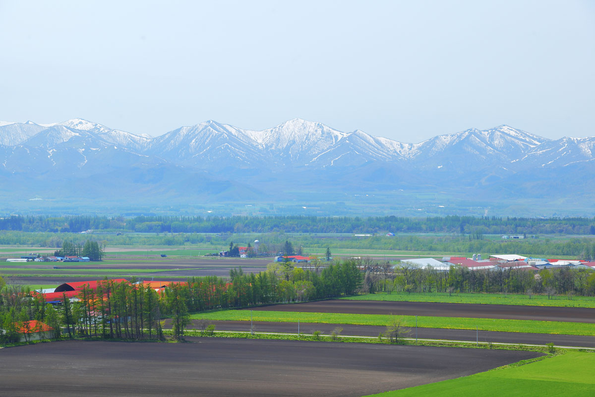
The Hidaka area is quite easy to get to if you start from New Chitose Airport in Sapporo. By bus, rental car or train, it will take about 1h50m to 3h, depending on your destination. Hidaka region is provided with few recently paved roads useful for travellers who are planning to move by bike or MTB. Since Hokkaido is a wild volcanic region, trying a hot spring bath may prove a good decision after your daily hike. For example, Hidaka no Mahoroba onsen in Samani city offers an open-air bath with a panoramic view of Mt. Apoi. But Hidaka is also popular for horse-riding facilities, which offer many different kinds of experiences.
Major Cities
- Shinhidaka is known to be producing 80 percent of race horses in Japan. The town boasts Hokkaido Market, the largest race horse market in Asia, where more than 2,000 race horses are auctioned each year. Apart from horses, there is Mitsuishi Kombu Onsen “Kurazo” in Mitsuishi Seaside Park that boasts of aroma and Jacuzzi baths, and the scenery seen from the open-air bath is spectacular, especially at sunset.
- Shintokucho
- Minamifuranocho
- Taiki
- Hiroo
- Hidaka
- Nibutani
- Biratori
- Samani