Scan the QR code and open PeakVisor on your phone
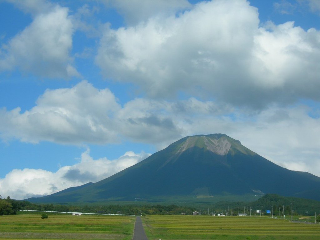
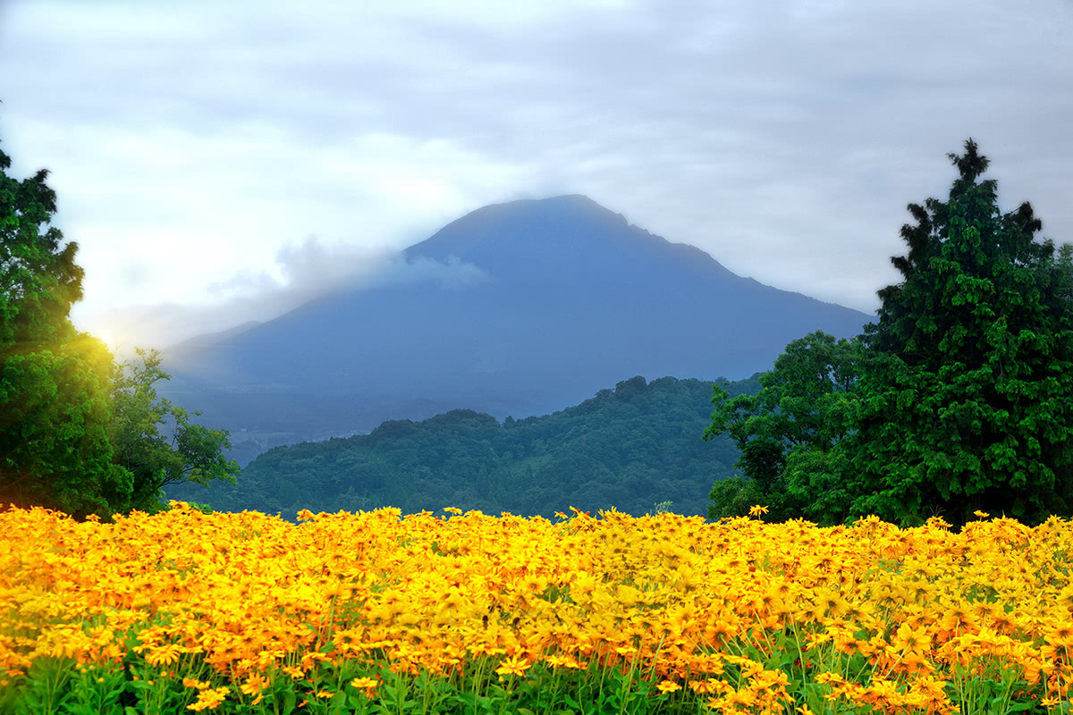
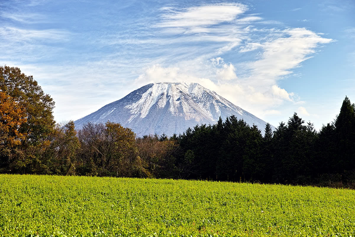
The Chūgoku Mountains consists of 962 named peaks, the highest and the most prominent of which is Kengamine (Mt. Daisen 1,729m).
The name Chūgoku, literally meaning “country in the middle”, must not be confused with the current Japanese word for "China", which is written and pronounced the same way. Despite being sometimes called Chūgoku Sanmyaku (Chūgoku Range), geologically speaking they cannot be considered a proper mountain range, but a mountainous area. The difference lays in the disposition of the mountains, which are not directly connected with one to another. Covering the southern-west part of Honshū Island and including in its territory five prefectures (Hiroshima, Tottori, Okayama, Shimane, Yamaguchi) Chūgoku region is an extraordinary area, both from a historical and naturalistic point of view.
Just to give one example, beside the luxuriant vegetation on Mount Daisen (1,729m), Tottori prefecture can boast of desert landscapes with sand dunes that will make you believe you are somewhere in Egypt and it also has coastal landscapes like those of the Uradome beach, which looks like a tropical paradise.
In addition, a sort of primaeval atmosphere is created thanks to the presence of wild plants and animals, such as foxes (kitsune), wild boars, and Japanese racoon dog(tanuki). These animals are also recurring characters of Japanese folklore, besides the numerous Yōkai (demons, ghosts etc.) that inspired the famous mangaka Mizuki Shigeru, whose hometown was in fact in Tottori Prefecture, where there are also a museum and a walking route dedicated to him.
Luckily or unfortunately, depending on what kind of adventure you are looking for, there are many places out of the ordinary tourism destination circle you may well want to explore.
In general, Chūgoku mountains are not particularly elevated peaks. Another perk of the area is that the majority of the trails are suitable for beginner and intermediate hikers, and the average one-way route doesn’t take more than 4 hours to be completed.
A 1,998-km trail doable in about 100 days. It covers all five prefectures in the region. The majority of the paths are classified as “easy walking” and run along the coast, but there are also mountainous trails, like the one descending from Mt. Daisen to Akamatsuno Pond through a splendid pine forest. The place is also surrounded by an aura of mystery, due to the legend of a feudal lord’s daughter who disappeared in it.
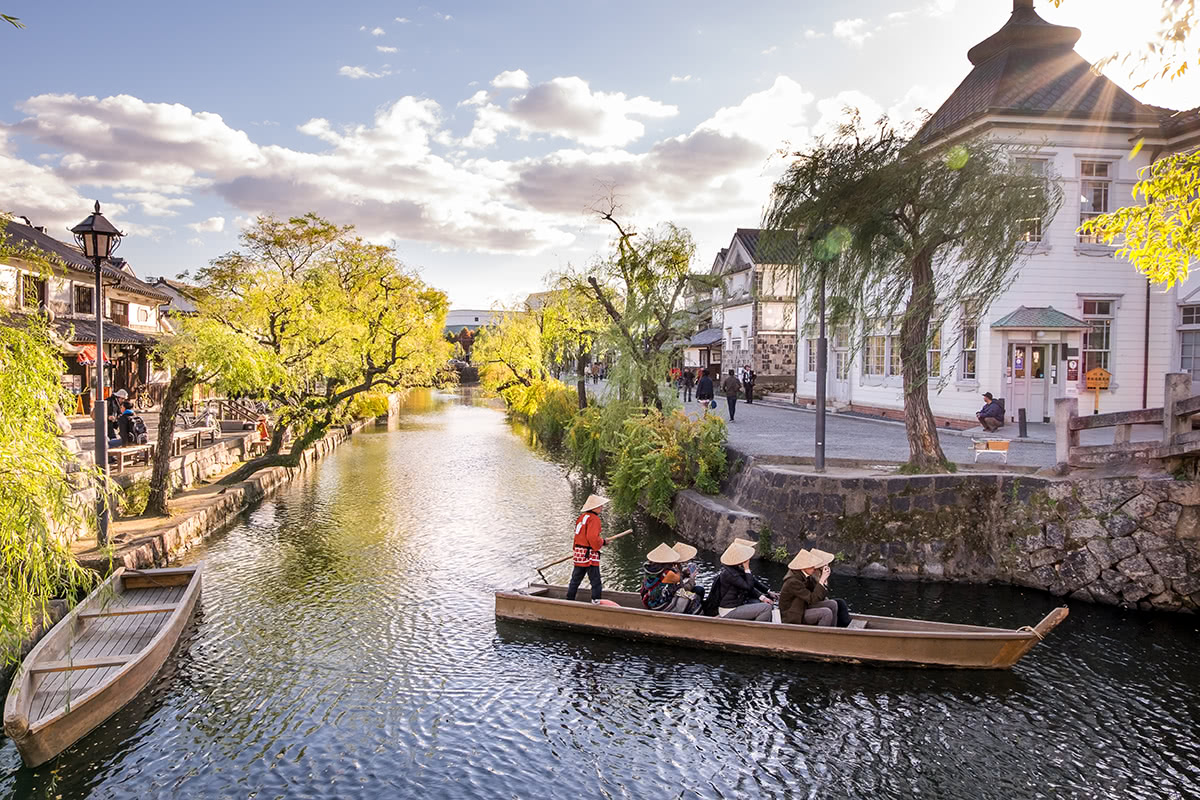
In Okayama prefecture there are 5 routes and 43 trails belonging to this Nature trails, connecting mountains and valleys to the Setouchi Sea. For example, when walking one of the trails around the Setouchi Sea, top in the historical town of Kurashiki, where you can get on a boat and enjoy the ancient town observing it from the river. But other equally interesting options are available as well.
At the heart of Daisen-Oki National Park lies Mount Daisen (1,729m), the highest peak of Chūgoku area and the most important volcano of the Daisen volcanic belt. The main route leading from the information center at the foot of the mountain to a small hut on the mountain top is suitable for beginners and children. Depending on the season, having a walk with snowshoes or skiing are included in the options available. All the routes include a stop at Ogamiyama Shrine, a Shinto shrine set up in the Heian Period (794-1185), part of which is designated as an Important Cultural Property in the designation system of the Japanese Law for the Protection of Cultural Properties.
Chugoku mountains in Okayama are particularly popular in winter. Tsuguro Kogen or Ibuki no Sato are provided with ski runs and mountain lifts, and there are many facilities to enjoy winter sports.
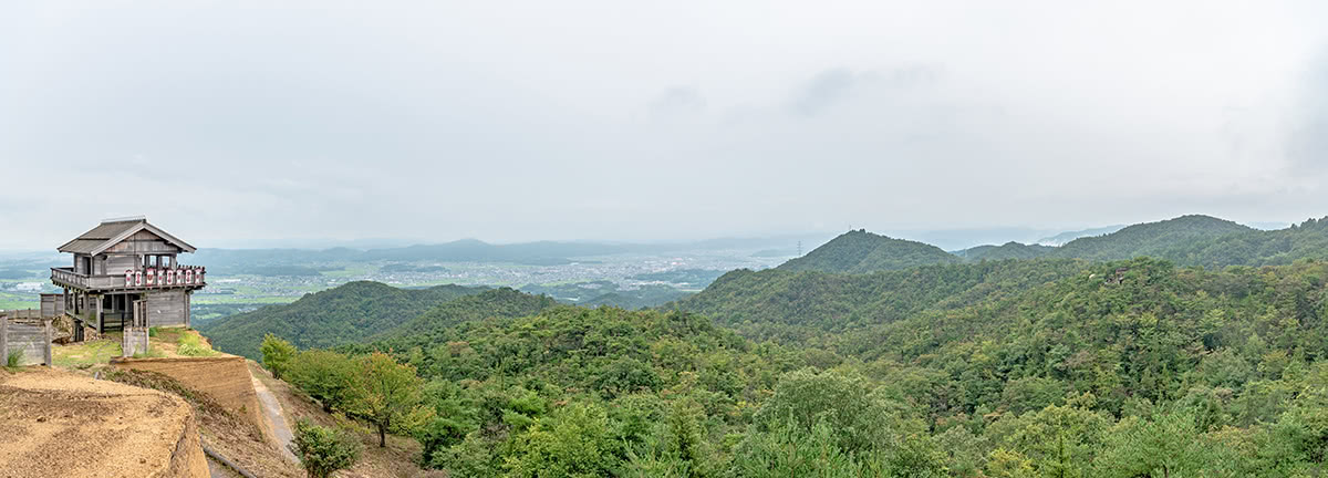
Another significant destination is the Demon’s Castle in Soja City (総社市), which offers a stunning view and Bicchu Matsuyama Castle Observatory in the same area.
Since the 17-km Kibi plain cycle route ends just at Soja Station, you can try some cycling as well while you are there.
Part of the above mentioned Chūgoku Nature Trail includes paths leading to Mount Ushiroyama (1,344m) the top of which can be reached through well-marked trails and it is a privileged spot on the Setouchi Sea.
Easy trails of discrete beauty are easily accessible directly from Yamaguchi City. Chomonkyo is a picturesque gorge in Yamaguchi Prefecture, accessible through an excellent path. It is connected with the Chūgoku Nature Trail.
Hiroshima Prefecture has much more to offer than the sad memory of the atomic bomb. Mount Osorakan is the proof nature is marvelous in this place. There are ski runs as well as snowshoe hiking trails. Besides classic hiking activities, forest therapy is becoming very popular, especially in summer.
There are three main trails feasible in about 2h each, ideal for bird watching and enjoying the wilder Chūgoku nature.
This ravine is located in the northeastern Hiroshima prefecture. Its extraordinary gorges are perfect for canoeing and kayaking.
Start from the natural monument Onbashi, a bridge walking course that takes visitors around the ravine’s famous spots. Take a walking trail that follows the Taishaku River you will reach the northern area of this enormous valley, called Kamitaishaku.
Like Mt. Tsukuba, Mt. Osanbe has both a Male Peak and a Female Peak. It is an active volcano and its environment makes it perfect for peaceful hiking and outdoor activities.
There are six different routes to approach the mountain from different directions. On average, trails are easy and doable in about 3h.
A mountain lift takes you up to the observatory, where you will stand left breathless with the panoramic view. Camping field and facilities of learning include Shimane Nature Museum of Mt. Sanbe.