There are 50 named mountains in Akan Volcanic Complex. The highest and the most prominent mountain is Meakan Dake (雌阿寒岳1,500m).
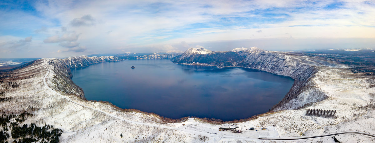
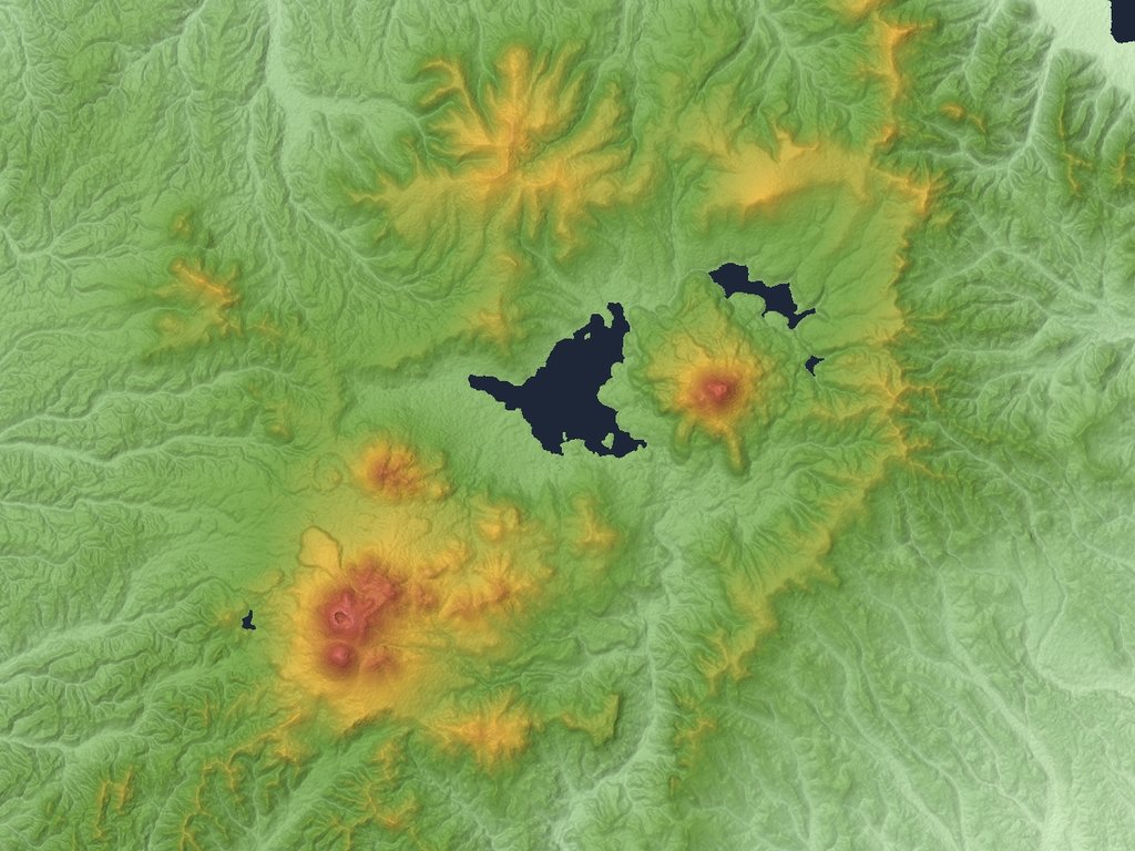
This volcanic complex is one of the most active in the whole country, as well as one of the most interesting from both natural and cultural points of view. It lies in the eastern part of Hokkaido covering all of the Akan National Park. The range consists of three major areas of moderate height, distributed around three volcanic lakes: Lake Akan, Lake Mashū and Lake Kussharo.
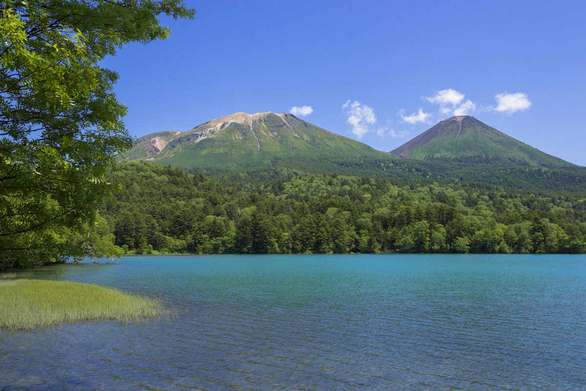
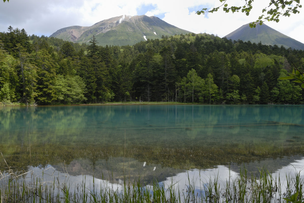
Mt. Meakan or a ‘female peak’, Mt. Oakan ( 雌阿寒岳 1,370m) or a ‘male peak’ and Mt. Akan Fuji (阿寒富士1,475m) originated from the Akan Caldera. They are grouped around Lake Akan and Lake Onnetō, another major water basin of the area. On the opposite side of the park lies Lake Mashū. Around this lake, there is Mt. Mashū ( 摩周岳857m) and Mt. Nishibetsu(西別岳 799m).
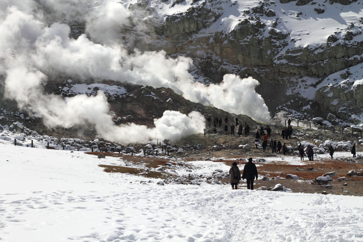
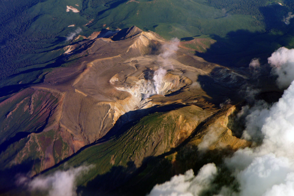
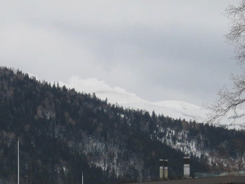
Instead, Mount Iō (硫黄山 508m) lies near Lake Kussharo, also known as Japan's Loch Ness after numerous reported sightings of a mysterious creature called ‘Kusshii’. The beast is estimated to be 10 to 20 m long, of brownish colour, it produces strange grunting noises that make you icky, and it was extensively sighted in the 1970s. No wonder, it might be disgrunted in Lake Kussharo because the lake is not particularly a good habitat for aquatic life. The area is well known for its hot springs and volcanic activity, and volcanic gases bubbling up beneath the surface render the water of the lake highly acidic. In addition, a 1938 eruption in the area created a large amount of sulphur which found its way into the water. The conditions are not ideal for fish. Those that do thrive in the lake are species that are resistant to acidic water conditions, such as the introduced rainbow trout, and most fish in the lake congregate near inflowing streams which dilute the water. This limits the potential food supply and makes conditions difficult for a large animal.

Being characterized by wild, unexplored nature and world heritage sites as well as traces of the ancient past, the Akan Volcanic Complex perfectly matches Hokkaido standards. For example, it includes nine of the 100 Famous Japanese Mountains. Also, due to its volcanic origins, it is possible to spot boiling mud fumaroles and hot water waterfalls. It is one of the few areas in the world where it is possible to find Marimo balls (moss balls), specific algae formations that come in shape of big green balls, mainly growing into lakes. This is the right place to discover Ainu traditions, not only in museums but also in nature, as numerous peaks are known by their Ainu names. For example, Mt. Mashu goes under the name of Kamuinupuri ‘the mountain of the gods’, while Mount Iō is called Atosanupuri, the ‘naked mountain’.
Discovering the ancient toponymy through hiking may be an alternative way to understand the cultural value of this beautiful land.
Major Hiking Areas
- Akan Area hosts a wide variety of trails mainly suitable for beginners. The Meakan Onsen Trail is a 5.8km round trail that starts from the local hot springs and it is feasible in 3h40m. It is the most popular route, since it offers a good compromise between steepness and shortness, traversing both forests and rocky landscapes.
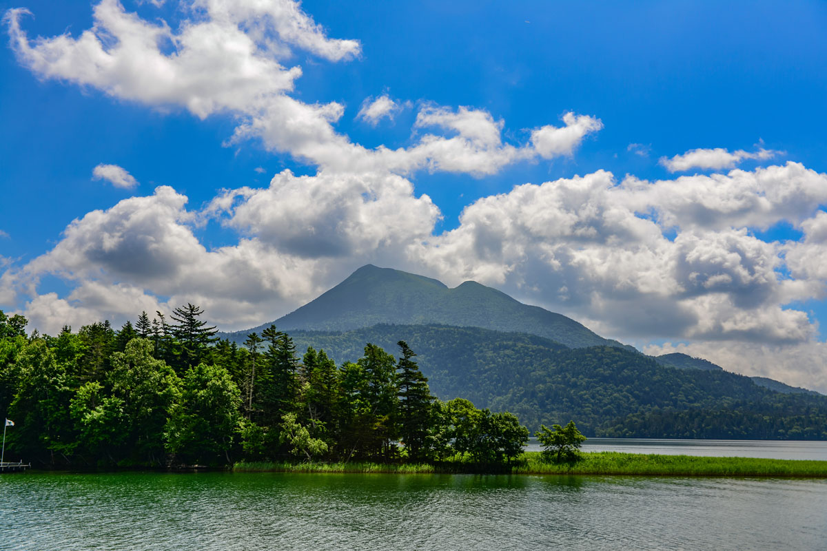
- The Onnetō Trail is an 8km route feasible in 5h, which leads to Mt. Meakan after traversing the junction with Mt. AkanFuji. Lake Onnetō is a dammed lake on the west side of Mt. Meakan that, depending on the weather, location and time of the day, displays a variety of colours, which is the reason why it is known as ‘the five-coloured marsh’. The colour combination also varies seasonally. Visiting the area when the vegetation is deep green in summer and visiting it when red autumn leaves are falling may leave a very different impression on the hikers.
- Despite its 12km length, the Akan Onsen Trail is feasible in only 5h30. This route is longer than the others but runs on a quite gentle slope. It is the right place for beginners to enjoy the peculiar volcanic landscape of the Akan area. Compared to other Hokkaido trails, these trails are well-marked and in general, the peaks located beside Lake Akan are easy to walk. Hikers should check the state of the volcanic activity before planning their hike.
- Among the other destinations of interest, there are Lake Panketou and Lake Penketou, right beside Lake Akan. Located on the south side of Lake Akan, Mt. Hakuto (924m) has a nature trail that runs from the ski slopes of the Akan Lakeside National Ski Area up to the summit observatory from where hikers can fully enjoy the nature of the Akan Volcanic Complex.
- Water Trails – From sightseeing boats to lakeside walking trails, hikers can choose between different hiking combinations to fully enjoy this range, many of which include contact with water. Lake Taro and Lake Jiro are two small lakes located right beside Lake Akan. Following the path that runs along Lake Akan, you will be soon crossing over a concrete dam, then just follow a path that makes its way over to Lake Taro. As for Lake Jiro, it takes 1h from the shore of Lake Akan to walk the 4km-long path. If you add some zest to your hiking experience, choose a cruise on Lake Akan. The route includes a stop at Marimo Exhibition and Observation Center. After finishing the cruise, hikers can make their way along the Bokke Nature Trail, a 45m walk, called so for the presence of bubbling pools of mud with their characteristic smell of sulfur. Alternatively, adventurous hikers might like discovering the Akan area by canoeing on the Kushiro River or the Onnetō Marsh in Nemuro.
- Mt. Iō (硫黄山 508m) - Sitting within the borders of the town of Teshikaga, this mountain is characterized by a reddish-brown surface, which is why its name means 'naked mountain' in Ainu language. It was once the site of sulfur-mining and it boasts over 1,500 volcanic craters with fumaroles and volcanic gases spreading around. Eggs cooked by the natural heat are local delicacies usually sold near the mountain. A few trails reach the peak of Mt. Iō. The longest path is Tsutsujigahara Nature Trail, a 2.5 km well-maintained route passing through low bushes and moving into a forest area in Kawayu Onsen.
- Wakoto Peninsula – Having emerged after the formation of the Kussharo Caldera, Wakoto Peninsula is a volcanic area with high ground temperatures, so that it never freezes in winter. This allows many plants and animals to survive the winter here when other areas cool down. One of these is a species of cicadas, officially designated as a nationally protected species. Beside a campsite, a 1h trail extends for approximately 2.5km around the Wakoto Peninsula, following the shores of Lake Kussharo to Oyakotsu Jigoku where you can spot some intense volcanic activity.
- Mt. Mokoto is located on the external ring of the Kussharo Caldera. Hikers can choose between three major trails.
- Skyline Promenade (Skyline yuhodo) starting in Koshimizu is the 7th stage of the mountain and it is not hard climbing, so many children and adults can climb it. From Lake Kushiro, the trail follows the ridgeline. Pay attention to the rocks on the sheer cliffs, when the weather is bad, they become slippery. The ascent takes about 1h and traverses a tunnel of creeping pines, then pops out in an open space on the left side of Lake Kussharo. In the centre of the lake you can see a refleciton of Mt. Nakajima, a small stratovolcano which releases volcanic gases wich make many lakes in the area acid. Nevertheless, fish live in it.
- Higashi Mokoto Trail is the shortest route. It takes only 30min, so it is perfect for family hikes. Besides Lake Kussharo, you can see the city of Okhotsk in the distance.
- The Long Trail is a medium-length route of 6.5km feasible in 3h that connects three trails: the Dodomatsu Promenade (トドマツ遊歩道), the Observatory Promenade (望岳台遊歩道) and the Ginreisui Promenade (銀嶺水遊歩道).
- Mt. Nishibetsu has a 6km trail from Nishibetsu Cabin leading to the peak, traversing the Gamanzaka ‘Perseverance Slope’, Mt. Nishibetsu’s most difficult stretch and passing on to Mt.Ritsuke. There is also an 11.2km trail leading directly to Lake Mashu.
Major Cities and Facilities
This an unpopulated area. Except for the Lake Akan Hot Spring, a hot spring town in the southern area of Lake Akan, there isn’t any settlement around. On the western end of the town, there is an Ainu village called Ainu Kotan, which is the biggest in Hokkaido. Thanks to the absence of big cities and the predominance of lush nature, the area is particularly suitable for skiing, canoeing, trekking and other outdoor activities and baths in hot springs. Despite being filled with vast and beautiful natural landscapes, with abundant waters nourishing the land, it is neither popular nor crowded as expected. The best way to access the area is from Haneda Airport in Tokyo, getting off at Memanbetsu Airport or Kushiro Airport. Relying on public transport might not be a great idea, renting a car is cheaper and more convenient.
Major Cities
Kushiro is the capital city of Kushiro Subprefecture, as well as the most populous city in eastern Hokkaido. Compared to other well visited cities in Hokkaido like Sapporo, Hakodate and Furano, Kushiro gets considerably fewer visitors and consequently, retains an idyllic and rural atmosphere.
- Akan
- Ashoro
- Teshikaga
- Koshimizu
- Kawakami