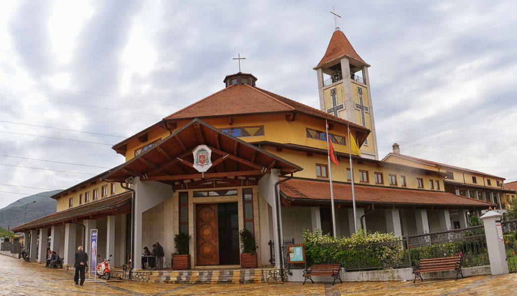
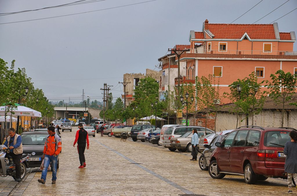
Vau i Dejës (Albanian pronunciation: [ˌvau i ˈdɛjəs]), English: Deja's Ford, is a town and a municipality in Shkodër County, northwestern Albania. It was formed at the 2015 local government reform by the merger of the former municipalities Bushat, Hajmel, Shllak, Temal, Vau i Dejës, and Vig-Mnelë, that became municipal units. The seat of the municipality is the town Vau i Dejës. The total population is 30,438 (2011 census), in a total area of 499.35 km2. The population of the former municipality at the 2011 census was 8,117. Vau i Dejës (or Vau Dejës or Vau-Dejës) also refers to the city center for the municipality, which is sometimes referred to as Laç or Laç-Vau i Dejës. Located in the northern region of Zadrima, Vau i Dejës is intersected by the Drin and Gjadër rivers. It is also strategically about 41 kilometres from the Adriatic Sea. Settlements in the area can be dated back to the 15th century, while the main city of Vau i Dejës was developed to house workers during the construction of the Vau i Dejës hydroelectric dam from 1971- 73. After the completion of the dam, families displaced from the floodwaters began to inhabit the city. Today Vau i Dejës is composed of 8 villages and a city center. The population in 2008 was 12,345. The municipality covers a total of 31 km and is composed of 1 city center and 8 villages. The villages of Vau i Dejës are Mjedë, Spathar, Shelqet, Kacë, Narac, Dush, Gomsiqe and Karmë. It is the seat of the Roman Catholic Diocese of Sapë.
Show more
Sun and Moon
Mon
Tue
Wed
Thu
Fri
Sat
Sun
May 2022
Date and time
00:00
06:00
12:00
18:00
Today
--
--
Sunrise
--
Sunset
--
Moonrise
--
Moonset
Phase
🌔 Waxing Gibbous
The perfect light time for beautiful photos:
--
Sunrise
--
Sunset
PeakVisor app
Get the app on your smartphone
New Panorama Tools
Trace location on the map
Measure distances
All the instruments are available in the context menu as well.
We use GPS information embedded into the photo when it is available.
3D mountains overlay
Adjust mountain panorama to perfectly match your photos because recorded by camera photo position might be imprecise.
Move tool
Rotate tool
Zoom
More customization
Choose which peak labels should make into the final photo and what photo title should be.
Next
Photo Location
Satellitte
Flat map
Relief map
Latitude
Longitude
Altitude
OR
Latitude
°'''
Longitude
°'''
Apply
Register Peak
Peak Name
Latitude
Longitude
Altitude
Register
Teleport
PeakVisor
This 3D model of Sagarmatha National Park in Nepal was made using the PeakVisor app topographic data. The mobile app features higher precision models worldwide, more topographic details, and works offline. Download PeakVisor maps today.
Download OBJ model
PeakVisor
The download should start shortly. If you find it useful please consider supporting the PeakVisor app.
PeakVisor for iOS and Android
Be a superhero of outdoor navigation with state-of-the-art 3D maps and mountain identification in the palm of your hand!


.jpg)