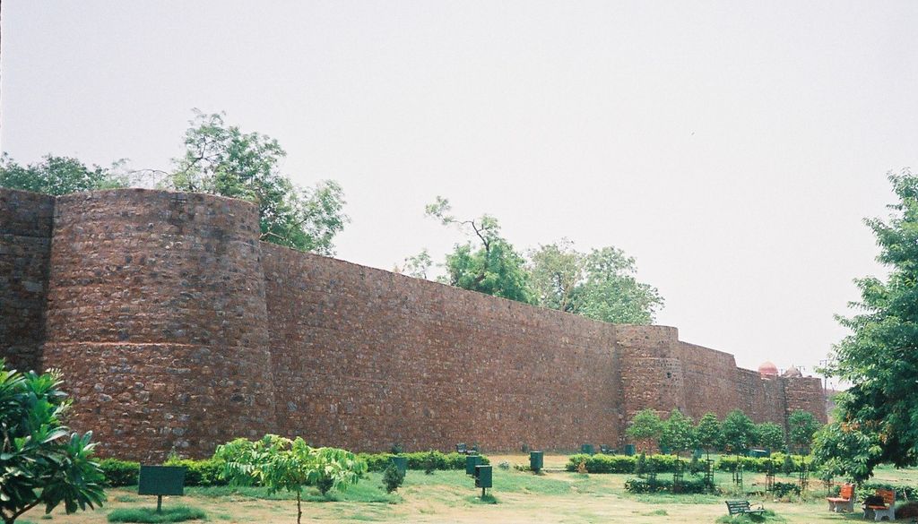
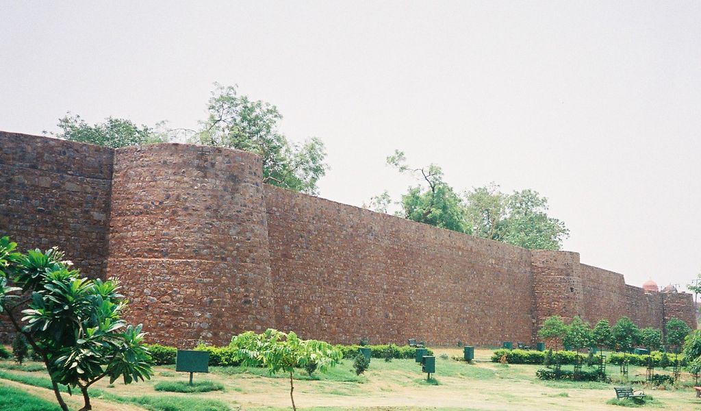
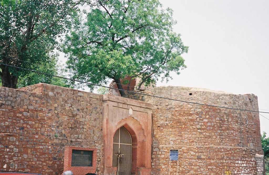
Salimgarh Fort (Salim's Fort) was built in 1546 AD, in Delhi, in a former island of the Yamuna River, by Salim Shah Suri, son of Sher Shah Suri. There was a pause in Mughal rule when in 1540 AD Sher Shah Suri defeated the Mughal emperor Humayun (and ousted him from Delhi) and established the Sur dynasty rule in Delhi. Sur dynasty rule lasted till 1555 AD when Humayun regained his kingdom by defeating Sikander Suri, the last ruler of the dynasty. During the Mughal period, in later years, while building the Red Fort and Shahjahanbad, several Mughal rulers reigned, including Emperor Shahjahan, who is credited with completing Shahjahanabad in 1639 AD had camped at the fort. It is said that Humayun had camped at the fort for three days before launching his successful attack for recapturing Delhi. Aurangzeb, the Mughal emperor, converted the fort into a prison, which practice was perpetuated by the British who took control of the fort in 1857. The fort is part of the Red Fort Complex. The complex was declared as a UNESCO World Heritage Site in 2007, which obligates the Archaeological Survey of India (ASl) to ensure well-planned conservation measures for the heritage monuments.
Show more
Sun and Moon
Mon
Tue
Wed
Thu
Fri
Sat
Sun
May 2022
Date and time
00:00
06:00
12:00
18:00
Today
--
--
Sunrise
--
Sunset
--
Moonrise
--
Moonset
Phase
🌔 Waxing Gibbous
The perfect light time for beautiful photos:
--
Sunrise
--
Sunset
PeakVisor app
Get the app on your smartphone
New Panorama Tools
Trace location on the map
Measure distances
All the instruments are available in the context menu as well.
We use GPS information embedded into the photo when it is available.
3D mountains overlay
Adjust mountain panorama to perfectly match your photos because recorded by camera photo position might be imprecise.
Move tool
Rotate tool
Zoom
More customization
Choose which peak labels should make into the final photo and what photo title should be.
Next
Photo Location
Satellitte
Flat map
Relief map
Latitude
Longitude
Altitude
OR
Latitude
°'''
Longitude
°'''
Apply
Register Peak
Peak Name
Latitude
Longitude
Altitude
Register
Teleport
PeakVisor
This 3D model of Sagarmatha National Park in Nepal was made using the PeakVisor app topographic data. The mobile app features higher precision models worldwide, more topographic details, and works offline. Download PeakVisor maps today.
Download OBJ model
PeakVisor
The download should start shortly. If you find it useful please consider supporting the PeakVisor app.
PeakVisor for iOS and Android
Be a superhero of outdoor navigation with state-of-the-art 3D maps and mountain identification in the palm of your hand!