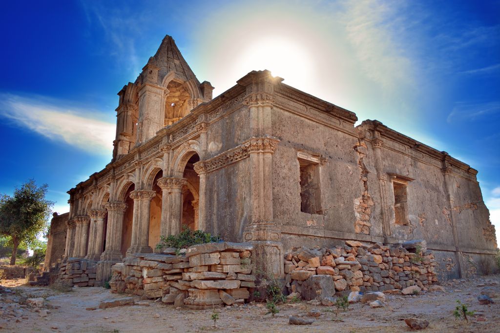
Roha Fort is one of the many forts of Kutch, Gujarat. The fort is located on the periphery of Roha village, in Nakhatrana Taluka of Kutch. It was the seat of Roha Jagir. One hundred twenty Soomra Rajput princesses sought asylum with Abda (Jagirdar of Abdasa) who died in the battle with Allaudin Khilji. Consequently, all the princesses sacrificed their lives and took samadhi here, consequently, the place came to be known as Sumari Roha. Roha Fort is situated about 50 kilometers from Bhuj. It covers almost an area of 16 acres and it is connected by main road. Its height is 500 feet from the ground level and 800 feet from the sea level. Roha was the leading jagir of Kutch which is also known as ‘Roha Sumari Fort’. About 52 villages are under this fort. Sahebji, the brother of Rao Khengarji – I (1510–1585) set up the Roha village and died in the battle with Raysinhji Zala. Two big tanks were made by his successor Jiyaji and a fort was built by his son Thakore Noganji. The famous poet of Gujarat, Kalapi, wrote romantic poems at Roha hill because the atmosphere of Roha was peaceful and close to nature with many peacocks and other birds which can be seen here even now. Roha is now a major tourist attraction of Kutch.
Show more
Sun and Moon
Mon
Tue
Wed
Thu
Fri
Sat
Sun
May 2022
Date and time
00:00
06:00
12:00
18:00
Today
--
--
Sunrise
--
Sunset
--
Moonrise
--
Moonset
Phase
🌔 Waxing Gibbous
The perfect light time for beautiful photos:
--
Sunrise
--
Sunset
PeakVisor app
Get the app on your smartphone
New Panorama Tools
Trace location on the map
Measure distances
All the instruments are available in the context menu as well.
We use GPS information embedded into the photo when it is available.
3D mountains overlay
Adjust mountain panorama to perfectly match your photos because recorded by camera photo position might be imprecise.
Move tool
Rotate tool
Zoom
More customization
Choose which peak labels should make into the final photo and what photo title should be.
Next
Photo Location
Satellitte
Flat map
Relief map
Latitude
Longitude
Altitude
OR
Latitude
°'''
Longitude
°'''
Apply
Register Peak
Peak Name
Latitude
Longitude
Altitude
Register
Teleport
PeakVisor
This 3D model of Sagarmatha National Park in Nepal was made using the PeakVisor app topographic data. The mobile app features higher precision models worldwide, more topographic details, and works offline. Download PeakVisor maps today.
Download OBJ model
PeakVisor
The download should start shortly. If you find it useful please consider supporting the PeakVisor app.
PeakVisor for iOS and Android
Be a superhero of outdoor navigation with state-of-the-art 3D maps and mountain identification in the palm of your hand!