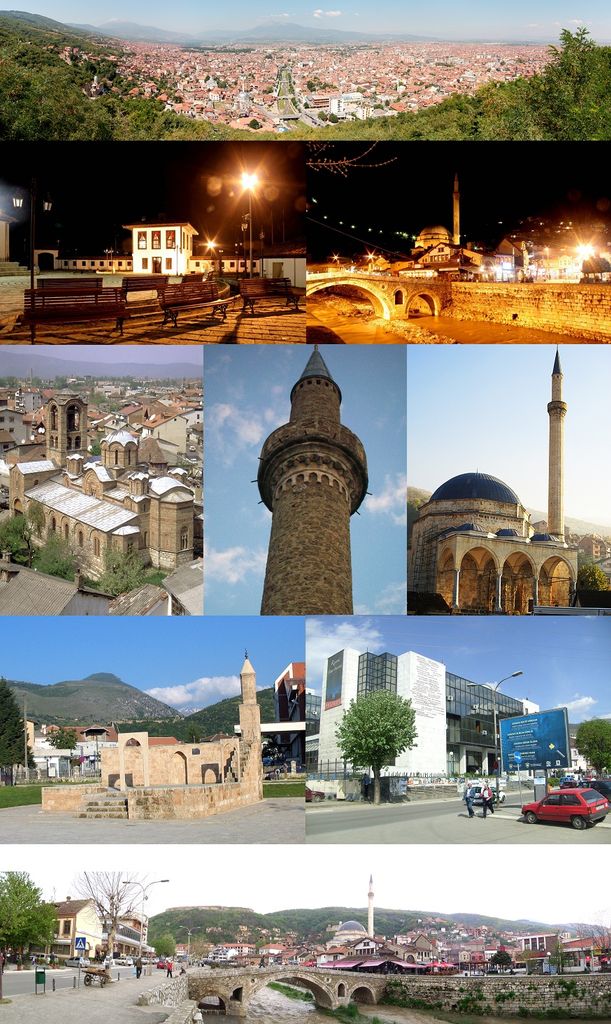
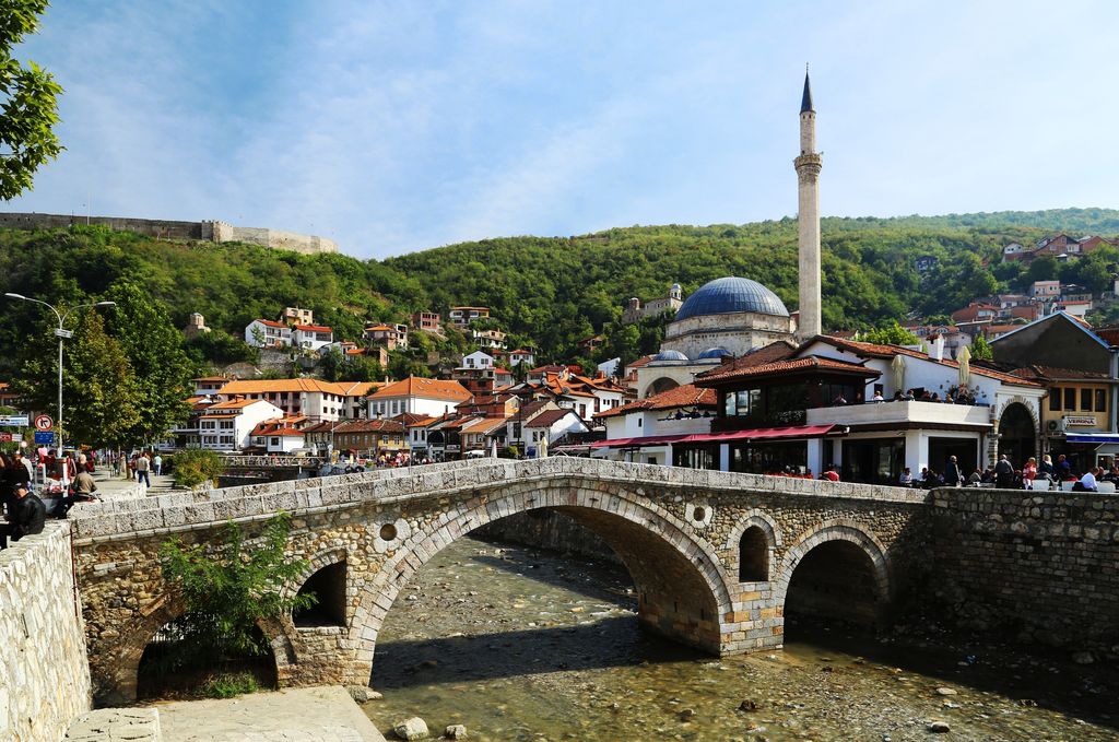
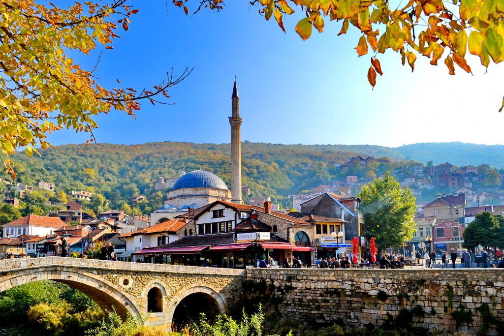
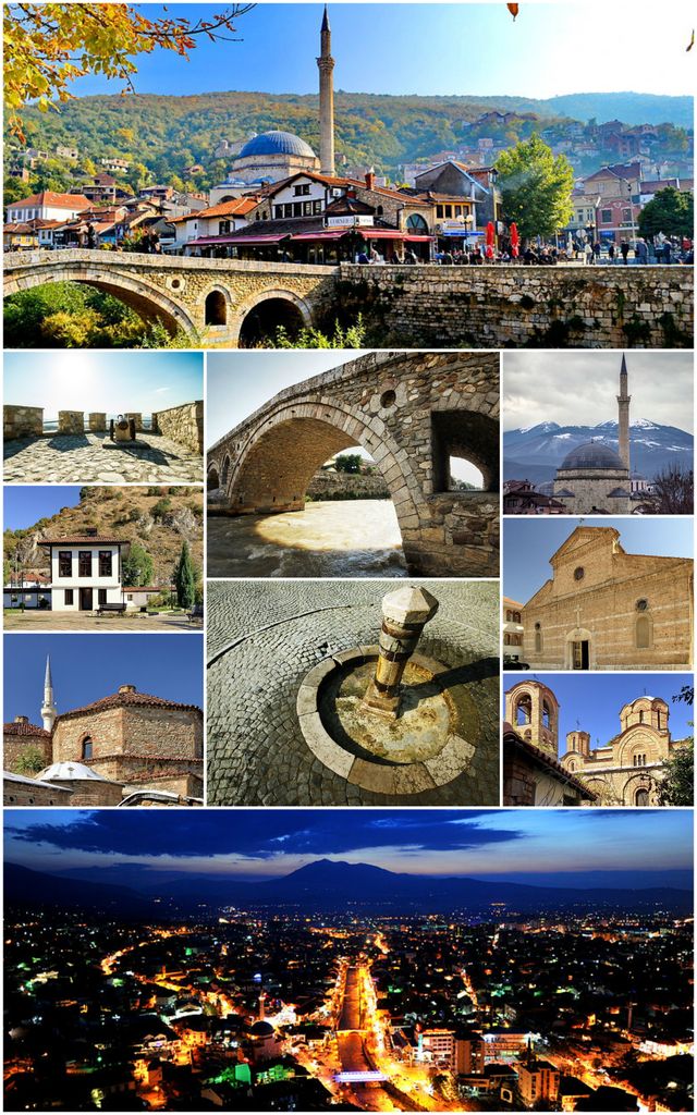
Prizren (Albanian: Prizreni pronounced [priˈzrɛni]; Serbian Cyrillic: Призрен) is the second most populous city and municipality of Kosovo and seat of the eponymous municipality and district. It is located on the banks of the Prizren River between the foothills of the Sharr Mountains in southern Kosovo. Prizren experiences an oceanic climate under the influence of the surrounding mountains. Prizren is constitutionally designated as the historical capital of the country. Archaeological excavations in Prizren Fortress indicate that its fortress area has seen habitation and use since the Bronze Age. Prizren has been traditionally identified with the settlement of Theranda in Roman Dardania, although other locations have been suggested in recent research. In late antiquity it was part of the defensive fortification system in western Dardania and the fort was reconstructed in the era of eastern Roman Emperor Justinian. Byzantine rule in the region ended definitively in 1219-20 as the Serbian Nemanjić dynasty took control of the fort and the town. Prizren served as the capital of the Serbian Empire under the reign of Stefan Dušan, as it bloomed to become an important center of trade and commerce during Dušan's reign. From 1371, a series of regional feudal rulers came to control Prizren, that includes Mrnjavčević, Balšić and the Branković dynasty. Ottomans captured Prizren from Serbian Despotate in 1455 and would almost immediately serve as the capital of Sanjak of Prizren in the Ottoman Empire. While standing as an important administrative city for the Ottomans, Prizren would also become an important political center for Albanians during the late 19th century. Prizren is often recognized for its predominantly Islamic influence, with approximately 96% of the population identifying as Muslim (2011 census). Mosques, such as the Sinan Pasha Mosque, are a dominant feature in the town.
Show more
Sun and Moon
Mon
Tue
Wed
Thu
Fri
Sat
Sun
May 2022
Date and time
00:00
06:00
12:00
18:00
Today
--
--
Sunrise
--
Sunset
--
Moonrise
--
Moonset
Phase
🌔 Waxing Gibbous
The perfect light time for beautiful photos:
--
Sunrise
--
Sunset
PeakVisor app
Get the app on your smartphone
New Panorama Tools
Trace location on the map
Measure distances
All the instruments are available in the context menu as well.
We use GPS information embedded into the photo when it is available.
3D mountains overlay
Adjust mountain panorama to perfectly match your photos because recorded by camera photo position might be imprecise.
Move tool
Rotate tool
Zoom
More customization
Choose which peak labels should make into the final photo and what photo title should be.
Next
Photo Location
Satellitte
Flat map
Relief map
Latitude
Longitude
Altitude
OR
Latitude
°'''
Longitude
°'''
Apply
Register Peak
Peak Name
Latitude
Longitude
Altitude
Register
Teleport
PeakVisor
This 3D model of Sagarmatha National Park in Nepal was made using the PeakVisor app topographic data. The mobile app features higher precision models worldwide, more topographic details, and works offline. Download PeakVisor maps today.
Download OBJ model
PeakVisor
The download should start shortly. If you find it useful please consider supporting the PeakVisor app.
PeakVisor for iOS and Android
Be a superhero of outdoor navigation with state-of-the-art 3D maps and mountain identification in the palm of your hand!