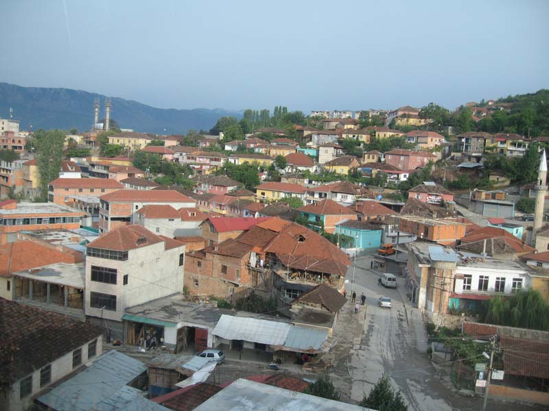
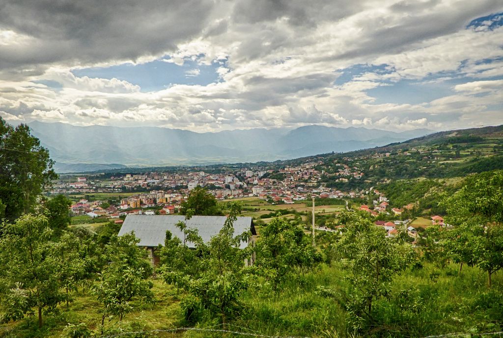
Peshkopi (Albanian definite form: Peshkopia, Latin: Penestae) is a town located in the mountainous regions of northeastern Albania, in Dibër County. It is the capital of both the county (Albanian: qark) and the district (Albanian: rreth) of Dibër, and is the only county regional capital in Albania which does not share its name with its county. The population at the 2011 census was 13,251. Peshkopi lies east of the Black Drin river, about 187 kilometres (116 mi) northeast of Tirana, the capital of Albania, and 20 kilometres (12 mi) from the Macedonian border. The town sits 651 metres (2,136 ft) above sea level. Known for its thermal waters, year-round agriculture, and natural beauty, Peshkopi is also developing a reputation as tourism destination for outdoor activities such as hiking, camping, mountain biking, and rock climbing. The third tallest mountain in the Balkans, Mount Korabi, and the birthplace of Albania's national hero, Gjerg Kastrioti, are nearby heritages sites. The district also contains large mineral ore deposits such as chromium, sulfur, and marble. It is also an important industrial center in Albania, producing many agricultural products for Albania.
Show more
Sun and Moon
Mon
Tue
Wed
Thu
Fri
Sat
Sun
May 2022
Date and time
00:00
06:00
12:00
18:00
Today
--
--
Sunrise
--
Sunset
--
Moonrise
--
Moonset
Phase
🌔 Waxing Gibbous
The perfect light time for beautiful photos:
--
Sunrise
--
Sunset
PeakVisor app
Get the app on your smartphone
New Panorama Tools
Trace location on the map
Measure distances
All the instruments are available in the context menu as well.
We use GPS information embedded into the photo when it is available.
3D mountains overlay
Adjust mountain panorama to perfectly match your photos because recorded by camera photo position might be imprecise.
Move tool
Rotate tool
Zoom
More customization
Choose which peak labels should make into the final photo and what photo title should be.
Next
Photo Location
Satellitte
Flat map
Relief map
Latitude
Longitude
Altitude
OR
Latitude
°'''
Longitude
°'''
Apply
Register Peak
Peak Name
Latitude
Longitude
Altitude
Register
Teleport
PeakVisor
This 3D model of Sagarmatha National Park in Nepal was made using the PeakVisor app topographic data. The mobile app features higher precision models worldwide, more topographic details, and works offline. Download PeakVisor maps today.
Download OBJ model
PeakVisor
The download should start shortly. If you find it useful please consider supporting the PeakVisor app.
PeakVisor for iOS and Android
Be a superhero of outdoor navigation with state-of-the-art 3D maps and mountain identification in the palm of your hand!