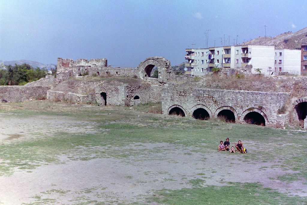
The Peqin Castle (Albanian: Kalaja e Peqinit) is a castle in Peqin, Albania. In the Roman times the city was known by the name of Claudiana, an Illyrian-inhabited territory. The foundations of the castle are thought to date from the Roman period, the time of the construction of the Via Egnatia. Its walls at one point had a height of around 12 metres (39 ft). The castle was later rebuilt and expanded during the Turkish occupation of Albania, at which time it was passed into the control of the Sipahi (lord) of the local fief, who added a palace and a harem. The last resident of the castle was Demir Pasha. The 17th-century historian Evliya Çelebi mentioned the fortress in his writings: ...the walls of this castle reach about 12 m in height. Within resides the dizdar, along with 70 soldiers. There are five cannons in the castle, and ten small houses roofed with tiles. There is also a small mosque with no minaret. On the left side of the castle, connected to a wall, is a prayer chapel (namazgja)... The castle was equipped with tunnels which served as exits several km away from the city in difficult times. Similarly, clay pipes have been found in the walls of the castle, which archaeologists believe is an indication that water was supplied from outside the castle during wartime.
Show more
Sun and Moon
Mon
Tue
Wed
Thu
Fri
Sat
Sun
May 2022
Date and time
00:00
06:00
12:00
18:00
Today
--
--
Sunrise
--
Sunset
--
Moonrise
--
Moonset
Phase
🌔 Waxing Gibbous
The perfect light time for beautiful photos:
--
Sunrise
--
Sunset
PeakVisor app
Get the app on your smartphone
New Panorama Tools
Trace location on the map
Measure distances
All the instruments are available in the context menu as well.
We use GPS information embedded into the photo when it is available.
3D mountains overlay
Adjust mountain panorama to perfectly match your photos because recorded by camera photo position might be imprecise.
Move tool
Rotate tool
Zoom
More customization
Choose which peak labels should make into the final photo and what photo title should be.
Next
Photo Location
Satellitte
Flat map
Relief map
Latitude
Longitude
Altitude
OR
Latitude
°'''
Longitude
°'''
Apply
Register Peak
Peak Name
Latitude
Longitude
Altitude
Register
Teleport
PeakVisor
This 3D model of Sagarmatha National Park in Nepal was made using the PeakVisor app topographic data. The mobile app features higher precision models worldwide, more topographic details, and works offline. Download PeakVisor maps today.
Download OBJ model
PeakVisor
The download should start shortly. If you find it useful please consider supporting the PeakVisor app.
PeakVisor for iOS and Android
Be a superhero of outdoor navigation with state-of-the-art 3D maps and mountain identification in the palm of your hand!