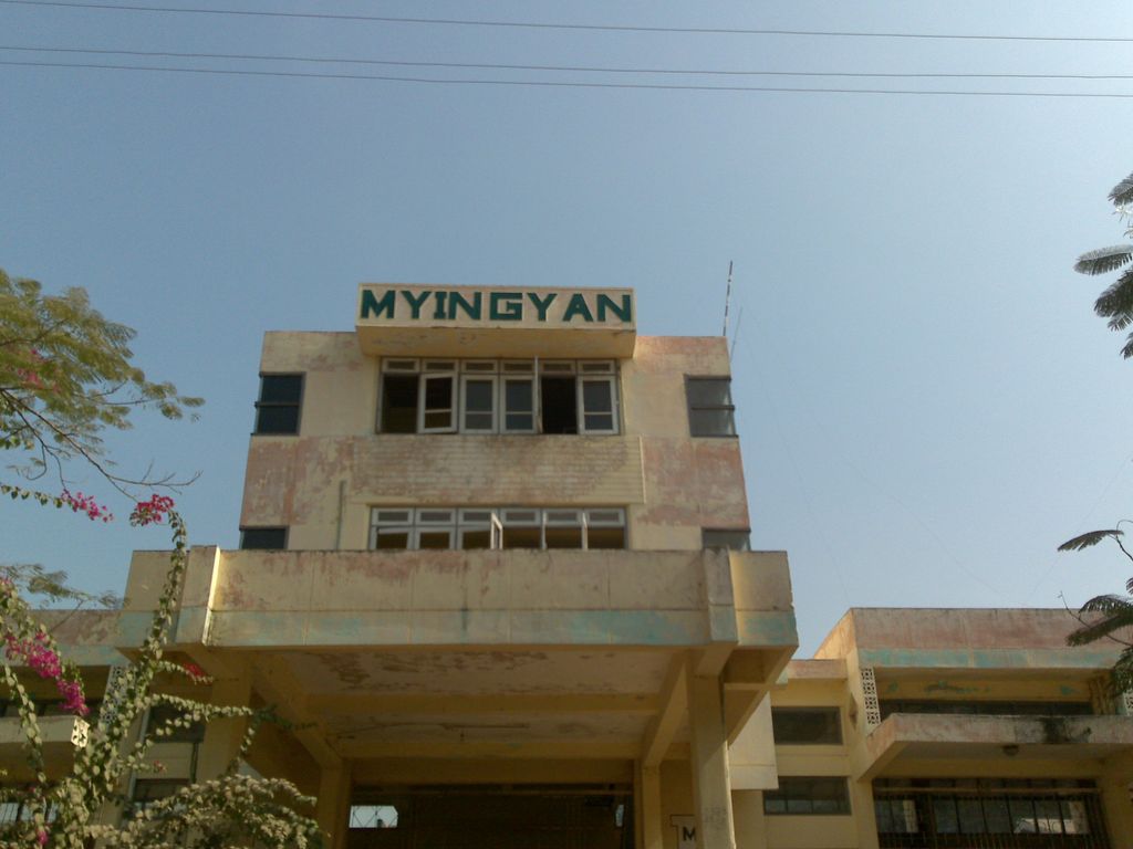
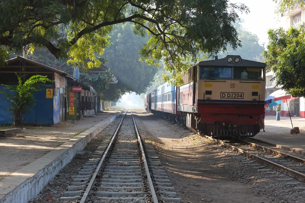
Myingyan (Burmese: မြင်းခြံ; MLCTS: mrang:hkram, [mjɪ́ɰ̃d͡ʑàɰ̃]) is a city and district in the Mandalay Division of central Myanmar, previously, it was a district in the Meiktila Division of Upper Burma. It is currently the capital of Myingyan Township and lies along the National Highway 2. As of 2014, the city had a population of 276,096 and the district had 1,055,957. It lies in the valley of the Ayeyarwady River, to the south of Mandalay, on the east bank of the river. The area around the city is flat, especially to the north and along the banks of the Ayeyarwady. Inland the country rises in gently undulating slopes. The most noticeable feature is Popa Hill, an extinct volcano, to the south-east. The highest peak is 4,962 feet (1,512 m). above sea-level. The climate is dry, with high south winds from March until September. The annual rainfall averages about 35 inches (890 mm). The temperature varies between 70 and 106 °F (21 and 41 °C). The ordinary crops are millet, sesame, cotton, maize, rice and a great variety of peas and beans. There are no forests, but a great deal of low scrubland. Myingyan is the head of the branch railway to Thazi and the main line between Yangon and Mandalay. Myingyan Prison in Myingyan District was known as the most infamous detention center among Burma's political prisoners for its atrocities from early 1990s' to October 1999 when the International Committee for Red Cross (ICRC) was granted an access to the prison.
Show more
Sun and Moon
Mon
Tue
Wed
Thu
Fri
Sat
Sun
May 2022
Date and time
00:00
06:00
12:00
18:00
Today
--
--
Sunrise
--
Sunset
--
Moonrise
--
Moonset
Phase
🌔 Waxing Gibbous
The perfect light time for beautiful photos:
--
Sunrise
--
Sunset
PeakVisor app
Get the app on your smartphone
New Panorama Tools
Trace location on the map
Measure distances
All the instruments are available in the context menu as well.
We use GPS information embedded into the photo when it is available.
3D mountains overlay
Adjust mountain panorama to perfectly match your photos because recorded by camera photo position might be imprecise.
Move tool
Rotate tool
Zoom
More customization
Choose which peak labels should make into the final photo and what photo title should be.
Next
Photo Location
Satellitte
Flat map
Relief map
Latitude
Longitude
Altitude
OR
Latitude
°'''
Longitude
°'''
Apply
Register Peak
Peak Name
Latitude
Longitude
Altitude
Register
Teleport
PeakVisor
This 3D model of Sagarmatha National Park in Nepal was made using the PeakVisor app topographic data. The mobile app features higher precision models worldwide, more topographic details, and works offline. Download PeakVisor maps today.
Download OBJ model
PeakVisor
The download should start shortly. If you find it useful please consider supporting the PeakVisor app.
PeakVisor for iOS and Android
Be a superhero of outdoor navigation with state-of-the-art 3D maps and mountain identification in the palm of your hand!