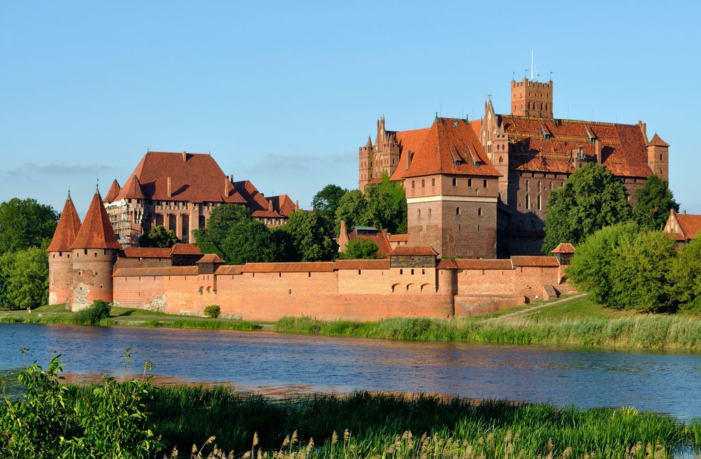
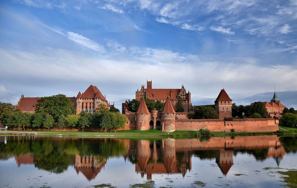
The Castle of the Teutonic Order in Malbork, commonly known as Malbork Castle (Polish: Zamek w Malborku; German: Ordensburg Marienburg), is a 13th-century castle complex located in the town of Malbork, Poland. It is the largest castle in the world measured by land area and a UNESCO World Heritage Site. It was constructed by the Teutonic Order, a German Catholic religious order of crusaders, in the form of an Ordensburg fortress and named Marienburg in honour of Mary, mother of Jesus. In 1457, during the Thirteen Years' War, the castle was sold by Bohemian mercenaries to King Casimir IV of Poland in lieu of indemnities. It then served as one of several Polish royal residences and the seat of Polish offices and institutions, interrupted by several years of Swedish occupation, fulfilling this function until the First Partition of Poland in 1772. From then on, the castle was under German rule for over 170 years until 1945, albeit largely falling into disrepair as military technological advances rendered the castle a mere historical point of interest. The construction period is a point of debate, but most historians generally accept the 132 years between 1274 and 1406 as the construction time. The castle is a classic example of a medieval fortress and, upon its completion in 1406, was the world's largest brick castle. UNESCO designated the "Castle of the Teutonic Order in Malbork" and the Malbork Castle Museum a World Heritage Site in December 1997. It is one of two World Heritage Sites in the region (north-central Poland), together with the "Medieval Town of Toruń", which was founded in 1231. Malbork Castle is also one of Poland's official national Historic Monuments (Pomnik historii), as designated on 8 September 1994. Its listing is maintained by the National Heritage Board of Poland.
Show more
Sun and Moon
Mon
Tue
Wed
Thu
Fri
Sat
Sun
May 2022
Date and time
00:00
06:00
12:00
18:00
Today
--
--
Sunrise
--
Sunset
--
Moonrise
--
Moonset
Phase
🌔 Waxing Gibbous
The perfect light time for beautiful photos:
--
Sunrise
--
Sunset
PeakVisor app
Get the app on your smartphone
New Panorama Tools
Trace location on the map
Measure distances
All the instruments are available in the context menu as well.
We use GPS information embedded into the photo when it is available.
3D mountains overlay
Adjust mountain panorama to perfectly match your photos because recorded by camera photo position might be imprecise.
Move tool
Rotate tool
Zoom
More customization
Choose which peak labels should make into the final photo and what photo title should be.
Next
Photo Location
Satellitte
Flat map
Relief map
Latitude
Longitude
Altitude
OR
Latitude
°'''
Longitude
°'''
Apply
Register Peak
Peak Name
Latitude
Longitude
Altitude
Register
Teleport
PeakVisor
This 3D model of Sagarmatha National Park in Nepal was made using the PeakVisor app topographic data. The mobile app features higher precision models worldwide, more topographic details, and works offline. Download PeakVisor maps today.
Download OBJ model
PeakVisor
The download should start shortly. If you find it useful please consider supporting the PeakVisor app.
PeakVisor for iOS and Android
Be a superhero of outdoor navigation with state-of-the-art 3D maps and mountain identification in the palm of your hand!


.jpg)


