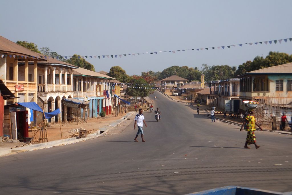
Magburaka is the capital and largest city of Tonkolili District in the Northern Province of Sierra Leone. Its population was 16,313 in the 2004 census. and a current estimate of 40,313. It is located at around 8°43′1″N 11°56′36″W, along the Rokel River. Magburaka lies just about 26 miles (42 km) drive south-west of Makeni, the economic center of Northern Sierra Leone and about 80 miles (135 km) drive east of the country's capital Freetown. Magburaka is a trade center and is one of the main cities in Northern Sierra Leone. As with most parts of Sierra Leone, the Krio language of the Sierra Leone Creole people is the most widely spoken language in Magburaka. Magburaka is an educational center and is home to the Magburaka Government Secondary School for Boys, the first western standard Secondary school built in the Northern Sierra Leone. The school is one of the elite secondary schools in Sierra Leone and is well known for producing some of the most gifted students in the country. Sierra Leone's former president Ernest Bai Koroma is a graduate of the Government Secondary School for Boys. The city is home to the Magburaka Technical Institute, a two-year technical college and a university which is known as Ernest Bai Koroma University of Science and Technology. The Golden Dragon F.C., which is based in Magburaka, represent the city in the Sierra Leone National Premier League, the top football league in the country.
Show more
Sun and Moon
Mon
Tue
Wed
Thu
Fri
Sat
Sun
May 2022
Date and time
00:00
06:00
12:00
18:00
Today
--
--
Sunrise
--
Sunset
--
Moonrise
--
Moonset
Phase
🌔 Waxing Gibbous
The perfect light time for beautiful photos:
--
Sunrise
--
Sunset
PeakVisor app
Get the app on your smartphone
New Panorama Tools
Trace location on the map
Measure distances
All the instruments are available in the context menu as well.
We use GPS information embedded into the photo when it is available.
3D mountains overlay
Adjust mountain panorama to perfectly match your photos because recorded by camera photo position might be imprecise.
Move tool
Rotate tool
Zoom
More customization
Choose which peak labels should make into the final photo and what photo title should be.
Next
Photo Location
Satellitte
Flat map
Relief map
Latitude
Longitude
Altitude
OR
Latitude
°'''
Longitude
°'''
Apply
Register Peak
Peak Name
Latitude
Longitude
Altitude
Register
Teleport
PeakVisor
This 3D model of Sagarmatha National Park in Nepal was made using the PeakVisor app topographic data. The mobile app features higher precision models worldwide, more topographic details, and works offline. Download PeakVisor maps today.
Download OBJ model
PeakVisor
The download should start shortly. If you find it useful please consider supporting the PeakVisor app.
PeakVisor for iOS and Android
Be a superhero of outdoor navigation with state-of-the-art 3D maps and mountain identification in the palm of your hand!