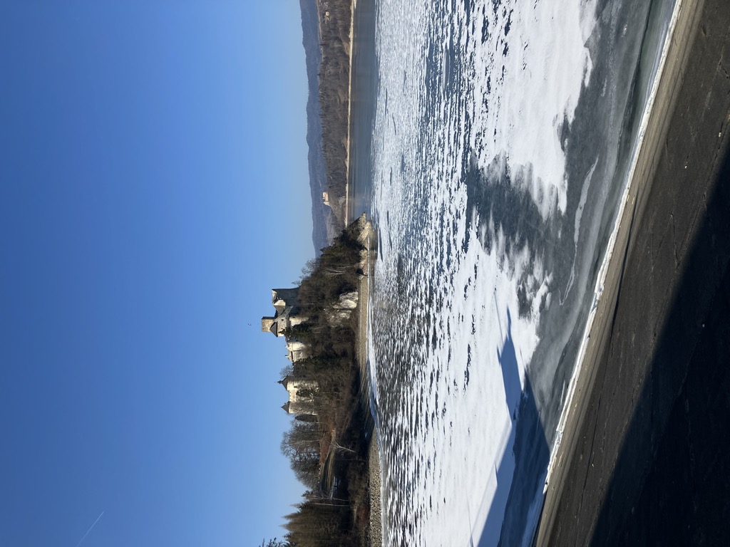
Lake Czorsztyn (Polish: Jezioro Czorsztyńskie) is a man-made reservoir on the Dunajec river, southern Poland, between the Pieniny and the Gorce Mountains. It exists due to a dam in the village of Niedzica. The dam itself was completed in 1995. Its measurements are: 56 metres (184 ft) high, 400 metres (1,300 ft) long and 7 metres (23 ft) wide on top. The lake has the area ranging from 4.15 square kilometres (1.60 sq mi) to 13.35 square kilometres (5.15 sq mi). Usually, its area is approximately 11 square kilometres (4.2 sq mi), with the length of 9 kilometres (5.6 mi) and width of 1.5 kilometres (0.93 mi). Maximum depth is 50 metres (160 ft), and average depth is 17.6 metres (58 ft). Total length of the shoreline is 29.7 kilometres (18.5 mi). Below the dam there is a much smaller Sromowce Lake, which regulates the water level of Czorsztyn Lake. Main purpose of the reservoir is to prevent floods in the Dunajec river valley. Furthermore, it attracts a growing number of tourists. The dam is equipped with a 92 megawatt power plant. The lake is located in close proximity of several popular tourist spots, such as Pieniny National Park, Niedzica Castle, Czorsztyn Castle, and the tourist village of Kluszkowce. Among villages located by Czorsztyn Lake are Niedzica, Falsztyn, Frydman, Dębno Podhalańskie, Maniowy, Kluszkowce and Czorsztyn.
We use GPS information embedded into the photo when it is available.
3D mountains overlay
Adjust mountain panorama to perfectly match your photos because recorded by camera photo position might be imprecise.
Move tool
Rotate tool
Zoom
More customization
Choose which peak labels should make into the final photo and what photo title should be.
Next
Photo Location
Satellitte
Flat map
Relief map
Latitude
Longitude
Altitude
OR
Latitude
°'''
Longitude
°'''
Apply
Register Peak
Peak Name
Latitude
Longitude
Altitude
Register
Teleport
PeakVisor
This 3D model of Sagarmatha National Park in Nepal was made using the PeakVisor app topographic data. The mobile app features higher precision models worldwide, more topographic details, and works offline. Download PeakVisor maps today.
Download OBJ model
PeakVisor
The download should start shortly. If you find it useful please consider supporting the PeakVisor app.
PeakVisor for iOS and Android
Be a superhero of outdoor navigation with state-of-the-art 3D maps and mountain identification in the palm of your hand!