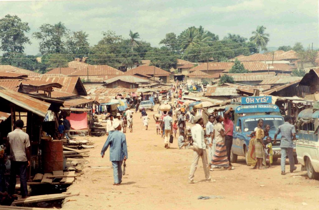
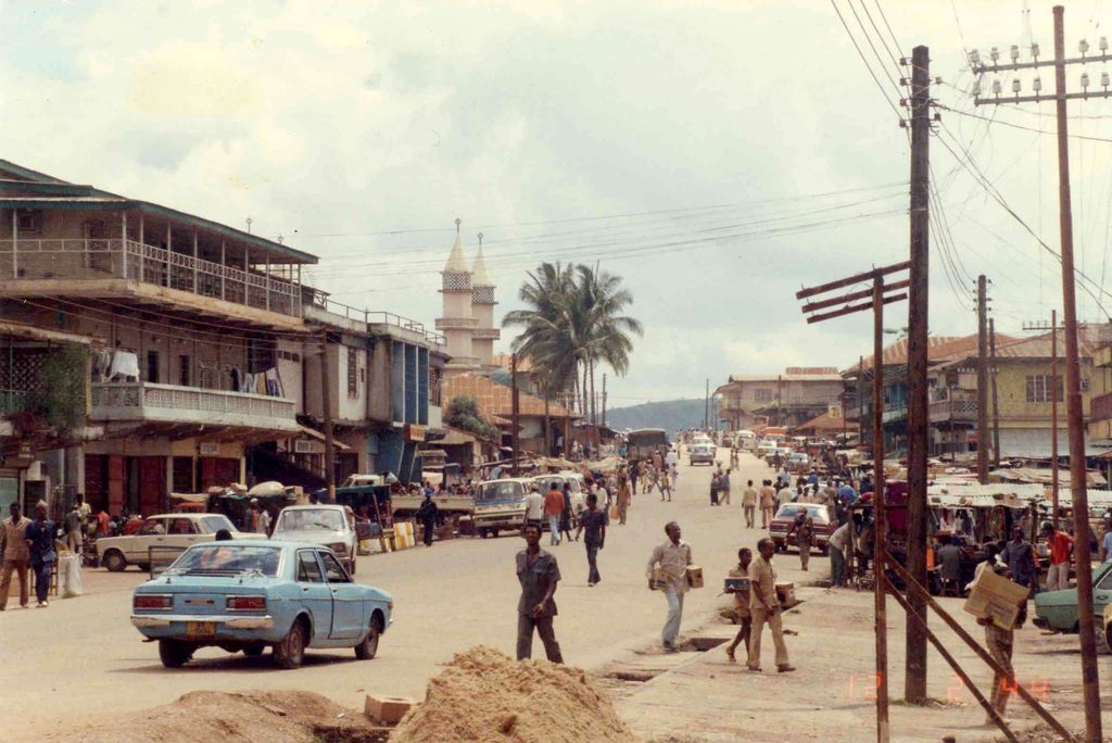
Koidu Town (or Sefadu; officially known as Koidu City) is the capital and largest city of the Kono District in the Eastern Province of Sierra Leone. Its population is 128,030 based on the 2015 census. It is the fifth largest city in Sierra Leone by population, after Freetown, Kenema, Bo and Makeni. It lies approximately 280 miles east of Freetown, and about 60 miles north of Kenema. Koidu Town is a major urban, business, commercial and diamond trade center. Two of the world's ten largest and most famous rough diamonds were found in the Woyie River that flows through Koidu Town. The mayor of Koidu City and members of the Koidu-New Sembehun city council are directly elected every four years. The current mayor of Koidu Town is Komba Sam of the Coalition 4 Change political party. Koidu is not a stronghold of any political party; the city is home to large support of both the Sierra Leone People's Party and the All People's Congress. Koidu is one of the most ethnically and religiously diverse cities in Sierra Leone. The city is inhabited by many ethnic groups, with no ethnic group forming a majority. The Krio language is by far the most widely spoken language in Koidu Town and is the primary language of communication in the city. Sierra Leone's vice president Mohamed Juldeh Jalloh, Sierra Leone's First Lady Fatima Bio and Sierra Leone's former vice president Samuel Sam-Sumana were born and raised in the city.
Show more
Sun and Moon
Mon
Tue
Wed
Thu
Fri
Sat
Sun
May 2022
Date and time
00:00
06:00
12:00
18:00
Today
--
--
Sunrise
--
Sunset
--
Moonrise
--
Moonset
Phase
🌔 Waxing Gibbous
The perfect light time for beautiful photos:
--
Sunrise
--
Sunset
PeakVisor app
Get the app on your smartphone
New Panorama Tools
Trace location on the map
Measure distances
All the instruments are available in the context menu as well.
We use GPS information embedded into the photo when it is available.
3D mountains overlay
Adjust mountain panorama to perfectly match your photos because recorded by camera photo position might be imprecise.
Move tool
Rotate tool
Zoom
More customization
Choose which peak labels should make into the final photo and what photo title should be.
Next
Photo Location
Satellitte
Flat map
Relief map
Latitude
Longitude
Altitude
OR
Latitude
°'''
Longitude
°'''
Apply
Register Peak
Peak Name
Latitude
Longitude
Altitude
Register
Teleport
PeakVisor
This 3D model of Sagarmatha National Park in Nepal was made using the PeakVisor app topographic data. The mobile app features higher precision models worldwide, more topographic details, and works offline. Download PeakVisor maps today.
Download OBJ model
PeakVisor
The download should start shortly. If you find it useful please consider supporting the PeakVisor app.
PeakVisor for iOS and Android
Be a superhero of outdoor navigation with state-of-the-art 3D maps and mountain identification in the palm of your hand!