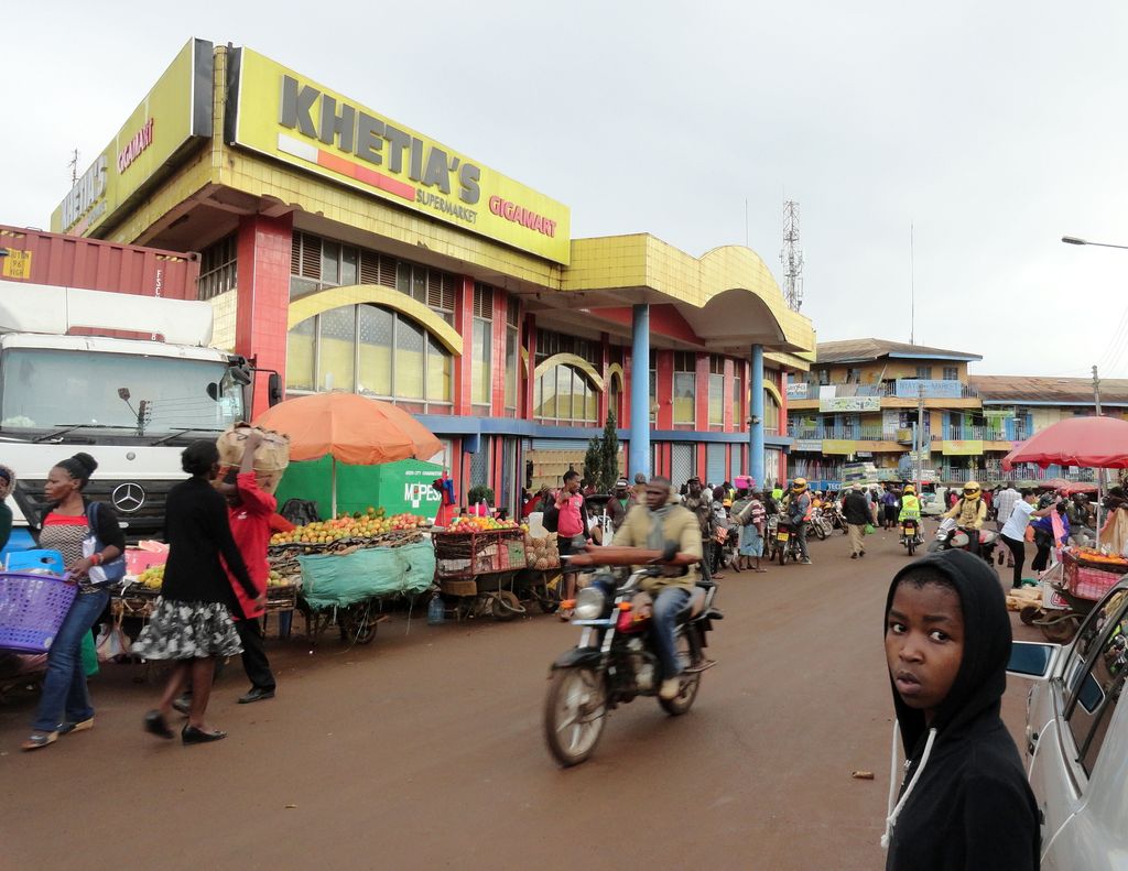
Kitale is a town in the north west of Kenya, in the old Rift Valley province. It situated between Mount Elgon and the Cherangany Hills.The town has an elevation of around 1,900 metres (6,200 ft) Its population was 162,174 as of 2019. Kitale town is the headquarter of the Trans-Nzoia County, which is also sometimes generally referred to by the name of the town. Kitale is reachable by air through Kitale Airport. The postal code for Kitale is 30200. The National Museum of Western Kenya is located at Kitale. It is a natural history museum and was originally created by Lt Col. Hugh Stoneham in 1926. Just next to the museum there is a demonstration farm with agroforestry practices run by a Swedish non-governmental organisation called Vi Agroforestry.
We use GPS information embedded into the photo when it is available.
3D mountains overlay
Adjust mountain panorama to perfectly match your photos because recorded by camera photo position might be imprecise.
Move tool
Rotate tool
Zoom
More customization
Choose which peak labels should make into the final photo and what photo title should be.
Next
Photo Location
Satellitte
Flat map
Relief map
Latitude
Longitude
Altitude
OR
Latitude
°'''
Longitude
°'''
Apply
Register Peak
Peak Name
Latitude
Longitude
Altitude
Register
Teleport
PeakVisor
This 3D model of Sagarmatha National Park in Nepal was made using the PeakVisor app topographic data. The mobile app features higher precision models worldwide, more topographic details, and works offline. Download PeakVisor maps today.
Download OBJ model
PeakVisor
The download should start shortly. If you find it useful please consider supporting the PeakVisor app.
PeakVisor for iOS and Android
Be a superhero of outdoor navigation with state-of-the-art 3D maps and mountain identification in the palm of your hand!