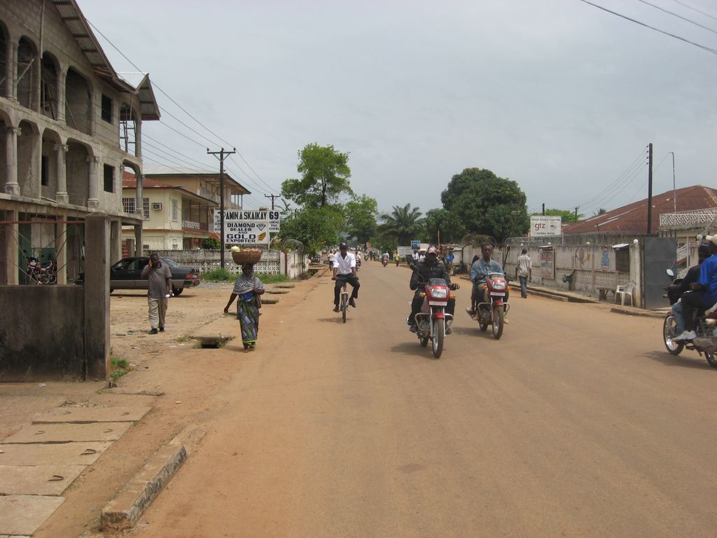
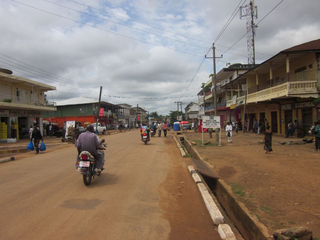
Based on the 2021 national mid-term census, Kenema has a population of 255,110. making it the second most populous city in Sierra Leone after Freetown, and the largest city in the country's Eastern Province. Kenema City servers as capital of Kenema District and is a major economic hub in the Eastern Province. Kenema is located approximately 200 miles from Freetown, and 60 kilometres (40 mi) south of Bo. Kenema is one of Sierra Leone's most ethnically diverse cities. Like most parts of Sierra Leone, the Krio language of the Sierra Leone Creole people is by far the most widely spoken language in Kenema. Kenema is governed by a directly elected city council, headed by a mayor in whom executive authority is vested, and who is responsible for the city's general management. The mayor and council members are elected every four years. Kenema's current mayor is Thomas Karimu Baio of the Sierra Leone People's Party[2]. Karimu Baio was elected mayor with 79.4% of the vote in the 2018 Kenema Mayoral election [3]. Kenema is an overwhelming political stronghold of the Sierra Leone People's Party, the current national ruling party in Sierra Leone. As in the rest of Sierra Leone, football is by far the city's most popular sport. The Kamboi Eagles, a professional football club based in Kenema, represents the city in the Sierra Leone National Premier League. Kenema is known as the hometown of some of Sierra Leone's greatest international soccer stars, including the country's most widely known athlete, retired soccer star Mohamed Kallon. Other notable Sierra Leonean international footballers from Kenema include the country's current top striker, Kei Kamara, and retired soccer stars Paul Kpaka, Kemokai Kallon and Musa Kallon. Kenema's growth was originally promoted by the logging and carpentry industries, which were linked to the city by the now-closed railway. Since then, its economy has benefited from the diamond mines first discovered in the area in 1931.
Show more
Sun and Moon
Mon
Tue
Wed
Thu
Fri
Sat
Sun
May 2022
Date and time
00:00
06:00
12:00
18:00
Today
--
--
Sunrise
--
Sunset
--
Moonrise
--
Moonset
Phase
🌔 Waxing Gibbous
The perfect light time for beautiful photos:
--
Sunrise
--
Sunset
PeakVisor app
Get the app on your smartphone
New Panorama Tools
Trace location on the map
Measure distances
All the instruments are available in the context menu as well.
We use GPS information embedded into the photo when it is available.
3D mountains overlay
Adjust mountain panorama to perfectly match your photos because recorded by camera photo position might be imprecise.
Move tool
Rotate tool
Zoom
More customization
Choose which peak labels should make into the final photo and what photo title should be.
Next
Photo Location
Satellitte
Flat map
Relief map
Latitude
Longitude
Altitude
OR
Latitude
°'''
Longitude
°'''
Apply
Register Peak
Peak Name
Latitude
Longitude
Altitude
Register
Teleport
PeakVisor
This 3D model of Sagarmatha National Park in Nepal was made using the PeakVisor app topographic data. The mobile app features higher precision models worldwide, more topographic details, and works offline. Download PeakVisor maps today.
Download OBJ model
PeakVisor
The download should start shortly. If you find it useful please consider supporting the PeakVisor app.
PeakVisor for iOS and Android
Be a superhero of outdoor navigation with state-of-the-art 3D maps and mountain identification in the palm of your hand!