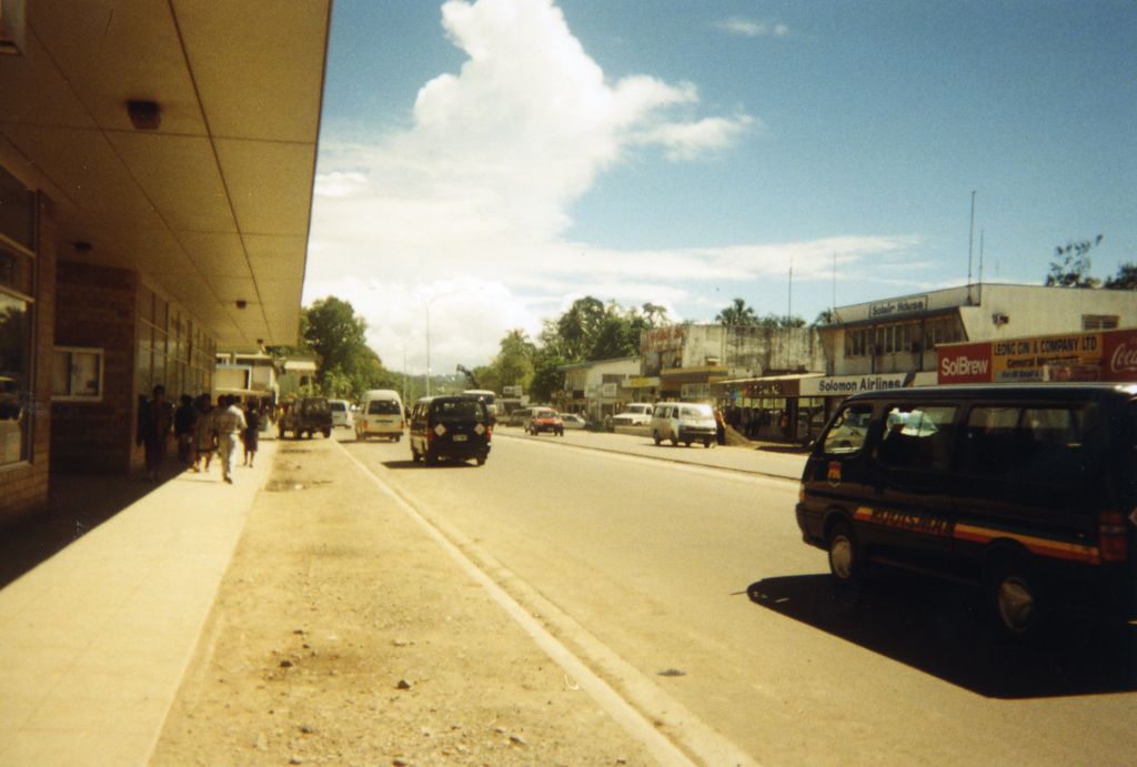
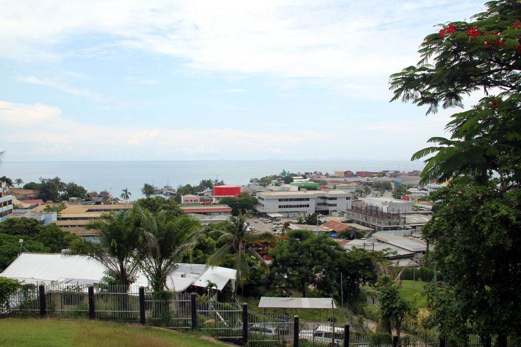
Honiara () is the capital and largest city of Solomon Islands, situated on the northwestern coast of Guadalcanal. As of 2021, it had a population of 92,344 people. The city is served by Honiara International Airport and the seaport of Point Cruz, and lies along the Kukum Highway. In 1983, a Capital Territory – comprising the 22 square-kilometre metropolitan area of Honiara – was proclaimed, with a self-governing status akin to a province, although the city also retained an older role as capital of Guadalcanal Province. The airport area to the east of Honiara was the site of a battle between the United States and the Japanese during the Guadalcanal Campaign in World War II, the Battle of Henderson Field of 1942, from which the former emerged victorious. After Honiara became the new administrative centre of the British Solomon Islands Protectorate in 1952 with the addition of many administrative buildings, the town began to develop and grow in population. Since the late 1990s, Honiara has suffered a turbulent history of ethnic violence and political unrest and is scarred by rioting. A coup attempt in June 2000 resulted in violent rebellions and fighting between the ethnic Malaitans of the Malaita Eagle Force (MEF) and the Guadalcanal natives of the Isatabu Freedom Movement (IFM). Although a peace agreement was made in October 2000, violence ensued in the city streets in March 2002 when two diplomats from New Zealand and several others were murdered. In July 2003, conditions had become so bad in Honiara that the Regional Assistance Mission to Solomon Islands (RAMSI), consisting of multiple Pacific nations under Australian leadership, was invited into the country by the Solomons Government to restore order. In 2006, riots broke out following the election of Snyder Rini as Prime Minister, destroying a part of Chinatown and making more than 1,000 Chinese residents homeless. The riots devastated the town and tourism in the city and the islands was severely affected. Honiara contains the majority of the major government buildings and institutions of Solomon Islands. The National Parliament of Solomon Islands, Honiara Solomon Islands College of Higher Education, International School in Honiara and University of the South Pacific Solomon Islands are located in Honiara as is the national museum and Honiara Market. Politically Honiara is divided into three parliamentary constituencies, electing 3 of the 50 members of the National Parliament. These constituencies, East Honiara, Central Honiara and West Honiara, are three of only six constituencies in the country to have an electorate of over 10,000 people. Honiara is predominantly Christian and is served by the headquarters of the Church of the Province of Melanesia (Anglican), the Roman Catholic Archdiocese of Honiara, the South Seas Evangelical Church, the United Church, the Seventh-day Adventist Church and other Christian churches.
Show more
Sun and Moon
Mon
Tue
Wed
Thu
Fri
Sat
Sun
May 2022
Date and time
00:00
06:00
12:00
18:00
Today
--
--
Sunrise
--
Sunset
--
Moonrise
--
Moonset
Phase
🌔 Waxing Gibbous
The perfect light time for beautiful photos:
--
Sunrise
--
Sunset
PeakVisor app
Get the app on your smartphone
New Panorama Tools
Trace location on the map
Measure distances
All the instruments are available in the context menu as well.
We use GPS information embedded into the photo when it is available.
3D mountains overlay
Adjust mountain panorama to perfectly match your photos because recorded by camera photo position might be imprecise.
Move tool
Rotate tool
Zoom
More customization
Choose which peak labels should make into the final photo and what photo title should be.
Next
Photo Location
Satellitte
Flat map
Relief map
Latitude
Longitude
Altitude
OR
Latitude
°'''
Longitude
°'''
Apply
Register Peak
Peak Name
Latitude
Longitude
Altitude
Register
Teleport
PeakVisor
This 3D model of Sagarmatha National Park in Nepal was made using the PeakVisor app topographic data. The mobile app features higher precision models worldwide, more topographic details, and works offline. Download PeakVisor maps today.
Download OBJ model
PeakVisor
The download should start shortly. If you find it useful please consider supporting the PeakVisor app.
PeakVisor for iOS and Android
Be a superhero of outdoor navigation with state-of-the-art 3D maps and mountain identification in the palm of your hand!