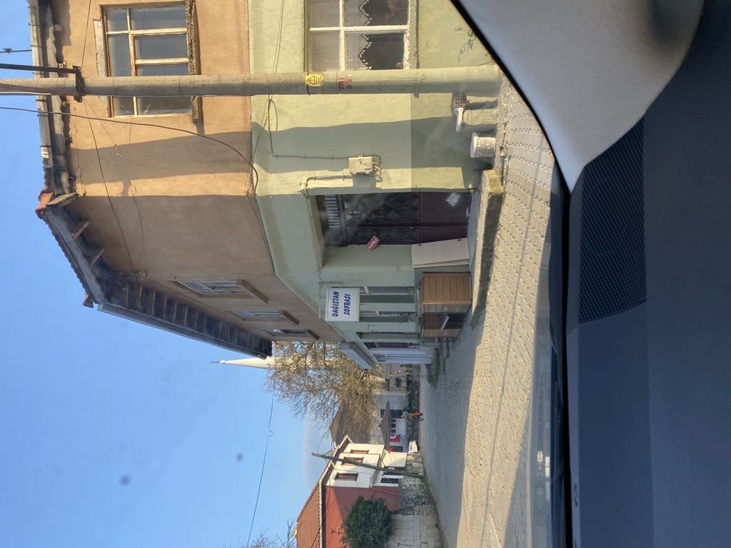
Güneyköy is a village in the Yalova District of the Yalova Province in Turkey. Its population is 505 (2022). The village was founded in 1896 by immigrants from Dagestan. The first official name of the village was given as Almali or Elmaalani in 1899, as mentioned in the archives of the prime minister. While the name Almali was used, the name was changed to Reşadiye in 1910 after Sultan Mehmed V Reshad visited the village, was pleased by it, and had a memorial fountain built there. In 1934, it was named Güneyköy because of its location on the southernmost shore of Istanbul's borders. The village has three mosques, two official schools and a medrese. In 1919, it was invaded by the Greek Army during the Turkish War of Independence, and its inhabitants migrated to the Geyve and Adapazarı regions for three years. Only a portion of this population was able to return after the war. Sheikh Şerafeddin Dağıstanî and Abu Muhammad al-Madani of the Naqshbandi-Haqqani Golden Chain are buried up in the cemetery of the village.
Show more
Sun and Moon
Mon
Tue
Wed
Thu
Fri
Sat
Sun
May 2022
Date and time
00:00
06:00
12:00
18:00
Today
--
--
Sunrise
--
Sunset
--
Moonrise
--
Moonset
Phase
🌔 Waxing Gibbous
The perfect light time for beautiful photos:
--
Sunrise
--
Sunset
PeakVisor app
Get the app on your smartphone
New Panorama Tools
Trace location on the map
Measure distances
All the instruments are available in the context menu as well.
We use GPS information embedded into the photo when it is available.
3D mountains overlay
Adjust mountain panorama to perfectly match your photos because recorded by camera photo position might be imprecise.
Move tool
Rotate tool
Zoom
More customization
Choose which peak labels should make into the final photo and what photo title should be.
Next
Photo Location
Satellitte
Flat map
Relief map
Latitude
Longitude
Altitude
OR
Latitude
°'''
Longitude
°'''
Apply
Register Peak
Peak Name
Latitude
Longitude
Altitude
Register
Teleport
PeakVisor
This 3D model of Sagarmatha National Park in Nepal was made using the PeakVisor app topographic data. The mobile app features higher precision models worldwide, more topographic details, and works offline. Download PeakVisor maps today.
Download OBJ model
PeakVisor
The download should start shortly. If you find it useful please consider supporting the PeakVisor app.
PeakVisor for iOS and Android
Be a superhero of outdoor navigation with state-of-the-art 3D maps and mountain identification in the palm of your hand!