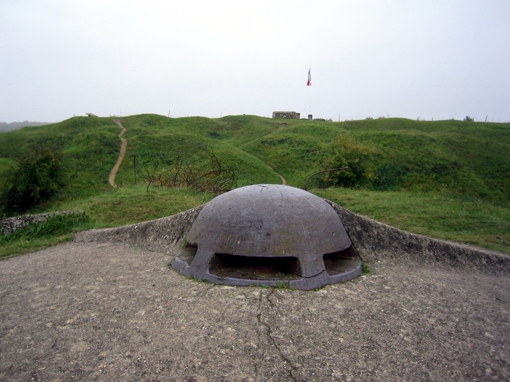
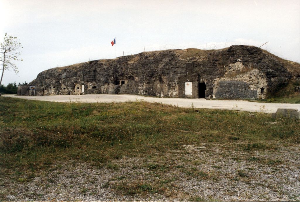
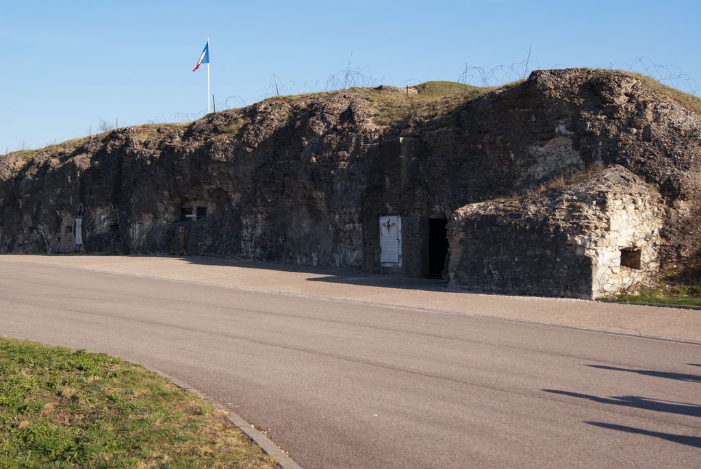
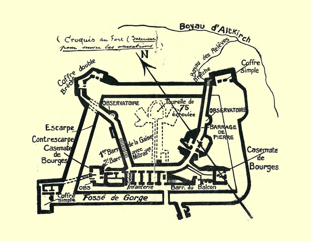
Fort Vaux (French: Fort de Vaux), in Vaux-Devant-Damloup, Meuse, France, was a polygonal fort forming part of the ring of 19 large defensive works intended to protect the city of Verdun. Built from 1881 to 1884 for 1,500,000 francs, it housed a garrison of 150 men. Vaux was the second fort to fall in the Battle of Verdun after Fort Douaumont, which was captured by a small German raiding party in February 1916 in the confusion of the French retreat from the Woëvre plain. Vaux had been modernised before 1914 with reinforced concrete top protection like Fort Douaumont and was not destroyed by German heavy artillery fire, which had included shelling by 16-inch (410 mm) howitzers. The superstructure of the fort was badly damaged but the garrison, the deep interior corridors and stations were intact when the fort was attacked on 2 June by German Stormtroops. The defence of Fort Vaux was marked by the heroism and endurance of the garrison, including Major Sylvain-Eugene Raynal. Under his command, the French garrison repulsed German assaults, including fighting underground from barricades inside the corridors, during the first big engagement inside a fort during the First World War. The last men of the French garrison gave up after running out of water (some of which was poisoned), ammunition, medical supplies and food. Raynal sent several messages by homing pigeon (including Le Vaillant), requesting relief for his soldiers. In his last message, Raynal wrote "This is my last pigeon". After the surrender of the garrison on 7 June, Crown Prince Wilhelm, the commander of the 5th Army, presented Major Raynal with a French officer's sword as a sign of respect. Raynal and his soldiers remained in captivity in Germany until the Armistice of 11 November 1918. The fort was recaptured by French infantry on 2 November 1916 after an artillery bombardment involving two long-range 400 mm (16 in) railway guns. After its recapture, Fort Vaux was repaired and garrisoned. Several underground galleries were dug to reach far outside the fort, one of them being 1.5 km (1 mi) long, the water reserve was quadrupled and light was provided by two electric generators. Some damage from the fighting on 2 June can still be seen. The underground installations of the fort are well preserved and are open to the public for guided visits.
Show more
Sun and Moon
Mon
Tue
Wed
Thu
Fri
Sat
Sun
May 2022
Date and time
00:00
06:00
12:00
18:00
Today
--
--
Sunrise
--
Sunset
--
Moonrise
--
Moonset
Phase
🌔 Waxing Gibbous
The perfect light time for beautiful photos:
--
Sunrise
--
Sunset
PeakVisor app
Get the app on your smartphone
New Panorama Tools
Trace location on the map
Measure distances
All the instruments are available in the context menu as well.
We use GPS information embedded into the photo when it is available.
3D mountains overlay
Adjust mountain panorama to perfectly match your photos because recorded by camera photo position might be imprecise.
Move tool
Rotate tool
Zoom
More customization
Choose which peak labels should make into the final photo and what photo title should be.
Next
Photo Location
Satellitte
Flat map
Relief map
Latitude
Longitude
Altitude
OR
Latitude
°'''
Longitude
°'''
Apply
Register Peak
Peak Name
Latitude
Longitude
Altitude
Register
Teleport
PeakVisor
This 3D model of Sagarmatha National Park in Nepal was made using the PeakVisor app topographic data. The mobile app features higher precision models worldwide, more topographic details, and works offline. Download PeakVisor maps today.
Download OBJ model
PeakVisor
The download should start shortly. If you find it useful please consider supporting the PeakVisor app.
PeakVisor for iOS and Android
Be a superhero of outdoor navigation with state-of-the-art 3D maps and mountain identification in the palm of your hand!