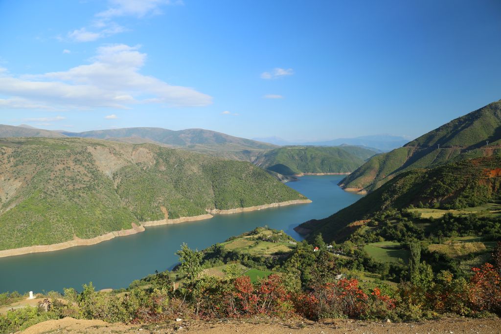
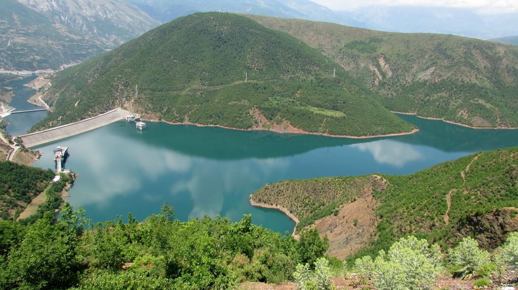
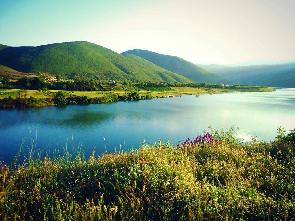
The Fierza Reservoir (Albanian: Liqeni i Fierzës) is a reservoir in Albania and Kosovo. The Drin River and parts of the White Drin and Black Drin also runs through the reservoir. The size of the lake is 72.6 km2 (28.0 sq mi), of which 2.46 km2 (0.95 sq mi) belong to Kosovo. It is 70 km (43 mi) long and has a depth of 128 m (420 ft). In the Albanian side of the lake there are many canyons and some small islands. The dam is 167 m (548 ft) tall. In 2014, the lake was declared a Regional Nature Park by the Kukës County Council. The reservoir was formed as a result of the construction of the Fierza Hydroelectric Power Station in 1978 by the Albanian government.
Show more
Sun and Moon
Mon
Tue
Wed
Thu
Fri
Sat
Sun
May 2022
Date and time
00:00
06:00
12:00
18:00
Today
--
--
Sunrise
--
Sunset
--
Moonrise
--
Moonset
Phase
🌔 Waxing Gibbous
The perfect light time for beautiful photos:
--
Sunrise
--
Sunset
PeakVisor app
Get the app on your smartphone
New Panorama Tools
Trace location on the map
Measure distances
All the instruments are available in the context menu as well.
We use GPS information embedded into the photo when it is available.
3D mountains overlay
Adjust mountain panorama to perfectly match your photos because recorded by camera photo position might be imprecise.
Move tool
Rotate tool
Zoom
More customization
Choose which peak labels should make into the final photo and what photo title should be.
Next
Photo Location
Satellitte
Flat map
Relief map
Latitude
Longitude
Altitude
OR
Latitude
°'''
Longitude
°'''
Apply
Register Peak
Peak Name
Latitude
Longitude
Altitude
Register
Teleport
PeakVisor
This 3D model of Sagarmatha National Park in Nepal was made using the PeakVisor app topographic data. The mobile app features higher precision models worldwide, more topographic details, and works offline. Download PeakVisor maps today.
Download OBJ model
PeakVisor
The download should start shortly. If you find it useful please consider supporting the PeakVisor app.
PeakVisor for iOS and Android
Be a superhero of outdoor navigation with state-of-the-art 3D maps and mountain identification in the palm of your hand!