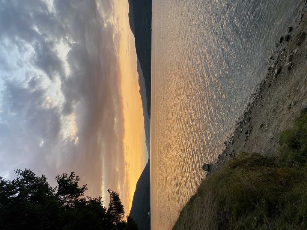
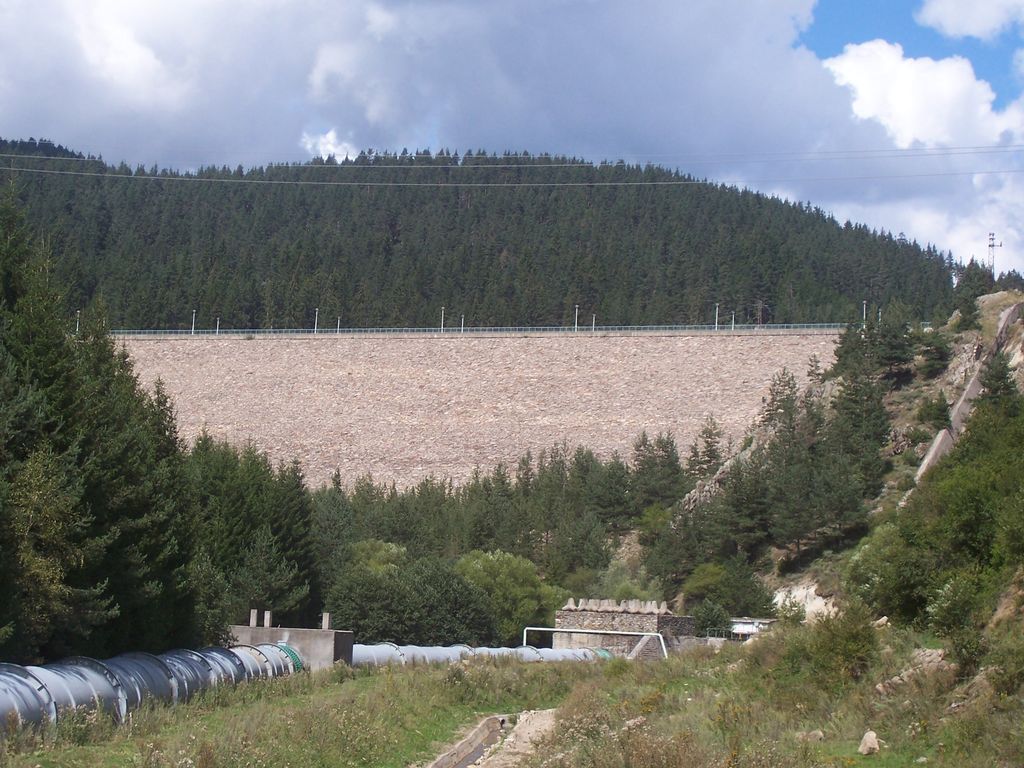
Dospat Reservoir (Bulgarian: язовир Доспат) is situated in the western part of the Rhodope Mountains, Bulgaria. The reservoir (formed by a dam in the town of Dospat, 82 km (51 mi) west of Smolyan) stretches nearly 19 km (12 mi) northwest to the city of Sarnitsa. At 1,200 m (3,900 ft) above the sea level, it is one of the highest dams in Bulgaria in terms of altitude, and, with its 22 km2 (8.5 sq mi) of water area, the second largest in capacity. It is fed by the Dospat River. The dam, which creates the lake, is built for hydroelectricity generation as part of the Dospat–Vacha Hydropower Cascade (500.2 MW). There is no hydroelectric power plant (HPP) installed at the dam but rather the water is taken to the Teshel HPP and then further down the Devin HPP and the Vacha River with its power plants, dams and reservoirs (Tsankov Kamak HPP, Vacha Reservoir, Krichim Reservoir, Vacha II HPP, Krichim HPP and Vacha I HPP). Besides that, a minimum of 0.15 m3/s (0.20 cu yd/s) is constantly released for sanitation of the Dospat River riverbed where the average input to the reservoir is 7.9 m3/s (10.3 cu yd/s). The flora and fauna around the reservoir are diverse and the geography offers breathtaking sights. Old coniferous forests surround the lake. On the northern bank, the town of Sarnitsa and Krushata neighborhood are located. The terrain is hilly, with meadows and arable land available, used for grazing, potato growing and other agricultural activities. Parallel to the south bank are steep slopes covered in spruce and this bank is where most holiday cabins and hotels are located. The reservoir is rich in fish. It is stocked with perch, trout (rainbow, brown, brook), carp, European chub, common rudd, common roach, pumpkinseed, wels catfish, Danube Bleak and various members of Carassius. Trout are reared in cages within the reservoir. Most types of fishing are practiced: spinning with lures, fly fishing, and others. In the surrounding areas there are a number of other large dams, including Vacha, Golyam Beglik, Batak and Shiroka Polyana. The area offers great opportunities for recreation and tourism. Accessibility is, however, rather poor. Four main mountain roads link the reservoir to the rest of the world. One from Batak, a second from Velingrad to Sarnitsa, a third from Devin and a fourth from Gotse Delchev to the town of Dospat. The one from Batak allows accessibility to some of the other Rhodope dams along its length. It forks into two roads; one leading to the town of Dospat and the other to Sarnitsa. This road to Sarnitsa is in places very rutted and may prove a challenge to navigate. Along the south bank there runs a rough dirt track from Sarnitsa to Dospat but this is only used to access the holiday spots.
Show more
Sun and Moon
Mon
Tue
Wed
Thu
Fri
Sat
Sun
May 2022
Date and time
00:00
06:00
12:00
18:00
Today
--
--
Sunrise
--
Sunset
--
Moonrise
--
Moonset
Phase
🌔 Waxing Gibbous
The perfect light time for beautiful photos:
--
Sunrise
--
Sunset
PeakVisor app
Get the app on your smartphone
New Panorama Tools
Trace location on the map
Measure distances
All the instruments are available in the context menu as well.
We use GPS information embedded into the photo when it is available.
3D mountains overlay
Adjust mountain panorama to perfectly match your photos because recorded by camera photo position might be imprecise.
Move tool
Rotate tool
Zoom
More customization
Choose which peak labels should make into the final photo and what photo title should be.
Next
Photo Location
Satellitte
Flat map
Relief map
Latitude
Longitude
Altitude
OR
Latitude
°'''
Longitude
°'''
Apply
Register Peak
Peak Name
Latitude
Longitude
Altitude
Register
Teleport
PeakVisor
This 3D model of Sagarmatha National Park in Nepal was made using the PeakVisor app topographic data. The mobile app features higher precision models worldwide, more topographic details, and works offline. Download PeakVisor maps today.
Download OBJ model
PeakVisor
The download should start shortly. If you find it useful please consider supporting the PeakVisor app.
PeakVisor for iOS and Android
Be a superhero of outdoor navigation with state-of-the-art 3D maps and mountain identification in the palm of your hand!