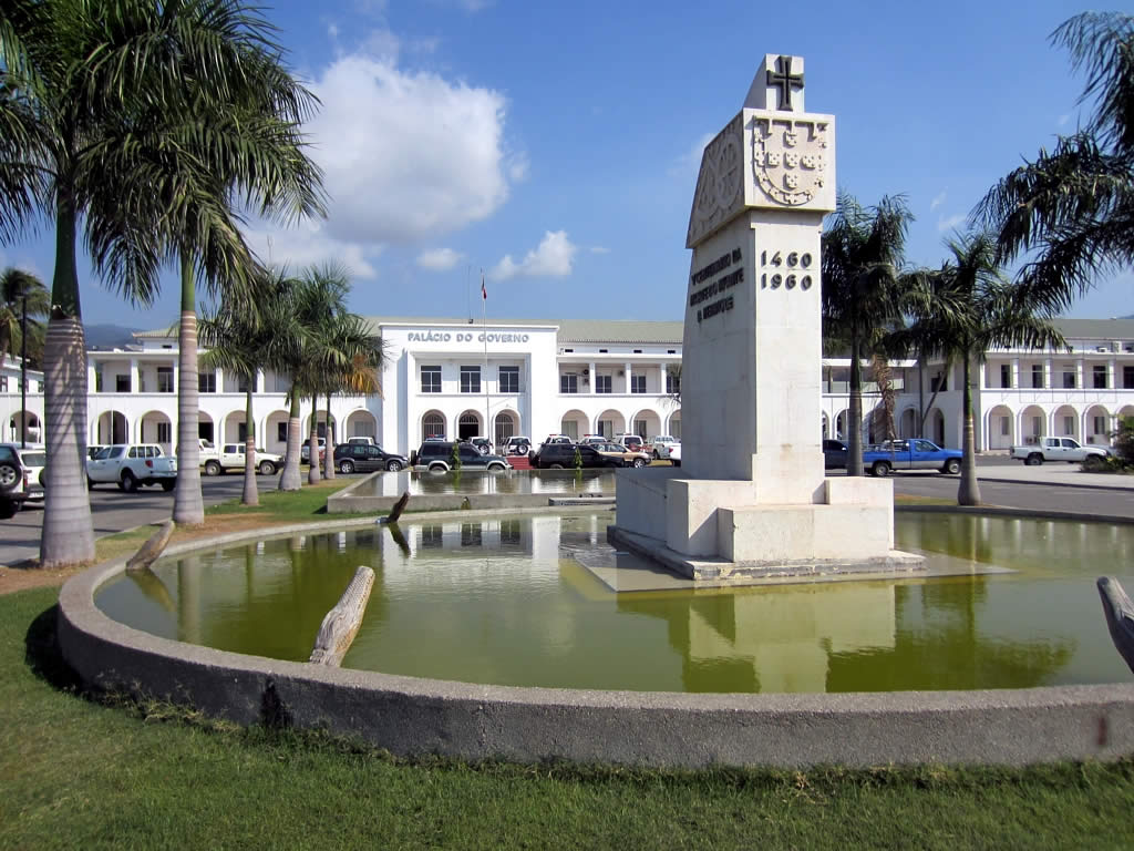
Dili (Portuguese and Tetum: Díli) is the capital and largest city of East Timor. It lies on the northern coast of the island of Timor, in a small area of flat land hemmed in by mountains. The climate is tropical, with distinct wet and dry seasons. The city has served as the economic hub and chief port of what is now East Timor since its designation as the capital of Portuguese Timor in 1769. It also serves as the capital of the Dili Municipality, which includes some rural subdivisions in addition to the urban ones that make up the city itself. Dili's growing population is relatively youthful, being mostly of working age. The local language is Tetum; however, residents include many internal migrants from other areas of the country. The initial settlement was situated in what is now the old quarter in the eastern side of the city. Centuries of Portuguese rule were interrupted in World War II, when Dili became the site of a battle between Allied and Japanese forces. The damaged city returned to Portuguese control following the war. In 1975, a civil war between Timorese political parties broke out, leading to a declaration of independence and a subsequent invasion by Indonesia. Under Indonesian rule infrastructure in the city was developed, with landmarks such as the Immaculate Conception Cathedral and Cristo Rei of Dili being built during this time. The city expanded as its population grew to over 100,000 people. Resistance to Indonesian rule faced violent repression, and a massacre in Dili led to international pressure culminating in an independence referendum. Following a vote for independence violence erupted in the city, destroying huge amounts of its infrastructure and leading to an exodus of refugees. A period of United Nations rule followed, during which international agencies began the reconstruction of the city. Dili became the capital of an independent East Timor in 2002. A period of violence in 2006 saw another period of infrastructure damage and population displacement. In 2009 the government launched the City of Peace campaign to reduce tensions. As the population has continued to grow and the original site of the city has filled up, the urban area has expanded into coastal areas to the east and west of the main city. Infrastructure in Dili continues to be developed. The city was the first location in East Timor to see 24 hours of electricity, although its water infrastructure remains relatively limited. Education levels are higher than the national average, and the country's universities are located in the city. An international port and airport lie within the city limits. Most economic activity comes from the tertiary sector and public employment. To further build the economy, the government is developing the tourism potential of the city, focusing on cultural, environmental, and historical attractions.
Show more
Sun and Moon
Mon
Tue
Wed
Thu
Fri
Sat
Sun
May 2022
Date and time
00:00
06:00
12:00
18:00
Today
--
--
Sunrise
--
Sunset
--
Moonrise
--
Moonset
Phase
🌔 Waxing Gibbous
The perfect light time for beautiful photos:
--
Sunrise
--
Sunset
PeakVisor app
Get the app on your smartphone
New Panorama Tools
Trace location on the map
Measure distances
All the instruments are available in the context menu as well.
We use GPS information embedded into the photo when it is available.
3D mountains overlay
Adjust mountain panorama to perfectly match your photos because recorded by camera photo position might be imprecise.
Move tool
Rotate tool
Zoom
More customization
Choose which peak labels should make into the final photo and what photo title should be.
Next
Photo Location
Satellitte
Flat map
Relief map
Latitude
Longitude
Altitude
OR
Latitude
°'''
Longitude
°'''
Apply
Register Peak
Peak Name
Latitude
Longitude
Altitude
Register
Teleport
PeakVisor
This 3D model of Sagarmatha National Park in Nepal was made using the PeakVisor app topographic data. The mobile app features higher precision models worldwide, more topographic details, and works offline. Download PeakVisor maps today.
Download OBJ model
PeakVisor
The download should start shortly. If you find it useful please consider supporting the PeakVisor app.
PeakVisor for iOS and Android
Be a superhero of outdoor navigation with state-of-the-art 3D maps and mountain identification in the palm of your hand!