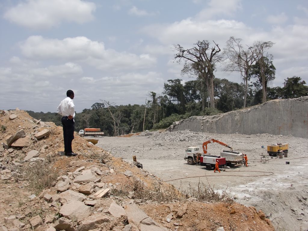
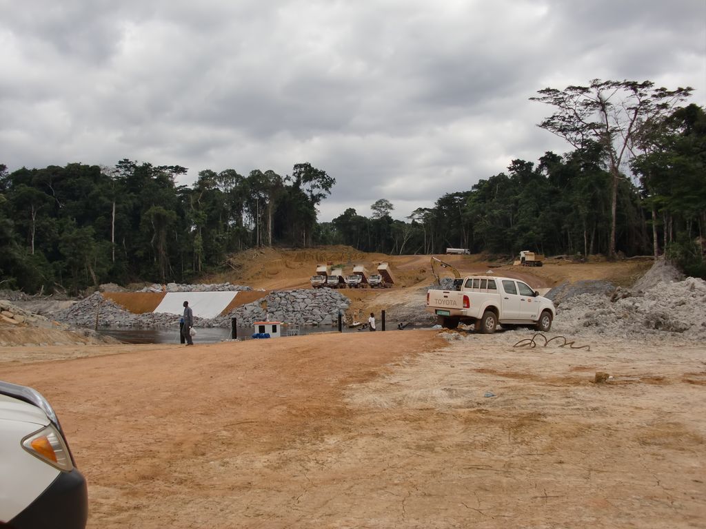
Ciudad de la Paz (Spanish: [θjuˈdad de la ˈpaθ], lit. 'City of Peace'), formerly Oyala, also known as Djibloho – Ciudad de la Paz, is a city in Equatorial Guinea that is being built to replace Malabo as the national capital. Established as an urban district in Wele-Nzas in 2015, it is now the administrative headquarters of Djibloho, Equatorial Guinea's newest province created in 2017, and is located near the town of Mengomeyén. In 2017, the city was officially renamed Ciudad de la Paz ("City of Peace"). The planned city's location was chosen for its easy access and benign climate. It is notably on the mainland, in contrast to Malabo, which is on the island of Bioko. It was designed by the Portuguese Studio for Architecture and Urbanism FAT – Future Architecture Thinking. It is projected to have around 200,000 inhabitants, a new Parliament building, a number of presidential villas and an area of 8150 hectares. The construction of this new capital has been criticised by the political opposition to President Teodoro Obiang, the driving force behind the initiative. The Government of Equatorial Guinea began to move to the city in early 2017.
Show more
Sun and Moon
Mon
Tue
Wed
Thu
Fri
Sat
Sun
May 2022
Date and time
00:00
06:00
12:00
18:00
Today
--
--
Sunrise
--
Sunset
--
Moonrise
--
Moonset
Phase
🌔 Waxing Gibbous
The perfect light time for beautiful photos:
--
Sunrise
--
Sunset
PeakVisor app
Get the app on your smartphone
New Panorama Tools
Trace location on the map
Measure distances
All the instruments are available in the context menu as well.
We use GPS information embedded into the photo when it is available.
3D mountains overlay
Adjust mountain panorama to perfectly match your photos because recorded by camera photo position might be imprecise.
Move tool
Rotate tool
Zoom
More customization
Choose which peak labels should make into the final photo and what photo title should be.
Next
Photo Location
Satellitte
Flat map
Relief map
Latitude
Longitude
Altitude
OR
Latitude
°'''
Longitude
°'''
Apply
Register Peak
Peak Name
Latitude
Longitude
Altitude
Register
Teleport
PeakVisor
This 3D model of Sagarmatha National Park in Nepal was made using the PeakVisor app topographic data. The mobile app features higher precision models worldwide, more topographic details, and works offline. Download PeakVisor maps today.
Download OBJ model
PeakVisor
The download should start shortly. If you find it useful please consider supporting the PeakVisor app.
PeakVisor for iOS and Android
Be a superhero of outdoor navigation with state-of-the-art 3D maps and mountain identification in the palm of your hand!