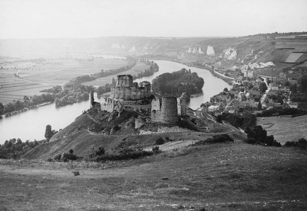
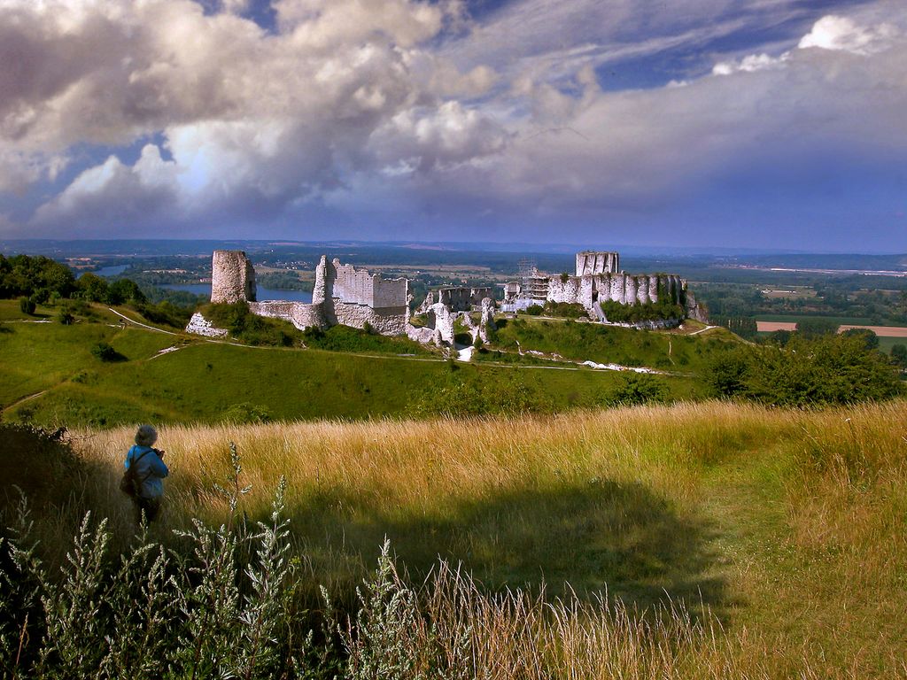
Château Gaillard (French pronunciation: [ʃɑto ɡajaʁ]) is a medieval castle ruin overlooking the River Seine above the commune of Les Andelys, in the French department of Eure, in Normandy. It is located some 95 kilometres (59 mi) north-west of Paris and 40 kilometres (25 mi) from Rouen. Construction began in 1196 under the auspices of Richard the Lionheart, who was simultaneously King of England and feudal Duke of Normandy. The castle was expensive to build, but the majority of the work was done in an unusually short period of time. It took just two years and, at the same time, the town of Petit Andely was constructed. Château Gaillard has a complex and advanced design, and uses early principles of concentric fortification; it was also one of the earliest European castles to use machicolations. The castle consists of three enclosures separated by dry moats, with a keep in the inner enclosure. Château Gaillard was captured in 1204 by the king of France, Philip II, after a lengthy siege. In the mid-14th century, the castle was the residence of the exiled David II of Scotland. The castle changed hands several times in the Hundred Years' War, but in 1449 the French king captured Château Gaillard from the English king definitively, and from then on it remained in French ownership. Henry IV of France ordered the demolition of Château Gaillard in 1599; although it was in ruins at the time, it was felt to be a threat to the security of the local population. The castle ruins are listed as a monument historique by the French Ministry of Culture. The inner bailey is open to the public from March to November, and the outer baileys are open all year.
Show more
Sun and Moon
Mon
Tue
Wed
Thu
Fri
Sat
Sun
May 2022
Date and time
00:00
06:00
12:00
18:00
Today
--
--
Sunrise
--
Sunset
--
Moonrise
--
Moonset
Phase
🌔 Waxing Gibbous
The perfect light time for beautiful photos:
--
Sunrise
--
Sunset
PeakVisor app
Get the app on your smartphone
New Panorama Tools
Trace location on the map
Measure distances
All the instruments are available in the context menu as well.
We use GPS information embedded into the photo when it is available.
3D mountains overlay
Adjust mountain panorama to perfectly match your photos because recorded by camera photo position might be imprecise.
Move tool
Rotate tool
Zoom
More customization
Choose which peak labels should make into the final photo and what photo title should be.
Next
Photo Location
Satellitte
Flat map
Relief map
Latitude
Longitude
Altitude
OR
Latitude
°'''
Longitude
°'''
Apply
Register Peak
Peak Name
Latitude
Longitude
Altitude
Register
Teleport
PeakVisor
This 3D model of Sagarmatha National Park in Nepal was made using the PeakVisor app topographic data. The mobile app features higher precision models worldwide, more topographic details, and works offline. Download PeakVisor maps today.
Download OBJ model
PeakVisor
The download should start shortly. If you find it useful please consider supporting the PeakVisor app.
PeakVisor for iOS and Android
Be a superhero of outdoor navigation with state-of-the-art 3D maps and mountain identification in the palm of your hand!