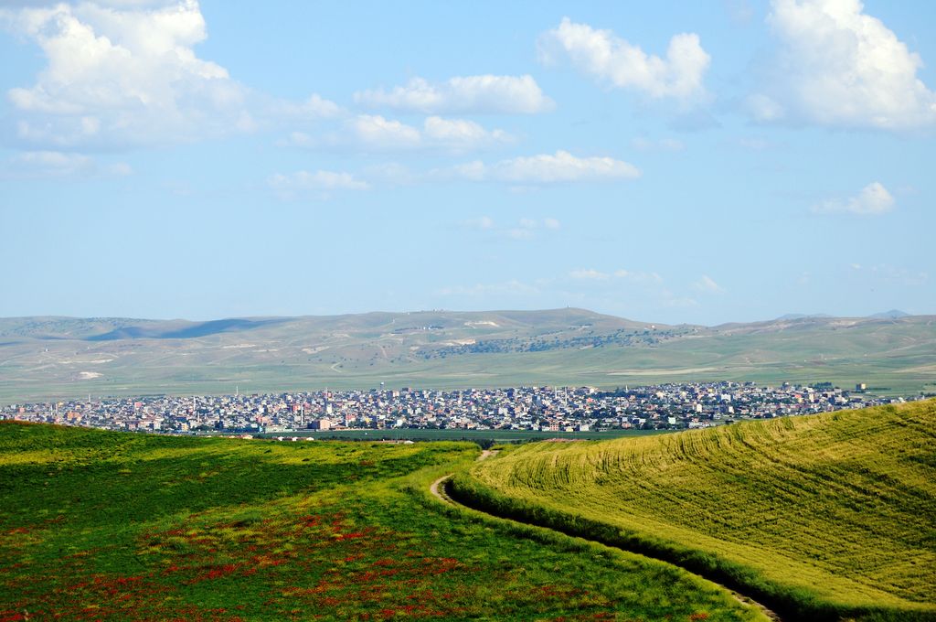
Batman (Kurdish: Êlih) is a city and capital of Batman District in Batman Province, Turkey. It lies on a plateau, 540 meters (1,772 feet) above sea level, near the confluence of the Batman River and the Tigris and had a population of 452,157 in 2021. It is populated by Kurds. The Batı Raman oil field, which is the largest oil field in Turkey, is located just outside the city. Batman has a local airport and a military airbase, which was used for transit of aircraft and helicopters in some search and rescue operations during the Gulf War. Until the 1950s, Batman was a village, with a population of about 3,000. However, oil fields were discovered around it in the 1940s that resulted in a rapid development of the area and in the inflow of workforce from other parts of Turkey. In 1957, the village was renamed Batman, after the river namesake, received a city status and became a district center. Over the next 50 years, a significant amount of Batman's one-story buildings were rebuilt as multi-story buildings. As a result, its population grew to many times its previous size. A 511 km (318 mi) km long oil pipeline was built in 1967 from Batman to the port city of Dörtyol near the easternmost point of the Mediterranean coast in order to transport the crude oil from the Batman refinery. In 1990, the city became the capital of Batman Province. Apart from oil, which is by far the dominant commodity of the region, Batman produces beverages, processed food, chemicals, furniture, footwear, machinery and transport equipment. A university was established in 2007, Batman University, and is part of the Erasmus foreign student exchange program.
We use GPS information embedded into the photo when it is available.
3D mountains overlay
Adjust mountain panorama to perfectly match your photos because recorded by camera photo position might be imprecise.
Move tool
Rotate tool
Zoom
More customization
Choose which peak labels should make into the final photo and what photo title should be.
Next
Photo Location
Satellitte
Flat map
Relief map
Latitude
Longitude
Altitude
OR
Latitude
°'''
Longitude
°'''
Apply
Register Peak
Peak Name
Latitude
Longitude
Altitude
Register
Teleport
PeakVisor
This 3D model of Sagarmatha National Park in Nepal was made using the PeakVisor app topographic data. The mobile app features higher precision models worldwide, more topographic details, and works offline. Download PeakVisor maps today.
Download OBJ model
PeakVisor
The download should start shortly. If you find it useful please consider supporting the PeakVisor app.
PeakVisor for iOS and Android
Be a superhero of outdoor navigation with state-of-the-art 3D maps and mountain identification in the palm of your hand!