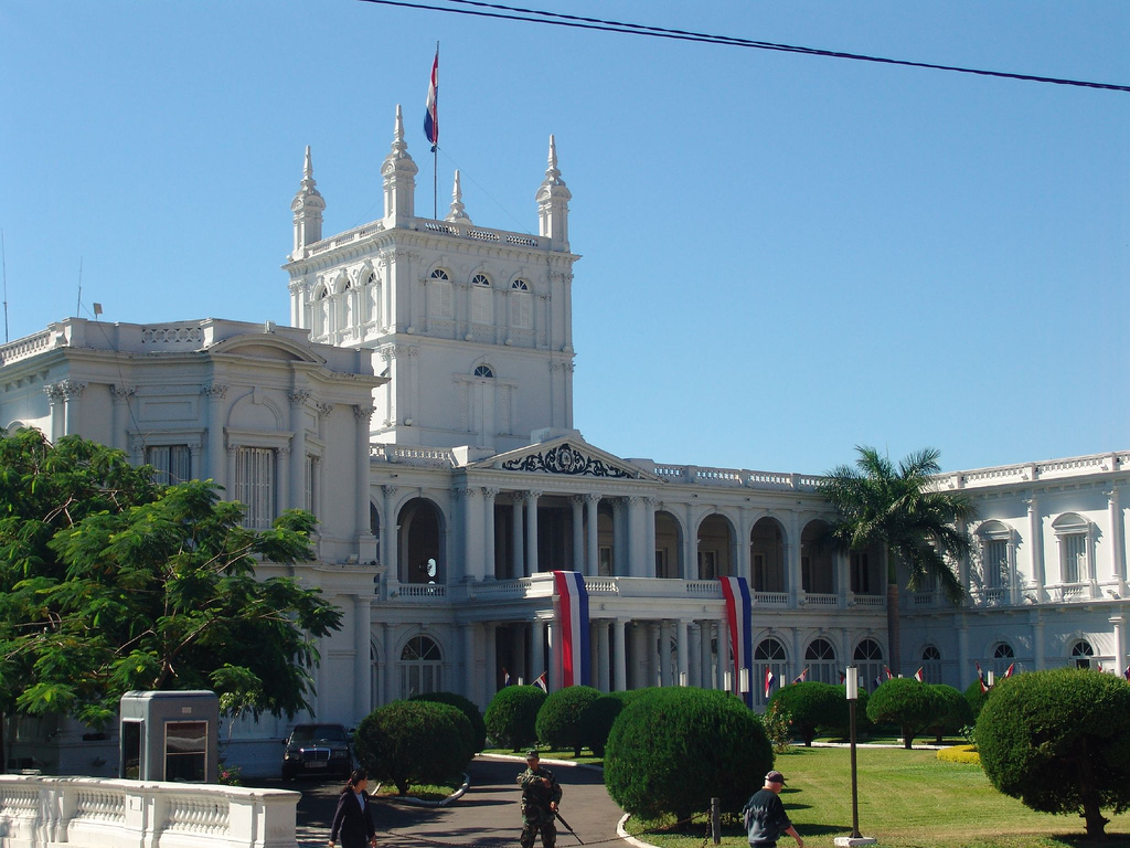
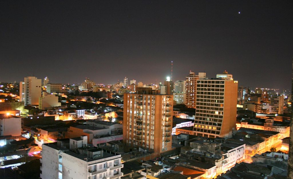
Asunción (English: , Spanish: [asunˈsjon]) is the capital and the largest city of Paraguay. The city stands on the eastern bank of the Paraguay River, almost at the confluence of this river with the Pilcomayo River. The Paraguay River and the Bay of Asunción in the northwest separate the city from the Occidental Region of Paraguay and from Argentina in the south part of the city. The rest of the city is surrounded by the Central Department. Asunción is one of the oldest cities in South America and the longest continually inhabited area in the Río de la Plata Basin; for this reason it is known as "the Mother of Cities". From Asunción, Spanish colonial expeditions departed to found other cities, including the second foundation of Buenos Aires, that of other important cities such as Villarrica, Corrientes, Santa Fe, Córdoba, Santa Cruz de la Sierra and 65 more. According to the 2022 Paraguayan Census, Asunción has 477,346 inhabitants, while its metropolitan area (known as Greater Asunción) exceeds 2.3 million inhabitants, making it the most densely populated area in Paraguay, and also the most productive as it concentrates the 70% of the National GDP. Asunción is the third most populated "jurisdiction" or "political division" in the country, surpassed by the Central and Alto Paraná departments. Administratively, the city forms an autonomous capital district, not a part of any department. The metropolitan area, called Gran Asunción, includes the cities of San Lorenzo, Fernando de la Mora, Lambaré, Luque, Mariano Roque Alonso, Ñemby, San Antonio, Limpio, Capiatá and Villa Elisa, which are part of the Central Department. The Asunción metropolitan area has around two million inhabitants. The Asunción Stock Exchange lists the Municipality of Asunción as BVPASA: MUA. Asunción is one of the best cities for investments, both in construction and services, thus being one of the cities in the region with the highest economic growth, nowadays. It is the headquarters of the three state powers (Executive, Legislative and Judicial), the Cultural Center of the Republic and the different agencies and entities of the State. It used to be the main river port of the country, a function that Villeta occupies today. Despite the situations throughout its history, Asunción continues to be the center of national and cultural activities. From the capital, the main state resolutions and projects are issued; and the banking, economic, cultural, diplomatic, social, union and industrial entities of the country are centralized. Most of the main routes to the main cities of the country begin here. It is the headquarters of the Permanent Review Court of Mercosur. In the metropolitan area of Asunción, district of Luque, is the headquarters of the South American Football Confederation. It is located in a strategic area for Mercosur, in the center-north of the Southern Cone. This geographical position allows it relative proximity to cities such as Buenos Aires, Montevideo, Córdoba, Rosario, Curitiba, São Paulo, Porto Alegre, Santa Cruz de la Sierra, and other important cities in the region. It is located about 1,300 km (810 mi) from the Pacific Ocean and about 1,000 km (620 mi) from the Atlantic Ocean, being relatively equidistant between both oceans, a factor that promotes economic growth and leads it to become a kind of hub in the region. The Globalization and World Cities Research Network classifies Asunción as a "Gamma City". It is the home of the national government, principal port, and the chief industrial, political, economic and cultural center of Paraguay. Near Asunción, in Luque, are the headquarters of the CONMEBOL, the continental governing body of association football in South America. Asunción ranks as one of the cheapest cities in the world for foreign visitors, and the third-safest capital in Latin America, behind Buenos Aires and Santiago, according to InSight Crime.
Show more
Sun and Moon
Mon
Tue
Wed
Thu
Fri
Sat
Sun
May 2022
Date and time
00:00
06:00
12:00
18:00
Today
--
--
Sunrise
--
Sunset
--
Moonrise
--
Moonset
Phase
🌔 Waxing Gibbous
The perfect light time for beautiful photos:
--
Sunrise
--
Sunset
PeakVisor app
Get the app on your smartphone
New Panorama Tools
Trace location on the map
Measure distances
All the instruments are available in the context menu as well.
We use GPS information embedded into the photo when it is available.
3D mountains overlay
Adjust mountain panorama to perfectly match your photos because recorded by camera photo position might be imprecise.
Move tool
Rotate tool
Zoom
More customization
Choose which peak labels should make into the final photo and what photo title should be.
Next
Photo Location
Satellitte
Flat map
Relief map
Latitude
Longitude
Altitude
OR
Latitude
°'''
Longitude
°'''
Apply
Register Peak
Peak Name
Latitude
Longitude
Altitude
Register
Teleport
PeakVisor
This 3D model of Sagarmatha National Park in Nepal was made using the PeakVisor app topographic data. The mobile app features higher precision models worldwide, more topographic details, and works offline. Download PeakVisor maps today.
Download OBJ model
PeakVisor
The download should start shortly. If you find it useful please consider supporting the PeakVisor app.
PeakVisor for iOS and Android
Be a superhero of outdoor navigation with state-of-the-art 3D maps and mountain identification in the palm of your hand!